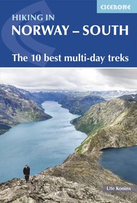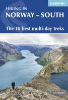
Wandelgids Hiking in Norway-South | Cicerone

0
This guide describes 10 shorter hut-to-hut treks showcasing southern Norway's wild natural beauty, with highlights including Galdhøpiggen - Norway's highest peak at 2469m - and the iconic Pulpit Rock and Kjeragbolten on the Lysefjord. The routes range from 3 to 8 days (although many can be adapted or combined to create longer or shorter routes) an...

Verkopers met dit product

Verkoper
Bezorging
Prijs
DeZwerver.nl logo
DeZwerver.nl
2,95
23,95

Anderen bekeken ook

Wandelgids Hiking in Norway-South | Cicerone
This guide describes 10 shorter hut-to-hut treks showcasing southern Norway's wild natural beauty, with highlights including Galdhøpiggen - Norway's highest peak at 2469m - and the iconic Pulpit Rock and Kjeragbolten on the Lysefjord. The routes range from 3 to 8 days (although many can be adapted or combined to create longer or shorter routes) and cover Jotunheimen, Rondane, Dovrefjell, Trollheimen and Ryfylke. They are suitable for experienced hikers with a good level of fitness and can be walked from mid-July to the end of September.   Clear route description and mapping are provided for each hike. Stages are graded according to difficulty: although all of the routes follow waymarked trails, some cross remote and challenging terrain which may include exposed sections calling for a sure foot and a good head for heights. However, in many instances, alternatives are provided avoiding the most demanding sections. The guide also offers comprehensive advice on public transport access and…
23,95
Wandelgids Hiking in Hong Kong | Cicerone
Although Hong Kong is often thought of as intrinsically urban, just a short distance from the big cities are lush mountains and attractive and varied countryside. This guide presents the highlights of this hiking-friendly territory, detailing 21 graded day walks and four short treks: Hong Kong Trail (presented in 3 day stages), Lantau Trail (5 days), MacLehose Trail (5 days) and Wilson Trail (5 days). The day walks - of 5 to 22.5km - cover Hong Kong, Kowloon, the New Territories and the islands and range from easy hikes suitable for families to challenging ascents of Hong Kong's highest peaks. The territory's compact nature and excellent public transport infrastructure make it easy to access the routes.   The guide has all you need to explore Hong Kong's excellent network of trails. Route description is accompanied by clear mapping and there are comprehensive notes - including Chinese place names - to help visitors navigate the public transport system. Alongside practicalities such as…
24,95
Wandelgids - Fietsgids Hiking and Cycling in the Black Forest | Cicerone
Guidebook describing day walks, multi-stage treks and 5 cycle routes covering the north, central and southern regions of Germany's Black Forest. From easy routes for families to multi-day journeys, the walks and rides explore the many forests, villages, castles and hills near Strasbourg, Baden-Baden, Freiburg and Basle.   Seasons spring and autumn are the best times of the year to visit the Black Forest. But the cool forest glades and lofty hills make summer walking bearable. Some routes are even accessible in winter and make for magical winter wonderland walking   Centres Freiburg im Breisgau Waldkirch, Hinterzarten, Baden Baden, Baiersbronn, Titisee, Bad Wildbad, Nagold, Calw, Breisach am Rhein   Difficulty The Black Forest is a medium-height mountain range with the highest peaks around 1500m. Trails are well marked and maintained, so the terrain is not especially difficult in most parts. Good physical condition and ability to cope with sometimes steep ascends is required. Normal wa…
23,95
Wandelgids - Fietsgids Hiking and Cycling the California Missions Trail - Californie | Cicerone
Guidebook to hiking or cycling the 800 mile (1289km) California Missions Trail between San Francisco Bay and San Diego. The pilgrimage trail takes in 21 historic Spanish missions and can be completed in 50-60 walking days or 2-3 weeks cycling. With 1:100,000 mapping, route description, and details of accommodation and facilities for each stage. Ancient footpaths became connecting routes between the Spanish missions, pueblos, and presidios in the period 1769 to 1823. Over time these routes became automobile roadways and were marked with bells starting in 1906 to promote and preserve the El Camino Real. Today, the California Missions Trail follows a pedestrian route through urban cities and historic towns, through forest paths and country lanes, to each of the twenty-one historic Spanish missions. The 800-mile California Missions Trail leads walkers and cyclists through some of the most scenic and historic sites of one of America's most beautiful states. The 21 missions, founded 200-250…
26,50
Wandelgids Alta Via 2 - Trekking in the Dolomites | Cicerone
Uitstekende wandelgids van een gerenommeerde Engelse uitgever. De tochten zijn met zorg beschreven en voorzien van allerhande nuttige informatie. Guidebook describing Alta Via 2, a challenging hut-to-hut trek through the Italian Dolomites. Stretching 174km from Bressanone (Brixen) to Feltre, the route involves some aided and exposed sections (although several can be bypassed) calling for a sure foot and a good head for heights. It can be walked in under a fortnight - although it is also possible to walk shorter chunks should you only have limited time, and the guide highlights potential exit routes and transport options. Also included are summaries of Alte Vie 3-6, which are more demanding and include remote terrain and stretches of via ferrata for which climbing experience is essential. On Alte Vie 3-6 some nights will be spent in unmanned bivouac huts, meaning trekkers must carry their own kit, although it is possible to walk shorter hut-to-hut sections. The easiest of the Alta Via …
23,95
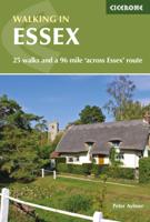
Wandelgids Walking in Essex | Cicerone
Wandelgids met 25 dagtochten en een meerdaagse tocht in Essex.  Goede omschrijvingen, veel praktische informatie. Redelijk kaartmateriaal   This guidebook describes 25 coastal and inland day walks covering the whole of the county of Essex, stretching from the Lea Valley in the west and the Thames in the south over to the North Sea and up to the River Stour in the north. Walks range from 4 to 18 miles and are mostly circular. Also included is a description of the Essex Way which crosses the county in 11 stages from Manor Park, on the fringes of London, to the port of Harwich - a distance of 96 miles. The walks are suitable for all abilities and there are shorter alternatives for many of the longer routes.   With a huge variety of scenery and walking landscapes, Essex surprises and delights in equal measure. It boasts a 350-mile coastline (which, away from the busy seaside resorts, is barely known), numerous estuaries and river valleys, great and ancient forests, and more green lanes th…
18,95
Wandelgids Walking in the Thames Valley | Cicerone
Walking in the Thames Valley offers 25 challenging circular walks around the River Thames and River Kennet in the south of England, taking in the Southern Chilterns, the Berkshire and North Hampshire Downs, Southern Oxfordshire and the eastern edge of Wiltshire. All routes are within easy reach of Reading, Newbury, Abingdon and London. While some walks visit Iron Age hill forts, others pass more modern features such as Wilton Windmill and the Kennet and Avon Canal. Some follow sections of the Ridgeway, while others meander along the banks of the Thames. What they all have in common is that they take the keen rambler to some of the best parts of the Thames Valley – a patchwork of open chalk grassland, broadleaved woodland and farmland and home to two Areas of Outstanding Natural Beauty. • walks from 10 to 18 miles, including one 2-day route • shorter, less strenuous alternatives for many of the walks • detailed route descriptions with information on local points of interest, OS mapping…
18,50
Wandelgids Walking on Dartmoor | Cicerone
A guidebook to 39 day walks and one two-day Ten Tors challenge across the Dartmoor National Park and its surrounding area. The guide contains low-level shorter walks and higher level more strenuous and challenging routes, therefore there's a walk suitable for all abilities, allowing you to explore all of what Devon's national park has to offer. Each walk contains a detailed route description, 1:50,000 OS maps and colour photography, alongside practical information on public transport links and refreshment stops on each walk.   Dartmoor, a National Park since 1951, is wild, and at times isolated. Its a land of blanket bogs and grass moors dotted with fascinating tors, old stone clapper bridges, tree-shaded river valleys and a diverse range of wildlife. Our ancestors have left behind a fascinating treasure trove from intriguing stone rows to fascinating stones circles and burial cairns to hut circles.   There are also the stark ruins of Dartmoor's mining heritage, picturesque villages a…
20,95
Wandelgids Walking the GR7 in Andalucia | Cicerone
Uitstekende wandelgids van een gerenommeerde Engelse uitgever. De tochten zijn met zorg beschreven en voorzien van allerhande nuttige informatie. With its white sandy beaches, pine forests, snow-capped peaks, traditional villages, lush river valleys and olive groves, the GR7 in Andalucía takes you on a journey through the most geographically diverse region on the Iberian peninsula. This wonderfully varied route starts at the southernmost tip of Spain at Tarifa, and meanders through the provinces of Cádiz and Málaga before dividing. The northern route heads through Córdoba and Jaén provinces (711km in total), whilst the southern route passes through Almería and Granada (720km). The route crosses seven stunning natural parks and the Sierra Nevada national park. • The first guide to cover the whole of the GR7 in Andalucía. • Detailed route description for around 60 days of walking, with options for creating shorter sections and days. • Information on all the villages en route offering ac…
26,50

Klanten-reviews van Wandelgids Hiking in Norway-South | Cicerone

Er zijn nog geen beoordelingen voor dit productBen jij de eerste die een review plaatst?

Meer over Wandelgids Hiking in Norway-South | Cicerone

Productomschrijving

This guide describes 10 shorter hut-to-hut treks showcasing southern Norway's wild natural beauty, with highlights including Galdhøpiggen - Norway's highest peak at 2469m - and the iconic Pulpit Rock and Kjeragbolten on the Lysefjord. The routes range from 3 to 8 days (although many can be adapted or combined to create longer or shorter routes) and cover Jotunheimen, Rondane, Dovrefjell, Trollheimen and Ryfylke. They are suitable for experienced hikers with a good level of fitness and can be walked from mid-July to the end of September.   Clear route description and mapping are provided for each hike. Stages are graded according to difficulty: although all of the routes follow waymarked trails, some cross remote and challenging terrain which may include exposed sections calling for a sure foot and a good head for heights. However, in many instances, alternatives are provided avoiding the most demanding sections. The guide also offers comprehensive advice on public transport access and accommodation options, and background notes on each of the featured mountain regions.   From narrow ridges to wide glacial valleys and from shimmering fjords to striking alpine peaks, Norway is home to many awe-inspiring landscapes. Throw in the warmth and hospitality of the Norwegian Trekking Association's extensive hut network and you have all the ingredients of a fantastic adventure. This guide is an ideal companion to discovering some of Norway's classic shorter hikes and best-loved mountain landscapes.

Productinformatie

    Verken gerelateerde categorieën

    Webshop.nl maakt gebruik van cookies. Ga je verder op onze website, ga dan akkoord met het plaatsen van cookies en de verwerking van deze data door ons en vermelde partners.