Wandelgids Harris | Pocket Mountains

0
The Isle of Harris is home to some wonderful walking country, from the rugged ridges and glens of the Harris Hills to the astonishingly beautiful white sand beaches of the island's west coast, while the remarkably complex eastern coastline is punctuated with sea lochs, headlands, coves and bays. These environments are also full of historical inter...

Verkopers met dit product

Verkoper
Bezorging
Prijs
DeZwerver.nl logo
DeZwerver.nl
niet bekend
10,95

Anderen bekeken ook

Wandelgids The high mountains of Crete - Kreta | Cicerone
Guidebook to walking and trekking the high mountains of Crete. The largest of the Greek Islands, Crete's mountains provide breathtaking walking and wilderness to this popular island. The routes in this guidebook are graded for difficulty and range from short, easy strolls to challenging, multi-day treks and summit climbs, so there are options for walkers of all abilities.    All the mountain ranges of Crete feature high plains, gorges and ravines, but in the heart of the Lefka Ori there is something else. High above the treeline snow thaws by July to reveal a great circle of massive barren peaks, interspersed with ‘moonscape’ outcrops, or depressions, of sinkholes in black, grey or red rock. This high desert wilderness is seldom visited but covers some 960sqkm.   In central Crete, where the island is at its widest, the huge mass of Psiloritis (Mount Ida) dominates the whole region. Covering about 560sqkm this massif is different in that a single huge, partly scree-surfaced summit ridg…
26,50
Wandelgids Islands of Croatia | Cicerone
This guidebook describes 30 day walks on the islands of the Croatian Adriatic, ranging from short, easy coastal strolls to more challenging, full day outings over rocky ridges and summits, with spectacular views of the Dalmatian coast. Featuring routes on 14 Croatian islands, including the islands of Hvar and Mljet, as well as quieter islands. From short coastal strolls to full-day outings over rocky summits (suitable for all abilities), the walks in this guide cover an island chain of outstanding beauty. From the Kvarner Gulf (south of Rijeka) to southern Dalmatia (west of Dubrovnik), the Croatian islands feature limestone ridges and toothy knolls alternating with olive groves and lush green forest, while coastlines boast sun-drenched beaches and striking cliffs.   A superb network of trails covers the islands, and the views they offer are frequently spectacular. Yet, despite being near tourist hotspots, most see hardly any use. This guide has all the information walkers need to expl…
22,95
Fietskaart Cycling guides Exmoor - North Devon | Goldeneye
Scheur- en watervast foetskaart van Exmoor en Noord Devon met ingetekende fietsroutes.   Our maps are double-sided, printed on an A2 sheet with a concertina fold. This allows for easy folding and folding, and an ease of access to the mapping. The material is rain and tear-resistant. Our early maps were designed at the scale of 2 miles to 1 inch/1:126,720. The later designs along with digitalisation are 1: 100,000. We were encouraged by the Cycle Touring Club to convert our cartography toward the cycle market (to replace the out-of-print Bartholomew series). As time and the series progressed we have added more data: The National Cycle Network routes, Regional Routes, and Traffic-Free Family Routes, as and when they are developed. These routes are in addition to the Circular Routes Goldeneye Commissioned at the outset of our publishing schedule. We are also adding to new editions; bike shops, cycle hire, and tea rooms, along with the tourist attractions already featured. Our plan is to …
12,95
Wandelgids Walking on Jura, Islay and Colonsay | Cicerone
Uitstekende wandelgids van deze weldadige eilanden. goed beschreven met veel praktische informatie om de route te kunnen lopen, inclusief redelijke kaarten. This guidebook presents a selection of 23 walking routes on the wild and beautiful southern islands of Scotland's Inner Hebrides, with nine walks on Jura, one on neighbouring Scarba, seven on Islay and five on Colonsay, plus a spectacular 5-day trek along Jura's dramatic west coast. The wildest of the southern Hebrides, the walking on Jura is frequently rugged, with many routes crossing remote and often pathless terrain that calls for fitness, self-reliance and navigational competence. The routes on the other islands are somewhat easier, but should still not be underestimated.   In addition to clear route description illustrated with 1:50,000 OS mapping, the guide offers practical advice on the various options for getting to the islands, accommodation and amenities. There are suggestions for linking walks and notes on the islands'…
20,95
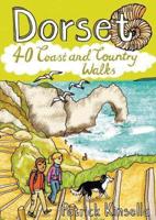
Wandelgids Dorset | Pocket Mountains
Handige compacte wandelgids met 40 dagwandelingen. Deze gids bevat kleine kaartjes en leuke uitgebreide informatie over wat er langs de route te zien is. Goede wandelkaarten zijn echter wel aan te raden voor deze tochten: de Ordnance Survey explorer maps of Landranger maps zijn zeer geschikt. From Old Harry Rocks, Lulworth Cove and Durdle Door, all along the shore of the Jurassic Coast to Lyme Regis, via the glowing summit of Golden Cap and the one-eyed winking lighthouse at Portland Bill, Dorset is a walkers’ wonderland.   The 40 routes in this book roam over hills and across heathland, go through forests and voluptuous valleys, trace ridgelines and precipitous cliffs, passing caves, castles, coves, country pubs and stunning viewpoints, to find vibrant villages and secret beaches. Here you’ll come face-to-face with history, walk with the words of Thomas Hardy ringing in your ears, witness wondrous wildlife and encounter all manner of cottage industries, from community cake- and marma…
10,95
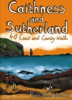
Wandelgids Caithness and Sutherland | Pocket Mountains
Handige compacte wandelgids met 40 dagwandelingen. Deze gids bevat kleine kaartjes en leuke uitgebreide informatie over wat er langs de route te zien is. Goede wandelkaarten zijn echter we noodzakelijk voor deze tochten: de Ordnance Survey explorer maps of Landanger maps zijn zeer geschikt. The county of Ayrshire is located on the Firth of Clyde on the beautiful West Coast of Scotland and is known as one of the most fertile areas of the country, famed for its cattle and crops. Although more industrial to the north, it is in the main a landscape made for walking with an abundance of open countryside and rugged little hills, golden sandy beaches and beautiful sunsets. This guide features 40 mostly moderate walks full of interest which explore all aspects of the region, from craggy cliffs and caves to historic castles, ancient forests to sandy shorelines. Sutherland and Caithness are the most northerly parts of mainland Britain. Northwest Sutherland is a landscape of sandy beaches and …
10,95
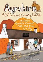
Wandelgids Ayrshire | Pocket Mountains
Handige compacte wandelgids met 40 dagwandelingen. Deze gids bevat kleine kaartjes en leuke uitgebreide informatie over wat er langs de route te zien is. Goede wandelkaarten zijn echter we noodzakelijk voor deze tochten: de Ordnance Survey explorer maps of Landanger maps zijn zeer geschikt.   The county of Ayrshire is located on the Firth of Clyde on the beautiful West Coast of Scotland and is known as one of the most fertile areas of the country, famed for its cattle and crops. Although more industrial to the north, it is in the main a landscape made for walking with an abundance of open countryside and rugged little hills, golden sandy beaches and beautiful sunsets. This guide features 40 mostly moderate walks full of interest which explore all aspects of the region, from craggy cliffs and caves to historic castles, ancient forests to sandy shorelines.
10,95
Wandelgids Lewis | Pocket Mountains
The Isle of Lewis is a magnificent domain of rugged hillcountry and lochan-scattered moorland, fringed by tenacious crofting townships. The coastline is a realm of rocky cliffs, sea lochs, islands and skerries while the west coast is garlanded with dazzling dune-backed beaches. History is everywhere in Lewis, with remarkable monuments to human endeavour - ancient and more recent - punctuating the landscape.   These 25 walks explore the island's range of environments, providing opportunities to experience its spectacular wildlife and encounter the physical traces of its history.
12,50
Wandelgids Coll, Tiree and the Small Isles | Pocket Mountains
Handige compacte wandelgids met 40 dagwandelingen. Deze gids bevat kleine kaartjes en leuke uitgebreide informatie over wat er langs de route te zien is. Goede wandelkaarten zijn echter we noodzakelijk voor deze tochten: de Ordnance Survey explorer maps of Landanger maps zijn zeer geschikt.     Off the west coast of Scotland, south of the Isle of Skye and north of Mull and Ardnamurchan, the islands' of Coll and Tiree are the most westerly of the Inner Hebrides and have a reputation as being amongst Scotland's sunniest places. Together with the Small Isles archipelago of Eigg, Rum, Muck and Canna to the north, these Hebridean gems provide a remarkable range and variety of walking. The 36 routes in this book explore these six magical islands rich histories and thriving wildlife as well as the fine sandy beaches, awe-inspiring cliffs and coves, wild interiors and dramatic mountain ranges which make them so special.    
10,95
Wandelgids - Fietsgids Hiking and Cycling the California Missions Trail - Californie | Cicerone
Guidebook to hiking or cycling the 800 mile (1289km) California Missions Trail between San Francisco Bay and San Diego. The pilgrimage trail takes in 21 historic Spanish missions and can be completed in 50-60 walking days or 2-3 weeks cycling. With 1:100,000 mapping, route description, and details of accommodation and facilities for each stage. Ancient footpaths became connecting routes between the Spanish missions, pueblos, and presidios in the period 1769 to 1823. Over time these routes became automobile roadways and were marked with bells starting in 1906 to promote and preserve the El Camino Real. Today, the California Missions Trail follows a pedestrian route through urban cities and historic towns, through forest paths and country lanes, to each of the twenty-one historic Spanish missions. The 800-mile California Missions Trail leads walkers and cyclists through some of the most scenic and historic sites of one of America's most beautiful states. The 21 missions, founded 200-250…
26,50

Klanten-reviews van Wandelgids Harris | Pocket Mountains

Er zijn nog geen beoordelingen voor dit productBen jij de eerste die een review plaatst?

Meer over Wandelgids Harris | Pocket Mountains

Productomschrijving

The Isle of Harris is home to some wonderful walking country, from the rugged ridges and glens of the Harris Hills to the astonishingly beautiful white sand beaches of the island's west coast, while the remarkably complex eastern coastline is punctuated with sea lochs, headlands, coves and bays. These environments are also full of historical interest and spectacular wildlife. These 25 walking routes explore the island's range of landscapes, including strolls along the west coast beaches, half-day walks on rocky coastal paths, day-long mountain ridge traverses and wild country backpacking routes.  

Verken gerelateerde categorieën

Webshop.nl maakt gebruik van cookies. Ga je verder op onze website, ga dan akkoord met het plaatsen van cookies en de verwerking van deze data door ons en vermelde partners.