webshop.nl
Categorieën
  Sluiten

Meer Pocket Mountains
Meer Pocket Mountains in Geschiedenis & politiek boeken

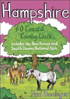
Wandelgids Hampshire | Pocket Mountains

Handige compacte wandelgids met 40 dagwandelingen. Deze gids bevat kleine kaartjes en leuke uitgebreide informatie over wat er langs de route te zien is. Goede wandelkaarten zijn echter we noodzakelijk voor deze tochten: de Ordnance Survey explorer maps of Landanger maps zijn zeer geschikt.   With a network of over 4,800km of rights of way and two ...
10,95

Webshops met dit product

Webshop
Bezorging
Prijs

Anderen bekeken ook

Wandelgids Hampshire | Pocket Mountains
Handige compacte wandelgids met 40 dagwandelingen. Deze gids bevat kleine kaartjes en leuke uitgebreide informatie over wat er langs de route te zien is. Goede wandelkaarten zijn echter we noodzakelijk voor deze tochten: de Ordnance Survey explorer maps of Landanger maps zijn zeer geschikt.   With a network of over 4,800km of rights of way and two national parks, Hampshire offers a myriad of adventures for walkers. The jewel in the county¿s crown is the New Forest, one of Britain¿s most stunning national parks and a remarkable example of a medieval hunting forest. The South Downs, England¿s newest national park, also presents some outstanding walks in landscapes of high ecological and scenic value. The two national parks cover around 45% of Hampshire¿s area. This guide covers both of these parks and features many other superb walks across the county.
10,95
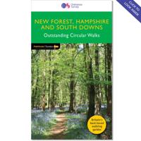
Wandelgids 12 Pathfinder Guides New Forest, Hampshire and South Downs
Wandelgids van een deel van Engeland, Schotland of Wales. Deze gids bevat 28 dagwandelingen, variërend van korte tochten tot pittige dagtochten. De bijbehorende kaarten zijn uitstekend: men heeft de topografische kaarten van Ordnance Survey gebruikt waarop de route is ingetekend. Daarnaast praktische informatie over de wandeling en wat beschrijvingen van het gebied. Pathfinder® Guide to New Forest, Hampshire and South Downs offers interest, regional variety and balance of routes in the New Forest and South Downs National Parks within Hampshire, and in the Itchen and Test valleys, and across the north of the county, providing the best walks in the area.   From an easy stroll across typical New Forest heathland at Bishop's Dyke to the much more energetic downland walking around Kingsclere and Watership Down, this volume contains something for everyone. This newly published OS edition contains a brand new walk on Beaulieu Heath and takes in Hawkhill Inclosure, contrasting two celebrated N…
18,50
Wandelgids Walking in the Thames Valley | Cicerone
Walking in the Thames Valley offers 25 challenging circular walks around the River Thames and River Kennet in the south of England, taking in the Southern Chilterns, the Berkshire and North Hampshire Downs, Southern Oxfordshire and the eastern edge of Wiltshire. All routes are within easy reach of Reading, Newbury, Abingdon and London. While some walks visit Iron Age hill forts, others pass more modern features such as Wilton Windmill and the Kennet and Avon Canal. Some follow sections of the Ridgeway, while others meander along the banks of the Thames. What they all have in common is that they take the keen rambler to some of the best parts of the Thames Valley – a patchwork of open chalk grassland, broadleaved woodland and farmland and home to two Areas of Outstanding Natural Beauty. • walks from 10 to 18 miles, including one 2-day route • shorter, less strenuous alternatives for many of the walks • detailed route descriptions with information on local points of interest, OS mapping …
18,50
Wandelgids Walking in the New Forest | Cicerone
Goede wandelgids met veel dagtochten, geschikt voor iedereen.   A guidebook to 30 walks of between 3 and 10 miles set throughout the New Forest National Park in Hampshire and Wiltshire. Routes explore ancient woodland, heather-clad heath and dramatic coastline, all within easy reach of Southampton, Bournemouth and Salisbury. Walks for all abilities, easily combined to create longer challenges.   This guidebook presents 30 walks in the New Forest in Hampshire and Wiltshire, Britain's smallest National Park. Easily accessible from Southampton, Bournemouth, Salisbury and Winchester, the New Forest encompasses varied landscapes, from ancient woodlands to open heaths, rivers and coastline. Routes of between 5 and 16km (3 and 10 miles) explore the Forest, mainly on fairly flat terrain, often on well-defined tracks and paths. Most walks are suitable for all the family and many can be combined to make longer outings. Each walk is described in detail, highlighting the many points of interest …
18,50
Wandelgids Wye Valley | Pocket Mountains
This guide contains forty circular routes, covering an area somewhat broader than the AONB but within similar north-south boundaries. This collection of walks is split into five areas: Hereford Lowlands and the Woolhope Dome; Archenfield and the Monnow and Trothy Valleys; The Wye Gorge; The Forest of Dean; The Trellech to Chepstow Plateau. In part, the areas reflect the diverse geology and ecology of the landscape, but they are in no way essentially distinct or separate. Each has its own particular attractions and character, but there is much that is shared between all five areas.   Most of the routes are intended as comfortable walks or strolls, manageable by all willing to put one foot in front of another, at most requiring half a day to complete. Occasionally, the cumulative ascent may leave unseasoned legs a little stiffer, but in general the walking is on well-worn paths, lanes and tracks, which should require minimal time and effort for route-finding. However, the sketch maps serve an…
10,95
Wandelgids Landscapes of the Tatra Mountains (Polen en Slowakije) | Su
Wandelgids: vele dagtochten worden degelijk beschreven met openbaar vervoer informatie, goede routebeschrijvingen en kaartmateriaal. Tevens enkele autotochten. (Engelstalig) The go-to Tatra Mountains travel guide for discovering the best walks and car tours. Strap on your boots and discover Tatra Mountains on foot with the Sunflower Tatra Mountains travel guide. And on the days when your feet may have had enough, enjoy some spectacular scenery on one of our legendary car tours.   The Sunflower Tatra Mountains guide is indispensable for hiking in the Tatra Mountains or seeing Tatra Mountains by car. For those who love mountain walks, there can be few places where hikers are better catered for than in the Polish Tatras and the Slovakian Tatras. Skilfully constructed paths make hiking in very rough terrain comparatively easy; signposting and waymarking are almost universally excellent.   Hillwalkers will be in their element here, but there are often shorter, easy suggestions for the less …
23,50

Klanten-reviews van Wandelgids Hampshire | Pocket Mountains

Er zijn nog geen beoordelingen voor dit productBen jij de eerste die een review plaatst?

Meer over Wandelgids Hampshire | Pocket Mountains

Productomschrijving

Handige compacte wandelgids met 40 dagwandelingen. Deze gids bevat kleine kaartjes en leuke uitgebreide informatie over wat er langs de route te zien is. Goede wandelkaarten zijn echter we noodzakelijk voor deze tochten: de Ordnance Survey explorer maps of Landanger maps zijn zeer geschikt.   With a network of over 4,800km of rights of way and two national parks, Hampshire offers a myriad of adventures for walkers. The jewel in the county¿s crown is the New Forest, one of Britain¿s most stunning national parks and a remarkable example of a medieval hunting forest. The South Downs, England¿s newest national park, also presents some outstanding walks in landscapes of high ecological and scenic value. The two national parks cover around 45% of Hampshire¿s area. This guide covers both of these parks and features many other superb walks across the county.

Productspecificaties

Artikelnummer(s)
Brand
Pocket Mountains

Verken gerelateerde categorieën

Webshop.nl maakt gebruik van cookies. Ga je verder op onze website, ga dan akkoord met het plaatsen van cookies en de verwerking van deze data door ons en vermelde partners.