webshop.nl
Categorieën
  Sluiten

Meer Rucksack Readers
Meer Rucksack Readers in Literatuur boeken

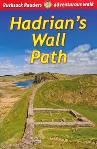
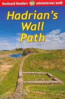
Wandelgids Hadrian's Wall path | Rucksack Readers

Uitgevoerd in de vorm van een klapper, met ringband geeft deze gids een goede beschrijving van de lange afstands route. De kaarten zijn schetsmatig maar wel duidelijk.   Hadrian's Wall Path runs for 86 miles (138 km) between Bowness-on-Solway and Wallsend (Newcastle) along the line of the Roman Wall completed in AD122 under the Emperor Hadrian. Thi...
17,95

Webshops met dit product

Webshop
Bezorging
Prijs

Anderen bekeken ook

Wandelgids Hadrian's Wall path | Rucksack Readers
Uitgevoerd in de vorm van een klapper, met ringband geeft deze gids een goede beschrijving van de lange afstands route. De kaarten zijn schetsmatig maar wel duidelijk.   Hadrian's Wall Path runs for 86 miles (138 km) between Bowness-on-Solway and Wallsend (Newcastle) along the line of the Roman Wall completed in AD122 under the Emperor Hadrian. This National Trail crosses northern England from Irish Sea to North Sea and offers many chances to look at the forts, milecastles and interpretation centres within this UNESCO World Heritage Site.    The route is clearly waymarked and well supported by public transport, giving flexibility to walk it in linear sections or as loop walks. Although the book's detailed description runs from west to east (Bowness to Wallsend), it includes notes for east-to-west walkers. For conservation reasons, you are encouraged to walk the Path between May and October. This guidebook contains all you need to plan and enjoy a classic week's walking
17,95
Wandelgids Hadrian's Wall Path | Cicerone
Meest duidelijke wandelgids van de route: veel details in kaarten en informatie, beide kanten op beschreven! The essential guidebook to walking the 84-mile Hadrian’s Wall Path. One of the UK's most visited National Trails, it runs the length of the Roman Wall from Bowness-on-Solway in Cumbria to Wallsend, Newcastle.   Begun in AD122 and stretching from the River Tyne to the Solway Firth, Hadrian’s Wall was a massive feat of engineering and is the best preserved frontier from the classical Roman Empire. Today it is a World Heritage Site, with iconic scenery and fascinating archaeological remains like Birdoswald, Housesteads and Vindolanda, giving a glimpse into Roman life and power. The trail is presented here in 10 stages, with suggestions for five and eight-day itineraries. It is suitable for beginners, although a reasonable level of fitness is required if doing it as a multi-day trek. The route is described both west to east and east to west, and the guidebook also features extension…
24,95
Wandelatlas Hadrian's Wall Path Map Booklet | Cicerone
All the mapping you need to walk the 84 mile (135km) Hadrian's Wall Path from Bowness-on-Solway in Cumbria to Wallsend, Newcastle. This booklet of Ordnance Survey 1:25,000 Explorer maps has been designed for convenient use on the trail. It shows the full and up-to-date line of the Hadrian's Wall Path, along with the relevant extract from the OS Explorer map legend. It can be used when walking the trail west-east or east-west, and includes an extension to the east coast at South Shields. It is conveniently sized for slipping into a jacket pocket or top of a rucksack. This booklet is included with the Cicerone guidebook to Hadrian's Wall Path National Trail.
17,95
Wandelkaart Adventure Atlas Hadrian's Wall Path | A-Z Map Company
AZ heeft de meest gedetailleerde wandelkaarten van het Hadrian's Wall Path gebundeld in een atlasje. Daardoor is het heel handig qua formaat. De kaarten zelf zijn perfect voor het wandelen. Schaal 1:25.000 The A-Z Adventure Series of maps combines the best of OS and A-Z, creating the perfect companion for walkers, off-road cyclists, horse riders and anyone wishing to explore the great outdoors. Hadrian's Wall Path is a National Trail which follows the line of Hadrian's Wall from coast-to-coast. The 84 mile (135km) path weaves through beautiful countryside, encountering historic remains of Roman forts and milecastles, splendid bridges, views from the Whin Sill escarpment and Solway salt marshes. Starting in Wallsend in Newcastle and ending in Bowness-on-Solway, the route on the map is clearly highlighted in yellow with mileage markers added to guage distances when planning sections of the walk to enjoy. This official National Trail Map of Hadrian's Wall Path features 38 pages of continu…
12,95
Wandelgids Hadrian's Wall Path | Trailblazer Guides
Goede wandelgids van de hele route van kust naar kust. Met veel details zijn alle etappes beschreven. Tevens informatie over overnachtingen en openbaar vervoer. Hadrian’s Wall Path, 84 miles from end to end, follows the course of northern Europe’s largest surviving Roman monument, a 2nd-century fortification built – in the border country between England and Scotland – on the orders of the Emperor Hadrian in AD122. Hadrian’s Wall Path is the first National Trail to follow the course of a UNESCO World Heritage Site. This week-long walk is regarded as one of the least challenging of the National Trails. 7 town plans and 45 large scale walking maps – at just under 1:20,000 – showing route times, places to stay, points of interest and much more Itineraries for all walkers – whether walking the route in its entirety over seven to eight days or sampling the highlights on day walks and short breaks Practical information for all budgets, all updated for the new edition – camping, bunkhouses, ho…
19,95
Wandelkaart Hadrian's Wall Path | Vertebrate Publishing
The 138-kilometre Hadrian's Wall Path traces a grey line along Great Whin Sill, the dolerite ridge chosen by the Romans for their historic wall. The route, one of Britain's most popular National Trails, is dotted with milecastles and forts, and attracts trail runners and walkers all year round due to its sweeping views. Beginning in Newcastle, the trail passes through rolling grassy paths and grey-green crags to reach Bowness-on-Solway on the Cumbrian Coast.   Hadrian's Wall Path appeals to people who have different levels of experience and travel at all speeds, and this Vertebrate Publishing Guidemap is unique in that it caters for four categories of user, providing custom itineraries for walkers, trekkers, fastpackers and trail runners. This lightweight, waterproof, durable and easy-to-use folding map features all the essential information for a successful Hadrian's Wall Path, including 1:40,000-scale mapping for the linear route starting in Wallsend and finishing in Bowness-on-Solwa…
24,50

Klanten-reviews van Wandelgids Hadrian's Wall path | Rucksack Readers

Er zijn nog geen beoordelingen voor dit productBen jij de eerste die een review plaatst?

Meer over Wandelgids Hadrian's Wall path | Rucksack Readers

Productomschrijving

Uitgevoerd in de vorm van een klapper, met ringband geeft deze gids een goede beschrijving van de lange afstands route. De kaarten zijn schetsmatig maar wel duidelijk.   Hadrian's Wall Path runs for 86 miles (138 km) between Bowness-on-Solway and Wallsend (Newcastle) along the line of the Roman Wall completed in AD122 under the Emperor Hadrian. This National Trail crosses northern England from Irish Sea to North Sea and offers many chances to look at the forts, milecastles and interpretation centres within this UNESCO World Heritage Site.    The route is clearly waymarked and well supported by public transport, giving flexibility to walk it in linear sections or as loop walks. Although the book's detailed description runs from west to east (Bowness to Wallsend), it includes notes for east-to-west walkers. For conservation reasons, you are encouraged to walk the Path between May and October. This guidebook contains all you need to plan and enjoy a classic week's walking

Productspecificaties

Artikelnummer(s)
Brand
Rucksack Readers

Verken gerelateerde categorieën

Webshop.nl maakt gebruik van cookies. Ga je verder op onze website, ga dan akkoord met het plaatsen van cookies en de verwerking van deze data door ons en vermelde partners.