Wandelgids Hadrian's coastal route | The History Press

0
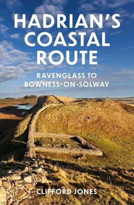
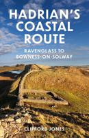
Dit is meer een reisgids dan een wandelgids: de kaarten zijn slechts schetsmatig, een wandelkaart er bij is wel zo handig! Hadrian's Wall, running from Wallsend to Bowness, is a much visited attraction and an iconic landmark with over 200 years of serious research behind it. The Western Frontier has had barely 70 but through the efforts of a small...

Verkopers met dit product

Webshop
Bezorging
Prijs
DeZwerver.nl logo
DeZwerver.nl
niet bekend
18,50

Anderen bekeken ook

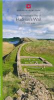
Historische Kaart An Archaeological Map of Hadrian's Wall | English Heritage
It was more than just a wall: it was a whole military zone designed to control movement across the northern frontier of the Roman province of Britannia. Great earthwork barriers survive, along with the remains of forts and temporary camps; watch-towers and fortified gates; civilian settlements, temples, cemeteries, bath-houses, roads and bridges. Stretching across the spine of England from the North-East coast to the Irish Sea, the line of the frontier extends for over 100 miles through every type of landscape: from the streets of urban Tyneside, through arable fields; along the crags of the wild Whin Sill; to the sands of the Solway, and down the coast of Cumbria. Drawing upon the extensive expertise and unrivalled archives of English Heritage, and those of its partners, this map depicts the fruits of modern archaeological research: in field survey, geophysics, excavation, and the analysis of aerial photographs. Using Ordnance Survey 1:25,000 data - the ideal scale for walkers - this…
14,95
Wandelgids Hadrian's Wall Path | Aurum Press
Beschrijving van Hadrian's Wall Path. Historische en culturele aspecten komen vrij uitgebreid aan bod, praktische informatie is wel summier. Kaartmateriaal van Ordnance Survey is zonder meer uitstekend! Since it opened in 2003 Hadrian's Wall Path has become one of Britain's most popular long-distance paths. Its 84 miles are a convenient week's walking, shadowing for the most part the historic line of Hadrian's Wall in its spectacular progress across the superbly wild landscape of the north of England. Starting in what used to be Tyneside's shipbuilding heart, and joining Newcastle in the east with Carlisle in the west, it takes you via the extraordinary Roman forts of Vindolanda and Housesteads, close to handsome towns like Hexham and Corbridge, to finish on the lonely shores of the Solway Firth with views of Scotland. Comprehensive and engrossing, this official guide, published in conjunction with Natural England, is the only companion you need. Ordnance Survey mapping for the entire…
20,95
Wandelgids Hadrian's Wall Path | Trailblazer Guides
Goede wandelgids van de hele route van kust naar kust. Met veel details zijn alle etappes beschreven. Tevens informatie over overnachtingen en openbaar vervoer. Hadrian’s Wall Path, 84 miles from end to end, follows the course of northern Europe’s largest surviving Roman monument, a 2nd-century fortification built – in the border country between England and Scotland – on the orders of the Emperor Hadrian in AD122. Hadrian’s Wall Path is the first National Trail to follow the course of a UNESCO World Heritage Site. This week-long walk is regarded as one of the least challenging of the National Trails. 7 town plans and 45 large scale walking maps – at just under 1:20,000 – showing route times, places to stay, points of interest and much more Itineraries for all walkers – whether walking the route in its entirety over seven to eight days or sampling the highlights on day walks and short breaks Practical information for all budgets, all updated for the new edition – camping, bunkhouses, h…
19,95
Wandelgids - Pelgrimsroute Pilgrim Paths of Ireland | The Collins Press
The popularity of the Camino de Santiago has prompted renewed interest in pilgrim walks in Ireland. Our ancient network of sacred paths means there is no need to travel abroad to enjoy symbolic trails in the footsteps of generations past. Increasing numbers now follow ancient routes through captivating Irish scenery to such holy places as Glencolumbkille, Croagh Patrick, Lough Derg and Glendalough. John G. O'Dwyer has walked these pilgrim trails, from Slieve Mish in the northeast, where Christianity may have had its first dawning in Ireland, to Skellig Michael in the southwest, where the known world once ended. His well-received guide is now updated with five additional journeys of homage, including Kerry's Cnoc na dTobar and Wicklow's St Declan's Way. Each walk includes clear directions, the degree of difficulty, estimated time and a map. The paths are varied and suit a range of abilities, from casual ramblers to committed walkers.Whatever your beliefs, enjoy a sublime escape from th…
22,50
Reisverhaal The Realm of the Punisher | Tom Sykes
In June 2016, Rodrigo Duterte won the Philippine presidential election by a landslide. Infamous for his bombastic temper and un-PC wisecracks, he is waging a brutal drug war that has killed more than 12,000 people so far.   Over the last nine years, British writer Tom Sykes has travelled extensively in the Philippines in order to understand the Duterte phenomenon, interviewing friends and enemies of ‘The Punisher’ – as he is known – in politics, the media, the arts and civil society. Sykes witnesses anti-government demonstrations in the capital Manila and visits the provincial city of Davao, where Duterte began his crusade against crime using police and vigilante death squads. By delving into Duterte’s troubled childhood of violent rebellion, Sykes discovers what motivates the man today in his pursuit of a merciless ‘war on the poor’ – as Amnesty has described it – that has no end in sight.   The Realm of the Punisher also examines oppressed and marginalized groups in the modern Phili…
18,50
Wandelgids Dales Way | Trailblazer Guides
The popular Dales Way long-distance footpath begins in Ilkley, West Yorkshire and runs for 84 miles (135km) to end in the Lake District, in Bowness-on-Windermere. It follows riverside paths along the River Wharf towards Ribblehead and the watershed of northern England, then meanders along the river valleys of Dentdale, the River Mint and the River Kent dropping down into the Lake District to end beside Lake Windermere. It's a relatively easy walk that takes about a week. Includes 40 large-scale maps (3 1/8 inches to 1 mile); 9 town plans and 8 overview maps. Full details of all accommodations and campsites, restaurants and pubs; plus full public transport information. Plus day-walks. - 40 large-scale walking maps - at just under 1:20,000 - showing route times, places to stay, points of interest and much more - 9 town plans - 8 area maps and trail profiles - Itineraries for all walkers - whether walking the route in its entirety over a week or sampling the highlights on day walks and s…
19,95
Wandelgids Shetland | Pocket Mountains
Handige compacte wandelgids met 40 dagwandelingen. Deze gids bevat kleine kaartjes en leuke uitgebreide informatie over wat er langs de route te zien is. Goede wandelkaarten zijn echter we noodzakelijk voor deze tochten: de Ordnance Survey explorer maps of Landanger maps zijn zeer geschikt. The most northerly of Britain's island groups, Shetland is so far removed from the rest of the UK that it usually appears as an inset on maps. Although relatively little known to those from outside the islands, Shetland is a magnificent terrain for walkers, especially those who love to really explore and get away from the beaten track. The coastal walking here includes some of the finest in the country, with superb cliffs, towering sea stacks, caves and natural arches seemingly around every corner. Added to this is Shetland's better known claim to fame for its spectacular seabird colonies, huge gannetries, moorland packed with arctic and great skuas, arctic terns in the more sheltered spots, and ev…
10,95
Wandelgids The Burren & the Aran Islands | The Collins Press
Duidelijke wandelgids van dit specifieke deel van Ierland. Goede praktische informatie en zeker voor de GPS wandelaar handig met vermelde waypoints. Kaarten zijn schetsmatig, maar er wordt verwezen naar de benodigde topografische kaarten van Ierland.  The Burren and the Aran Islands, with their unique combination of flora, fauna and landscape, are explored by large numbers of walkers annually. This is a revised guide to some of the best walking routes in the region, with lucid descriptions and additional information to enhance the walkers' enjoyment and appreciation of the place. From the rugged interior to spectacular coastal scenery, from challenging upland walks to shorter road and waterside excursions, this selection has something for everyone. Every part of the region is covered. Walks vary from two-hour strolls to the longer Burren Way, a six-hour walk from Lisdoonvarna to Ballyvaughan.   The author has put his considerable experience and detailed knowledge of the area to great …
22,50
Reisgids Zwitserland - Switzerland by public transport | Bradt Travel Guides
Voor vele landen net zo goed, zo niet beter dan de Planet. Beduidend soberder uitgevoerd, maar ook met veel informatie voor backpackers en met veel kaartmateriaal. Een aanrader! Thoroughly updated, this seventh edition of Bradt’s guide to Switzerland offers a unique perspective on getting the most from this mountainous country while travelling only by public transport. Switzerland boasts the world’s finest public transport network – the comfort, efficiency and frequency of trains, buses, boats and cable cars explain why many Swiss don’t own cars – yet is still enhancing services, including recently around Geneva. The Swiss Travel System is a revelation. Moreover, using public transport is a must. Visitors cannot reach many fine Swiss sights by road, and over a dozen car-free resorts enable them to experience the serenity and clean air of the country’s mountains (208 above 3,000m). Walkers and cyclists enjoy superb networks – almost 64,000km of footpaths and many surprisingly unhilly c…
27,50
Wandelgids City Walks Oxford | Crimson
Aan de hand van 15 wandelingen leer je de stad Oxford heel goed kennen. Oford gids Victoria Bentatat Azaz leidt je roind met veel informatie, goiede beschrijvinfen en heldere kaarten.  Are you visiting Oxford for the first time? Or are you an avid walker interested in taking a stroll around Oxford's scenic and famous sites? Whether you visit Oxford regularly or are a first-time visitor, City Walks Oxford provides a new look at this charming city with unique insights and imaginative tours. Take any route and see Oxford come to life, from Jericho and Port Meadow to Headington and Iffley, see Oxford's historic sites and top attractions. Expert local guide Victoria Bentata Azaz gives you a personal tour of Oxford, with each walk packed full of intriguing tales and fascinating features including, Oxford Castle, the colleges of Oxford University and its world-class museums and libraries. Learn little-known facts and tales in an entertaining and exciting way and discover the stories and even…
14,50

Klanten-reviews van Wandelgids Hadrian's coastal route | The History Press

Er zijn nog geen beoordelingen voor dit productBen jij de eerste die een review plaatst?

Meer over Wandelgids Hadrian's coastal route | The History Press

Productomschrijving

Dit is meer een reisgids dan een wandelgids: de kaarten zijn slechts schetsmatig, een wandelkaart er bij is wel zo handig!

Hadrian's Wall, running from Wallsend to Bowness, is a much visited attraction and an iconic landmark with over 200 years of serious research behind it. The Western Frontier has had barely 70 but through the efforts of a small band of archaeologists and the Hadrian's Wall Heritage Trust Ltd this is gradually changing. The frontier route followed in this guide, running from Ravenglass to Bowness on Solway, is punctuated by Roman forts, the visible remains of a frontier of watchtowers, mileforts and manned bases.

‘Be part of history, walk a frontier lost for over fifteen hundred years.’The Western Hadrianic Frontier of the Roman Empire is little known by the general public. Until recently the frontier was viewed as merely a series of forts with a fluid means of defence and administration between them, and the public was understandably drawn to the physical remains of Hadrian’s Wall crossing from Bowness-on-Solway to Wallsend. Archaeologists have always known different, and it is only now that they are beginning to shout from the rooftops that the Western Frontier is as important as the stones that cross the Pennines.   Fortunately, through the efforts of a small band of archaeologists and Historic England, the public perception is changing. There is a wealth of magnificent and diverse scenery and amazing archaeology which rivals the better-known sites along the Hadrian’s Wall. Walking the frontier offers opportunities for personal adventure and discovery.   There is plenty of variety in the west; catch a train or bus, buy local produce, enjoy a beer and a good bed, but most of all enjoy the quest. This fully updated and illustrated guide offers the walker an insight into this relatively unknown world – one that still has much to reveal.

Verken gerelateerde categorieën

Webshop.nl maakt gebruik van cookies. Ga je verder op onze website, ga dan akkoord met het plaatsen van cookies en de verwerking van deze data door ons en vermelde partners.