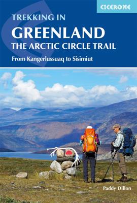
Wandelgids Groenland: Trekking in Greenland The Arctic Circle Trail | Cicerone

0
Uitstekende wandelgids van dit geweldige gebied. goed beschreven met veel praktische informatie om de route te kunnen lopen, inclusief redelijke kaarten. A comprehensive guidebook for hiking the Arctic Circle Trail, which crosses the largest ice-free area of West Greenland, 25-30 miles north of the Arctic Circle. At just over 100 miles long, and t...

Verkopers met dit product

Verkoper
Bezorging
Prijs
DeZwerver.nl logo
DeZwerver.nl
2,95
23,95

Anderen bekeken ook

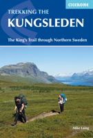
Wandelgids Trekking The Kungsleden | Cicerone
Sweden's most famous long-distance trail, the Kungsleden (King's Trail) traverses the land of the Sámi people and the midnight sun, stretching 460km between Abisko and Hemavan. Around half the route lies within the Arctic Circle showcasing an ever-changing landscape of snowy mountains, deep glacial valleys, open fell, expansive lakes and verdant forest. The fully waymarked trail is comprised of five continuous and distinct sections: these can be walked individually or a thru-hike will take around a month. The guide also includes the popular Abisko to Nikkaluokta circuit, which can be completed in a week, and an ascent of Kebnekaise, Sweden's highest peak at 2098m. In addition to clear route description and mapping, you'll find a wealth of practical advice covering accommodation and facilities, equipment and resupply and detailed notes on how to get to and from the section start and finish-points. A Swedish and Fell Sámi glossary can be found in the appendix. Although there are plenti…
24,95
Reisgids Greenland | Bradt Travel Guides
New from Bradt, Greenland is the first standalone travel guidebook to the country from a mainstream publisher. Targeted at independent travellers, but equally serving those visiting on organised tours or cruises, this guide combines essential information – such as getting around on an island lacking roads connecting the major settlements – with advice on what to see and do, and where to stay and eat. Every chapter is infused with Greenland’s remarkable combination of pristine nature and traditional culture, which sets it apart from Arctic neighbours – and which makes a trip so rewarding. The world’s twelfth-largest country, but also part of the Kingdom of Denmark, Greenland sits near the top of the world, a vast expanse of white in a planet full of green, blue and brown. Today’s visitors relish opportunities for close encounters with immense icebergs and glaciers. The epic scenery provides the backdrop to the numerous activities on offer – from visiting the world’s second-largest ice …
27,95
Wandelgids Walking and Trekking in Iceland - IJsland | Cicerone
Wandelgids met beschrijvingen, kaarten en praktische informatie zoals bussen, overnachten, etc. voor meerdaagse wandelroutes en dagwandeltochten op IJsland. A country of extraordinary beauty, Iceland’s incredible variety of volcanic and glacial landscapes makes it a unique destination for walking and trekking holidays. Its three national parks include the mighty Vatnajökull, largest national park in Europe.   The wide range of routes in this book introduce walkers and backpackers to this ‘Land of Ice and Fire’. There are 100 days of walking in this guidebook, stretching over 1722km, split between 49 day walks and 10 multi-stage treks. They climb mountains, cross glaciers, pass lakes and explore coastlines and geothermal areas, and range from easy nature trails to challenging treks. So, there is enough variation to satisfy all kinds of walkers. The routes are spread all around Iceland, grouped into twelve regions. Detailed information is given at the start of each route or trekking sta…
26,95
Wandelgids - Fietsgids Hiking and Cycling the California Missions Trail - Californie | Cicerone
Guidebook to hiking or cycling the 800 mile (1289km) California Missions Trail between San Francisco Bay and San Diego. The pilgrimage trail takes in 21 historic Spanish missions and can be completed in 50-60 walking days or 2-3 weeks cycling. With 1:100,000 mapping, route description, and details of accommodation and facilities for each stage. Ancient footpaths became connecting routes between the Spanish missions, pueblos, and presidios in the period 1769 to 1823. Over time these routes became automobile roadways and were marked with bells starting in 1906 to promote and preserve the El Camino Real. Today, the California Missions Trail follows a pedestrian route through urban cities and historic towns, through forest paths and country lanes, to each of the twenty-one historic Spanish missions. The 800-mile California Missions Trail leads walkers and cyclists through some of the most scenic and historic sites of one of America's most beautiful states. The 21 missions, founded 200-250…
26,50
Wandelgids Walking in the Thames Valley | Cicerone
Walking in the Thames Valley offers 25 challenging circular walks around the River Thames and River Kennet in the south of England, taking in the Southern Chilterns, the Berkshire and North Hampshire Downs, Southern Oxfordshire and the eastern edge of Wiltshire. All routes are within easy reach of Reading, Newbury, Abingdon and London. While some walks visit Iron Age hill forts, others pass more modern features such as Wilton Windmill and the Kennet and Avon Canal. Some follow sections of the Ridgeway, while others meander along the banks of the Thames. What they all have in common is that they take the keen rambler to some of the best parts of the Thames Valley – a patchwork of open chalk grassland, broadleaved woodland and farmland and home to two Areas of Outstanding Natural Beauty. • walks from 10 to 18 miles, including one 2-day route • shorter, less strenuous alternatives for many of the walks • detailed route descriptions with information on local points of interest, OS mapping…
18,50
Wandelgids The South West Coast Path | Cicerone
Goede wandelgids van het langste gemarkeerde wandelpad van Groot Brittanië; 1015 km! Uit de bekende Cicerone serie, dus met mooie foto's en duidelijke routebeschrijvingen en kaartjes. The South West Coast Path is Britain's longest way-marked trail, measuring a staggering 1015km (630 miles). Written by the well-known outdoor writer, Paddy Dillon, the guide provides a wealth of detailed knowledge to help tackle this immense route with confidence. It describes the way-marked trail from Minehead to Poole along the north Devon, Cornish and south Devon coastline to finish at Poole Harbour. A full introduction provides the route's historical background, advice on accommodation along the route and details on travelling to and around the South West.There is detailed information on how to use this guide to make the most of your walk, whether you choose to walk the whole route in one go or decide to achieve sections at intervals.Day-by-day route summaries accompany the 45-day stages and the fina…
24,95
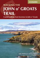
Wandelgids Walking the John o' Groats Trail | Cicerone
Guide to the John o' Groats Trail, a 233km walking route linking Inverness with John o' Groats on the northeast tip of mainland Britain. Much of the walking is coastal, with the northern half characterised by its spectacular seacliffs; however, there is some inland walking too, and the scenery is varied, ranging from dunes and deserted sandy beaches to beautiful woodland. With rough ground and some exposed clifftop walking, the route is suited to experienced hikers.   It takes around a fortnight to complete. The route is described in 14 stages, each of which includes: an overview map; step-by-step route description illustrated with custom mapping; details of accommodation, facilities and transport links; and information on local points of interest. While the main route description is from south to north, notes are supplied for southbound walkers.   Also included is a bonus route linking the trail with the Great Glen, for the benefit of walkers undertaking the Land's End to John o' Gro…
23,95
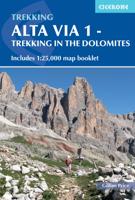
Wandelgids Alta Via 1 - Trekking in the Dolomites | Cicerone
Uitstekende wandelgids van een gerenommeerde Engelse uitgever. De tochten zijn met zorg beschreven en voorzien van allerhande nuttige informatie. The Alta Via 1 is one of Italy's most famous and most popular long-distance routes and is the easiest of six Alta Via routes that traverse the magnificent Dolomites. The hut-to-hut trail extends 115km from Lago di Braies to La Pissa, boasting spectacular alpine vistas. Although it demands a moderate level of fitness, it is well waymarked and follows clear well-trodden paths, making for an ideal introduction to trekking in the Dolomites.   Welcoming refuges offer meals and accommodation along the way, though camping is also possible on the middle stages (restrictions apply elsewhere). The route is presented in 11 stages, each with overview statistics, a brief summary of the day's walking and detailed route description illustrated with clear mapping. There are also comprehensive notes on the huts the route passes, with contact details and tips…
23,95
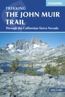
Wandelgids The John Muir Trail | Cicerone
Een uitstekende beschrijving van het beroemde lange afstandspad in Californie. Guidebook to walking the John Muir Trail through California's High Sierra from Yosemite (El Capitan and Half Dome) to the summit of Mount Witney. The 216 mile hike is split into 21 daily stages, with full information on preparation, permits, wilderness, bears, water and trekking skills. Part of the Pacific Crest Trail. The John Muir Trail (JMT) is one of the world’s most spectacular treks and is North America’s best known mid-distance walking trail. It runs for 216 miles through the high Sierra Nevada mountains of California, from Yosemite Valley to the summit of Mount Whitney (14, 496ft), the highest peak in the USA outside Alaska. The walking trail, which is named after the great 19th-century Scottish naturalist, conservationist and writer John Muir, is entirely through the unspoilt wilderness of the American West and passes through three national parks: Yosemite, Kings Canyon and Sequoia National Parks. …
25,95
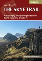
Wandelgids The Skye Trail | Cicerone
Guidebook to the Skye Trail, a challenging 80-mile (128km) trek that snakes its way north–south across the largest island in Scotland’s Inner Hebrides. This unofficial, week-long route is ideal for backpacking, camping wild each night, but can also be walked between overnight accommodation.   Unwaymarked route on sometimes-pathless terrain requires navigational skill, fitness and self-reliance, so is suitable for experienced mountain walkers Seven daily stages of 7–18 miles (11–29km) in length, with an optional 6-mile (11km) alternative route via the summit of Bla Bheinn, one of Skye’s most spectacular Munros Starts at Rubha Hunish at the northern tip of Skye, visits the capital Portree, follows Glen Sligachan between the Black Cuillin and Red Hills, before finishing in the south at Broadford Highlights include the Trotternish Ridge, the Quiraing, the Old Man of Storr, the mighty Cuillin and the abandoned village of Boreraig Clear route descriptions with full 1:50,000 OS mapping and e…
20,95

Klanten-reviews van Wandelgids Groenland: Trekking in Greenland The Arctic Circle Trail | Cicerone

Er zijn nog geen beoordelingen voor dit productBen jij de eerste die een review plaatst?

Meer over Wandelgids Groenland: Trekking in Greenland The Arctic Circle Trail | Cicerone

Productomschrijving

Uitstekende wandelgids van dit geweldige gebied. goed beschreven met veel praktische informatie om de route te kunnen lopen, inclusief redelijke kaarten.

A comprehensive guidebook for hiking the Arctic Circle Trail, which crosses the largest ice-free area of West Greenland, 25-30 miles north of the Arctic Circle. At just over 100 miles long, and taking 7 to 10 days to complete, this splendid backpacking route runs from Kangerlussuaq to Sisimiut - both with airport access.

At just over 100 miles long, and taking 7 to 10 days to complete, the Arctic Circle Trail crosses the largest ice-free patch of West Greenland. This splendid trekking route, lying 25-30 miles north of the Arctic Circle runs from Kangerlussuaq to Sisimiut (both of which have airport access).    The trail traverses remote, empty, silent and stunningly scenic arctic tundra, and is mostly gently graded with just a few short, steep and rocky slopes. However, the landscape between the two towns of Kangerlussuaq and Sisimiut is extremely remote and those who choose to take on this route must be competely self-sufficient. The book includes plenty of practical information on what to take with you and when to go, as well as on safety, travel and accommodation.   Fully illustrated with a variety of photographs and its route is highlighted on continuous trekking maps. The guide also includes an optional extension to the Greenlandic ice cap.

Productinformatie

    Verken gerelateerde categorieën

    Webshop.nl maakt gebruik van cookies. Ga je verder op onze website, ga dan akkoord met het plaatsen van cookies en de verwerking van deze data door ons en vermelde partners.