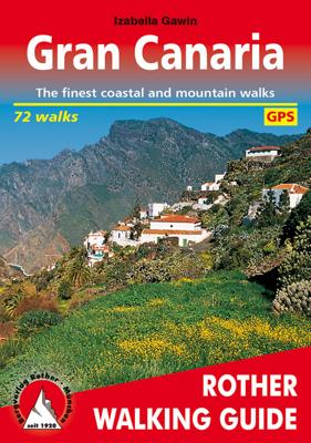
Wandelgids Gran Canaria | Rother Bergverlag

0
Gran Canary not only enjoys a fabulous reputation as a paradise of sunshine and beaches; it can also be described as one of the most versatile hiking islands of the Canary Archipelago. Connoisseurs praise it as a miniature continent because of its diversity of landscapes: shimmering dunes in contrast with luscious subtropical valleys, deep ravines...

Verkopers met dit product

Verkoper
Bezorging
Prijs
DeZwerver.nl logo
DeZwerver.nl
2,95
18,50

Anderen bekeken ook

Wandelgids Tenerife (Engelstalig) | Rother Bergverlag
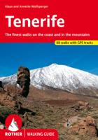
Uitstekende wandelgids met een groot aantal dagtochten in dal en hooggebergte. Met praktische informatie en beperkt kaartmateriaal! Wandelingen in verschillende zwaarte weergegeven in rood/blauw/zwart. Aanbevolen wandelkaarten bij deze gids:   Voor het hele eiland Wandelkaart WKE7 Tenerife hiking map | Freytag & Berndt 1:50.000   of    Wandelkaart 233 Teneriffa | Kompass 1:50.000   Voor Nationaal Park El Teide Wandelkaart Tenerife - Teide - Anaga - Teno | Editorial Alpina 1:25.000   of   Wandelkaart 4 Parques Nacionales El Teide Red de Senderos -T enerife | CNIG - Instituto Geográfico Nacional 1:25.000     Tenerife can easily be described as the most versatile hiking paradise of the Canary Islands. The »Island of Bliss« not only offers the highest peak of the Canary archipelago and the whole of Spain – the Pico del Teide measuring 3718m – it also unites countless, completely different types of landscape: the extremely bare, almost desert-like south, holiday destination of sun aficion…
18,50
Wandelgids Corsica | Rother Bergverlag
Uitstekende wandelgids met een groot aantal dagtochten in dal en hooggebergte. Met praktische informatie en beperkt kaartmateriaal! Wandelingen in verschillende zwaarte weergegeven in rood/blauw/zwart. Bizarre coastal cliffs, charming sandy bays, beautiful chestnut and pine forests, sparkling clean brooks, magical mountain lakes, summit destinations at over 2700 metres high, as well as predominantly unspoilt nature – what other holiday destination in Europe can boast a similar offer? There is hardly another place where a walking and bathing holiday can be combined in such an ideal way as on this Mediterranean island. Among hikers and mountain climbers, Corsica is no longer a secret. The long-distance alpine hiking trail »GR 20« is especially popular, and a few tours in this guide follow portions of that route. The undisputed highlight, however, are the towering peaks of the two-thousand metre mountains Monte Cinto, Monte Rotondo, Paglia Orba and Monte d’Oro, which place the breathtaki…
17,50
Fietskaart - Wandelkaart 076 Nebelstein - Gmünd - Weitra - Gross Gerungs | Freytag & Berndt
The Nebelstein hiking map on a scale of 1:50,000 is the ideal companion for excursions, hikes and bike tours in the Oberes Waldviertel, Waldviertel Mitte and Mühlviertler Alm Freistadt regions Lainsitz, the Castles and Castles Trail, the St. John's Trail and the Life Trail. The hiking trails on the map are easy to follow thanks to the exact cartography by freytag & berndt and the ideal scale. Also for cyclists and mountain bikersthe Nebelstein hiking map is very suitable. In addition to demanding mountain bike routes, the course of the Waldviertel cycle path and parts of the EuroVelo 13 - Iron Curtain Trail can also be followed. Information on the Nebelstein hiking map 1:50,000 Hiking and long-distance hiking trails Cycle paths and mountain bike tours Attractive excursion destinations With info guide GPX Tracks zum Download Waterproof and tear resistant 90 x 61 cm, double-sided Info guide The "short and compact" info guide offers a journey through the regions of the Upper Waldviertel,…
13,95
Wandelgids Cyprus - South & North | Rother Bergverlag
Uitstekende wandelgids met een groot aantal dagtochten. Met praktische informatie en beperkt kaartmateriaal! Wandelingen in verschillende zwaarte weergegeven in rood/blauw/zwart. 192 pages, 122 photos, 50 maps in 1:25,000, 1:50,000 and 1:75,000, overview maps to a scale of 1:400,000 and 1:900,000 Cyprus is not only famous for its cultural heritage and 9000 year old past – »Aphrodite’s Island« is one of the most popular hiking destinations in the eastern Mediterranean. The centre of the island is dominated by the Troodos mountain measuring some 2000 m in height, which despite its considerable altitude is more reminiscent of European low mountains, due to its softly rounded and forested peak. This Rother hiking guide proposes 50 routes mostly ranging from easy to medium level. Next to mountain tours, it also includes a selection of coastal paths along bizarre cliffs and adventurous ravine tours. Forest paths and nature trails lead through aromatic cedar woods, silent valleys and to remo…
17,50
Reisgids Marco Polo ENG Gran Canaria (Engels) | MairDumont
Let op : Engelstalige versie Het is een handige en overzichtelijke, kleine reisgids voor een  goede kennismaking met de vakantiebestemming. Globale uitklapkaart achterin, makkelijk binnenzakformaat. Toch best veel aandacht voor de toeristische hoogtepunten en leuke tips van en door de schrijvers die er vaker geweest zijn.  Explore Gran Canaria with this handy, pocket-sized, authoritative guide, packed with Insider Tips. Discover boutique hotels, authentic restaurants, the island's trendiest places, and get tips on shopping and what to do on a limited budget. There are plenty of ideas for travel with kids, and a summary of all the festivals and events that take place. Let Marco Polo show you all this Spanish Canary Island has to offer... Paradise beaches, rugged mountains and immense sand dunes entice the visitor, as does the big city atmosphere of the capital, Las Palmas. Diving, walking, windsurfing, enjoying the nightlife or simply relaxing, with the assurance of year-round sunshine…
14,95
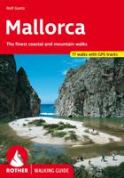
Wandelgids Mallorca (Engelstalig) | Rother Bergverlag
Uitstekende wandelgids met een groot aantal dagtochten in dal en hooggebergte. Met praktische informatie en beperkt kaartmateriaal! Wandelingen in verschillende zwaarte weergegeven in rood/blauw/zwart. Mallorca is not only a primary holiday destination for sun-lovers, but also a true hiking paradise, with lovely valleys, wild, romantic gorges and countless panoramic summits, all in the serene hinterland, tucked away from the seasonally overcrowded coasts. The "other" Mallorca surprises the visitor with a well-developed network of trails, and offers a variety of tours for all demands and levels of difficulty, starting from simple beach walks, to adventurous cliff tours and challenging mountain hikes, up to a spectacular canyon crossing. Rolf Goetz, the author of this Rother hiking guide, is one of the best experts on the Spanish Islands, and, through his various publications, has already made an excellent name for himself. He presents hikers with a wide variety of entertaining tour sug…
17,95
Wandelkaart Tour & Trail Gran Canaria | Discovery Walking Guides
Goede, scheur- en watervaste, wandelkaart van Gran Canaria.   Gran Canaria Tour & Trail Super-Durable Map covers the whole island at 50,000 scale  in a double sided map sheet of North and South with a generous overlap common to both North and South map sheets.   For the best adventures, use the best map.  Gran Canaria is a large island of dramatic landscapes. Gran Canaria Tour & Trail Super-Durable Map (50k scale) is a large 960mm by 700mm double sided map sheet which folds to its 235mm by 120mm pocket size. A special concertina map fold makes the map easy to unfold and refold in use.  Super-Durable means water-proof and tear-proof, simply wipe clean with a damp cloth if your map gets dirty. This map has a "2 Year Guarantee" covering adventurous use.   Gran Canaria North is on one side with South on the reverse side, while a generous common overlap minimises your map turning.    Now in its 5th edition Gran Canaria Tour & Trail Super-Durable Map, 50k scale, is the result o…
15,95
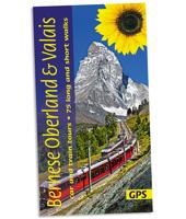
Wandelgids Bernese Oberland & Valais | Sunflower books
Wandelgids: vele dagtochten worden degelijk beschreven met openbaar vervoer informatie, goede routebeschrijvingen en kaartmateriaal. Tevens enkele autotochten. Deze gids staat goed bekend!  This new guide – in Sunflower’s new, wider format – covers the most popular destinations in western Switzerland, countryside blessed with a most dramatic and spectacular landscape. Mountains, glaciers, lakes, rivers, gorges, and waterfalls are plentiful natural elements into which cultural influences blend. Although a car is the best way to explore much of the Oberland and Valais, Switzerland boasts the world’s best public transport system. You can see a vast majority of its mountain landscapes by public transport. There are many suggested train tours in the guide. But where trains don’t go, buses will – even to remote valleys and hamlets.   Switzerland is a hiker’s paradise (you would expect nothing less of a country which has an article in its constitution regulating the responsibilities of those…
20,95
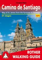
Wandelgids Camino de Santiago - Jakobsweg - Sint Jacobs route | Rother Bergverlag
With over 1000 years of history, the Way of St. James is one of the classic long distance walks. This historical route along almost 1000 kilometres from the Pyrenees to Santiago de Compostela offers unique cultural, scenic and nature experiences. Since the Holy Year of 2010 the Way of St. James has gained even more in popularity and attracts more and more people from very different backgrounds, faiths and generations. It does not matter what the reason might be for setting out on the path to Santiago de Compostela - in the end you are confident that you have had a quite special experience. The Rother walking guide describes in a total of 42 stages the whole of the Camino francés from Saint-Jean-Pied-de-Port via Roncesvalles, as well as the Aragon route from the Somport pass via Jaca to Santiago de Compostela, including possible secondary routes and the extension to Finisterre or Muxía. Thus the Way of St. James leads through a wealth of diverse landscapes, continuously interrupted by …
17,50
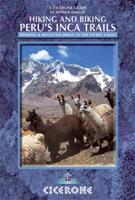
Wandelgids Peru - Hiking and Biking Peru's Inca Trails | Cicerone
The eastern slope of the Peruvian Andes is one of the most dramatic and diverse places on the planet, dropping from over 6000m (20,000ft) to just 200m above sea level. This dramatic drop in elevation produces a wide range of constantly changing climactic and vegetative zones – it is often possible to hike from the base of a glacier down to the jungle in just a day or two. Combined with the countless Inca sites and ubiquitous Inca roads, this makes the Sacred Valley one of the best trekking and mountain biking destinations in the world.    Machu Picchu is well known as one of the Seven Wonders of the World, and the Inca Trail trek that leads there is nearly as famous. What is less known, however, is the vast choice of other epic adventure trips that exist in the region – treks through soaring Andean glaciers and Incan ruins, bike rides through stunning alpine and jungle scenery. Nearly every route in this book uses an Inca road or visits an Inca ruin – and most do both. The majority of…
22,95

Klanten-reviews van Wandelgids Gran Canaria | Rother Bergverlag

Er zijn nog geen beoordelingen voor dit productBen jij de eerste die een review plaatst?

Meer over Wandelgids Gran Canaria | Rother Bergverlag

Productomschrijving

Gran Canary not only enjoys a fabulous reputation as a paradise of sunshine and beaches; it can also be described as one of the most versatile hiking islands of the Canary Archipelago. Connoisseurs praise it as a miniature continent because of its diversity of landscapes: shimmering dunes in contrast with luscious subtropical valleys, deep ravines with palm tree oases and glittering reservoirs, next to which are extensive pine tree forests and green slopes with grazing sheep and goats. To the North West cliffs drop down 800 m deep into the ocean, while in the centre of the island serrated, almost 2000 metre high ridges and bizarre rock monoliths emerge, which the Spanish writer Miguel de Unamuno once interpreted as »fossilised storms of fire and lava.   This Rother walking guide includes excursions to beaches and spectacular cave villages, walks through pine forests and atmospheric ridge paths. Due to the increased significance of hiking tourism, parts of what at times are more than 500 year old rocks have been carefully restored over the last years. These Caminos Reales (royal paths) stretch across the entire island and used to link remote mountain villages with coastal territory. Many proposed tours follow these mainly stone-paved hiking paths and are therefore also ideal for less experienced hikers. Experienced mountain hikers who are not afraid of dramatic walks will also find a rich offer of tours. The first comprehensive hiking guide on Gran Canary leaves nothing to desire!   Coloured illustrations and excellent hiking maps at an ideal scale of 1:50,000/1:75,000 round off the picture and awaken the curiosity for ever new excursions into the charmingly bizarre world of the mountains. The Rother walking guide has been completely revised for this edition and added to 32 routes.

Verken gerelateerde categorieën

Webshop.nl maakt gebruik van cookies. Ga je verder op onze website, ga dan akkoord met het plaatsen van cookies en de verwerking van deze data door ons en vermelde partners.