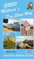
Wandelgids GR221 Mallorca's Long Distance Trail | Discovery Walking Guides

0
Gedetailleerde beschrijving van de GR 221 op Mallorca, met veel praktische informatie, hoogteprofielen, goed kaartmateriaal etc. Achterin ook nog eens veel GPS - waypoints. Bijna onmisbaar bij het lopen van de route! Walk! GR221 Mallorca's Long Distance Trail - The Dry Stone Way. If you want to get away from it all , there is no surer way than str...

Verkopers met dit product

Verkoper
Bezorging
Prijs
DeZwerver.nl logo
DeZwerver.nl
2,95
18,50

Anderen bekeken ook

Wandelgids GR221 Mallorca's Long Distance Trail | Discovery Walking Guides
Gedetailleerde beschrijving van de GR 221 op Mallorca, met veel praktische informatie, hoogteprofielen, goed kaartmateriaal etc. Achterin ook nog eens veel GPS - waypoints. Bijna onmisbaar bij het lopen van de route! Walk! GR221 Mallorca's Long Distance Trail - The Dry Stone Way. If you want to get away from it all , there is no surer way than strapping on your boots, shouldering your backpack, and embarking on a long distance path; and there are few long distance paths more beguiling and more crammed with adventure than Mallorca s GR221, La Ruta de Pedra en Sec or The Dry Stone Way. Anybody who has visited Mallorca will appreciate the justice of the GR221's title. Following ancient bridleways along the length of the Tramuntana range, from Port d'Andratx in the southwest to Pollenca in the northeast, the GR221 touches on dry stone in its every manifestation, from the raw rock of the peaks and sweeping fields of karst to the tailored stones that have always been the island's building m…
18,50
Wandelgids Mallorca o.a. GR221 | Cicerone
Uitstekende wandelgids, goed beschreven met veel praktische informatie om de route te kunnen lopen, inclusief redelijke kaarten.   This guidebook describes the GR221, a 140km (87 mile) long-distance trail through northwestern Mallorca, from Port d'Andratx to Pollença. Also known as the 'Ruta de Pedra en Sec' ('the Drystone Route'), the GR221 is a celebration of Mallorca's limestone heritage, taking in many historic drystone structures as it traverses the rocky peaks of the Serra de Tramuntana. Following old stone-paved paths and mule trails, it showcases the region's beautiful landscape of mountains, forests and cultivated terraces, as well as its spectacular coastline.    The GR221 can be walked in 1–2 weeks, although the guide also covers 3 alternative start-points and 3 alternative finishes, which would allow for a shorter trek. The main route is presented in 10 stages of 8.5–20.5km (5–13 miles), with a handful of optional detours to bag neighbouring summits. Detailed route descrip…
23,95
Wandelkaart Tour & Trail Mallorca - Tramuntana North | Discovery Walking Guides
Let op: deze kaart dekt het noordelijke deel van Mallorca.   For your best adventures, use the best map. Water-proof, split-proof, tear-proof, adventure-proof. Mallorca's Tramuntana North Tour & Trail Super-Durable Map is simply the toughest, most accurate, easy-to-read, easy-to-use multi-purpose map that you can get.   Whether you plan to walk, or explore northern Tramuntana by car or the bus, this is the map for you. A large 960mm by 694mm double sided map sheet covers northern half of Serra de Tramuntana at 1:30,000 scale. This 8th edition sees a significant upgrade from the previous Mallorca North & Mountains Tour & Trail Map, as we have split Serra de Tramuntana in two halves to produce TWO much more detailed maps of larger scale.   This map covers a continuous area from Tramuntana's northern-most Cap de Formentor, including all the coastal resorts such as Port de Pollenca and Port d'Alcudia, all the way to Soller and Deia at the opposite end of the map (for the area from S…
18,95
Wandelkaart Tour & Trail Mallorca - Tramuntana South | Discovery Walking Guides
For your best adventures, use the best map. Water-proof, split-proof, tear-proof, adventure-proof. Mallorca's Tramuntana South Tour & Trail Super-Durable Map is simply the toughest, most accurate, easy-to-read, easy-to-use multi-purpose map that you can get.   Whether you plan to walk, or explore southern Tramuntana by car or the bus, this is the map for you. A large 960mm by 694mm double sided map sheet covers southern half of Serra de Tramuntana at 1:30,000 scale. This 8th edition sees a significant upgrade from the previous Mallorca North & Mountains Tour & Trail Map, as we have split Serra de Tramuntana in two halves to produce TWO much more detailed maps of larger scale, now also including all the popular tourist resorts on the southern coast.   This map covers a continuous area from Tramuntana's southern-most point Cap de Cala Figuera, including all the coastal resorts such as Magaluf, Santa Ponca and Peguera, with Port d'Andratx and Sa Dragonera islet also covered, all the way …
18,95
Wandelgids Walk! La Gomera | Discovery Walking Guides
La Gomera is the ultimate get-away-from-it-all island: easy-going, unspoilt, friendly, isolated from the hustle and bustle of modern living, and so laid back it’s virtually supine - even the volcanoes have been dormant for millions of years. The walks, however, are a bit more energetic. For the new 4th edition of Walk! La Gomera Charles Davis has teamed up with Jan Kostura. Jan brings his wide experience and passion for the Canaries, checking, re-walking and revising existing routes, and adding a couple of his own adventures, including a new Top Three Gomeran walk. Two routes have been dropped as having become too dangerous, but the good news is that many of the more harum-scarum walks have been improved through path clearing and the addition of railings to the vertiginous stretches. Other good news is that the devastating forest fires of 2012 have proved not nearly as damaging as we feared, leaving most of our itineraries unscathed. In short, there is every reason to take off and ex…
17,50
Wandelgids Walk! Dartmoor | Discovery Walking Guides
Engelstalige wandelgids voor Dartmoor, met uitgebreide beschrijvingen van wandelroutes, routekaartjes, praktische informatie zoals bussen en accommodatie. Kate and Alan Hobbs have reviewed and refreshed their Walk! Dartmoor classic guide book for its new 2016 edition. 40 fully detailed walking routes with OS maps and gps waypoints for you to enjoy adventuring on Dartmoor. Walk! Dartmoor with Kate and Alan Hobbs covers walks of varying length across Dartmoor - from the dramatic high moors, gentle riversides, idyllic country lanes, unspoilt villages, to sites of ancient archaeology and former industries, and all with spectacular views.   This user friendly illustrated guide has a summary of walking routes and is rated by time, effort, distance and hills, as well as the availability of refreshments en route and the vertigo risk.Each walk is described in full and there are timings listed in the book to help with navigation and progress. Walk! Dartmoor contains a 1:40,000 scale Ordnance Su…
19,95
Wandelkaart Tour & Trail Alpujarras | Discovery Walking Guides
Scheur- en watervaste wandelkaart van de Alpujarras met hoogtelijnen en graden. For the best adventures, use the best map. The Moorish white villages of the Alpujarras are well known to day trippers from the Costa del Sol. For walkers this is an idyllic region with stone-laid donkey trails linking the tipico villages and stretching up the southern slopes of the Sierra Nevada to Mulhacen; at 3,483 metres the highest mountain peak on mainland Spain. From Spring to the end of Autumn this is a paradise for hikers, whether you are walking from village to village sampling the local delicacies or tackling the challenging major ascents. One thing you will know is that using the Alpujarras Tour & Trail Map will help you plan, and get the best out of, your adventures.   On a large 960mm by 700mm, double sided, map sheet at 40k scale this map has all the detail you need. 20 and 100 metre contours, combined with altitude shading, giving you a true feel to this impressive landscape.  Stret…
15,95
Wandelgids Trekking the Mallorca GR221 | Knife Edge Outdoor
Goede wandelgids met duidelijke routekaarten en praktische informatie.   The definitive two-way guide to the Mallorca GR221 (the Drystone Way): both northbound and southbound routes are described in full.   The GR221 is one of Europe’s most beautiful and aspirational treks in Europe. It travels the length of Mallorca’s rugged mountain range, the Serra de Tramuntana. Along the way, you find a textbook Mediterranean landscape of azure waters, sandy beaches, rocky coves, all overlooked by rugged limestone peaks. As you pass the numerous drystone structures on the trail, you will learn plenty of the island’s fascinating history and you will spend the night in some of its finest villages. This is Spain at its best and it will be an adventure that you will never forget.   Real Maps: Full mapping inside (1:25,000) by Editorial Alpina. All accommodation is numbered and marked on the maps.   12 different itineraries: schedules of 7, 8, 9, 10 and 11 days for hikers and runners. Includes both no…
21,95
Wandelgids Walk! Lanzarote | Discovery Walking Guides
Engelstalige wandelgids Lanzarote, met uitgebreide beschrijvingen van wandelroutes, routekaartjes, praktische informatie zoals bussen en accommodatie. Walk! Lanzarote 5th edition builds on the reputation of our earlier editions with more walks and comprehensive updating so that it caters for the needs of the increasing number of people who would like to combine some walking with a holiday on the Fire island. Walk Lanzarote explodes the myth that there is nowhere worth walking on the island as we range through strolling on coastal promenades, walking across alpine style meadows, striding over the lava sea, dropping into volcanoes, sitting on high mountain seats - quite simply you will be amazed at the wide variety of stunning landscapes the Fire island has to offer the adventurous leisure walker.   new extended coastal route from Arrieta to Los Cocoteros to Costa Teguise, new Playa Blanca to Las Brenas to Yaiza on the GR131, which also updates our Yaiza to Las Brenas circular, newly re…
18,50
Wandelgids 1 Madeira Walks | Discovery Walking Guides
Engelstalige wandelgids Madeira, met uitgebreide beschrijvingen van wandelroutes, routekaartjes en praktische informatie zoals bussen en accommodatie.   Dit eerste deel heeft wandelingen voor zowel de beginnende als de geoefende wandelaar.   Madeira is a wonderful destination for walkers, offering a breathtaking diversity of landscapes; lushly verdant slopes, towering volcanic peaks, dramatic gorges and soaring cliffs surprise and amaze the newcomer. Add the levada network, primeval forests, subtropical flora and the superb landscaped gardens - little wonder that the island is fondly called "The floating garden of the Atlantic". Shirley Whitehead, Madeira's resident walking expert, has brought together over 40 'Leisure Walks' adventures suitable for a wide range of abilities and age groups.   Madeira Walks volume 1 offers a wealth of choice for every walker and explores the best areas the island has to offer. With Madeira Walks in your pocket, your visit to Madeira becomes an unforget…
18,50

Klanten-reviews van Wandelgids GR221 Mallorca's Long Distance Trail | Discovery Walking Guides

Er zijn nog geen beoordelingen voor dit productBen jij de eerste die een review plaatst?

Meer over Wandelgids GR221 Mallorca's Long Distance Trail | Discovery Walking Guides

Productomschrijving

Gedetailleerde beschrijving van de GR 221 op Mallorca, met veel praktische informatie, hoogteprofielen, goed kaartmateriaal etc. Achterin ook nog eens veel GPS - waypoints. Bijna onmisbaar bij het lopen van de route!

Walk! GR221 Mallorca's Long Distance Trail - The Dry Stone Way. If you want to get away from it all , there is no surer way than strapping on your boots, shouldering your backpack, and embarking on a long distance path; and there are few long distance paths more beguiling and more crammed with adventure than Mallorca s GR221, La Ruta de Pedra en Sec or The Dry Stone Way. Anybody who has visited Mallorca will appreciate the justice of the GR221's title. Following ancient bridleways along the length of the Tramuntana range, from Port d'Andratx in the southwest to Pollenca in the northeast, the GR221 touches on dry stone in its every manifestation, from the raw rock of the peaks and sweeping fields of karst to the tailored stones that have always been the island's building material of choice. In some cases, we use immaculately paved trails, at other times we walk on bare rock below looming cliffs, and everywhere we cross the rocky passes that have always been the portals between the Mallorca's otherwise isolated communities.

En route, we see dry-stone huts, dry-stone springs, dry-stone threshing circles, dry-stone snowpits, dry-stone walls, dry-stone limekilns, dry-stone byres, dry-stone stiles, dry-stone bread ovens, dry-stone wells ...basically, anything you can prefix with 'dry-stone', we get it. Moreover, there is enough variety packed into this trail to fill an itinerary twice as long, the dry stone being broken up by plains of citrus groves, terraces of olive trees, forests of Holm Oak, exquisite pastoral enclaves, and spectacular valleys laced with glittering threads of mountain torrents, all of it backed by the broad blue palette of the Mediterranean. In the course of its 115 kilometres, the Ruta de Pedra en Sec takes walkers into places most tourists never see and offers us a bird's eye view of this magnificent landscape, giving visitors a complete picture of the Tramuntana range in a single holiday, freeing one from constraints of time and transport, and lending a coherence to the experience that day walks can only achieve over the course of a far longer and more costly trip.

Features of Walk! GR221: Full details concerning the state of the route and accommodation options. Specific advice and comprehensive practical information to help you plan your trip. Detailed walking descriptions for each stage of the itinerary, including frequent timings to aid navigation and check your progress. GPS waypoints for every key point on the route. Full colour 1:40,000 scale maps drawn from our own surveys. Coloured photos illustrating each stage and dedicated photo pages so you can see at a glance what to look forward to each day. Walking route summaries including ratings for Effort, Time, Distance, Ascents/Descents, Refreshments and Vertigo risk. Altitude profiles drawn from our own GPS records. Alternative itineraries. Links to other walks. Town sketches describing the settlements en route. Gobbets giving background information about the island's history and culture.

Productinformatie

    Verken gerelateerde categorieën

    Webshop.nl maakt gebruik van cookies. Ga je verder op onze website, ga dan akkoord met het plaatsen van cookies en de verwerking van deze data door ons en vermelde partners.