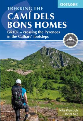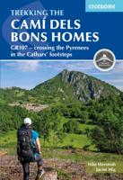
Wandelgids GR107 Trekking the Cami dels Bons Homes | Cicerone

0
A guidebook to walking the Cami dels Bons Homes (GR107), from Foix in France to Berga in Catalonia. Covering 225km (140 miles), this long-distance hike follows a Cathar trail through the French and Spanish Pyrenees. Some sections of the trail are long and somewhat demanding, so a reasonable level of fitness is required for the trek.   The route is...

Verkopers met dit product

Verkoper
Bezorging
Prijs
DeZwerver.nl logo
DeZwerver.nl
2,95
23,50

Anderen bekeken ook

Wandelgids GR107 Trekking the Cami dels Bons Homes | Cicerone
A guidebook to walking the Cami dels Bons Homes (GR107), from Foix in France to Berga in Catalonia. Covering 225km (140 miles), this long-distance hike follows a Cathar trail through the French and Spanish Pyrenees. Some sections of the trail are long and somewhat demanding, so a reasonable level of fitness is required for the trek.   The route is described from north to south in 10 stages, each between 16 and 36km (10–22 miles) in length.   GPX files available to download 1:100,000 maps included for each stage Handy stage facilities planner that highlights information about accommodation, facilities and public transport along the route Advice on planning and preparation
23,50
Wandelgids Trekking Slovenia's Juliana Trail | Cicerone
The Juliana Trail is a 330-km-long circular long-distance hiking trail through the Julian Alps in Triglav National Park, Slovenia. The trek takes in some less familiar valleys along with well-known spots such as Lake Bohinj and Bled, swings briefly through the corner of Italy, and into the Brda wine region. Accessible by public transport, the trek is straightforward and relatively easy, perfect for hikers of various skill levels.   The guidebook offers route description for every stage of this 20-day trekking route, along with providing background information on local history, geology, and wildlife, as well as planning details on when to go, where to stay, and what facilities are available along the trail. 1:50,000 mapping is provided for each stage. Designed to promote sustainable tourism this trail is a true gem of Slovenia's Julian Alps.
26,50
Wandelgids Walking the Cammino Materano | Cicerone
A guidebook to walking to Matera on the Via Peuceta, Via Ellenica and Via Lucana, three long-distance cammino routes through southern Italy's Puglia and Basilicata regions. The three routes are presented in 7, 14 and 6 stages of between 10 and 30km (7 and 19 miles), including variant routes, accompanied by information on facilities, accommodation and where to get your cammino accreditation. The routes are suitable for most abilities. 1:100,000 maps and profiles included for each stage GPX files available to download Handy route summary tables and stage facilities planners help you plan your itinerary Refreshment and accommodation information given for each stage Advice on planning and preparation  
24,95
Wandelgids Trekking the Tour du Mont Blanc | Cicerone
Uitstekende wandelgids die in etappes de route nauwkeurig beschijft; ook de zijtakken en alternatieve routes koman aan bod. Kaarten zijn schetsmatig en in onze ogen onvoldoende bij slechte weersomstandigheden. Wij raden dan ook om er losse kaarten bij te kopen. A guidebook to hiking the Tour du Mont Blanc (TMB), a spectacular circuit around Mont Blanc, Western Europe's highest mountain. Covering 170km (105 miles), the TMB takes around 11 days to walk from its official start at Les Houches (France), passing through Courmayeur (Italy) and Champex (Switzerland) before returning to France via the Chamonix valley. A well-serviced introduction to high-level mountain trekking for walkers with good levels of fitness, it can also be run, fastpacked or hiked in 5–9 days.   The route is described in both directions in 11 daily stages between 7 and 21km (5–13 miles) in length. Variant routes and alternative stages are also provided, giving the option of visiting cols, refuges and viewpoints no…
25,95
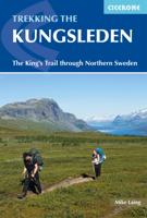
Wandelgids Trekking The Kungsleden | Cicerone
Sweden's most famous long-distance trail, the Kungsleden (King's Trail) traverses the land of the Sámi people and the midnight sun, stretching 460km between Abisko and Hemavan. Around half the route lies within the Arctic Circle showcasing an ever-changing landscape of snowy mountains, deep glacial valleys, open fell, expansive lakes and verdant forest. The fully waymarked trail is comprised of five continuous and distinct sections: these can be walked individually or a thru-hike will take around a month. The guide also includes the popular Abisko to Nikkaluokta circuit, which can be completed in a week, and an ascent of Kebnekaise, Sweden's highest peak at 2098m. In addition to clear route description and mapping, you'll find a wealth of practical advice covering accommodation and facilities, equipment and resupply and detailed notes on how to get to and from the section start and finish-points. A Swedish and Fell Sámi glossary can be found in the appendix. Although there are plenti…
24,95
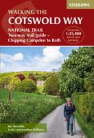
Wandelgids The Cotswold Way | Cicerone
Uitstekende wandelgids van de Cotswolds Way, waarbij naast alle noodzakelijke informatie ook gebruik gemaakt wordt van de echte topografische kaart. inclusief gidsje met routekaarten van 1:25000 (deze is hier ook los te bestellen) Guidebook to walking the 102 mile (163km) Cotswold Way National Trail between Chipping Campden and Bath, across the Cotswolds AONB. The guidebook - which includes both a guide to the route and a separate OS 1:25,000 map booklet - describes the route in both directions.   The route is described over 13 stages, each following the Cotswold escarpment, with dramatic and far-reaching views across the Severn Vale towards the Welsh hills, plunging down to visit honey-coloured villages, old market towns and the elegant and historic city of Bath. The longest of the 13 stages is 10 miles, the shortest 6 miles: these are dictated by the existence of overnight accommodation. For the determined, the trail can be walked in as little as five days.   The Cotswold Way offers…
23,50
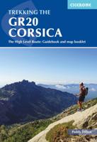
Wandelgids Trekking the GR20 Corsica | Cicerone
Engelstalige beschrijving van de mooiste wandeltocht op Corsica. De gids voldoet aan alle verwachtingen die je kunt hebben. Wel heb je voor de zwaardere gedeelte voor de zekerheid goede kaarten nodig ...... The GR20, on the mountainous Mediterranean island of Corsica, is reputated to be the toughest waymarked trail in Europe. This ambitious route for fit and agile walker covers 190km as it makes a complete traverse through the island's high mountains. It can be completed in about two weeks, and calls for backpacking the whole way, sometimes with hands-on scrambling along the way. Facilities are limited to a dozen mountain refuges and a mere handful of hotels or gîtes. The ‘classic’ route is described in the guide, along with high and low-level alternatives, plus extra mountain climbs. This guide explains exactly what is involved in following the GR20, including what walkers need to carry. In the past, many have carried too much, or carried the wrong things, or simply had no idea how d…
24,95
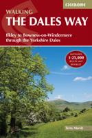
Wandelgids The Dales Way | Cicerone
A fully waymarked trail from Ilkley to Bowness-on-Windermere, the Dales Way links two of England's most celebrated national parks, the Yorkshire Dales and the Lake District. Well served for accommodation and facilities, and with easy walking on riverside paths, it is one of the gentlest multi-day walks in Britain and therefore an ideal introduction to long-distance walking. It can be comfortably completed in 6-8 days.   The guide offers comprehensive notes on local points of interest, as well as an overview of Dales geology, history, plants and wildlife to enhance the walking experience. The practical information is all there too, including when to go, how to get there and what to take, making for an ideal companion to enjoying this delightful route.   Presented in six daily stages of 7-19 miles (with suggestions for alternative schedules), this guide describes the Way in both directions, with the main route description running from south to north. Step-by-step route description is ac…
20,95
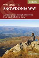
Wandelgids Snowdonia Way | Cicerone
Een beschrijving van de Snowdonia Way, goede beschrijving met gedetailleerd kaartmateriaal..Ook praktische informatie en hoogteprofielen per etappe.   This guidebook describes the Snowdonia Way in Wales, a long-distance route through Snowdonia National Park from Machynlleth to Conwy. A low-level route of 97 miles (in 6 stages of between 13 and 21 miles) passes through the heart of Snowdonia’s stunning mountain scenery and includes Pass of Aberglaslyn, Ogwen Valley and Aber Falls. It is suitable for walkers of average fitness and stamina, though days are long. An alternative mountain route covers 122 miles in 9 stages of 12–18 miles giving a spectacular journey over the most famous peaks such as Cadair Idris, Snowdon and Glyders. The high-level route is more physically challenging and requires good navigation skills. Full route descriptions for each stage are accompanied by OS maps and profiles. The guide also includes lists of accommodation and transport providers and a table of facil…
20,95
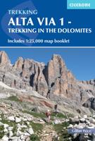
Wandelgids Alta Via 1 - Trekking in the Dolomites | Cicerone
Uitstekende wandelgids van een gerenommeerde Engelse uitgever. De tochten zijn met zorg beschreven en voorzien van allerhande nuttige informatie. The Alta Via 1 is one of Italy's most famous and most popular long-distance routes and is the easiest of six Alta Via routes that traverse the magnificent Dolomites. The hut-to-hut trail extends 115km from Lago di Braies to La Pissa, boasting spectacular alpine vistas. Although it demands a moderate level of fitness, it is well waymarked and follows clear well-trodden paths, making for an ideal introduction to trekking in the Dolomites.   Welcoming refuges offer meals and accommodation along the way, though camping is also possible on the middle stages (restrictions apply elsewhere). The route is presented in 11 stages, each with overview statistics, a brief summary of the day's walking and detailed route description illustrated with clear mapping. There are also comprehensive notes on the huts the route passes, with contact details and tips…
23,95

Klanten-reviews van Wandelgids GR107 Trekking the Cami dels Bons Homes | Cicerone

Er zijn nog geen beoordelingen voor dit productBen jij de eerste die een review plaatst?

Meer over Wandelgids GR107 Trekking the Cami dels Bons Homes | Cicerone

Productomschrijving

A guidebook to walking the Cami dels Bons Homes (GR107), from Foix in France to Berga in Catalonia. Covering 225km (140 miles), this long-distance hike follows a Cathar trail through the French and Spanish Pyrenees. Some sections of the trail are long and somewhat demanding, so a reasonable level of fitness is required for the trek.   The route is described from north to south in 10 stages, each between 16 and 36km (10–22 miles) in length.   GPX files available to download 1:100,000 maps included for each stage Handy stage facilities planner that highlights information about accommodation, facilities and public transport along the route Advice on planning and preparation

Productinformatie

    Verken gerelateerde categorieën

    Webshop.nl maakt gebruik van cookies. Ga je verder op onze website, ga dan akkoord met het plaatsen van cookies en de verwerking van deze data door ons en vermelde partners.