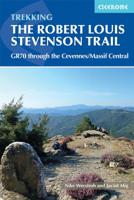
Wandelgids GR 70: The Robert Louis Stevenson Trail van Le Puy tot St-Jean du Gard | Cicerone

0
Uitstekende wandelgids van een gerenommeerde Engelse uitgever. De tochten zijn met zorg beschreven en voorzien van allerhande nuttige informatie. Met beperkt kaartmateriaal. Aanbevolen wandelkaarten bij deze gids 1:100.000 Wandelkaart GR 70 The Stevenson Trail | IGN - Institut Géographique National Als overzichtskaart Of Wegenkaart 156 Le Puy en V...

Verkopers met dit product

Verkoper
Bezorging
Prijs
DeZwerver.nl logo
DeZwerver.nl
2,95
23,95

Anderen bekeken ook

Wandelgids GR 70: The Robert Louis Stevenson Trail van Le Puy tot St-Jean du Gard | Cicerone
Uitstekende wandelgids van een gerenommeerde Engelse uitgever. De tochten zijn met zorg beschreven en voorzien van allerhande nuttige informatie. Met beperkt kaartmateriaal. Aanbevolen wandelkaarten bij deze gids 1:100.000 Wandelkaart GR 70 The Stevenson Trail | IGN - Institut Géographique National Als overzichtskaart Of Wegenkaart 156 Le Puy en Velay - Privas - Mende | IGN - Institut Géographique National Wegenkaart 163 Avignon - Nimes | IGN - Institut Géographique National  of 1:25.000 1. Wandelkaart - Topografische kaart 2835OT Le Puy-en-Velay | IGN - Institut Géographique National 2. Wandelkaart - Topografische kaart 2836OT Gerbier de Jonc | IGN - Institut Géographique National 3. Wandelkaart - Topografische kaart 2736SB Monistrol d'Allier, Solignac-sur-Loire, Cayres | IGN - Institut Géographique National 4. Wandelkaart - Topografische kaart 2737SB Langogne - Grandrieu | IGN - Institut Géographique National 5. Wandelkaart - Topografische kaart 2738SB Le Bleymard | IGN - Institut G…
23,95
Wandelgids GR 11 Spaanse Pyreneeen - Through the Spanish Pyrenees | Cicerone
Uitstekende wandelgids van dit geweldige gebied. goed beschreven met veel praktische informatie om de route te kunnen lopen, inclusief redelijke kaarten. Beschrijving van de GR 11, het lange afstandswandelpad aan de Spaanse kant van de Pyreneeën. Aanbevolen wandelkaarten Schaal 1:50.000 Wandelkaart Senda Pirenaica GR11 | Editorial Alpina - Set van 21 kaarten Of Wandelkaarten van Rando Pyreneeën - 10 losse kaarten This comprehensive guidebook to the magnificent GR11 trail, which runs 820km from the Atlantic to the Mediterranean, provides everything trekkers will need to take up the challenge - detailed route description, excellent photographs, lots of background information and unique, custom-produced maps. This glorious traverse of the Pyrenees, on the Spanish side, is a serious challenge - passing over a succession of high alpine passes where boulderfields, scree slopes and occasional snowfields may need to be crossed. It is presented in 47 stages of 8-31km.    It is well waymarked a…
23,95
Wandelgids Backpacker's Britain | Cicerone
Guidebook includes 25 2 or 3-day walks taking walkers into the most scenic and wild parts of Wales, from Snowdon, the Glyderau and Carneddau in the north, down to the Black Mountains, Brecon Beacons and Fforest Fawr ranges in the south, including the ridges of the Arans, Arenigs, Berwyns and Cadair Idris, the Cwmdeuddwr hills and Plynlimon.   The mountains of Wales are a great place to get away from it all for a few days, and this book describes the very best backpacking routes throughout the principality. A total of 25 two- or three-day walks take you into the most scenic, beautiful and wild parts of Wales, each one with a night or more out among the mountains at wild camp sites, bothies or hostels. The routes cover all the main mountain ranges, from Snowdon, the Glyderau and Carneddau in the north, down to the Black Mountains, Brecon Beacons and Fforest Fawr ranges in the south. Everything in between is included too, such as the superb ridges of the Arans, Arenigs, Berwyns and Cadai…
18,95

Klanten-reviews van Wandelgids GR 70: The Robert Louis Stevenson Trail van Le Puy tot St-Jean du Gard | Cicerone

Er zijn nog geen beoordelingen voor dit productBen jij de eerste die een review plaatst?

Meer over Wandelgids GR 70: The Robert Louis Stevenson Trail van Le Puy tot St-Jean du Gard | Cicerone

Productomschrijving

Uitstekende wandelgids van een gerenommeerde Engelse uitgever. De tochten zijn met zorg beschreven en voorzien van allerhande nuttige informatie. Met beperkt kaartmateriaal.

Aanbevolen wandelkaarten bij deze gids

1:100.000

Wandelkaart GR 70 The Stevenson Trail | IGN - Institut Géographique National Als overzichtskaart

Of

Wegenkaart 156 Le Puy en Velay - Privas - Mende | IGN - Institut Géographique National

Wegenkaart 163 Avignon - Nimes | IGN - Institut Géographique National 

of 1:25.000

1. Wandelkaart - Topografische kaart 2835OT Le Puy-en-Velay | IGN - Institut Géographique National

2. Wandelkaart - Topografische kaart 2836OT Gerbier de Jonc | IGN - Institut Géographique National

3. Wandelkaart - Topografische kaart 2736SB Monistrol d'Allier, Solignac-sur-Loire, Cayres | IGN - Institut Géographique National

4. Wandelkaart - Topografische kaart 2737SB Langogne - Grandrieu | IGN - Institut Géographique National

5. Wandelkaart - Topografische kaart 2738SB Le Bleymard | IGN - Institut Géographique National

6. Wandelkaart - Topografische kaart 2739OT Mont Lozère - Florac | IGN - Institut Géographique National

7. Wandelkaart - Topografische kaart 2740ET Corniche des Cevennes | IGN - Institut Géographique National

8. Wandelkaart - Topografische kaart 2741ET Saint-Hippolyte-du-Fort | IGN - Institut Géographique National

Early one morning in the autumn of 1878 RLS set out from the sleepy village of Le Monastier-sur-Gazeille with his donkey, Modestine, to traverse the Velay and Cévennes to the small town of Saint-Jean-du-Gard in the south. Robert Louis Stevenson’s account of his 140-mile trek through southern France has long captured the imagination of walkers and lovers of literature alike. Today, the RLS Trail has become a classic route across the hills and along the valleys of this delightful region of rural France.

The route, which is well served by accommodation of all types, is divided into twelve day-stages in the guide, so that the Trail easily fits into a fortnight’s holiday. The book includes details of the facilities for the traveller and places of interest en route, together with a detailed route description and an account of Stevenson’s adventures with Modestine. For those with more time available, trails that link the beginning and end of the route are also described, making it is possible to walk all the way from the historic town of Le Puy to Alés.

Packed with snippets of fascinating information about this historic region, the guide is also of use to cyclists and motorists keen to trace a parallel road route, following in the footsteps of Stevenson and Modestine.

The Robert Louis Stevenson Trail is a linear long-distance walk through the Velay, Gévaudan and Cévennes regions of southern France. It follows closely, but not exactly, the route taken by the writer Robert Louis Stevenson (affectionately known as RLS), accompanied by his donkey, Modestine, during the autumn of 1878, and later recounted in his first successful book, Travels with a Donkey in the Cévennes (1879).

The trail meanders south for some 225km (140 miles), from Le Monastier-sur-Gazeille near Le Puy in the Velay, across the Cévennes mountains, to finish at Saint-Jean-du-Gard, west of Alès. In so doing, it crosses some of the most remote and finest country in rural France, and visits numerous towns and villages of historical importance, including Pradelles, Le Pont-de-Montvert and Florac. The latter sections of the trail pass through the land of the Camisards, an area ravaged by nearly 100 years of religious war between the local Protestants and their Catholic rulers.

Steden en Dorpen

Le Puy and St Jean de Gard at each end of the route. Also Florac, Fouzillac, La Bastide-Puylaurent, Pradelles, Le Pont de Montvert


Productinformatie

    Verken gerelateerde categorieën

    Webshop.nl maakt gebruik van cookies. Ga je verder op onze website, ga dan akkoord met het plaatsen van cookies en de verwerking van deze data door ons en vermelde partners.