Meer Cicerone
Meer Cicerone in Reisgidsen & talen boeken

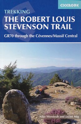
Wandelgids GR 70: The Robert Louis Stevenson Trail van Le Puy tot St-J

0
Uitstekende wandelgids van een gerenommeerde Engelse uitgever. De tochten zijn met zorg beschreven en voorzien van allerhande nuttige informatie. Met beperkt kaartmateriaal. Aanbevolen wandelkaarten bij deze gids 1:100.000 Wandelkaart GR 70 The Stevenson Trail | IGN - Institut Géographique National Als overzichtskaart Of Wegenkaart 156 Le Puy en Ve...

Verkopers met dit product

Verkoper
Bezorging
Prijs
DeZwerver.nl logo
DeZwerver.nl
niet bekend
23,95

Anderen bekeken ook

Wandelgids GR 70: The Robert Louis Stevenson Trail van Le Puy tot St-Jean du Gard | Cicerone
Uitstekende wandelgids van een gerenommeerde Engelse uitgever. De tochten zijn met zorg beschreven en voorzien van allerhande nuttige informatie. Met beperkt kaartmateriaal. Aanbevolen wandelkaarten bij deze gids 1:100.000 Wandelkaart GR 70 The Stevenson Trail | IGN - Institut Géographique National Als overzichtskaart Of Wegenkaart 156 Le Puy en Velay - Privas - Mende | IGN - Institut Géographique National Wegenkaart 163 Avignon - Nimes | IGN - Institut Géographique National  of 1:25.000 1. Wandelkaart - Topografische kaart 2835OT Le Puy-en-Velay | IGN - Institut Géographique National 2. Wandelkaart - Topografische kaart 2836OT Gerbier de Jonc | IGN - Institut Géographique National 3. Wandelkaart - Topografische kaart 2736SB Monistrol d'Allier, Solignac-sur-Loire, Cayres | IGN - Institut Géographique National 4. Wandelkaart - Topografische kaart 2737SB Langogne - Grandrieu | IGN - Institut Géographique National 5. Wandelkaart - Topografische kaart 2738SB Le Bleymard | IGN - Institut G…
23,95
Wandelgids Frankreich: Cevennen - Stevensonweg GR 70 | Conrad Stein Verlag
Handzaam boekje met de routebeschrijving inclusief een heleboel praktische informatie. De beschrijving is uitstekend, maar kaarten zijn beperkt en schetsmatig aanwezig. Duits. Aanbevolen wandelkaarten bij deze gids 1:100.000 Wandelkaart GR 70 The Stevenson Trail | IGN - Institut Géographique National Als overzichtskaart Of Wegenkaart 156 Le Puy en Velay - Privas - Mende | IGN - Institut Géographique National Wegenkaart 163 Avignon - Nimes | IGN - Institut Géographique National  of 1:25.000 1. Wandelkaart - Topografische kaart 2835OT Le Puy-en-Velay | IGN - Institut Géographique National 2. Wandelkaart - Topografische kaart 2836OT Gerbier de Jonc | IGN - Institut Géographique National 3. Wandelkaart - Topografische kaart 2736SB Monistrol d'Allier, Solignac-sur-Loire, Cayres | IGN - Institut Géographique National 4. Wandelkaart - Topografische kaart 2737SB Langogne - Grandrieu | IGN - Institut Géographique National 5. Wandelkaart - Topografische kaart 2738SB Le Bleymard | IGN - Institut…
17,95
Wandelgids Cevennen: Stevenson weg GR 70 | Rother Bergverlag
Uitstekende wandelgids met een groot aantal dagtochten in alle landschappen. Met praktische informatie e  een goede beschrijving van de route maar met beperkt kaartmateriaal! Wandelingen in verschillende zwaarte weergegeven in rood, blauw of zwart. detaillierte Wanderkarten aussagekräftige Höhenprofile GPS-Tracks zum Download Der Stevensonweg ist ein besonderes Abenteuer durch die Cevennen und die faszinierenden Gorges du Tarn. Auf den Spuren des schottischen Abenteuerschriftstellers R.L. Stevenson, der 1878 mit seiner treuen Eselin Modestine diese malerische Region durchwanderte, erlebt man die fantastische Landschaft Südfrankreichs. Der Stevensonweg, auch als GR 70 bekannt, ist heute einer der beliebtesten französischen Fernwanderwege. Der Rother Wanderführer stellt ihn mit allen wichtigen Informationen vor.   Die 14-tägige Tour auf dem Stevensonweg beginnt im Pilgerort Le Puy en Velais, durchquert Täler und Höhen des ländlichen Gévaudan und steigt an zum alpinen Mont Lozère Massiv.…
18,50
Reisverhaal Travels with a Donkey in the Cévennes | Robert Louis Stevenson
Robert Louis Stevenson was not only a gifted writer, he was also an indefatigable traveller. His thirst for adventure was formed by his boyhood visits to remote Scottish lighthouses, and he spent much of his life fleeing the rigours of cold climes and social orthodoxy. Along the way he canoed through Belgium and France, booked passage to and across America, and finally famously settled in Samoa in the South Seas. The walking trip that Stevenson describes in Travels with a Donkey in the Cevennes (1879) was taken when the nascent author was still in his twenties and pining for a lost love. Accompanied by Modestine, the eponymous donkey he hired to carry his camping gear, the journey proved both challenging and charming. The book is infused with all of the qualities that make Stevenson the most popular of writers: humour and humanity, poetry and perspicacity, ebullience and intelligence.
9,95
Reisverhaal Travels with a Donkey in the Cévennes | Robert Louis Stevenson
In 1878 Robert Louis Stevenson escaped from his numerous troubles--poor health, tormented love, inadequate funds--by embarking on a journey through the Cévennes in France, accompanied by Modestine, a rather single-minded donkey. The notebook Stevenson kept during this time became Travels with a Donkey in the Cévennes, a highly entertaining account of the French and their country. The Amateur Emigrant describes his travels to and around America: the crowded weeks in steerage, the cross-country train journey. Filled with sharp-eyed observations, it brilliantly conveys Stevenson's perceptions of America and the Americans. Together, these writings reveal as much about the traveler as the places he travels to.
15,50
Wandelkaart 89023 GR 70 The Stevenson Trail | IGN - Institut Géographique National
Speciale wandelkaart met de ingetekende GR 70 van le Puy en Velay naar Ales. Op een schaal van 1:100.000 wordt de route keurig en helder ingetekend, met hoogtelijnen aan de zijkant van de kant wordt duidelijk of het een al dan niet zwaar traject is. Op de achterkant staan bezienswaardigheden op de route vermeld.  Van de uitgever Une carte à l’échelle du 1 : 90 000 (1cm = 900m) incontournable pour parcourir le mythique GR70® Chemin de Stevenson du Puy en Velay à Alès.   Suivre les traces de cet aventurier écossais amoureux de la France, écrivain de L’Île au trésor, de Dr Jekyll et de Mr Hyde et de Voyage avec un âne dans les Cévennes.   En plus du tracé précis du Chemin de Stevenson, vous retrouverez dans la carte les descriptions et informations sur les lieux touristiques rencontrés : les musées, les parcs nationaux, les activités …Liens vers les offices de tourisme du parcours. les textes éditoriaux sont en français et anglais.   Seul, en groupe ou en famille, à pied, à vélo, à cheva…
11,95
Wandelgids 3400 Tours dans le Pays Haut Languedoc et Vignobles GR787 | FFRP
Franstalige wandelgids met een beschrijving van een lange afstands wandeling. Uitstekende beschrijvingen met duidelijk kaartmateriaal, hiervoor zijn de topografische kaarten gebruikt van IGN. Mislopen is nauwelijks mogelijk, maar ja .. de franse taal! Ook praktische informatie staat in deze gids. Alle gidsen bevatten een door ons toegevoegde uitgebreide frans - nederlandse wandelwoordenlijst. Amphithéâtre ouvert sur la mer Méditerranée, le sentier GR® de Pays Tours dans le Pays Haut Languedoc et Vignobles est une plongée au coeur d'un territoire préservé. Sa situation géographique et climatique donne naissance à une véritable mosaïque de paysages.   Depuis les monts de l'Espinouse (1 148 m) et du Caroux (1 091 m), en passant par les vallées sinueuses de l'Orb, du Jaur et de la Mare, jusqu'aux piémonts et coteaux viticoles qui dominent la riche plaine bitteroise, ce sont plus de 300 km de sentiers qui vous sont ici proposés.   Des itinéraires, à la découverte d'un pays où se mêlent pat…
18,50
Wandelgids Miam Miam Dodo Section 1 Le Puy en Velay - Cahors GR65 Via Podiensis | 2025 | Les Editions du Vieux Crayon
Toonaangevende Franstalige wandelgids met zowel de route, kaarten en praktische informatie. Met een overzicht van de eetadressen en overnachtingsadressen langs het lange afstandswandelpad GR 65 van Puy-en-Velay naar Cahors. De uitgebreid in het Frans beschreven adressen (met prijzen en condities) van restaurants, cafe's en slaapplekken, zoals kloosters, herbergen, gastverblijven en campings liggen allen binnen een straal van 5km van de wandelroute GR 65. De gids geeft ook andere praktische informatie zoals adressen van postkantoren, apotheken, banken, etc. Two guides cover the entire route of the GR®65, also called Via Podiensis, between Le Puy-en-Velay and Roncesvalles. Here is the first guide, which covers the first part of the way of Puy: from Puy-en-Velay to Cahors.   The Via Podiensis, also called "the way of Puy", is one of the 4 main roads that cross France and converge towards Spain and then Santiago de Compostela. It starts in Le Puy-en-Velay and crosses the Pyrenees through …
22,50
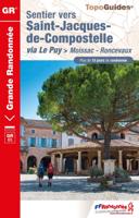
Wandelgids 653 Sentier vers Saint-Jacques-de-Compostelle via Le Puy Moissac - Roncevaux GR65 | FFRP
Uitstekende routegids met gedetailleerde topografische kaarten en een routebeschrijving. Fout lopen wordt op deze manier wel erg moeilijk. Met symbolen is weergegeven welke voorzieningen (openbaar vervoer / winkels / overnachtingen) er zijn langs of bij de route. De gids bevat een lijst met overnachtingsadressen inclusief telefoonnummers en vaak aangevuld met websites/mailadressen. Beschrijving van een lang stuk van de Jacobsroute Moissac - Roncevaux, met een lengte van 345 km. De enige echt goede wandelgids voor deze route! Suite et fin du chemin du Puy, à travers Quercy, Béarn et Pays Basque. Plus de 15 jours de randonnée.  Le dernier tronçon de la via Podiensis, qui traverse d'est en ouest la grande Gascogne, offre au randonneur une véritable mosaïque de couleurs et de territoires. Après Moissac, voici la verte Lomagne, pays de l'ail blanc et des églises romanes. Vient ensuite le Gers, aux collines asymétriques qui alternent joliment les carrés de vigne, de tournesols ou de maïs. I…
19,95

Klanten-reviews van Wandelgids GR 70: The Robert Louis Stevenson Trail van Le Puy tot St-J

Er zijn nog geen beoordelingen voor dit productBen jij de eerste die een review plaatst?

Meer over Wandelgids GR 70: The Robert Louis Stevenson Trail van Le Puy tot St-J

Productomschrijving

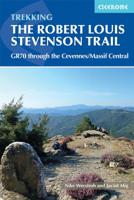
Uitstekende wandelgids van een gerenommeerde Engelse uitgever. De tochten zijn met zorg beschreven en voorzien van allerhande nuttige informatie. Met beperkt kaartmateriaal. Aanbevolen wandelkaarten bij deze gids 1:100.000 Wandelkaart GR 70 The Stevenson Trail | IGN - Institut Géographique National Als overzichtskaart Of Wegenkaart 156 Le Puy en Velay - Privas - Mende | IGN - Institut Géographique National Wegenkaart 163 Avignon - Nimes | IGN - Institut Géographique National  of 1:25.000 1. Wandelkaart - Topografische kaart 2835OT Le Puy-en-Velay | IGN - Institut Géographique National 2. Wandelkaart - Topografische kaart 2836OT Gerbier de Jonc | IGN - Institut Géographique National 3. Wandelkaart - Topografische kaart 2736SB Monistrol d'Allier, Solignac-sur-Loire, Cayres | IGN - Institut Géographique National 4. Wandelkaart - Topografische kaart 2737SB Langogne - Grandrieu | IGN - Institut Géographique National 5. Wandelkaart - Topografische kaart 2738SB Le Bleymard | IGN - Institut Géographique National 6. Wandelkaart - Topografische kaart 2739OT Mont Lozère - Florac | IGN - Institut Géographique National 7. Wandelkaart - Topografische kaart 2740ET Corniche des Cevennes | IGN - Institut Géographique National 8. Wandelkaart - Topografische kaart 2741ET Saint-Hippolyte-du-Fort | IGN - Institut Géographique National Early one morning in the autumn of 1878 RLS set out from the sleepy village of Le Monastier-sur-Gazeille with his donkey, Modestine, to traverse the Velay and Cévennes to the small town of Saint-Jean-du-Gard in the south. Robert Louis Stevenson’s account of his 140-mile trek through southern France has long captured the imagination of walkers and lovers of literature alike. Today, the RLS Trail has become a classic route across the hills and along the valleys of this delightful region of rural France. The route, which is well served by accommodation of all types, is divided into twelve day-stages in the guide, so that the Trail easily fits into a fortnight’s holiday. The book includes details of the facilities for the traveller and places of interest en route, together with a detailed route description and an account of Stevenson’s adventures with Modestine. For those with more time available, trails that link the beginning and end of the route are also described, making it is possible to walk all the way from the historic town of Le Puy to Alés. Packed with snippets of fascinating information about this historic region, the guide is also of use to cyclists and motorists keen to trace a parallel road route, following in the footsteps of Stevenson and Modestine. The Robert Louis Stevenson Trail is a linear long-distance walk through the Velay, Gévaudan and Cévennes regions of southern France. It follows closely, but not exactly, the route taken by the writer Robert Louis Stevenson (affectionately known as RLS), accompanied by his donkey, Modestine, during the autumn of 1878, and later recounted in his first successful book, Travels with a Donkey in the Cévennes (1879). The trail meanders south for some 225km (140 miles), from Le Monastier-sur-Gazeille near Le Puy in the Velay, across the Cévennes mountains, to finish at Saint-Jean-du-Gard, west of Alès. In so doing, it crosses some of the most remote and finest country in rural France, and visits numerous towns and villages of historical importance, including Pradelles, Le Pont-de-Montvert and Florac. The latter sections of the trail pass through the land of the Camisards, an area ravaged by nearly 100 years of religious war between the local Protestants and their Catholic rulers. Steden en Dorpen Le Puy and St Jean de Gard at each end of the route. Also Florac, Fouzillac, La Bastide-Puylaurent, Pradelles, Le Pont de Montvert
Productinformatie

    Productspecificaties

    Artikelnummer(s)
    Brand
    Cicerone

    Verken gerelateerde categorieën

    Webshop.nl maakt gebruik van cookies. Ga je verder op onze website, ga dan akkoord met het plaatsen van cookies en de verwerking van deze data door ons en vermelde partners.