Wandelgids GR 11 Spaanse Pyreneeen - Through the Spanish Pyrenees | Cicerone

0
Uitstekende wandelgids van dit geweldige gebied. goed beschreven met veel praktische informatie om de route te kunnen lopen, inclusief redelijke kaarten. Beschrijving van de GR 11, het lange afstandswandelpad aan de Spaanse kant van de Pyreneeën. Aanbevolen wandelkaarten Schaal 1:50.000 Wandelkaart Senda Pirenaica GR11 | Editorial Alpina - Set van...

Verkopers met dit product

Verkoper
Bezorging
Prijs
DeZwerver.nl logo
DeZwerver.nl
2,95
23,95

Anderen bekeken ook

Nieuw
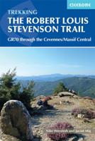
Wandelgids GR 70: The Robert Louis Stevenson Trail van Le Puy tot St-Jean du Gard | Cicerone
Uitstekende wandelgids van een gerenommeerde Engelse uitgever. De tochten zijn met zorg beschreven en voorzien van allerhande nuttige informatie. Met beperkt kaartmateriaal. Aanbevolen wandelkaarten bij deze gids 1:100.000 Wandelkaart GR 70 The Stevenson Trail | IGN - Institut Géographique National Als overzichtskaart Of Wegenkaart 156 Le Puy en Velay - Privas - Mende | IGN - Institut Géographique National Wegenkaart 163 Avignon - Nimes | IGN - Institut Géographique National  of 1:25.000 1. Wandelkaart - Topografische kaart 2835OT Le Puy-en-Velay | IGN - Institut Géographique National 2. Wandelkaart - Topografische kaart 2836OT Gerbier de Jonc | IGN - Institut Géographique National 3. Wandelkaart - Topografische kaart 2736SB Monistrol d'Allier, Solignac-sur-Loire, Cayres | IGN - Institut Géographique National 4. Wandelkaart - Topografische kaart 2737SB Langogne - Grandrieu | IGN - Institut Géographique National 5. Wandelkaart - Topografische kaart 2738SB Le Bleymard | IGN - Institut G…
23,95
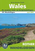
Wandelgids Wales | Uitgeverij Elmar
De Rother wandelgids Wales beschrijft de 50 mooiste kust- en bergwandelingen in het westen van het Verenigd Koninkrijk - van Pembrokeshire tot Anglesey, van de Ierse Zee tot de grens met Engeland, in de bergachtige regio's, het binnenland en langs de kust.   * Betrouwbare routebeschrijvingen * Gedetailleerde wandelkaarten * Informatieve hoogteprofielen * Downloadbare GPS Tracks   Aanbevolen wandelkaarten bij deze gids:   The Gower + directe omgeving Wandelkaart - Topografische kaart 164 Explorer Gower, Gwyr | Ordnance Survey 1:25.000 Wandelkaart - Topografische kaart 178 Explorer Llanelli, Ammanford, Rhydaman | Ordnance Survey 1:25.000   Pembrokeshire Wandelkaart - Topografische kaart OL35 Explorer Pembrokeshire North - Gogledd Sir Benfro | Ordnance Survey 1:25.000 Wandelkaart - Topografische kaart OL36 Explorer South Pembrokeshire - De Sir Benfro | Ordnance Survey 1:25.000 Wandelkaart - Topografische kaart 198 Explorer Cardigan, New Quay | Ordnance Survey 1:25.000 Wandelkaart - Topog…
19,99
Nieuw
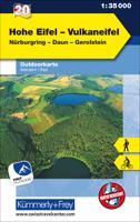
Wandelkaart 20 Outdoorkarte Hohe Eifel - Vulkaneifel | Kümmerly & Frey
Hele goede wandelkaart met alle noodzakelijke topografische details, hoogtelijnen, ingetekende wandelroutes en hutten, mountainbikeroutes en fietsroutes - de kaart is geplastificeerd. De vakantie-kaarten van Kümmerly + Frey zijn de ideale hulp bij het voorbereiden van uw vakantie. En op het resort overtreffen ze elke plaatselijke gids: aantrekkelijke, beeldende kaarten, uitgebreide regionale dekking (een kaart voor elke regio) en informatieve toeristische inhoud, zoals belangrijk wandelpaden, berghutten en monumenten. Dorpen, Bergen & Dalen: Antwiler, Ahr, Adenau, Hohe Acht, Weibern, Nürburg-Ring, Virneburg, Nohn, Monreal, Kelberg, Dockweiler, Ernstberg, Kyll, Gerolstein, Rengen, Daun, Berenbach, Ulmen, Lutzerath, Manderscheid  
13,50
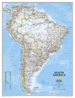
Wandkaart Zuid Amerika, politiek, 91 x 117 cm | National Geographic
Staatkundige  kaart van Zuid-Amerika (in kleur). De kaart wordt verzonden in een koker.  This classic map of South America shows political boundaries, place names, airports, major roads and highways, and other geographic features for the entire continent. 36 x 46 inches (approx). Scale size: 1:7,105,000. Founded in 1915 as the Cartographic Group, the first division of the National Geographic Society, National Geographic Maps has been responsible for illustrating the world around us through the art and science of mapmaking. Today, National Geographic Maps continues this mission by creating the world s best wall maps, recreation maps, atlases, and globes which inspire people to care about and explore their world. All proceeds from the sale of National Geographic maps go to support the Society s non-profit mission to increase global understanding and promote conservation of our planet through exploration, research, and education.
49,95
Nieuw
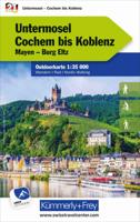
Wandelkaart 21 Outdoorkarte Untermosel Cochem bis Koblenz | Kümmerly & Frey
Hele goede wandelkaart met alle noodzakelijke topografische details, hoogtelijnen, ingetekende wandelroutes en hutten, mountainbikeroutes en fietsroutes - de kaart is geplastificeerd. De vakantie-kaarten van Kümmerly + Frey zijn de ideale hulp bij het voorbereiden van uw vakantie. En op het resort overtreffen ze elke plaatselijke gids: aantrekkelijke, beeldende kaarten, uitgebreide regionale dekking (een kaart voor elke regio) en informatieve toeristische inhoud, zoals belangrijk wandelpaden, berghutten en monumenten. Dorpen, Bergen en Dalen: Maria Laach, Mendig, Mühlheim-Kärlich, Koblenz, Lahnstein, Rhein, Mosel, Boppard, Münstermaifeld, Mayen, Kaisersesch, Brodenbach, Eltz, Klotten, Cochem, Bad Bertrich, Kastellaun, Dommerhausen
13,50
Nieuw
Fietskaart 7 Velo Finistere a Velo - Finistere by Bike - Bretagne | IGN - Institut Géographique National
Dit is een duidelijke fietskaart van een bepaald gebied in Frankrijk. Bedenk wel dat er nauwelijks aparte fietspaden bestaan, het is dan ook vooral een gedetailleerde kaart waarop route-suggesties staan ingetekend over bestaande kleine, rustige wegen. Daarvoor is deze kaart zeer geschikt! De routes die zijn ingetekend op de kaart staan naast de kaart met afstanden uitgewerkt.  Specifieke fietsinformatie als cols en wegnummering zijn goed terug te vinden, naast de algemene kaart op schaal  van ca. 1:100.000.  Les grands itinéraires, les tours de pays, la Drôme est un département très riche en découvertes à vélo avec plusieurs dizaines de parcours et des centaines de kilomètres de voies. Les bons plans, les tracés classés par difficultés, cette carte ravira tous les adeptes du vélo, des plus novices aux plus expérimentés.
11,95
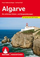
Wandelgids Algarve | Rother Bergverlag
Uitstekende wandelgids met een groot aantal dagtochten in dal en hooggebergte. Met praktische informatie en beperkt kaartmateriaal! Wandelingen in verschillende zwaarte weergegeven in rood/blauw/zwart. Aanbevolen wandelkaarten bij deze gids: De west- en zuidwestkust van de Algarve (wandeling 1 t/m 11) + een deel van de Serra de Monchique (wandeling 12 en 13): Wandelkaart Parque Natural do Sudoeste Alentejano e Costa Vicentina | Adventure MAPS Die Algarve ist die Sonnenküste Portugals – mit endlosen Sandstränden, klarem Meer und imposanten Klippenküsten. Doch die südwestlichste Ecke des europäischen Kontinents bietet mehr als nur Badeurlaub. Ein hügelreiches, sich nach Norden immer höher auftürmendes und blumenreiches Hinterland, eine eindrucksvolle Felsenküste im Westen und Südwesten, eine beschauliche Flusstallandschaft (Rio Guadiana) im Osten und die weit gestreckte Lagune zwischen Faro und Tavira (Ria Formosa) an der Südküste sind nur einige Beispiele für die große landschaftliche…
18,50
Nieuw
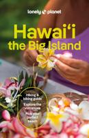
Reisgids Hawai'i the Big Island | Lonely Planet
De perfecte reisgids voor zowel de georganiseerde als de zelfstandige reiziger. Naast een algemene inleiding van het land / streek vol met praktische informatie over hoe je er het beste kunt reizen: slapen, eten, vervoer, excursies ... alles kun je er in vinden. Engelstalig. Lonely Planet. Indulge your spirit of adventure on the biggest Hawaiian island. It’s still a vast frontier, full of unexpected wonders. Lonely Planet will get you to the heart of Hawai‘i, the Big Island, with amazing travel experiences and the best planning advice.   Lonely Planet's local travel experts reveal all you need to know to plan the trip of a lifetime to Hawai'i the Big Island. Discover popular and off the beaten track experiences from visiting the 44ft 'Akaka Falls surrounded by lush rainforests to snorkelling at Kealakekua Bay State Historical Park, and dining with the locals at the lively Kamuela Farmers Market. Build a trip to remember with Lonely Planet's Hawai'i the Big Island travel guide: Ou…
24,95
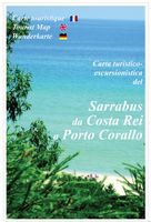
Wandelkaart A15 Sarrabus da Costa Rei a Porto Corallo | Abies
Sarrabus is a territory that is not known by everybody yet. Here lies its charm and this has made possible to keep this environmental area out of big building speculations and also out of history. In fact it preserves little traces of the past, and paradoxically the remains from the prehistoric age are more meaningful than those back to more recent times. We can find traces from the most remote past not far from the State Road SS125, that from Muravera goes to Costa Rei, by visiting the nuraghe Murtas, the nuraghe S’Aqua Secis and the megalithic complexes of Scalas and Cuili Piras. They are about ten menhirs, almost fully intact, arranged in groups and fixed in the ground in the original orthostatic position. They have been put in relation with the position of the sun and the moon, at dawn and at sunset. In fact they were used as a very precise astronomic calendar but also for religious purposes since they represented both the masculine divinity and the fertility according to the wors…
12,95
Wandelkaart A06 Siniscola | Abies
Siniscola area at 1:25,000 in a series of contoured maps from Ed. Abies. Overprint highlights campsites and agriturismo accommodation, climbing sites, wild sheep and bird watching sites and archaeological remains. This title has no UTM grid. Main series at 1:60,000 (Nos. 1 to 12) The maps have contours at 100m intervals and colouring for woodlands and maquis shrubland. Local trails are highlighted, with additional overprint for selected hiking, mountain bike and kayaking routes listed on the reverse of the maps with brief notes and grading for the degree of difficulty. All the maps have a UTM grid for GPS users. Very extensive range of symbols highlight numerous places of interest and tourist facilities, including campsites and caravan parks, beaches, sport and recreational sites, archaeological remains and nuraghi, etc. The maps also indicate places where typical local products can be purchased. On the reverse each title has descriptions of its main places of interest, beaches, etc…
12,95

Klanten-reviews van Wandelgids GR 11 Spaanse Pyreneeen - Through the Spanish Pyrenees | Cicerone

Er zijn nog geen beoordelingen voor dit productBen jij de eerste die een review plaatst?

Meer over Wandelgids GR 11 Spaanse Pyreneeen - Through the Spanish Pyrenees | Cicerone

Productomschrijving

Uitstekende wandelgids van dit geweldige gebied. goed beschreven met veel praktische informatie om de route te kunnen lopen, inclusief redelijke kaarten. Beschrijving van de GR 11, het lange afstandswandelpad aan de Spaanse kant van de Pyreneeën.

Aanbevolen wandelkaarten

Schaal 1:50.000

Wandelkaart Senda Pirenaica GR11 | Editorial Alpina - Set van 21 kaarten

Of

Wandelkaarten van Rando Pyreneeën - 10 losse kaarten

This comprehensive guidebook to the magnificent GR11 trail, which runs 820km from the Atlantic to the Mediterranean, provides everything trekkers will need to take up the challenge - detailed route description, excellent photographs, lots of background information and unique, custom-produced maps. This glorious traverse of the Pyrenees, on the Spanish side, is a serious challenge - passing over a succession of high alpine passes where boulderfields, scree slopes and occasional snowfields may need to be crossed. It is presented in 47 stages of 8-31km.    It is well waymarked and has regular opportunities to top up on food and drink, described within the routes and in a detailed place-by-place appendix at the back. Also included are bad weather options - although the weather is often good along this route - detours to find accommodation at some points, and advice on where to stay, supplies, language and logistics, as well as a glossary including Aragon, Basque and Catalan words, to help you find your way.   GR-11   The Basque country, Anayet lakes, Ordessa and Monte Perdido National Park, Aiguestortes and Estany de Sant Maurici National Park, the Maladeta range, Andorra, Cap de Creus Natural Park.  


Verken gerelateerde categorieën

Webshop.nl maakt gebruik van cookies. Ga je verder op onze website, ga dan akkoord met het plaatsen van cookies en de verwerking van deze data door ons en vermelde partners.