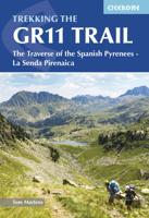
Wandelgids GR 11 Spaanse Pyreneeen - Through the Spanish Pyrenees | Cicerone

0
Uitstekende wandelgids van dit geweldige gebied. goed beschreven met veel praktische informatie om de route te kunnen lopen, inclusief redelijke kaarten. Beschrijving van de GR 11, het lange afstandswandelpad aan de Spaanse kant van de Pyreneeën. Aanbevolen wandelkaarten Schaal 1:50.000 Wandelkaart Senda Pirenaica GR11 | Editorial Alpina - Set van...

Verkopers met dit product

Verkoper
Bezorging
Prijs
DeZwerver.nl logo
DeZwerver.nl
2,95
23,95

Anderen bekeken ook

Wandelgids GR 11 Spaanse Pyreneeen - Through the Spanish Pyrenees | Cicerone
Uitstekende wandelgids van dit geweldige gebied. goed beschreven met veel praktische informatie om de route te kunnen lopen, inclusief redelijke kaarten. Beschrijving van de GR 11, het lange afstandswandelpad aan de Spaanse kant van de Pyreneeën. Aanbevolen wandelkaarten Schaal 1:50.000 Wandelkaart Senda Pirenaica GR11 | Editorial Alpina - Set van 21 kaarten Of Wandelkaarten van Rando Pyreneeën - 10 losse kaarten This comprehensive guidebook to the magnificent GR11 trail, which runs 820km from the Atlantic to the Mediterranean, provides everything trekkers will need to take up the challenge - detailed route description, excellent photographs, lots of background information and unique, custom-produced maps. This glorious traverse of the Pyrenees, on the Spanish side, is a serious challenge - passing over a succession of high alpine passes where boulderfields, scree slopes and occasional snowfields may need to be crossed. It is presented in 47 stages of 8-31km.    It is well waymarked a…
23,95
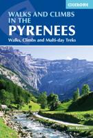
Wandelgids The Pyrenees - Pyreneeen | Cicerone
Uitputtende beschrijving van alle wandel- en klimmogelijkheden in de Pyreneeen. Ongekende diepgang in informatie over wat, waar en hoe de gebieden in elkaar zitten. Geschreven door een van de toonaangevende bergwandelaars op dit moment: Kev Reynolds. Essential guidebook of walks and climbs in the Pyrenees, one of Europe's finest mountain ranges. The guide includes 170 day walks, multi-day walks, climbing routes and mountaineering ascents, and covers all valleys and peaks on both sides of the border with France and Spain, with through routes and peaks to bag.   The guidebook divides the range into 21 sections, including Andorra, the Ordesa National Park, the Carlit Massif, Gavarnie and the Cirque du Lescun to name a few. Each area includes practical information on travel, accommodation and mountain refuges, as well sketch mapping.   Between short, half-hour walks, to 12-day treks and 25 summits, this guidebook will help any walker, climber or trekker experience the best of the Pyr…
24,95
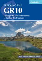
Wandelgids GR10 trail, Pyrenees - Pyreneeen | Cicerone
Engelstalige beschrijving van de mooiste wandeltocht in de Pyreneeen. De gids voldoet aan alle verwachtingen die je kunt hebben. Wel heb je voor de zwaardere gedeelte voor de zekerheid goede kaarten nodig ...... Guidebook to the GR10, a 955km trek across the French Pyrenees from Hendaye on the Atlantic Coast to the Mediterranean coast at Banyuls-sur-Mer. Described in 55-day stages, the route can be completed in its entirety, or in shorter sections using the bus and rail links found throughout the Pyrenees.   Step by step route descriptions are accompanied by 1:100,000 mapping and gradient profiles. Useful practical information is also included such as when to go, getting there and back, camping, accessing fuel and water, plus handy equipment tips and more.   The easiest, oldest and most popular of the three long-distance routes that traverse the mountain range, the GR10 is well waymarked and follows good mountain paths. For many walkers, the highlight of the route is the magnificent w…
26,50
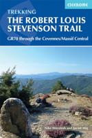
Wandelgids GR 70: The Robert Louis Stevenson Trail van Le Puy tot St-Jean du Gard | Cicerone
Uitstekende wandelgids van een gerenommeerde Engelse uitgever. De tochten zijn met zorg beschreven en voorzien van allerhande nuttige informatie. Met beperkt kaartmateriaal. Aanbevolen wandelkaarten bij deze gids 1:100.000 Wandelkaart GR 70 The Stevenson Trail | IGN - Institut Géographique National Als overzichtskaart Of Wegenkaart 156 Le Puy en Velay - Privas - Mende | IGN - Institut Géographique National Wegenkaart 163 Avignon - Nimes | IGN - Institut Géographique National  of 1:25.000 1. Wandelkaart - Topografische kaart 2835OT Le Puy-en-Velay | IGN - Institut Géographique National 2. Wandelkaart - Topografische kaart 2836OT Gerbier de Jonc | IGN - Institut Géographique National 3. Wandelkaart - Topografische kaart 2736SB Monistrol d'Allier, Solignac-sur-Loire, Cayres | IGN - Institut Géographique National 4. Wandelkaart - Topografische kaart 2737SB Langogne - Grandrieu | IGN - Institut Géographique National 5. Wandelkaart - Topografische kaart 2738SB Le Bleymard | IGN - Institut G…
23,95
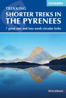
Wandelgids Shorter Treks in the Pyrenees | Cicerone
Uitstekende wandelgids van dit geweldige gebied. Goed beschreven met veel praktische informatie om de route te kunnen lopen, inclusief redelijke kaarten. A guidebook to seven circular treks exploring the Pyrenees of France and Spain. Seven 1 or 2 week routes in dramatic mountain scenery, including the Pic du Midi d'Ossau, Vignemale, Ordesa Canyon, Gavernie, Puigmal and Canigou. Using mostly waymarked mountain paths, with some boulderfield or easy scrambling, the treks are designed with accommodation in mountain refuges or mountain villages at the end of each stage, though there are plenty of options to camp for those who prefer to backpack. Detailed descriptions for each stage of the route are accompanied by sketch maps and elevation profiles, and there are notes on planning, equipment and access. The Pyrenees stretch 400km from Atlantic to Mediterranean, forming a barrier rising to over 3000m between France and Spain. The steep rolling hills of the Basque Country give way to the sp…
23,95
Wandelgids - Klimgids - Klettersteiggids The Pyrenees | Cicerone
Prachtige en volledige wandel- en klimgids van de Hoge Pyreneën in Frankrijk, Andorra en Spanje. Per deelgebied worden m.b.v. duidelijke kaartjes en route informatie de verschillende tochten beschreven. Geschikt voor iedere bergwandelaar. Er is informatie over accomodatie in opgenomen, evenals allerlei praktische en gebiedsinformatie. First in a new series of mountain guides by Cicerone Press, this illustrated book covers the high Pyrenees from the Cirque de Lescun in the west to the Carlit massif and Cerdagne east of Andorra. With introductory chapters on the region, detailed descriptions of long-distance routes and treks, and plenty of prectical travel detail. An extensive introduction gives all the practical advice and information needed for planning a trip. It offers a background to the mountains and their exploration, and provides a snapshot of the range with sections that help the reader focus on specific areas of activity, and suggests where best to exercise that activity. It a…
33,95
Wandelgids Catalunya - Girona Pyrenees | Cicerone
The delights of Spain's Catalunya - Girona Pyrenees region are revealed in this new walking guide, which covers 35 graded walks of 5 to 19km across Garrotxa, Ripolles and the Cadi-Moixero Natural Park. Walks are included for all abilities, from easy strolls to more demanding walks, and some of the walks are accessible by public transport. The guide provides detailed route descriptions, either 1:25k or 1:50k mapping for each route and a route summary table to help with choosing appropriate walks.   All the walks are illustrated with stunning photos. A list of local campsites and other useful contacts is included at the back, plus notes on refreshment opportunities along the routes. There's also background information on local geology, wildlife and history, and planning details on when to go, where to stay and what to take.   Leave behind Girona's medieval walls, narrow cobbled streets and colourful riverside and you will find a network of trails through the countryside surrounding Giro…
24,95
Wandelgids GR 11 Catalunya: sender dels Pirineus - Catalonië - Pyreneeen | Editorial Alpina
Mooie set van een goede wandelgids en een aantal losse kaarten. Met dit artikel wordt de hele GR11 in Catalonië beschreven van Cap de Creus aan de kust tot aan Benas in de centrale Pyreneeen, Beschrijving (in het Catalaan!) is goed , maar de kaarten zijn nog beter. Op een schaal van 25.000 is de route tot in detail ingetekend, handig want je kunt ze los meenemen.  El GR 11 és el sender que ens permet traspassar de punta a punta la serralada dels Pirineus. Aproximadament la meitat d'aquest camí transita per terres de parla catalana: Catalunya, el principat d'Andorra i la Franja de Ponent. En total, uns 400 km. Per primera vegada podem gaudir d'una guia feta en clau catalana i, per tant, comencem a caminar des de l'extrem del sender que tenim a Catalunya, al Cap de Creus, on els Pirineus emergeixen amb forÇa de la Mediterránia i acabem l'aventura a Benás, al peu dels grans cims de més de 3.000 m. Vint-i-tres etapes que cada excursionista podrá adaptar fácilment a les seves necessitats i…
32,95
Wandelkaart GR 11 Catalunya: sender dels Pirineus - Catalonië - Pyreneeen | Editorial Alpina
GR 11 – Wandelkaartenset Spaanse Pyreneeën van Atlantische tot Middellandse Zee 21 topografische kaarten voor de complete oversteek van de Pyreneeën via de GR 11 (Senda Pirenaica) Deze praktische kaartenset bevat de volledige GR 11, een van de spectaculairste langeafstandsroutes van Europa. De GR 11 loopt van Cabo Higuer (aan de Atlantische Oceaan) tot aan Cap de Creus (aan de Middellandse Zee), over de zuidflank van de Pyreneeën in Spanje. Deze vernieuwde editie bestaat uit 21 topografische kaarten op schaal 1:50.000met daarop de 46 officiële etappes en profielen, in beide looprichtingen. De GR 11 is ruiger dan de GR 10 (de Franse variant) en eenvoudiger dan de HRP (de Haute Route des Pyrénées), maar vraagt meer zelfstandigheid, oriëntatievermogen en bergwandelervaring. Onderweg doorkruis je landschappen van ongekende schoonheid – van het droge oosten van Catalonië en de meren van Aigüestortes tot de reuzen van de centrale Pyreneeën, zoals de Aneto, Posets en Monte Perdido, en uitein…
28,95
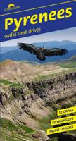
Wandelgids Pyrenees | Sunflower books
Sunflower Reisgids Pyreneeën – Wandelen & Autoroutes De ultieme reisgids voor wie de Pyreneeën te voet of per auto wil ontdekken. Of je nu houdt van stevige bergwandelingen, ontspannen dagtochten of adembenemende autoroutes, deze gids wijst je feilloos de weg. Wat biedt deze gids? 65 wandelingen – van korte, eenvoudige tochten tot langere dagwandelingen 12 autotochten – langs de mooiste wegen van de Pyreneeën Kaarten en GPS-tracks – topografische kaarten én gratis downloads van de routes Satnav-coördinaten – voor elk wandelstartpunt, ideaal voor automobilisten Uitschuifbare toeristische kaart – handig voor onderweg Tips voor picknickplekken – idyllische rustpunten langs de route Openbaar vervoer – dienstregelingen om routes te combineren zonder auto Online updateservice – met actuele informatie en wijzigingen De wandelingen zijn allemaal beoordeeld op moeilijkheidsgraad, zodat je snel een route kunt kiezen die past bij jouw niveau. En als je even geen zin hebt …
24,95

Klanten-reviews van Wandelgids GR 11 Spaanse Pyreneeen - Through the Spanish Pyrenees | Cicerone

Er zijn nog geen beoordelingen voor dit productBen jij de eerste die een review plaatst?

Meer over Wandelgids GR 11 Spaanse Pyreneeen - Through the Spanish Pyrenees | Cicerone

Productomschrijving

Uitstekende wandelgids van dit geweldige gebied. goed beschreven met veel praktische informatie om de route te kunnen lopen, inclusief redelijke kaarten. Beschrijving van de GR 11, het lange afstandswandelpad aan de Spaanse kant van de Pyreneeën.

Aanbevolen wandelkaarten

Schaal 1:50.000

Wandelkaart Senda Pirenaica GR11 | Editorial Alpina - Set van 21 kaarten

Of

Wandelkaarten van Rando Pyreneeën - 10 losse kaarten

This comprehensive guidebook to the magnificent GR11 trail, which runs 820km from the Atlantic to the Mediterranean, provides everything trekkers will need to take up the challenge - detailed route description, excellent photographs, lots of background information and unique, custom-produced maps. This glorious traverse of the Pyrenees, on the Spanish side, is a serious challenge - passing over a succession of high alpine passes where boulderfields, scree slopes and occasional snowfields may need to be crossed. It is presented in 47 stages of 8-31km.    It is well waymarked and has regular opportunities to top up on food and drink, described within the routes and in a detailed place-by-place appendix at the back. Also included are bad weather options - although the weather is often good along this route - detours to find accommodation at some points, and advice on where to stay, supplies, language and logistics, as well as a glossary including Aragon, Basque and Catalan words, to help you find your way.   GR-11   The Basque country, Anayet lakes, Ordessa and Monte Perdido National Park, Aiguestortes and Estany de Sant Maurici National Park, the Maladeta range, Andorra, Cap de Creus Natural Park.  


Productinformatie

    Verken gerelateerde categorieën

    Webshop.nl maakt gebruik van cookies. Ga je verder op onze website, ga dan akkoord met het plaatsen van cookies en de verwerking van deze data door ons en vermelde partners.