webshop.nl
Categorieën
  Sluiten

Meer Cicerone
Meer Cicerone in Literatuur boeken

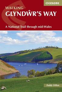
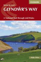
Wandelgids Glyndwr's Way - Wales | Cicerone

Een beschrijving van de Glyndwr's way, goede beschrijving met gedetailleerd kaartmateriaal..Ook praktische informatie en hoogteprofielen per etappe. Guidebook to walking Glyndwr's Way, a long-distance National Trail through mid-Wales. The 135 mile route from Knighton via Machynlleth to Welshpool takes 9 days to walk, and 2 days (29 miles) to comple...
23,95

Webshops met dit product

Webshop
Bezorging
Prijs

Anderen bekeken ook

Wandelgids Glyndwr's Way - Wales | Cicerone
Een beschrijving van de Glyndwr's way, goede beschrijving met gedetailleerd kaartmateriaal..Ook praktische informatie en hoogteprofielen per etappe. Guidebook to walking Glyndwr's Way, a long-distance National Trail through mid-Wales. The 135 mile route from Knighton via Machynlleth to Welshpool takes 9 days to walk, and 2 days (29 miles) to complete the loop down the Offa's Dyke Path to create a circular trail. A lovely trail through quiet hills, forests and rolling countryside.   A complete guide to walking Glyndŵr's Way National Trail. This guidebook divides the 135 mile trail into nine day stages, starting at Knighton and ending at Welshpool. Days 10 and 11 follow the Offa's Dyke Path National Trail for those who prefer a circular route. The step-by-step route descriptions are accompanied by OS map extracts, photographs and lots of information on facilities available and historical points of interest along the way. Glyndŵr's Way is clearly waymarked throughout and there is accommod…
23,95
Wandelgids Gllyndwr's Way | Trailblazer Guides
This title in our British Walking Guides series covers the 135-mile National Trail in Wales following in the footsteps of Owain Glyndŵr, the Welsh prince who led a rebellion against the English in 1400. Traversing a range of open farmland and forest, it links with another National Trail, Offa's Dyke Path, at its start in Knighton and end in Welshpool. 10 town plans and 58 large-scale walking maps - at just under 1:20,000 - showing route times, places to stay, points of interest and much more Plus 10 overview maps Itineraries for all walkers - whether walking the route in its entirety over seven to eight days or sampling the highlights on day walks and short breaks Practical information for all budgets - camping, bunkhouses, hostels, B&Bs, pubs and hotels - where to stay, where to eat, what to see, plus detailed street plans Comprehensive public transport information - for all access points on the path. Flora and fauna - four page full color flower guide, plus an illustrated secti…
20,95
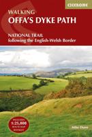
Wandelgids The Offa's Dyke Path - Wales | Cicerone
Engelstalige beschrijving van de mooiste wandeltocht in Wales. De gids voldoet aan alle verwachtingen die je kunt hebben, het enige dat je mist is een overzichtskaart. Inclusief gidsje met routekaarten van 1:25000 (deze is hier ook los te bestellen) This guidebook - which includes both a guide to the route and a separate OS map booklet - describes Offa's Dyke Path National Trail from south to north, following the longest linear earthwork in Britain, running 177 miles along the English-Welsh border between Sedbury (near Chepstow) and Prestatyn on the north Wales Coast. It links the Severn Estuary and the Irish Sea, following the longest linear earthwork in Britain, contouring above the Wye and Dee, visiting hillforts and Norman castles and exploring the hidden heritage of the Marches. The route is exceptional in all seasons, although the Black Mountains and Clwydian range deserve respect in winter conditions.   The guidebook splits one of Britain's classic trails into 12 stages, with su…
25,95
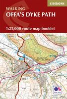
Wandelkaart Offa's Dyke Path - Wales | Cicerone
Handzaam gidsje met alleen de topografische routekaarten van 1:25000. De uitgebreide wandelgids (inclusief dit gidsje) is hier te bestellen. All the mapping you need to complete the Offa's Dyke Path National Trail, the longest linear earthwork in Britain, running 177 miles along the English–Welsh border between Sedbury (near Chepstow) and Prestatyn on the north Wales Coast   NOTE: An accompanying Cicerone guidebook - Offa's Dyke Path - describes the full route with lots of other practical and historical information. The accompanying guidebook includes a copy of this map booklet.   This booklet of Ordnance Survey 1:25,000 Explorer maps has been designed for convenient use on the trail. It shows the full and up-to-date line of the Offa's Dyke Path, along with the relevant extract from the OS Explorer map legend. It is conveniently sized for slipping into a jacket pocket or top of a rucksack and comes in a clear PVC sleeve.   The walk is astonishingly varied, taking in the lower Wye gorge…
14,95
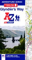
Wandelatlas Adventure Atlas Glyndwr's Way | A-Z Map Company
AZ heeft de meest gedetailleerde wandelkaarten van de Glyndwr's Way gebundeld in een atlasje. Daardoor is het heel handig qua formaat. De kaarten zelf zijn perfect voor het wandelen. Schaal 1:25.000 The A-Z Adventure Series of maps combines the best of OS and A-Z, creating the perfect companion for walkers, off-road cyclists, horse riders and anyone wishing to explore the great outdoors. Glynd r's Way is a 135 mile (217 km) National Trail in mid-Wales from Knighton to Welshpool via Machynlleth. Linking locations connected with Owain Glynd rs, the trail passes through the tranquil Radnorshire Hills and across open moorland and rolling farmland with views over Cadair Idris and Lake Vyrnwy. The route on the map is clearly highlighted in yellow with mileage markers to gauge distances when planning sections of the walk to enjoy. This official National Trail Map* of Glynd r's Way features 43 pages of continuous Ordnance Survey 1:25000 mapping providing complete coverage of Glynd r's Way. The…
12,95
Wandelgids Snowdonia Way | Cicerone
Een beschrijving van de Snowdonia Way, goede beschrijving met gedetailleerd kaartmateriaal..Ook praktische informatie en hoogteprofielen per etappe.   This guidebook describes the Snowdonia Way in Wales, a long-distance route through Snowdonia National Park from Machynlleth to Conwy. A low-level route of 97 miles (in 6 stages of between 13 and 21 miles) passes through the heart of Snowdonia’s stunning mountain scenery and includes Pass of Aberglaslyn, Ogwen Valley and Aber Falls. It is suitable for walkers of average fitness and stamina, though days are long. An alternative mountain route covers 122 miles in 9 stages of 12–18 miles giving a spectacular journey over the most famous peaks such as Cadair Idris, Snowdon and Glyders. The high-level route is more physically challenging and requires good navigation skills. Full route descriptions for each stage are accompanied by OS maps and profiles. The guide also includes lists of accommodation and transport providers and a table of facili…
20,95
Wandelatlas Adventure Atlas Glyndwr's Way | A-Z Map Company
AZ heeft de meest gedetailleerde wandelkaarten van de Glyndwr's Way gebundeld in een atlasje. Daardoor is het heel handig qua formaat. De kaarten zelf zijn perfect voor het wandelen. Schaal 1:25.000 The A-Z Adventure Series of maps combines the best of OS and A-Z, creating the perfect companion for walkers, off-road cyclists, horse riders and anyone wishing to explore the great outdoors. Glynd r's Way is a 135 mile (217 km) National Trail in mid-Wales from Knighton to Welshpool via Machynlleth. Linking locations connected with Owain Glynd rs, the trail passes through the tranquil Radnorshire Hills and across open moorland and rolling farmland with views over Cadair Idris and Lake Vyrnwy. The route on the map is clearly highlighted in yellow with mileage markers to gauge distances when planning sections of the walk to enjoy. This official National Trail Map* of Glynd r's Way features 43 pages of continuous Ordnance Survey 1:25000 mapping providing complete coverage of Glynd r's Way. The…
12,95

Klanten-reviews van Wandelgids Glyndwr's Way - Wales | Cicerone

Er zijn nog geen beoordelingen voor dit productBen jij de eerste die een review plaatst?

Meer over Wandelgids Glyndwr's Way - Wales | Cicerone

Productomschrijving

Een beschrijving van de Glyndwr's way, goede beschrijving met gedetailleerd kaartmateriaal..Ook praktische informatie en hoogteprofielen per etappe. Guidebook to walking Glyndwr's Way, a long-distance National Trail through mid-Wales. The 135 mile route from Knighton via Machynlleth to Welshpool takes 9 days to walk, and 2 days (29 miles) to complete the loop down the Offa's Dyke Path to create a circular trail. A lovely trail through quiet hills, forests and rolling countryside.   A complete guide to walking Glyndŵr's Way National Trail. This guidebook divides the 135 mile trail into nine day stages, starting at Knighton and ending at Welshpool. Days 10 and 11 follow the Offa's Dyke Path National Trail for those who prefer a circular route. The step-by-step route descriptions are accompanied by OS map extracts, photographs and lots of information on facilities available and historical points of interest along the way. Glyndŵr's Way is clearly waymarked throughout and there is accommodation available at the end of every stage, which is listed in full at the back of the guide to make planning easier. The trail commemorates the Welsh leader Owain Glyndŵr, visiting landmarks such as Powis Castle and Glyndŵr's Parliament House at Machynlleth, as well as other historical and archeological sites.   Steden en Dorpen Knighton, Llangunllo, Felindre, Llanbadarn Fynydd, Abbeycwmhir, Llanidloes, Dylife, Machynlleth, Cemmaes Road, Llanbrynmair, Llangadfan, Llanwddyn, Dolganog, Meifod, Welshpool, Montgomery

Productspecificaties

Artikelnummer(s)
Brand
Cicerone

Verken gerelateerde categorieën

Webshop.nl maakt gebruik van cookies. Ga je verder op onze website, ga dan akkoord met het plaatsen van cookies en de verwerking van deze data door ons en vermelde partners.