webshop.nl
Categorieën
  Sluiten

Meer Rucksack Readers

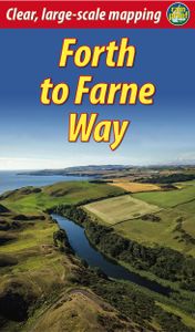
Wandelgids Forth to Farne Way | Rucksack Readers

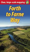
This inspiring 70-mile pilgrim route starts from North Berwick on the Firth of Forth near Edinburgh, and continues via Whitekirk's 12th century church to Dunbar. It follows the North Sea coastline to the stunning scenery of St Abb's Head and visits Coldingham Priory, perhaps Scotland's most important Benedictine monastery. Enjoy impressive cliffs a...
19,95

Webshops met dit product

Webshop
Bezorging
Prijs

Anderen bekeken ook

Wandelgids Forth to Farne Way | Rucksack Readers
This inspiring 70-mile pilgrim route starts from North Berwick on the Firth of Forth near Edinburgh, and continues via Whitekirk's 12th century church to Dunbar. It follows the North Sea coastline to the stunning scenery of St Abb's Head and visits Coldingham Priory, perhaps Scotland's most important Benedictine monastery. Enjoy impressive cliffs and dramatic sea stacks between visits to historic fishing villages. Cross the border and enter Berwick with its ramparts, walls and bridges across the River Tweed. The route culminates with a barefoot crossing of the Holy Island sands to Lindisfarne, where St Aidan founded a monastery in AD 635.Most people will complete the route within 5 to 8 days, staying in friendly B&Bs along the route, but it can also be done in several shorter expeditions using train and bus. This 72-page guidebook contains all you need to plan and enjoy the Forth to Farne Way: route detail in sections, with distance, terrain and refreshments where to find food and ac…
19,95
Wandelgids John Muir Way | Rucksack Readers
The John Muir Way runs for 134 miles (215 km) coast-to-coast across central Scotland, from Helensburgh on the Clyde to Dunbar on the North Sea. The route is as suitable for cyclists as for walkers, and it can be tackled as a coast-to-coast expedition or in sections - ten for walkers or five for cyclists.   The John Muir Way's appeal ranges from the Charles Rennie Mackintosh architecture of Helensburgh through the scenic grandeur of Loch Lomond, along two famous canals and past the amazing Falkirk Wheel, beside the Roman Antonine Wall, passing Linlithgow Palace, Blackness Castle and the Forth Bridges to the capital glories of Edinburgh. It goes beside the Firth of Forth to reach North Berwick, then heads inland to finish at Dunbar with its ruined castle and the John Muir birthplace.   This guidebook contains all you need to plan and enjoy your holiday on a bike or on foot:   background on John Muir's life, the canal heritage and wildlife detailed description of the route from west to …
23,95
Wandelgids Fife Coastal Path | Rucksack Readers
The Fife Coastal Path runs around the coastline of eastern Scotland for 117 miles (187 km) from Kincardine on the Forth to Newburgh on the Tay. Starting west of the famous Forth bridges, the route heads through former mining towns towards the villages of Fife's East Neuk (corner), with their rich tradition of smuggling and fishing. After rounding Fife Ness, the route follows the coastline through St Andrews, golf capital of the world and former religious centre of Scotland.Fife has long played an important part in Scottish history and the route passes many castles, towers and churches. There are splendid views along the coast and over the Firths of Forth and Tay, with great chances to sight seabirds, seals and dolphins. The villages have welcoming pubs, famous fish-and-chip shops and good B&Bs. Transport by train and bus makes for easy access throughout. The guidebook contains everything you need to plan and enjoy the Fife Coastal Path – on foot, or on a bike where cycling is appropria…
23,95
Wandelgids Wicklow Way | Rucksack Readers
Uitgevoerd in de vorm van een klapper, met ringband geeft deze gids een goede beschrijving van de lange afstands route. De kaarten zijn schetsmatig maar wel duidelijk. The Wicklow Way is Ireland’s first and most popular Waymarked Way, running between Marlay Park (Dublin) and Clonegal, 82 miles (132 km) to the south. It offers varied and scenic walking on the flanks of the rugged Wicklow mountains with loughs and waterfalls, passing historic buildings and hospitable villages. Much of the route lies over 1600 feet (500 metres) giving glorious views. Lower sections run through forests and farmland, over a mixture of tracks, roads and pathways rich in wildlife.   Our third edition is based on a research trip made in 2008, further revised in 2011, 2015, 2017 and 2019. It has many route updates, extra photographs and it explains new options for accommodation.   This guidebook contains all you need to plan and enjoy the Wicklow Way:   detailed route description, updated in 2019, with dist…
19,95
Wandelgids The Rob Roy Way | Rucksack Readers
Deze gids geeft een goede beschrijving van de lange afstands route. De kaarten zijn schetsmatig maar wel duidelijk. The Rob Roy Way is one of Scotland's Great Trails and is very popular with both walkers and cyclists. It runs through many places linked with Scotland's most famous outlaw, Rob Roy MacGregor (1671-1734). The route starts at Drymen (near Glasgow) and ends at Pitlochry in the eastern Highlands, so it takes you away from the crowds following the West Highland Way to some of Scotland's finest lochs and glens.   Its main spine runs for 79 miles (127 km) and is waymarked. There is an optional extra 17 miles if you take the wilderness extension through Glen Almond and Glen Quaich. Most walkers complete it in 6-8 days and most cyclists in 3-4 days.   The main route goes through Loch Ard forest to Aberfoyle, goes beside Lochs Venachar, Lubnaig and Tay and passes through superb scenery, with interesting aqueducts, viaducts and a 3600 year-old stone circle. The terrain is a mix…
22,50
Wandelgids The Kerry Way | Rucksack Readers
Beschrijving van de Kerry Way, een bekend lange afstands pad in Ierland. Goede beschrijvingen / Engels. "An eye-catching, colourful publication with clear directions" - Irish Mountain Log   The Kerry Way runs for about 130 miles (210 km) through Ireland’s most spectacular mountain landscapes, starting and finishing in the town of Killarney. Dramatic peaks and glens, wild moorlands, lakes and windswept passes blend magnificently with extensive coastal panoramas. The complete walk takes about nine days, but it can easily be shortened. The third edition of our guidebook was fully revised in 2021 with updates to the route options and the step-by-step directions. It has customised mapping at 1:45,000, a better scale than the OSI Discovery maps, and it contains 100 colour photos, many of them new.   This book is in our lighter, more pocket-friendly format, with perfect binding instead of concealed wiro.   This guidebook contains all you need to plan and enjoy the Kerry Way:   the Way in …
22,50

Klanten-reviews van Wandelgids Forth to Farne Way | Rucksack Readers

Er zijn nog geen beoordelingen voor dit productBen jij de eerste die een review plaatst?

Meer over Wandelgids Forth to Farne Way | Rucksack Readers

Productomschrijving

This inspiring 70-mile pilgrim route starts from North Berwick on the Firth of Forth near Edinburgh, and continues via Whitekirk's 12th century church to Dunbar. It follows the North Sea coastline to the stunning scenery of St Abb's Head and visits Coldingham Priory, perhaps Scotland's most important Benedictine monastery. Enjoy impressive cliffs and dramatic sea stacks between visits to historic fishing villages. Cross the border and enter Berwick with its ramparts, walls and bridges across the River Tweed. The route culminates with a barefoot crossing of the Holy Island sands to Lindisfarne, where St Aidan founded a monastery in AD 635.Most people will complete the route within 5 to 8 days, staying in friendly B&Bs along the route, but it can also be done in several shorter expeditions using train and bus. This 72-page guidebook contains all you need to plan and enjoy the Forth to Farne Way: route detail in sections, with distance, terrain and refreshments where to find food and accommodation background on the spiritual dimension, geology and wildlife planning information for travel by train, bus, car or plane 16 pages with detailed route mapping at 1:30,000 in full colour, with 135 photographs rucksack-friendly and on rainproof paper.

Productspecificaties

Artikelnummer(s)
Brand
Rucksack Readers
Webshop.nl maakt gebruik van cookies. Ga je verder op onze website, ga dan akkoord met het plaatsen van cookies en de verwerking van deze data door ons en vermelde partners.