webshop.nl
Categorieën
  Sluiten

Meer Hallewell Publications

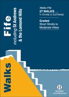
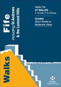
Wandelgids Fife | Hallewell Publications

Rewalked and updated in 2021, Walks Fife including St Andrews & the Lomond Hills covers the county of Fife, which lies between the estuaries of the Rivers Forth and Tay. There are a lot of coastal walks (along sections of the Fife Coastal Path), plus walks in and around the historic town of St Andrews and some good hill walks in the Lomond Hills. T...
5,95

Webshops met dit product

Webshop
Bezorging
Prijs

Anderen bekeken ook

Wandelgids Fife | Hallewell Publications
Rewalked and updated in 2021, Walks Fife including St Andrews & the Lomond Hills covers the county of Fife, which lies between the estuaries of the Rivers Forth and Tay. There are a lot of coastal walks (along sections of the Fife Coastal Path), plus walks in and around the historic town of St Andrews and some good hill walks in the Lomond Hills. The 27 walks featured range from 0.5 miles to 13 miles (1.5-21km). Routes include: West and East Lomond, Bishop Hill and St Andrews to Crail. Now on its 3rd edition, Walks Fife is part of a popular series of A6 pocket walking guides which describe routes which are suitable for walkers of all abilities and to suit all tastes. Route descriptions are accompanied by 2-colour sketch maps. The guides are illustrated with line illustrations, and will provide walkers with a good introduction to what each area covered has to offer.
5,95
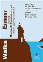
Wandelgids Exmoor | Hallewell Publications
Rewalked and revised in 2021, Walks Exmoor features walks in the Exmoor National Park - a beautiful area including moorland, farmland, wooded valleys and stunning coastal scenery. (The major settlements - Minehead, Ilfracombe and Barnstaple - are all just outside the area.) The 20 walks in the guide range from 1 to 9 miles (1.6 14.4km). The bulk of the routes are in the northern coastal strip (the guide contains a number of short walks from the South West Coast Path), including the path from Lynmouth to the stunning Valley of Rocks and a group of linked walks on Bossington Hill (by Minehead). Elsewhere there is a fine riverside walk to the ancient footbridge of Tarr Steps. Walks Exmoor is part of a popular series of A6 pocket walking guides which describe routes which are suitable for walkers of all abilities and to suit all tastes. Route descriptions are accompanied by 2-colour sketch maps. The guides are illustrated with line illustrations, and will provide walkers with a good introd…
5,95
Wandelgids East Lothian | Hallewell Publications
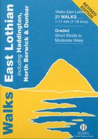
Rewalked and updated in 2017, Walks East Lothian including Haddington, North Berwick & Dunbar covers the county of East Lothian, which lies to the east of Edinburgh. Walks include a number of coastal paths along the Firth of Forth and the North Sea, some paths through the county's fertile farmland plus some hill walks on the edge of the Lammermuir Hills. The 21 walks featured range from 0.5 miles to 11 miles (1-18km). Routes include: Dunbar Clifftop Trail, Traprain Law, Haddington Riverside and Gullane to North Berwick. Part of a regularly updated popular series of A6 pocket walking guides which describe routes which are suitable for walkers of all abilities and to suit all tastes. Route descriptions are accompanied by 2-colour sketch maps. The guides are illustrated with line illustrations, and will provide walkers with a good introduction to what each area covered has to offer.
5,95
Wandelgids Moray Coast Trail | Rucksack Readers
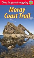
The Mary Queen of Scots Way stretches across central Scotland from coast to coast, linking many places associated with Mary Queen of Scots. It runs for 107 miles (172 km) from Arrochar on Loch Long in the west to St Andrews on the Fife coast, and links with four of Scotland’s Great Trails: the Loch Lomond & Cowal Way, the West Highland Way, the Rob Roy Way and the Fife Coastal Path. This route, however, has no official status: there is no dedicated MQS waymarking, although the guidebook gives detailed directions and parts of it are easy to follow. Some sections are unsuitable for novice walkers unless accompanied by somebody with map and compass skills.   The Way goes through richly varied scenery, starting from a rugged sea loch, crossing Loch Lomond and traversing its National Park to the hills of central Scotland, ending on a sandy beach on the Fife coast. It passes mountains, lochs and waterfalls; castles, hill forts and aqueducts; and is broken into manageable sections which end a…
19,95
Wandelgids Weekend Walks Kingdom of Fife | Pocket Mountains
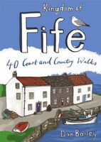
Following on from the new "Pocket Mountains Town and Country" series of shorter walks, this guidebook explores the stunning coast and countryside of the Kingdom of Fife.Featured here you'll find 40 inspiring short walks in and around the Kingdom, stretching from the north side of the famous Forth Bridges, along the Firth of Forth to Culross, and Gleneagles and Dollar further north, and then east beyond Kirkcaldy to the string of picturesque fishing villages of the East Neuk. The volume travels north through Dunfermline and Glenrothes to Falkland and beyond to St Andrews, Tentsmuir Forest and the mighty Tay, with forays also into Kinross.Ranging from lochside nature trails to short, exhilarating routes up into the Lomond and Ochil Hills to the best stretches of the Fife Coastal Trail and circuits around historic towns and villages, this book is all you need to really discover Fife.Many of these circular routes are suitable for families and accessible by public transport.
10,95
Wandelgids Isle of Mull, Coll and Tiree | Hallewell Publications
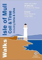
Rewalked and revised in 2015, Walks Isle of Mull, Coll & Tiree including Iona & Ulva includes walks on the Inner Hebridean island of Mull and the nearby islands. Mull is typified by spectacular coastal scenery and fine hill climbs, while the other islands are lower and gentler in character. The 29 walks featured range from 1 mile to 10.5 miles (1.6-17km). Routes on Mull include: Ben More, Carsaig Arches and two walks from Tobermory. The guide also features walks on the marvellous island of Ulva, two fine walks on Iona plus routes on the rugged island of Coll and the wide sand beaches of Tiree. Now on its 3rd edition, this guide is part of a popular series of A6 pocket walking guides which describe routes which are suitable for walkers of all abilities and to suit all tastes. Route descriptions are accompanied by 2-colour sketch maps. The guides are illustrated with line illustrations, and will provide walkers with a good introduction to what each area covered has to offer.
5,95
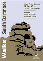
Wandelgids South Dartmoor | Hallewell Publications
Rewalked and revised in 2021, Walks South Dartmoor features walks in and around the southern half of the Dartmoor National Park - an area famous for its rolling moorland, ponies and dramatic tors (weathered granite outcrops rising from the moorland). This guide covers the area north of Ivybridge and south of an east-west line just north of Tavistock. (For the northern half of the area, see Walks North Dartmoor.) The 22 walks in the guide range from 1 to 8 miles (1.6 12.8km). The bulk of the high moorland walks are in the north of this area, passing such features as Great Mis Tor and Foxtor Mires (thought to be the inspiration for Grimpen Mire in The Hound of the Baskervilles). In the south there are more river and woodland walks, including paths from Burrator Reservoir and to the dramatic Dewterstone. Walks South Dartmoor is part of a popular series of A6 pocket walking guides which describe routes which are suitable for walkers of all abilities and to suit all tastes. Route descriptio…
5,95

Klanten-reviews van Wandelgids Fife | Hallewell Publications

Er zijn nog geen beoordelingen voor dit productBen jij de eerste die een review plaatst?

Meer over Wandelgids Fife | Hallewell Publications

Productomschrijving

Rewalked and updated in 2021, Walks Fife including St Andrews & the Lomond Hills covers the county of Fife, which lies between the estuaries of the Rivers Forth and Tay. There are a lot of coastal walks (along sections of the Fife Coastal Path), plus walks in and around the historic town of St Andrews and some good hill walks in the Lomond Hills. The 27 walks featured range from 0.5 miles to 13 miles (1.5-21km). Routes include: West and East Lomond, Bishop Hill and St Andrews to Crail. Now on its 3rd edition, Walks Fife is part of a popular series of A6 pocket walking guides which describe routes which are suitable for walkers of all abilities and to suit all tastes. Route descriptions are accompanied by 2-colour sketch maps. The guides are illustrated with line illustrations, and will provide walkers with a good introduction to what each area covered has to offer.

Productspecificaties

Artikelnummer(s)
Brand
Hallewell Publications
Webshop.nl maakt gebruik van cookies. Ga je verder op onze website, ga dan akkoord met het plaatsen van cookies en de verwerking van deze data door ons en vermelde partners.