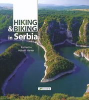
Wandelgids - Fietsgids Hiking and Biking in Serbia - Servië | Komshe

0
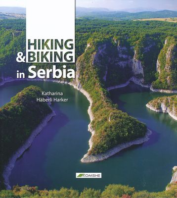
Een boek voor elk niveau wandelaar en fietser, birdwatcher, natuur en outdoor liefhebber. Alle routes zijn persoonlijk gecontroleerd door de auteur. Het boek behandelt meer dan 30 beschreven routes met gedetailleerde kaarten, trail beschrijvingen en timings, mooie foto's en zorgvuldig onderzocht achtergrond informatie over wat er te zien is langs ...

Verkopers met dit product

Verkoper
Bezorging
Prijs
DeZwerver.nl logo
DeZwerver.nl
niet bekend
2,95
22,95

Anderen bekeken ook

Wandelgids - Fietsgids Hiking and Biking in Serbia - Servië | Komshe
Een boek voor elk niveau wandelaar en fietser, birdwatcher, natuur en outdoor liefhebber. Alle routes zijn persoonlijk gecontroleerd door de auteur. Het boek behandelt meer dan 30 beschreven routes met gedetailleerde kaarten, trail beschrijvingen en timings, mooie foto's en zorgvuldig onderzocht achtergrond informatie over wat er te zien is langs de weg.   De routes dekken Fruska Gora, Valjevo Bergen i(inclusief rond Divcibare), Djerdap National Park met zijn ijzeren hek, de toppen van Rtanj, Trem, Kablar elk met een prachtig uitzicht, Stara planina (met inbegrip van het Dak van Servië), de Sjenica hoogvlakte, aan de vale gieren in Uvac, Tara National Park, langs de Donau en de Sava rivieren evenals routes in de omgeving van Belgrado.   Beetje groot formaat boek, niet direct om mee te nemen, maar voor ideeen zeer goed. 
22,95
Wandelgids - Fietsgids Hiking and Cycling in the Black Forest | Cicerone
Guidebook describing day walks, multi-stage treks and 5 cycle routes covering the north, central and southern regions of Germany's Black Forest. From easy routes for families to multi-day journeys, the walks and rides explore the many forests, villages, castles and hills near Strasbourg, Baden-Baden, Freiburg and Basle.   Seasons spring and autumn are the best times of the year to visit the Black Forest. But the cool forest glades and lofty hills make summer walking bearable. Some routes are even accessible in winter and make for magical winter wonderland walking   Centres Freiburg im Breisgau Waldkirch, Hinterzarten, Baden Baden, Baiersbronn, Titisee, Bad Wildbad, Nagold, Calw, Breisach am Rhein   Difficulty The Black Forest is a medium-height mountain range with the highest peaks around 1500m. Trails are well marked and maintained, so the terrain is not especially difficult in most parts. Good physical condition and ability to cope with sometimes steep ascends is required. Normal wa…
23,95
Wandelgids - Fietsgids Hiking and Cycling the California Missions Trail - Californie | Cicerone
Guidebook to hiking or cycling the 800 mile (1289km) California Missions Trail between San Francisco Bay and San Diego. The pilgrimage trail takes in 21 historic Spanish missions and can be completed in 50-60 walking days or 2-3 weeks cycling. With 1:100,000 mapping, route description, and details of accommodation and facilities for each stage. Ancient footpaths became connecting routes between the Spanish missions, pueblos, and presidios in the period 1769 to 1823. Over time these routes became automobile roadways and were marked with bells starting in 1906 to promote and preserve the El Camino Real. Today, the California Missions Trail follows a pedestrian route through urban cities and historic towns, through forest paths and country lanes, to each of the twenty-one historic Spanish missions. The 800-mile California Missions Trail leads walkers and cyclists through some of the most scenic and historic sites of one of America's most beautiful states. The 21 missions, founded 200-250…
26,50
Wandelgids Peru - Hiking and Biking Peru's Inca Trails | Cicerone
The eastern slope of the Peruvian Andes is one of the most dramatic and diverse places on the planet, dropping from over 6000m (20,000ft) to just 200m above sea level. This dramatic drop in elevation produces a wide range of constantly changing climactic and vegetative zones – it is often possible to hike from the base of a glacier down to the jungle in just a day or two. Combined with the countless Inca sites and ubiquitous Inca roads, this makes the Sacred Valley one of the best trekking and mountain biking destinations in the world.    Machu Picchu is well known as one of the Seven Wonders of the World, and the Inca Trail trek that leads there is nearly as famous. What is less known, however, is the vast choice of other epic adventure trips that exist in the region – treks through soaring Andean glaciers and Incan ruins, bike rides through stunning alpine and jungle scenery. Nearly every route in this book uses an Inca road or visits an Inca ruin – and most do both. The majority of…
22,95
Wegenkaart - landkaart Croatia, Serbia, Bosnia and Herzovina - Kroatië, Servië, Bosnië en Herzegowina | Marco Polo
Duidelijke wegenkaart van Marco Polo: alle wegen, zowel de verharde als belangrijke onverharde wegen zijn weergegeven.  Mooie toeristisch interessante wegen die de moeite waard zijn, zijn groen gearceerd. Veel toeristische informatie is toegevoegd zoals de nationale parken, campings, kastelen en vliegvelden. Afstanden tussen belangrijke steden en benzinestations staan ook op de kaart. Een plaatsnamenregister ontbreekt niet.   ---   This Marco Polo map features really easy to read cartography. Topography is highlighted with relief shading and loads of spot heights and the road network is clearly shown with roads ranging from motorways all the way through to minor secondary roads. The map also clearly indicates airports, places of interest, scenic/tourist routes, view points etc.   The map includes a booklet attached to the cover that contains some useful information and a very extensive index that covers locations, places of interest and geographical features. Also included are a dista…
14,95
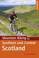
Fietsgids - Mountainbikegids Mountain Biking in Southern and Central Scotland | Cicerone
Degelijke fietsgids met 21 mountainbike routes in zuid en midden Schotland. Goede beschrijvingen en duidelijke kaarten.   This guidebook describes 21 mountain biking routes in central and southern Scotland. It includes the 7stanes trail centre in Dumfries and Galloway, as well as cross-country routes in the Campsie Fells, Pentland Hills and Lammermuirs, the Galloway Forest, Tweed Valley, Cheviots and Lowther Hills. The routes range from 16.5 to 66km and are graded from moderate to very hard. Taking between 2 and 7 hours to complete, they are intended for reasonably fit mountain bikers with at least some experience.   Detailed route descriptions are accompanied by 1:50,000 OS mapping, and the selected routes set out from various points across the area, including Greenock, Glentrool, Peebles and Milngavie, with good access from both Glasgow and Edinburgh. The guidebook also gives an overview of what the region's MTB trail centres have to offer, including the famous 7stanes trail cent…
24,95
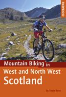
Fietsgids - Mountainbikegids Mountain Biking in West and North West Scotland | Cicerone
Degelijke fietsgids met 25 mountainbike routes in west en noord-west Schotland. Goede beschrijvingen en duidelijke kaarten.   This guidebook to  mountain biking routes in North and North West Scotland describes 25 MTB routes north of the Great Glen, Covering a large geographical area,including Fort William, Rannoch Moor, Glen Spean, Ben Nevis, Sutherland, Torridon and Skye, the routes give a real flavour of the variety of different bike riding available. The routes range from 19.5km to 73.25km, graded moderate to very hard. Many are long and committing, so good preparation and fitness are essential, and in some cases a willingness to “hike and bike”.   Each route has a clear and detailed route description along with 1:50,000 OS mapping and a height profile. All routes have key information, including distance on and off-road, ascent, grade, time and the nearest pub and cafe.  There is also advice on equipment, planning and preparation, before you hit the trails.   Scotland is rightly r…
24,95
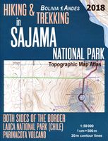
Topografische kaart - Atlas Hiking and Trekking in Sajama National Park Bolivia Chili Andes | Mazitto
Updated 2018 edition. Detailed topographic map 1:50.000 & 20 meter contours for hiking and trekking, printed as an atlas book (with overlapping pages). Covers the full area of the Sajama National Park in Bolivia with some surrounding area and part of the Lauca National Park (Chile) across the border. 20 meter contour lines, road network, trails & paths, transportation, food, campsites, shelters, guest houses & hotels.Mercator projection with both UTM and WGS84 coordinate grids. The map scale of 1:50000 (1 cm = 500 meters) provides a wealth of detail while keeping low the weight of the atlas itself. The largepage format of 8.5x11in minimizes page count and along with an overlapping map design allows for comfortable navigation. The details included in the topographic maps of this atlas were specifically selected to be useful for trekkers, hikers and walkers ofall interests, and make it easy to plan and enjoy both short excursions and hikes as well as long multi-day adventures along them…
27,50
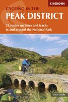
Fietsgids Cycling in the Peak District | Cicerone
Guide to cycling in and around the Peak District National Park, on road or trail bike. 20 day routes and one multi-day cycle tour of the Peak District. All easily accessible from Sheffield and Manchester with routes starting from charming Derbyshire towns such as Ashbourne, Matlock, Bakewell and Buxton. Includes route profiles and 1:100000 mapping. The scenic Peak District boasts an abundance of country lanes, tracks, towpaths and railway trails that are perfect for two-wheeled exploration. This guidebook presents 20 graded day rides in the national park, along with a challenging 250km route, the five-day 'Tour de Peak District'. With a focus on quiet lanes, gratifying downhills and not overly technical bridleways, tracks and trails, the routes are ideal for gravel/adventure bikes (or hybrid/cross), though most can be easily adapted for road bikes.   Each ride features step-by-step route description accompanied by 1:100,000 mapping. Overview stats are provided to aid route selection, …
18,50

Klanten-reviews van Wandelgids - Fietsgids Hiking and Biking in Serbia - Servië | Komshe

Er zijn nog geen beoordelingen voor dit productBen jij de eerste die een review plaatst?

Meer over Wandelgids - Fietsgids Hiking and Biking in Serbia - Servië | Komshe

Productomschrijving

Een boek voor elk niveau wandelaar en fietser, birdwatcher, natuur en outdoor liefhebber. Alle routes zijn persoonlijk gecontroleerd door de auteur. Het boek behandelt meer dan 30 beschreven routes met gedetailleerde kaarten, trail beschrijvingen en timings, mooie foto's en zorgvuldig onderzocht achtergrond informatie over wat er te zien is langs de weg.   De routes dekken Fruska Gora, Valjevo Bergen i(inclusief rond Divcibare), Djerdap National Park met zijn ijzeren hek, de toppen van Rtanj, Trem, Kablar elk met een prachtig uitzicht, Stara planina (met inbegrip van het Dak van Servië), de Sjenica hoogvlakte, aan de vale gieren in Uvac, Tara National Park, langs de Donau en de Sava rivieren evenals routes in de omgeving van Belgrado.   Beetje groot formaat boek, niet direct om mee te nemen, maar voor ideeen zeer goed. 

Productinformatie

    Verken gerelateerde categorieën

    Webshop.nl maakt gebruik van cookies. Ga je verder op onze website, ga dan akkoord met het plaatsen van cookies en de verwerking van deze data door ons en vermelde partners.