Wandelgids Exmoor | Pocket Mountains

0
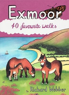
Straddling the counties of Somerset and Devon, Exmoor is a place which never fails to stir the imagination, thanks to the coastline of stark cliffs lining the Bristol channel, the wooded valleys, tumbling streams and wild moorland. Designation as a national park in 1954 has helped Exmoor's villages and small towns keep their character and, althoug...

Verkopers met dit product

Verkoper
Bezorging
Prijs
DeZwerver.nl logo
DeZwerver.nl
2,95
10,95

Anderen bekeken ook

Wandelgids Exmoor | Pocket Mountains
Straddling the counties of Somerset and Devon, Exmoor is a place which never fails to stir the imagination, thanks to the coastline of stark cliffs lining the Bristol channel, the wooded valleys, tumbling streams and wild moorland. Designation as a national park in 1954 has helped Exmoor's villages and small towns keep their character and, although the moorland can undoubtedly be austere, this unassuming corner of England has an overriding softness and beguiling, timeless charm. The 40 walks in this guide make the most of more than 1000km of public rights of way and the many long-distance walks which criss-cross the landscape, offering something for every kind of walker.  
10,95
Wandelgids Exmoor | Hallewell Publications
Rewalked and revised in 2021, Walks Exmoor features walks in the Exmoor National Park - a beautiful area including moorland, farmland, wooded valleys and stunning coastal scenery. (The major settlements - Minehead, Ilfracombe and Barnstaple - are all just outside the area.) The 20 walks in the guide range from 1 to 9 miles (1.6 14.4km). The bulk of the routes are in the northern coastal strip (the guide contains a number of short walks from the South West Coast Path), including the path from Lynmouth to the stunning Valley of Rocks and a group of linked walks on Bossington Hill (by Minehead). Elsewhere there is a fine riverside walk to the ancient footbridge of Tarr Steps. Walks Exmoor is part of a popular series of A6 pocket walking guides which describe routes which are suitable for walkers of all abilities and to suit all tastes. Route descriptions are accompanied by 2-colour sketch maps. The guides are illustrated with line illustrations, and will provide walkers with a good intro…
5,95
Wandelgids Lewis | Pocket Mountains
The Isle of Lewis is a magnificent domain of rugged hillcountry and lochan-scattered moorland, fringed by tenacious crofting townships. The coastline is a realm of rocky cliffs, sea lochs, islands and skerries while the west coast is garlanded with dazzling dune-backed beaches. History is everywhere in Lewis, with remarkable monuments to human endeavour - ancient and more recent - punctuating the landscape.   These 25 walks explore the island's range of environments, providing opportunities to experience its spectacular wildlife and encounter the physical traces of its history.
12,50
Wandelgids Uist, Barra & Vatersay | Pocket Mountains
The elemental landscapes of Uist and Barra include some superb walking country. The dune-backed beaches, machair and croftland of the Atlantic shores contrast with the lochan-scattered moorland and rugged hillcountry of the islands' interiors, while the frayed edges of the eastern coastline, with numerous islands, skerries and sea lochs, is a place apart. Each of the islands has its own distinctive character, geography and history.   These 25 walks reflect the range of terrain in the islands and provide opportunities to experience the spectacular wildlife and the physical traces of island history.
12,50
Wandelgids Yorkshire Dales | Pocket Mountains
Handige compacte wandelgids met 40 dagwandelingen. Deze gids bevat kleine kaartjes en leuke uitgebreide informatie over wat er langs de route te zien is. Goede wandelkaarten zijn echter we noodzakelijk voor deze tochten: de Ordnance Survey explorer maps of Landanger maps zijn zeer geschikt.     The Yorkshire Dales combine a wild limestone landscape of high rolling moorland gouged by dramatic caves and cascading waterfalls with peaceful farmland carpeted in wildflowers and dotted with ruined abbeys, ancient stone walls and barns, and timeless villages waiting to be discovered.The 40 moderate walks in this collection from award winning publisher Pocket Mountains highlight the very best the area has to offer and include adventures in Wharfedale, Malhamdale, Nidderdale, Ribblesdale, Wensleydale, Swaledale and Dentdale. Many routes make use of sections of established long-distance trails such as the Pennine Way and the Dales Way.  
10,95
Wandelgids Caithness and Sutherland | Pocket Mountains
Handige compacte wandelgids met 40 dagwandelingen. Deze gids bevat kleine kaartjes en leuke uitgebreide informatie over wat er langs de route te zien is. Goede wandelkaarten zijn echter we noodzakelijk voor deze tochten: de Ordnance Survey explorer maps of Landanger maps zijn zeer geschikt. The county of Ayrshire is located on the Firth of Clyde on the beautiful West Coast of Scotland and is known as one of the most fertile areas of the country, famed for its cattle and crops. Although more industrial to the north, it is in the main a landscape made for walking with an abundance of open countryside and rugged little hills, golden sandy beaches and beautiful sunsets. This guide features 40 mostly moderate walks full of interest which explore all aspects of the region, from craggy cliffs and caves to historic castles, ancient forests to sandy shorelines. Sutherland and Caithness are the most northerly parts of mainland Britain. Northwest Sutherland is a landscape of sandy beaches and …
10,95
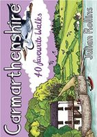
Wandelgids Carmarthenshire | Pocket Mountains
Handige compacte wandelgids met 40 dagwandelingen. Deze gids bevat kleine kaartjes en leuke uitgebreide informatie over wat er langs de route te zien is. Goede wandelkaarten zijn echter we noodzakelijk voor deze tochten: de Ordnance Survey explorer maps of Landanger maps zijn zeer geschikt.   Carmarthenshire is the largest of the old Welsh counties and nestles between Pembrokeshire and the Gower Peninsula in the heart of South West Wales. Its a land of contrasts; along the coast you'll walk close to the airy edge of tall cliffs, but there are beaches too, some so long you can't see an end to them. And sheltered estuaries, like the heron-priested shores at Laugharne that inspired the poet Dylan Thomas. Inland there are tucked-away valleys and castle-topped hills, open moorland, and ancient woodland that is fizzing with life.
10,95
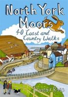
Wandelgids North York Moors | Pocket Mountains
Handige compacte wandelgids met 40 dagwandelingen. Deze gids bevat kleine kaartjes en leuke uitgebreide informatie over wat er langs de route te zien is. Goede wandelkaarten zijn echter we noodzakelijk voor deze tochten: de Ordnance Survey explorer maps of Landanger maps zijn zeer geschikt.   Designated a national park in 1952, the North York Moors include the largest area of heather upland in England, rising from the Vale of York and continuing to the North Sea coast where dramatic cliffs expose the geology that shaped this unique environment. This guide features 40 coast and country walks that take in the very best the moors have to offer - tranquil dales, stunning coastline, ancient woodlands, charming moorland villages and spectacular ruined castles and monasteries - as well as one of the UK's best heritage railways.
10,95
Wandelgids Devon | Pocket Mountains
Handige compacte wandelgids met 40 dagwandelingen. Deze gids bevat kleine kaartjes en leuke uitgebreide informatie over wat er langs de route te zien is. Goede wandelkaarten zijn echter wel aan te raden voor deze tochten: de Ordnance Survey explorer maps of Landranger maps zijn zeer geschikt. From the crumbly rhubarb-and-cream-coloured cliffs of the Jurassic Coast in the southeast to the surf-stroked craggy coves in the north, across the wilderness and woodland of Dartmoor and Exmoor, and through the verdant valleys and great green grazing lands of the dairy belt - Devon is a county of exquisite contrasts and natural wonder. Whether you're looking for an easy afternoon stroll along the shore, a riverside ramble to an atmospheric country pub or a tor-topping trek on the moors, there's something to suit every boot in Patrick Kinsella's inspiring collection of 40 Devon coast and country walks. Plaatsen in het boekje Axminster, Baggy Point, Beer, Berry Camp, Bigbury-on-Sea, Bishop’s Walk,…
10,95

Klanten-reviews van Wandelgids Exmoor | Pocket Mountains

Er zijn nog geen beoordelingen voor dit productBen jij de eerste die een review plaatst?

Meer over Wandelgids Exmoor | Pocket Mountains

Productomschrijving

Straddling the counties of Somerset and Devon, Exmoor is a place which never fails to stir the imagination, thanks to the coastline of stark cliffs lining the Bristol channel, the wooded valleys, tumbling streams and wild moorland. Designation as a national park in 1954 has helped Exmoor's villages and small towns keep their character and, although the moorland can undoubtedly be austere, this unassuming corner of England has an overriding softness and beguiling, timeless charm. The 40 walks in this guide make the most of more than 1000km of public rights of way and the many long-distance walks which criss-cross the landscape, offering something for every kind of walker.  

Productinformatie

    Verken gerelateerde categorieën

    Webshop.nl maakt gebruik van cookies. Ga je verder op onze website, ga dan akkoord met het plaatsen van cookies en de verwerking van deze data door ons en vermelde partners.