webshop.nl
Categorieën
  Sluiten

Meer Pocket Mountains

Wandelgids Exmoor | Pocket Mountains

Straddling the counties of Somerset and Devon, Exmoor is a place which never fails to stir the imagination, thanks to the coastline of stark cliffs lining the Bristol channel, the wooded valleys, tumbling streams and wild moorland. Designation as a national park in 1954 has helped Exmoor's villages and small towns keep their character and, although...
10,95

Webshops met dit product

Webshop
Bezorging
Prijs

Anderen bekeken ook

Wandelgids Exmoor | Pocket Mountains
Straddling the counties of Somerset and Devon, Exmoor is a place which never fails to stir the imagination, thanks to the coastline of stark cliffs lining the Bristol channel, the wooded valleys, tumbling streams and wild moorland. Designation as a national park in 1954 has helped Exmoor's villages and small towns keep their character and, although the moorland can undoubtedly be austere, this unassuming corner of England has an overriding softness and beguiling, timeless charm. The 40 walks in this guide make the most of more than 1000km of public rights of way and the many long-distance walks which criss-cross the landscape, offering something for every kind of walker.
10,95
Wandelgids Exmoor | Hallewell Publications
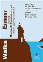
Rewalked and revised in 2021, Walks Exmoor features walks in the Exmoor National Park - a beautiful area including moorland, farmland, wooded valleys and stunning coastal scenery. (The major settlements - Minehead, Ilfracombe and Barnstaple - are all just outside the area.) The 20 walks in the guide range from 1 to 9 miles (1.6 14.4km). The bulk of the routes are in the northern coastal strip (the guide contains a number of short walks from the South West Coast Path), including the path from Lynmouth to the stunning Valley of Rocks and a group of linked walks on Bossington Hill (by Minehead). Elsewhere there is a fine riverside walk to the ancient footbridge of Tarr Steps. Walks Exmoor is part of a popular series of A6 pocket walking guides which describe routes which are suitable for walkers of all abilities and to suit all tastes. Route descriptions are accompanied by 2-colour sketch maps. The guides are illustrated with line illustrations, and will provide walkers with a good introd…
5,95
Wandelgids Wye Valley | Pocket Mountains
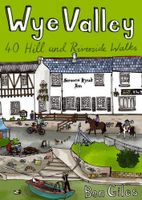
This guide contains forty circular routes, covering an area somewhat broader than the AONB but within similar north-south boundaries. This collection of walks is split into five areas: Hereford Lowlands and the Woolhope Dome; Archenfield and the Monnow and Trothy Valleys; The Wye Gorge; The Forest of Dean; The Trellech to Chepstow Plateau. In part, the areas reflect the diverse geology and ecology of the landscape, but they are in no way essentially distinct or separate. Each has its own particular attractions and character, but there is much that is shared between all five areas.   Most of the routes are intended as comfortable walks or strolls, manageable by all willing to put one foot in front of another, at most requiring half a day to complete. Occasionally, the cumulative ascent may leave unseasoned legs a little stiffer, but in general the walking is on well-worn paths, lanes and tracks, which should require minimal time and effort for route-finding. However, the sketch maps serve an…
10,95
Wandelgids North Dartmoor | Hallewell Publications
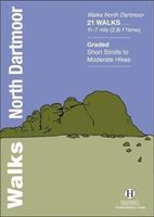
Rewalked and updated in 2020, Walks North Dartmoor features walks in and around the northern half of the Dartmoor National Park - an area famous for its rolling moorland, ponies and dramatic tors (weathered granite outcrops rising from the moorland). This guide covers the area between the town of Okehampton, in the north, and an east-west line just north of Tavistock. (For the southern half of the area, see Walks South Dartmoor.) The 21 walks in the guide range from 1.75 to 7 miles (2.8 11km). There are some fine low-level and woodland walks (notably the walk by the River Teign to Castle Drogo), but the bulk of the routes lead onto the moor, passing splendid features such as Hound Tor and Haytor Rocks. Walks North Dartmoor is part of a popular series of A6 pocket walking guides which describe routes which are suitable for walkers of all abilities and to suit all tastes. Route descriptions are accompanied by 2-colour sketch maps. The guides are illustrated with line illustrations, and w…
5,95
Wandelgids South Dartmoor | Hallewell Publications
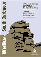
Rewalked and revised in 2021, Walks South Dartmoor features walks in and around the southern half of the Dartmoor National Park - an area famous for its rolling moorland, ponies and dramatic tors (weathered granite outcrops rising from the moorland). This guide covers the area north of Ivybridge and south of an east-west line just north of Tavistock. (For the northern half of the area, see Walks North Dartmoor.) The 22 walks in the guide range from 1 to 8 miles (1.6 12.8km). The bulk of the high moorland walks are in the north of this area, passing such features as Great Mis Tor and Foxtor Mires (thought to be the inspiration for Grimpen Mire in The Hound of the Baskervilles). In the south there are more river and woodland walks, including paths from Burrator Reservoir and to the dramatic Dewterstone. Walks South Dartmoor is part of a popular series of A6 pocket walking guides which describe routes which are suitable for walkers of all abilities and to suit all tastes. Route descriptio…
5,95
Wandelgids Yorkshire Dales | Pocket Mountains
Handige compacte wandelgids met 40 dagwandelingen. Deze gids bevat kleine kaartjes en leuke uitgebreide informatie over wat er langs de route te zien is. Goede wandelkaarten zijn echter we noodzakelijk voor deze tochten: de Ordnance Survey explorer maps of Landanger maps zijn zeer geschikt.     The Yorkshire Dales combine a wild limestone landscape of high rolling moorland gouged by dramatic caves and cascading waterfalls with peaceful farmland carpeted in wildflowers and dotted with ruined abbeys, ancient stone walls and barns, and timeless villages waiting to be discovered.The 40 moderate walks in this collection from award winning publisher Pocket Mountains highlight the very best the area has to offer and include adventures in Wharfedale, Malhamdale, Nidderdale, Ribblesdale, Wensleydale, Swaledale and Dentdale. Many routes make use of sections of established long-distance trails such as the Pennine Way and the Dales Way.
10,95

Klanten-reviews van Wandelgids Exmoor | Pocket Mountains

Er zijn nog geen beoordelingen voor dit productBen jij de eerste die een review plaatst?

Meer over Wandelgids Exmoor | Pocket Mountains

Productomschrijving

Straddling the counties of Somerset and Devon, Exmoor is a place which never fails to stir the imagination, thanks to the coastline of stark cliffs lining the Bristol channel, the wooded valleys, tumbling streams and wild moorland. Designation as a national park in 1954 has helped Exmoor's villages and small towns keep their character and, although the moorland can undoubtedly be austere, this unassuming corner of England has an overriding softness and beguiling, timeless charm. The 40 walks in this guide make the most of more than 1000km of public rights of way and the many long-distance walks which criss-cross the landscape, offering something for every kind of walker.

Productspecificaties

Artikelnummer(s)
Brand
Pocket Mountains
Webshop.nl maakt gebruik van cookies. Ga je verder op onze website, ga dan akkoord met het plaatsen van cookies en de verwerking van deze data door ons en vermelde partners.