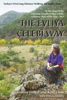
Wandelgids Evliya Celebi Way | Kate Clow

0
Deze gids beschrijft een lange afstandsroute van 160 km ten zuiden van Istanbul. De route begint in Altinova en eindigt in Simav. This is the guidebook to Turkey's new long-distance Cultural Route, complete with route description, map, historical background, and places to see. The route follows the Ottoman gentleman adventurer Evliya Celibi on his...

Verkopers met dit product

Webshop
Bezorging
Prijs
DeZwerver.nl logo
DeZwerver.nl
niet bekend
23,95

Anderen bekeken ook

Wandelgids Dales Way | Trailblazer Guides
The popular Dales Way long-distance footpath begins in Ilkley, West Yorkshire and runs for 84 miles (135km) to end in the Lake District, in Bowness-on-Windermere. It follows riverside paths along the River Wharf towards Ribblehead and the watershed of northern England, then meanders along the river valleys of Dentdale, the River Mint and the River Kent dropping down into the Lake District to end beside Lake Windermere. It's a relatively easy walk that takes about a week. Includes 40 large-scale maps (3 1/8 inches to 1 mile); 9 town plans and 8 overview maps. Full details of all accommodations and campsites, restaurants and pubs; plus full public transport information. Plus day-walks. - 40 large-scale walking maps - at just under 1:20,000 - showing route times, places to stay, points of interest and much more - 9 town plans - 8 area maps and trail profiles - Itineraries for all walkers - whether walking the route in its entirety over a week or sampling the highlights on day walks and s…
19,95
Fietskaart 14 Cycling guides Suffolk | Goldeneye
To be confronted with the variety and complexity of the cycling routes, trails and paths in Suffolk can be a bewildering experience.  For it appears that the Suffolk County Council and the three District Councils are all trying hard to promote their areas. This is indeed encouraging for the growth of cycling, but it can be confusing.  Our purpose is to provide clear, easy to use and easy to follow, cycling maps, and to illustrate these in a comprehensive form.    Suffolk must be one of the most charming of counties to explore by bicycle. When Al Churcher delivered his routes to us at Goldeneye we couldn’t keep him quiet, such was his enthusiasm and wonder at Suffolk’s country lanes and byways. He has cycled all over the UK, Canada, Mallorca, New Zealand and Sicily, but Suffolk remained a firm favourite.    The inland scenery is not spectacular for the county’s main glory lies with its attractive villages; the local architecture jealously preserved from modern depredation. There is an …
15,95
Pelgrimsroute - Wandelgids London to Walsingham Camino | Trailblazer Guides
Full colour, larger format Inspirational guide describing the 13 stages of the pilgrimage route from London to the shrines at Walsingham in Norfolk. The book follows a resurrected route which has now been given official recognition by the Confraternity of St James, better known for their organisation of the famous Camino de Santiago in Spain. That means any pilgrim who walks at least 25km of it, and gathers pilgrim stamps along the way, will be able to use that 25km towards the total of 100km that must be walked in order to get the official Passport/Credencial when they arrive at Santiago. In his foreword to this new guide, the Archbishop of York writes: "I have walked to Walsingham twice ... [and] ... I walked the Camino del Norte to Santiago. I am therefore delighted that the route from London to Walsingham is now better established and therefore more available for other pilgrims and also drawn into the network of pilgrimages under the umbrella of the Confraternity of Saint James. W…
24,95
Wandelgids Camino Ignaciano Loyola - Manresa 675 km | Bradt Travel Guides
In 1522 Ignatius of Loyola made a pilgrimage from his home in Spain's Basque country to Montserrat and Manresa. This new guide from Bradt provides all the information needed to follow in his footsteps in a neat, easy-to-carry portable format, including an essential mix of practicalities, such as when to go, where to stay along the route, national parks and public transport, and a detailed breakdown of the route's 27 stages. Start and finish points, level of difficulty, duration, distance, ascent and descent, and route descriptions are all included, as well as elevation charts, maps and what to see along the way. This is a unique secular walking guide to a religious-themed walk which takes intrepid hikers from the imposing tower house and sanctuary of Loyola in the Basque Country, up through the stunning Basque mountains and down to the beautiful town of Laguardia with its myriad wine caves. Through the vineyards of Alava and world-famous La Rioja, the trail visits lively Logroño and f…
23,95
Wandelgids Thames Path | Trailblazer Guides
This book follows the Thames Path National Trail from the river's source in Gloucestershire to the Thames Barrier in London. Officially 184 miles (294km) in length (although the actual distance you walk will depend on a number of decisions you make en route), the path meanders, accompanied by its watery muse, through pristine and tranquil countryside, past historic sites and buildings, via pub, lock, weir, and the occasional scattering of waterfowl, to a city, once the fulcrum of an empire, and now the heart of modern day England. The river, responsible for the metropolis' very being, tells tales, inspires artists, accommodates swans, geese, and water voles, reflects the silhouettes of red kites and kingfishers, provides employment, entices adventure, and allows time for carefree pilgrims to procrastinate and think. Following its banks is a grand way to go for a ramble. The path begins, as the river does, in a meadow in the Cotswolds; its upper reaches lonely and wild, the meadows and…
19,95
Reisverhaal Dreaming of Jupiter | Ted Simon
Ted Simon is the author of the classic travel book JUPITER'S TRAVELS. It documents his four-year journey round the world by motorbike, travelling through Europe, Africa, South and North America, and Asia. A number one bestseller in the late 1970s, it is still regarded as one of the greatest motorcycle books - indeed, one of the greatest travel books - ever written. In 2001, at the age of 69, Ted Simon decided to retrace his journey, and DREAMING OF JUPITER is the result. It took him two and a half years - during which time he revisited all the countries he had travelled through in the 1970s. He found much had changed, and he reflects upon the increased poverty, political upheavals, environmental issues and indeed the changes in himself. But ultimately, DREAMING OF JUPITER is a hugely inspiring read with a positive message at its heart - that even at the age of 70 you can still set off on an adventure, and be surprised and excited by what life throws at you along the way. *'Gloriously …
14,50
Wandelgids Peddars Way and Norfolk Coast Path | Aurum Press
Gedetailleerde routebeschrijving. De kaartjes zijn uitstekend (1:25.000 in kleur). Met goede achtergrondinformatie over de streek, maar de informatie omtrent accommodatie onderweg is zeer beperkt. Kijk daarvoor op de site van de engelse wandelvereninging: de Ramblers Organisation The Peddars Way and Norfolk Coast Path together form the 93-mile (149-km) National Trail that starts near Knettishall in the Brecklands on the Norfolk-Suffolk border and runs north-west to meet the shores of the Wash near Hunstanton before turning east to follow the beautiful North Norfolk coastline to Cromer. The first part of the route, The Peddars Way, follows the route of a Roman road, running arrow-straight along the chalk ridge of north-west Norfolk; the Norfolk Coast Path, in contrast, follows the seawall along the beaches and around the muddy creeks that form a coastline that is home to some of the most famous and spectacular nature reserves in the country. This is the complete, official guide to the …
19,95
Wandelgids South Downs Way | Trailblazer Guides
The South Downs Way is a 100-mile footpath which follows the line of chalk hills stretching from Winchester to Eastbourne. Walking the length of the Downs is the best way to experience this beautiful landscape with its mixture of rolling hills, steep hanging woodland and windswept fields. You'll also pass through picture-postcard villages with welcoming pubs, thatched cottages and country gardens. 1. Unique mapping features - In many walking guides the reader has to read a route description then try to relate it to the map. Our guides are easier to use because walking directions, tricky junctions, places to stay and eat, points of interest and walking times are all written onto the maps themselves in the places to which they apply. With their uncluttered clarity, these are not general-purpose maps but fully-edited maps drawn by walkers for walkers. Downloadable GPS waypoints also included. 2. The largest scale walking maps available - At just under 1:20,000 (8cm or 31/8 inches to 1 mi…
20,95
Wandelgids St. Paul Trail | Kate Clow
De St Paul Trail is een nieuw bewegwijzerd pad in Turkije. Zoals het eerste GR-pad in Turkije, de Lycian Way, is ook dit pad vooral de creatie van de onvermoeibare Kate Clow, een engelse vrouw die al meer dan 15 jaar in Turkije woont. De afstand bedraagt ruwweg 600 km en het pad is volledig gemarkeerd vanaf 2003 en beschreven. Bovendien wordt alles “op de voet” gevolgd en begeleid met een uitstekende website. Erg uitgebreid gaat het boek in op de geschiedenis en exploratie van een aantal archeologische plaatsen die je op de tocht passeert. Hierdoor is het boek ook bruikbaar voor zij die niet zo geïnteresseerd zijn in wandelen maar wel in afgelegen en eerder onbekende vergane steden uit de klassieke periode. Het boek staat bol van praktische info en tips verzameld door jaren te wandelen in dit gebied. The landscape of Turkey's Toros mountains and lake district contrasts and combines inA brand new edition of the St Paul Trail guidebook, following the saint's journey from Perge, near Ant…
25,95
Wandelgids Great Glen Way | Trailblazer Guides
Goede wandelgids waarin met veel details alle etappes zijn beschreven. Tevens informatie over overnachtingen en openbaar vervoer. All-in-one, practical guide to walking the Great Glen Way long-distance footpath. The trail begins where the West Highland Way ends - at Fort William - and follows the Great Glen faultline to finish at Inverness after 79 miles (127km). The trail passes Loch Lochy, Loch Oich and Loch Ness and also follows the towpath of the Caledonian Canal.   It's a relatively easy week-long walk amongst beautiful Highland scenery but there's a high level option between Fort Augustus and Drumnadrochit that gives even better mountain views. This 2nd edition has been re-walked and fully updated. * Includes 38 detailed walking maps: the largest-scale maps available - at just under 1:20,000 (8cm or 31/8 inches to 1 mile) these are bigger than even the most detailed walking maps currently available in the shops * Unique mapping features - walking times, directions, tricky juncti…
19,95

Klanten-reviews van Wandelgids Evliya Celebi Way | Kate Clow

Er zijn nog geen beoordelingen voor dit productBen jij de eerste die een review plaatst?

Meer over Wandelgids Evliya Celebi Way | Kate Clow

Productomschrijving

Deze gids beschrijft een lange afstandsroute van 160 km ten zuiden van Istanbul. De route begint in Altinova en eindigt in Simav.

This is the guidebook to Turkey's new long-distance Cultural Route, complete with route description, map, historical background, and places to see. The route follows the Ottoman gentleman adventurer Evliya Celibi on his way to Mecca in 1671; it runs for 600km from the Sea of Marmara via Bursa, Kutahya and Afyon to Usak and Simav. The route follows, as far as possible, ancient paved roads and visits the cities, sights and tiny villages that Evliya rode through and recorded in his "Seyatname" ("Book of Travels"). It can be explored by walkers, horse-riders and bikers. The UN has declared Evliya 'Man of the Year' for 2011, the 400th anniversary of his birth. This route is a practical addition to these celebrations - it enables modern travellers to directly experience Evliya's life, times and travels. It is brought to you by the noted Ottoman historian and author of "Osman's Dream", Caroline Finkel, and the originator of 'The Lycian Way', Kate Clow. 

Verken gerelateerde categorieën

Webshop.nl maakt gebruik van cookies. Ga je verder op onze website, ga dan akkoord met het plaatsen van cookies en de verwerking van deze data door ons en vermelde partners.