webshop.nl
Categorieën
  Sluiten

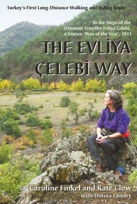
Wandelgids Evliya Celebi Way | Kate Clow

0
Deze gids beschrijft een lange afstandsroute van 160 km ten zuiden van Istanbul. De route begint in Altinova en eindigt in Simav. This is the guidebook to Turkey's new long-distance Cultural Route, complete with route description, map, historical background, and places to see. The route follows the Ottoman gentleman adventurer Evliya Celibi on his ...

Webshops met dit product

Webshop
Bezorging
Prijs

Anderen bekeken ook

Wandelgids Evliya Celebi Way | Kate Clow
Deze gids beschrijft een lange afstandsroute van 160 km ten zuiden van Istanbul. De route begint in Altinova en eindigt in Simav. This is the guidebook to Turkey's new long-distance Cultural Route, complete with route description, map, historical background, and places to see. The route follows the Ottoman gentleman adventurer Evliya Celibi on his way to Mecca in 1671; it runs for 600km from the Sea of Marmara via Bursa, Kutahya and Afyon to Usak and Simav. The route follows, as far as possible, ancient paved roads and visits the cities, sights and tiny villages that Evliya rode through and recorded in his "Seyatname" ("Book of Travels"). It can be explored by walkers, horse-riders and bikers. The UN has declared Evliya 'Man of the Year' for 2011, the 400th anniversary of his birth. This route is a practical addition to these celebrations - it enables modern travellers to directly experience Evliya's life, times and travels. It is brought to you by the noted Ottoman historian and autho…
23,95
Wandelgids GR 70: The Robert Louis Stevenson Trail van Le Puy tot St-J
Uitstekende wandelgids van een gerenommeerde Engelse uitgever. De tochten zijn met zorg beschreven en voorzien van allerhande nuttige informatie. Met beperkt kaartmateriaal. Aanbevolen wandelkaarten bij deze gids 1:100.000 Wandelkaart GR 70 The Stevenson Trail | IGN - Institut Géographique National Als overzichtskaart Of Wegenkaart 156 Le Puy en Velay - Privas - Mende | IGN - Institut Géographique National Wegenkaart 163 Avignon - Nimes | IGN - Institut Géographique National  of 1:25.000 1. Wandelkaart - Topografische kaart 2835OT Le Puy-en-Velay | IGN - Institut Géographique National 2. Wandelkaart - Topografische kaart 2836OT Gerbier de Jonc | IGN - Institut Géographique National 3. Wandelkaart - Topografische kaart 2736SB Monistrol d'Allier, Solignac-sur-Loire, Cayres | IGN - Institut Géographique National 4. Wandelkaart - Topografische kaart 2737SB Langogne - Grandrieu | IGN - Institut Géographique National 5. Wandelkaart - Topografische kaart 2738SB Le Bleymard | IGN - Institut Gé…
23,95
Fietskaart 14 Cycling guides Suffolk | Goldeneye
To be confronted with the variety and complexity of the cycling routes, trails and paths in Suffolk can be a bewildering experience.  For it appears that the Suffolk County Council and the three District Councils are all trying hard to promote their areas. This is indeed encouraging for the growth of cycling, but it can be confusing.  Our purpose is to provide clear, easy to use and easy to follow, cycling maps, and to illustrate these in a comprehensive form.    Suffolk must be one of the most charming of counties to explore by bicycle. When Al Churcher delivered his routes to us at Goldeneye we couldn’t keep him quiet, such was his enthusiasm and wonder at Suffolk’s country lanes and byways. He has cycled all over the UK, Canada, Mallorca, New Zealand and Sicily, but Suffolk remained a firm favourite.    The inland scenery is not spectacular for the county’s main glory lies with its attractive villages; the local architecture jealously preserved from modern depredation. There is an a…
15,95
Wandelgids The Cathar Way | Cicerone
Guidebook to the GR367 Cathar Way (Sentier Cathare) in the Languedoc region of southern France. The 260km waymarked trail from Port la Nouvelle on the Mediterranean to Foix traces the history of the Cathars through the Eastern foothills of the Pyrenees. Split into 13 stages and offering a northern variant, the route takes about 2 weeks to complete. Two of the southernmost départements of France, the Pyrénées-Orientales and Ariège are inextricably linked with the history of the Cathars, a heretical Christian sect who were subjected to a crusade in the thirteenth century. Striking castles built on jagged rocky precipices are a highlight of the region and a reminder of those turbulent times. This guidebook describes the 260km Cathar Way (Sentier Cathare or GR367), a long-distance trail from Port-la-Nouvelle on the Mediterranean coast to Ariége's departmental capital Foix linking several of the impressive Cathar castles. The route follows ancient footpaths, jeep tracks and country lanes an…
22,95
Wandelgids - Pelgrimsroute The Pilgrims' Way | Cicerone
Uitstekende wandelgids van de Pilgrims' Way, waarbij naast alle noodzakelijke informatie ook gebruik gemaakt wordt van de echte topografische kaart.  This guidebook details the Pilgrims' Way, an historic pilgrimage route to Canterbury Cathedral in Kent, home of the shrine of the martyred archbishop, St Thomas Becket. The route is described both from Winchester in Hampshire (136½ miles) and London's Southwark Cathedral (90¼ miles), with an optional spur to Rochester Cathedral.   With relatively easy walking on ancient byways, the route from Winchester is presented in 15 stages of 4¾-13½ miles: it can be comfortably completed in under a fortnight. It follows a major chalk ridge through scenic countryside, taking in characterful towns and villages and historic churches. The route from Southwark is described in 10 stages and includes a visit to the ruined Lesnes Abbey.   Detailed route description is accompanied by 1:50,000 OS mapping, advice on making the most of a trip and information on…
18,50
Wandelgids The Peddars Way and Norfolk Coast Path | Cicerone
Uitstekende wandelgids van de Peddars Way en de Norfolk Coast Path, waarbij naast alle noodzakelijke informatie ook gebruik gemaakt wordt van de echte topografische kaart. The Peddars Way and Norfolk Coast Path National Trail is an easy-to-follow 130-mile trail that combines the best of inland and coastal walking in Norfolk, and one that, being well waymarked, largely flat and within easy reach of public transport for most of its length, is ideal for people new to long-distance walks.   Described here in 11 stages, the route can be walked in just over a week but also easily split into day walks or over a series of weekends, with full information about access to start and finish points for each stage by public transport. This handy guidebook is illustrated throughout with extracts of OS 1:50,000 mapping and stunning photographs depicting the Trail in all seasons and describes points of interest along the way, including the Nofolk Songlines sculptures, and also facilities available in th…
18,50

Klanten-reviews van Wandelgids Evliya Celebi Way | Kate Clow

Er zijn nog geen beoordelingen voor dit productBen jij de eerste die een review plaatst?

Meer over Wandelgids Evliya Celebi Way | Kate Clow

Productomschrijving

Deze gids beschrijft een lange afstandsroute van 160 km ten zuiden van Istanbul. De route begint in Altinova en eindigt in Simav. This is the guidebook to Turkey's new long-distance Cultural Route, complete with route description, map, historical background, and places to see. The route follows the Ottoman gentleman adventurer Evliya Celibi on his way to Mecca in 1671; it runs for 600km from the Sea of Marmara via Bursa, Kutahya and Afyon to Usak and Simav. The route follows, as far as possible, ancient paved roads and visits the cities, sights and tiny villages that Evliya rode through and recorded in his "Seyatname" ("Book of Travels"). It can be explored by walkers, horse-riders and bikers. The UN has declared Evliya 'Man of the Year' for 2011, the 400th anniversary of his birth. This route is a practical addition to these celebrations - it enables modern travellers to directly experience Evliya's life, times and travels. It is brought to you by the noted Ottoman historian and author of "Osman's Dream", Caroline Finkel, and the originator of 'The Lycian Way', Kate Clow.
Webshop.nl maakt gebruik van cookies. Ga je verder op onze website, ga dan akkoord met het plaatsen van cookies en de verwerking van deze data door ons en vermelde partners.