Wandelgids Essex | Pocket Mountains

0
Essex is full of surprises. Not only is it one of the largest counties in England by population and area, it is also home to Britain’s first city, several bustling market towns, hundreds of countryside villages and – with its many estuaries, creeks and islands – more than 900km of winding coastline. The 40 walks in this guide show Essex in all its...

Verkopers met dit product

Verkoper
Bezorging
Prijs
DeZwerver.nl logo
DeZwerver.nl
2,95
10,95

Anderen bekeken ook

Wandelgids Walking in Essex | Cicerone
Wandelgids met 25 dagtochten en een meerdaagse tocht in Essex.  Goede omschrijvingen, veel praktische informatie. Redelijk kaartmateriaal   This guidebook describes 25 coastal and inland day walks covering the whole of the county of Essex, stretching from the Lea Valley in the west and the Thames in the south over to the North Sea and up to the River Stour in the north. Walks range from 4 to 18 miles and are mostly circular. Also included is a description of the Essex Way which crosses the county in 11 stages from Manor Park, on the fringes of London, to the port of Harwich - a distance of 96 miles. The walks are suitable for all abilities and there are shorter alternatives for many of the longer routes.   With a huge variety of scenery and walking landscapes, Essex surprises and delights in equal measure. It boasts a 350-mile coastline (which, away from the busy seaside resorts, is barely known), numerous estuaries and river valleys, great and ancient forests, and more green lanes th…
18,95
Wandelgids 50 Walks on the Essex Coast | Matador
A walking guide describing 50 walks along the Essex coast, the longest coastline of any English county. Peter Caton discovered the wonderful Essex coastline as he narrated his journey along its whole length, writing Essex Coast Walk (Matador, 2009). He now describes walks covering the entire publicly accessible coast, helping others to follow in his footsteps.   Detailed route instructions are provided, along with high-quality maps, while background information and colour photos add context and interest. Following rivers, creeks and open sea, on paths, tracks and promenades, often with circuits completed across countryside, the walking and views are varied. There is much history and wildlife to be seen as the walker discovers picturesque villages, smugglers' haunts, nature reserves and little-known gems along the coast.   Walks range from 2 to 15 miles, with most having different length options, plus the possibility of linking adjoining routes. Produced in full colour, 50 Walks on the…
13,95
Wandelgids 044 Pathfinder Guides Essex | Ordnance Survey
Pathfinder Guide to Essex offers excellent lowland walking in the south-east of England. The routes are all circular exploring the finer countryside of the county, in a series of parkland, farmland, woodland and coastal and estuarine walks, visiting its places of historic interest, attractive towns and charming villages. Given the pleasant and undramatic nature of the terrain, routes only really vary in length in terms of difficulty and there is a general progression through the book from shortest to longest. Beginning with a short walk linking Laindon Common with Great and Little Burstead, encountering the infant River Crouch, the book progresses to a near 10-mile excursion across Bradwell Marsh, with its wide open horizons, and a visit to the isolated and tiny Saxon chapel of St Peter-on-the-Wall. Sea air can also be taken on walks from Walton-on-the-Naze, a circuit of the eastern end of Mersea Island, along St Osyth Creek, at Maldon, from Burnham-on-Crouch, and overlooking Benfleet…
18,50
Fietskaart Cycling guides Dartmoor - South Devon | Goldeneye
Dartmoor. One of England’s greater National Parks; the Forest of Dartmoor covers 365 square miles and contains the highest ground in England south of the Peak District. On its desolate moorland tracks the wanderer can believe they are further from a public road than anywhere in the country, but on the fringes lush valleys lead down on every side to thick woodland, green vegetation and picturesque villages. Dartmoor is well known for its wildlife - attractive herds of ponies, seemingly wild but in fact individually owned, foxes, badgers and otters - also the occasional adder. Fallow, roe and Sitka deer can often be seen, but the red deer of Exmoor have never penetrated the area. Buzzards, kestrels and various Birds of Prey are frequently seen, as well as the wheatear, while crows, ravens and the skylark are fairly commonplace. The Moor abounds in prehistoric remains. There are also many deserted medieval villages with remains of the traditional ‘longhouse’ buildings. For centuries tin …
12,95
Wandelgids West Sussex | Pocket Mountains
From the city of Chichester with its ancient walls and harbour inlets standing sentinel over the English Channel to the northern heights of Black Down on its ridge of greensand above the intervening folds, farms and villages of the western Weald, from the bustling towns of Crawley and Horsham in the lee of the chalk slopes of the South Downs to the traditional seaside resorts of Littlehampton and Worthing, the 40 circular walks in this guide offer plenty of scope to explore West Sussex’s famed downs, woods, heaths and nature reserves, along with its villages, stately homes and country estates.  
10,95
Wandelgids Carmarthenshire | Pocket Mountains
Handige compacte wandelgids met 40 dagwandelingen. Deze gids bevat kleine kaartjes en leuke uitgebreide informatie over wat er langs de route te zien is. Goede wandelkaarten zijn echter we noodzakelijk voor deze tochten: de Ordnance Survey explorer maps of Landanger maps zijn zeer geschikt.   Carmarthenshire is the largest of the old Welsh counties and nestles between Pembrokeshire and the Gower Peninsula in the heart of South West Wales. Its a land of contrasts; along the coast you'll walk close to the airy edge of tall cliffs, but there are beaches too, some so long you can't see an end to them. And sheltered estuaries, like the heron-priested shores at Laugharne that inspired the poet Dylan Thomas. Inland there are tucked-away valleys and castle-topped hills, open moorland, and ancient woodland that is fizzing with life.
10,95
Wandelgids Weekend Walks The Surrey Hills | Pocket Mountains
Although Surrey is not far from metropolitan London, it famously has more mature woodland than any other county in England and has long been renowned for its rolling hills and valleys, ancient heathlands, beautiful waterways and charming villages.   There is a surprisingly extensive network of local paths and bridleways and, to the south of the North Downs chalk ridge, the hills are intersected by three long-distance walking trails. All these feature in this collection of 40 walks, which explore glorious parklands, country estates, ruined abbeys, impressive castles and wildlife-rich woodlands along the way.
10,95
Wandelgids The Tay | Pocket Mountains
Handige compacte wandelgids met 40 dagwandelingen. Deze gids bevat kleine kaartjes en leuke uitgebreide informatie over wat er langs de route te zien is. Goede wandelkaarten zijn echter we noodzakelijk voor deze tochten: de Ordnance Survey explorer maps of Landanger maps zijn zeer geschikt.     As well as being Scotland's longest river, the Tay also carries the largest volume of water of any river in the UK more than the Thames and Severn combined when it reaches the Firth of Tay. From its source high up the slopes of Ben Lui near Tyndrum, the Tay makes its way through Stirlingshire and Perthshire to meet the North Sea near Dundee. As one of the best salmon rivers in Europe, every year it lures anglers from around the world and countless more come to explore the glorious hills and glens it passes.   There is no better way to discover the wildlife, architecture and history of this area of Scotland than to walk. Whatever your ability walking at high or low level, following tough terra…
10,95
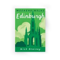
Wandelgids Weekend Walks Edinburgh | Pocket Mountains
Edinburgh is one of the most richly layered historical cities in Europe, with the medieval layout of the Old Town and the neoclassicism of the Georgian New Town attracting visitors from all over the world. Like Rome, Edinburgh has its Seven Hills, while two waterways slip unseen through the capital. These 25 walks feature the best of the city, as well as the harbours, beaches and nature reserves of the Firth of Forth, the hills and glens of the Pentlands and the parkland of some of the finest nearby country estates.  
10,95
Wandelgids Shetland | Pocket Mountains
Handige compacte wandelgids met 40 dagwandelingen. Deze gids bevat kleine kaartjes en leuke uitgebreide informatie over wat er langs de route te zien is. Goede wandelkaarten zijn echter we noodzakelijk voor deze tochten: de Ordnance Survey explorer maps of Landanger maps zijn zeer geschikt. The most northerly of Britain's island groups, Shetland is so far removed from the rest of the UK that it usually appears as an inset on maps. Although relatively little known to those from outside the islands, Shetland is a magnificent terrain for walkers, especially those who love to really explore and get away from the beaten track. The coastal walking here includes some of the finest in the country, with superb cliffs, towering sea stacks, caves and natural arches seemingly around every corner. Added to this is Shetland's better known claim to fame for its spectacular seabird colonies, huge gannetries, moorland packed with arctic and great skuas, arctic terns in the more sheltered spots, and ev…
10,95

Klanten-reviews van Wandelgids Essex | Pocket Mountains

Er zijn nog geen beoordelingen voor dit productBen jij de eerste die een review plaatst?

Meer over Wandelgids Essex | Pocket Mountains

Productomschrijving

Essex is full of surprises. Not only is it one of the largest counties in England by population and area, it is also home to Britain’s first city, several bustling market towns, hundreds of countryside villages and – with its many estuaries, creeks and islands – more than 900km of winding coastline. The 40 walks in this guide show Essex in all its glory while giving walkers the chance to appreciate its multiple layers: oil refineries and ports overlooking large stretches of saltmarsh, country estates drifting into industrial estates and pounding motorways flowing beneath dense forests that thrum with wildlife.  

Verken gerelateerde categorieën

Webshop.nl maakt gebruik van cookies. Ga je verder op onze website, ga dan akkoord met het plaatsen van cookies en de verwerking van deze data door ons en vermelde partners.