webshop.nl
Categorieën
  Sluiten

Meer Ordnance Survey

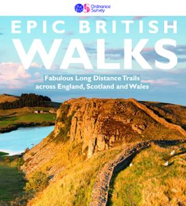
Wandelgids Epic British Walks | Ordnance Survey

This magnificent collection of truly EPIC WALKS brings together Britain’s most beautiful countryside with the long-distance trails that present the very best means of experiencing it.   An inspiring introduction to distance walking, discover thirty-eight amazing trails of immense diversity incorporating National Parks, Areas of Outstanding Natural ...
27,95

Webshops met dit product

Webshop
Bezorging
Prijs

Anderen bekeken ook

Wandelgids Epic British Walks | Ordnance Survey
This magnificent collection of truly EPIC WALKS brings together Britain’s most beautiful countryside with the long-distance trails that present the very best means of experiencing it.   An inspiring introduction to distance walking, discover thirty-eight amazing trails of immense diversity incorporating National Parks, Areas of Outstanding Natural Beauty, National Scenic Areas, Heritage Coastline, and UNESCO World Heritage Sites.   The perfect book for planning a walking adventure, hiking holiday or weekend ramble, discover insightful introductions to each route, suggested itineraries, the must-see highlights to take in along the way and, of course, the list of Ordnance Survey sheet maps for completing the walks.   Epic in so many ways…   Thirty-eight EPIC long-distance walks across England, Scotland, and Wales 5000 miles of inspirational walking in National parks, AONBs, UNESCO World Heritage Sites and more Stunning and inspiring photography revealing the character of each walk Al…
27,95
Wandelgids 100 outstanding British Walks | Ordnance Survey
Beschrijving van de 100 mooiste Pathfinder wandelingen in Engeland, Wales en Schotland. Uitstekende beschrijving van de route met een zeer duidelijke topografische kaart waarop de route is ingetekend.  This magnificent compendium of outstanding British walks brings together the finest selection of Pathfinder Walks in Britain s officially designated places of scenic beauty and historic interest: National Parks, Areas of Outstanding Natural Beauty, National Scenic Areas, Heritage Coast, National Trails and UNESCO World Heritage Sites. There are 100 walking gems in this collection, recommended by a group of experienced authors and guides. The walks span a range of distances and degrees of challenge and are organised by region with coverage across England, Wales and Scotland. 100 Outstanding British Walks is lavishly illustrated with stunning landscape photography and informative introductions to each of the walks. It is designed to be enjoyed at home, while the OS Maps app provides the pr…
27,95
Wandelgids 41 Pathfinder Guides Mid Wales | Ordnance Survey
Wandelgids van midden Wales. Deze gids bevat 28 dagwandelingen, variërend van korte tochten tot pittige dagtochten. De bijbehorende kaarten zijn uitstekend: men heeft de topografische kaarten van Ordnance Survey gebruikt waarop de route is ingetekend. Daarnaast praktische informatie over de wandeling en wat beschrijvingen van het gebied. Explore Mid Wales over 28 walks with this walking guidebook from the Pathfinder series. Each walk is listed by distance and difficulty, and range from a family-friendly 4km (2.5 miles) to a challenging 20km (12 miles)   Often ignored in favour of the more popular Snowdonia and Brecon Beacons National Parks to the north and south, mid Wales still offers some stunning views and beautiful walks. Both coastal routes and upland walks are featured, and include Catti's Cave, Devil's Bridge and the Mynach Valley, The Claerwen Valley and the source of the river Severn   Each of the 28 circular walks has been created by experienced walkers, and includes a route …
18,50
Wandelgids Brecon Beacons | Ordnance Survey
Get outside and enjoy ten short leisurely strolls across the Brecon Beacons National Park, indulging in wonderful mountain views across Southern Britain’s hilliest terrain. With routes for all abilities, enjoy a diverse range of experiences, including waterfalls, woodlands, riversides and even 12th century castle ruins.   Brecon Beacons Short Walks Made Easy routes include:       • Discover great mountain views from relatively level ground with routes at Mynydd Illtud and Craig y Cilau   • Or for a more strenuous walk, the ascent of Sugar Loaf will reward your uphill efforts with stupendous views across the national park   • Enjoy the thunderous sounds of the spectacular cascading waterfalls of Sgŵd Clun-gwyn and Sgŵd yr Eira, some of Wales most impressive!   • Delve into the Usk Valley for soothing riverside rambles from Brecon and Abergavenny, blessed with stunning views southwards towards the park’s highest peaks   • Spot an abundance of wildlife from the towpath along the Monmouths…
13,50
Wandelgids 82 Pathfinder Guides Orkney and Shetland | Ordnance Survey
Wandelgids van een deel van Engeland. Deze gids bevat 28 dagwandelingen, variërend van korte tochten tot pittige dagtochten. De bijbehorende kaarten zijn uitstekend: men heeft de topografische kaarten van Ordnance Survey gebruikt waarop de route is ingetekend. Daarnaast praktische informatie over de wandeling en wat beschrijvingen van het gebied. 28 outstanding walks – 23 circular and five there-and-back routes visiting eleven islands across both archipelagos. The size and nature of the islands lend themselves best to short and half-day walks where unhurried and free-range walking is encouraged and the endless distractions of scenery, seabirds, wildflowers and sea watching are best appreciated and enjoyed at a relaxed pace.   In Orkney, the first walk is a short stroll around Hoxa Head with its extensive views across Scapa Flow and subsequent routes go on to explore more widely over Mainland Orkney and take in the islands of Hoy, Rousay and South Ronaldsay, concluding with a ramble alo…
18,50
Wandelgids Great Walks on the England Coast Path | Cicerone
Guidebook to 30 routes celebrating the best day and weekend walks on the England Coast Path, a new National Trail. Includes a varied selection of walks along the country's diverse shoreline, on cliff paths, estuaries, beaches and saltmarsh. Routes from 9 to 45km to suit all ages and abilities, many of which can be enjoyed all year round. At around 4500km (2800 miles), the England Coast Path is the longest coastal trail in the world. This inspirational large-format guide presents a handpicked selection of 30 highlight sections, offering a taste of England's stunning and diverse shoreline. Routes range from 9 to 45km, spanning between 3 hours and 2 days, offering options to suit all abilities. They can be accessed by public transport and are walkable year round (weather permitting!). Route descriptions are accompanied by 1:50,000 OS map extracts. Included in each walk are comprehensive listings of public transport, toilets and places to eat and drink, which highlight the excellent walkin…
27,95

Klanten-reviews van Wandelgids Epic British Walks | Ordnance Survey

Er zijn nog geen beoordelingen voor dit productBen jij de eerste die een review plaatst?

Meer over Wandelgids Epic British Walks | Ordnance Survey

Productomschrijving

This magnificent collection of truly EPIC WALKS brings together Britain’s most beautiful countryside with the long-distance trails that present the very best means of experiencing it.   An inspiring introduction to distance walking, discover thirty-eight amazing trails of immense diversity incorporating National Parks, Areas of Outstanding Natural Beauty, National Scenic Areas, Heritage Coastline, and UNESCO World Heritage Sites.   The perfect book for planning a walking adventure, hiking holiday or weekend ramble, discover insightful introductions to each route, suggested itineraries, the must-see highlights to take in along the way and, of course, the list of Ordnance Survey sheet maps for completing the walks.   Epic in so many ways…   Thirty-eight EPIC long-distance walks across England, Scotland, and Wales 5000 miles of inspirational walking in National parks, AONBs, UNESCO World Heritage Sites and more Stunning and inspiring photography revealing the character of each walk All routes include an overview route map, elevation profile, difficulty rating, and facts and figures panel End-to-end itineraries for each route with day-stage distances Practical route planning advice including public transport, accommodation, and camping Routes for first time hikers, the super-fit, and seasoned ramblers Includes OS Explorer and OS Landranger map sheet numbers for every walk

Productspecificaties

Artikelnummer(s)
Brand
Ordnance Survey
Webshop.nl maakt gebruik van cookies. Ga je verder op onze website, ga dan akkoord met het plaatsen van cookies en de verwerking van deze data door ons en vermelde partners.