webshop.nl
Categorieën
  Sluiten

Meer Mica Publishing

Wandelgids Edinburgh the Walk | Mica Publishing

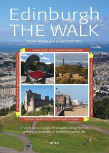
This guidebook describes a ‘green chain walk’ of 69km (43 miles) around Edinburgh, Scotland's capital city, linking the city’s green spaces, and highlighting the people who shaped its future and the natural forces that created the landscape. Divided into eight sections of between 8km (5 miles) and 11km (6.75miles), the route can be followed as a co...
23,95

Webshops met dit product

Webshop
Bezorging
Prijs

Anderen bekeken ook

Wandelgids Edinburgh the Walk | Mica Publishing
This guidebook describes a ‘green chain walk’ of 69km (43 miles) around Edinburgh, Scotland's capital city, linking the city’s green spaces, and highlighting the people who shaped its future and the natural forces that created the landscape. Divided into eight sections of between 8km (5 miles) and 11km (6.75miles), the route can be followed as a continuous multi-day walk or as individual day walks. • A 69km (43 miles) walk around Edinburgh divided into eight sections of between 8km (5 miles) and 11km (6.75miles) • The route can be followed as a multi-day walk, or as individual day walks. • Each section is accompanied by details of public transport between the city centre and the section's start and finish points. 45 fully annotated Ordnance Survey Street View maps detail the route. • Geological, historical, architectural and cultural highlights are included in a variety of panels adjacent to the main text. • Edinburgh The Walk guides the walker through glorious cityscape, coastline, ri…
23,95
Wandelgids guide to the Wye Valley Walk - Welsh borders, Wales | Cicer
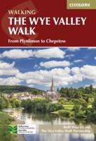
Uitstekende wandelgids van dit geweldige gebied. goed beschreven met veel praktische informatie om de route te kunnen lopen, inclusief goede kaarten. The official guide to backpacking or walking the Wye Valley Walk, 136 miles through the Welsh borders, crossing between south Wales and Herefordshire, from Chepstow to Plynlimon. Easy walking through wooded gorges, riverside meadows and open moorland, passing sites such as Tintern Abbey, Goodrich Castle, Hereford Cathedral and Hay-on-Wye. The Wye Valley Way offers a perfect mix of river and hill walking as it follows the River Wye for 136 miles from river’s mouth at Chepstow to the slopes of Plynlimon in Powys criss -crossing the border between England and Wales. The walk leads through a dramatic limestone gorge, dense woodland beneath limestone crags and past peaceful river meadows in some of the most superb scenery in the heart of the Wye Valley Area of Outstanding Natural Beauty, the birthplace of tourism and the Picturesque movement. …
21,95
Wandelgids 47 Pathfinder Guides Edinburgh, Pentlands & the Lothians |
Wandelgids van een deel van Engeland, Schotland of Wales. Deze gids bevat 28 dagwandelingen, variërend van korte tochten tot pittige dagtochten. De bijbehorende kaarten zijn uitstekend: men heeft de topografische kaarten van Ordnance Survey gebruikt waarop de route is ingetekend. Daarnaast praktische informatie over de wandeling en wat beschrijvingen van het gebied. This new edition of Pathfinder: Edinburgh, Pentlands & Lothians has been fully revised to include seven new walking routes, including a classic walk to the summit of Arthur's Seat. The countryside around Edinburgh is ideal for walking with rolling hills and an impressive Scottish coastline. Pathfinder: Edinburgh, Pentlands & Lothians includes new walks in the Pentlands Hills, the Moorfoot and the Lammermuir Hills, perfect for all ages and abilities, and all within 20 miles of Edinburgh; Scotland's historic capital city. With 28 stunning walking routes, ranging from 3-10 miles, Pathfinder walks are the essential walking guid…
18,50
Wandelgids guide to the Wye Valley Walk - Welsh borders, Wales | Cicer
Uitstekende wandelgids van dit geweldige gebied. goed beschreven met veel praktische informatie om de route te kunnen lopen, inclusief goede kaarten. The official guide to backpacking or walking the Wye Valley Walk, 136 miles through the Welsh borders, crossing between south Wales and Herefordshire, from Chepstow to Plynlimon. Easy walking through wooded gorges, riverside meadows and open moorland, passing sites such as Tintern Abbey, Goodrich Castle, Hereford Cathedral and Hay-on-Wye. The Wye Valley Way offers a perfect mix of river and hill walking as it follows the River Wye for 136 miles from river’s mouth at Chepstow to the slopes of Plynlimon in Powys criss -crossing the border between England and Wales. The walk leads through a dramatic limestone gorge, dense woodland beneath limestone crags and past peaceful river meadows in some of the most superb scenery in the heart of the Wye Valley Area of Outstanding Natural Beauty, the birthplace of tourism and the Picturesque movement. …
21,95
Wandelgids The South West Coast Path | Cicerone
Goede wandelgids van het langste gemarkeerde wandelpad van Groot Brittanië; 1015 km! Uit de bekende Cicerone serie, dus met mooie foto's en duidelijke routebeschrijvingen en kaartjes. The South West Coast Path is Britain's longest way-marked trail, measuring a staggering 1015km (630 miles). Written by the well-known outdoor writer, Paddy Dillon, the guide provides a wealth of detailed knowledge to help tackle this immense route with confidence. It describes the way-marked trail from Minehead to Poole along the north Devon, Cornish and south Devon coastline to finish at Poole Harbour. A full introduction provides the route's historical background, advice on accommodation along the route and details on travelling to and around the South West.There is detailed information on how to use this guide to make the most of your walk, whether you choose to walk the whole route in one go or decide to achieve sections at intervals.Day-by-day route summaries accompany the 45-day stages and the final…
24,95
Wandelgids Wales: The Ceredigion and Snowdonia Coast Paths | Cicerone
As part of the Wales Coast Path, the Ceredigion Coast Path and Snowdonia Coast Path trace a curve of 233km (145 miles) of coastal and inland walking down Cardigan Bay. This guidebook describes a 16-stage guide to the walk from Porthmadog to St Dogmaels covering the trail between the Llyn Peninsula and the Pembrokeshire Coast Path. .In 16 day stages from Porthmadog to St Dogmaels, this guidebook offers all the information walkers need to complete the 233km (145 miles) section of the Wales Coast Path that curve down Cardigan Bay, passing through a range of contrasting landscapes.   Six days are spent on the Snowdonia Coast Path, two around the Dyfi Estuary, seven on the Ceredigion Coast Path and one from Cardigan to St Dogmaels.   Linking the Llyn Peninsula Coast Path with that of the Pembrokeshire Coastal Path, this section takes in Snowdonia National Park’s splendid coastal plains, leads inland through beautiful hill country around the Dyfi Estuary and follows some of the finest coastl…
18,50
Wandelgids The South West Coast Path | Cicerone
Goede wandelgids van het langste gemarkeerde wandelpad van Groot Brittanië; 1015 km! Uit de bekende Cicerone serie, dus met mooie foto's en duidelijke routebeschrijvingen en kaartjes. The South West Coast Path is Britain's longest way-marked trail, measuring a staggering 1015km (630 miles). Written by the well-known outdoor writer, Paddy Dillon, the guide provides a wealth of detailed knowledge to help tackle this immense route with confidence. It describes the way-marked trail from Minehead to Poole along the north Devon, Cornish and south Devon coastline to finish at Poole Harbour. A full introduction provides the route's historical background, advice on accommodation along the route and details on travelling to and around the South West.There is detailed information on how to use this guide to make the most of your walk, whether you choose to walk the whole route in one go or decide to achieve sections at intervals.Day-by-day route summaries accompany the 45-day stages and the final…
24,95
Wandelgids Walking in the Thames Valley | Cicerone
Walking in the Thames Valley offers 25 challenging circular walks around the River Thames and River Kennet in the south of England, taking in the Southern Chilterns, the Berkshire and North Hampshire Downs, Southern Oxfordshire and the eastern edge of Wiltshire. All routes are within easy reach of Reading, Newbury, Abingdon and London. While some walks visit Iron Age hill forts, others pass more modern features such as Wilton Windmill and the Kennet and Avon Canal. Some follow sections of the Ridgeway, while others meander along the banks of the Thames. What they all have in common is that they take the keen rambler to some of the best parts of the Thames Valley – a patchwork of open chalk grassland, broadleaved woodland and farmland and home to two Areas of Outstanding Natural Beauty. • walks from 10 to 18 miles, including one 2-day route • shorter, less strenuous alternatives for many of the walks • detailed route descriptions with information on local points of interest, OS mapping …
18,50

Klanten-reviews van Wandelgids Edinburgh the Walk | Mica Publishing

Er zijn nog geen beoordelingen voor dit productBen jij de eerste die een review plaatst?

Meer over Wandelgids Edinburgh the Walk | Mica Publishing

Productomschrijving

This guidebook describes a ‘green chain walk’ of 69km (43 miles) around Edinburgh, Scotland's capital city, linking the city’s green spaces, and highlighting the people who shaped its future and the natural forces that created the landscape. Divided into eight sections of between 8km (5 miles) and 11km (6.75miles), the route can be followed as a continuous multi-day walk or as individual day walks. • A 69km (43 miles) walk around Edinburgh divided into eight sections of between 8km (5 miles) and 11km (6.75miles) • The route can be followed as a multi-day walk, or as individual day walks. • Each section is accompanied by details of public transport between the city centre and the section's start and finish points. 45 fully annotated Ordnance Survey Street View maps detail the route. • Geological, historical, architectural and cultural highlights are included in a variety of panels adjacent to the main text. • Edinburgh The Walk guides the walker through glorious cityscape, coastline, river, parkland and over the city’s famous ‘seven hills’, with wonderful views along the way. • Starting at Edinburgh Castle, the route ends with an ascent of Arthur's Seat and a final descent to the Palace of Holyroodhouse and the Scottish Parliament Building.

Productspecificaties

Artikelnummer(s)
Brand
Mica Publishing
Webshop.nl maakt gebruik van cookies. Ga je verder op onze website, ga dan akkoord met het plaatsen van cookies en de verwerking van deze data door ons en vermelde partners.