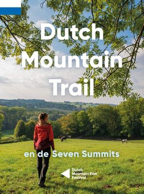
Wandelgids Dutch Mountain Trail | Stichting Moving Mountains

0
The Dutch Mountain Trail: Nederlands Enige echte bergwandeltocht! De Seven Summits zijn de zeven steilste bergtoppen van Zuid-Limburg. Beklim ze allemaal in de spannendste rondwandelingen met de meeste bergbeleving! De Dutch Mountain Trail is een ruige wandeltocht van ruim 100 km die de Seven Summits met elkaar verbindt. Loop van station Eygelshov...

Verkopers met dit product

Webshop
Bezorging
Prijs
DeZwerver.nl logo
DeZwerver.nl
niet bekend
19,95

Anderen bekeken ook

Wandelgids Dutch Mountain Trail (Engelstalig) | Stichting Moving Mountains
The Dutch Mountain Trail: Nederlands Enige echte bergwandeltocht nu ook in het Engels verkrijgbaar! The Dutch Mountain Trail traverses the southernmost part of the Netherlands, the only region which is not as flat as a pancake. Over 100 km long with several near-mountainous sections, it is a serious hiking trail which also incorporates the Seven Summits. Along the way you will enjoy fast-flowing streams, alpine meadows, picturesque valleys and spectacular vistas and switch back and forth between three different countries. As well as detailed route descriptions for the Trail (with separate ones for the Seven Summits), this guide is packed full of interesting facts and curiosities about the region.  
19,95
Nieuw
Dutch Mountain Trail (Paperback)
De Seven Summits zijn de zeven steilste bergtoppen van Zuid-Limburg. Beklim ze allemaal in de spannendste rondwandelingen met de meeste bergbeleving! De Dutch Mountain Trail is een ruige wandeltocht van ruim 100 km die de Seven Summits met elkaar verbindt. Loop van station Eygelshoven (Kerkrade) naar station Maastricht over een route waar het echte berggevoel nooit ver weg is. Alpenweides, snelstromende beken, rots- wanden en natuurlijk spectaculaire vergezichten: ze zullen je uitdagen en in vervoering brengen tijdens deze trail.
19,95
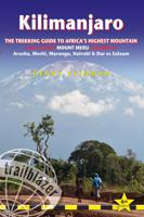
Wandelgids Kilimanjaro - A Trekking Guide to Africa's Highest Mountain | Trailblazer Guides
Dat dit boek je met de planning helpt is geen loze kreet. Werkelijk alle facetten van de berg en zijn omgeving komen aan bod. De auteur geeft informatie over hoe je een reis naar de Kili kunt boeken, hoe je er komt, wat je er kunt verwachten en hoe je vervolgens de top kunt bereiken. Maar hij is ook erg duidelijk voor wat betreft het bereiken van die top: doe dat alleen onder begeleiding van een erkende gids en doe het op je gemak. Kilimanjaro is immers niet voor niets de hoogste berg van Afrika en daarmee één van de beruchte 'seven summits'. Practical, best-selling guide to climbing Mount Kilimanjaro, Africa's highest mountain and most popular trek.   Fully updated 6th edition with amendments in 2024.   At 5895m (19,341ft) Kilimanjaro is Africa's highest mountain. Yet with no mountaineering skills necessary to reach the summit, even non-climbers can experience the thrill of climbing one of the world's greatest peaks. Taking you from the dusty plains of East Africa through jungle…
25,95
Wereldkaart Mountains of the Earth | Bergen van de Wereld | 140 x 100 cm | Marmota Maps
Mountains of the Earth invites you to discover the fascinating summits of our planet. We show Earth's highest peaks in the Himalaya, impressive country high points such as Fuji-san in Japan, mountains of great historic importance like Mount Olympus, particularly beautiful landmarks like the Table Mountain or the Matterhorn, and some of the world's most remote and rarely known summits in Siberia, Greenland, or Antarctica.   Information on every mountain We show each mountain's height and prominence, as well as the country or countries it lies in. The altitude bar for each mountain is color-coded, same as the mountain icons on the map. This makes it easy, for instance, to find Earth's 14 8000ers in the list. The Seven (Second / Third) Summits are highlighted, as well as country high points. We also mark mountains of historic importance and particularly beautiful and iconic mountains as landmarks.   Mountain icons on the map  The mountains on our map reveal much more than just the…
74,95
Wandelgids West Highland Way | Aurum Press
Gedegen routegids van het beroemdste pad van Schotland. Uitstekende kaarten, goede achtergronden, helaas wat beperkte praktische informatie. Engels. The 93-mile West Highland Way is indisputably Britain's most spectacular long-distance path. The first section, following the eastern shore of Loch Lomond, offers an idyllic waterside walk, with the full grandeur of the Highlands gradually revealing itself. Then, after crossing the barren wilderness of the Rannoch Moor, the walker climbs the Devil's Staircase above Glencoe and traverses classic Highland landscapes to reach Fort William and, if he or she wishes, a grand finale at the peak of Britain's highest mountain, Ben Nevis. This comprehensive, easy-to-use guide is an authoritative companion, packed with indispensable information. The West Highland Way recreational Path Guide by Anthony Burton is the definitive guide to Britain’s most spectacular long distance walk. This comprehensive, easy-to-use guide contains the entire route split…
20,95
Wandelgids Via Dinarica | Bradt Travel Guides
Bijzondere wandelgids : het beschrijft de wandelroute in Bosnie Herzegovina van de Via Dinarica, the White trail. Veel praktische informatie, redelijk kaartmateriaal en een goede beschrijving van de route.  This is the first detailed guide to the Bosnian part of the new Via Dinarica hiking trail that carves its way through the Dinaric Alps, one of Europe's least explored mountain ranges and last true wilderness frontiers, connecting the seven nations of Slovenia, Croatia, Bosnia and Herzegovina, Montenegro, Serbia, Kosovo, and Albania. In total, this trail system will span over 1,350km, 333km of which is in Bosnia Herzegovina. The Via Dinarica consists of three routes - White, Green and Blue - and this guide focuses primarily on the White Trail through Bosnia and Herzegovina, following the natural flow of the highest peaks of the Dinaric Alps. Detailed descriptions of each of the 12 stages of the White Trail through Bosnia and Herzegovina are included, along with maps, altitude charts…
20,95
Nieuw
Wandelgids The Cape Wrath Trail | Cicerone
Uitstekende wandelgids die in etappes de route nauwkeurig beschijft.  A guidebook to the Cape Wrath Trail, a long-distance trek through the Scottish Highlands from Fort William to Cape Wrath. The Cape Wrath Trail is a 230-mile, three-week challenge through wild and magnificent landscapes, such as Morar, Knoydart, Torridon and Assynt. Crossing such empty country, it is for the experienced backpacker only. Activities Long-distance walking and backpacking   Seasons April, May and June are ideal months to walk the trail. September and October are also good, but there may be diversions due to deer stalking and military operations at the cape. In July and August the days are superbly long and the weather can be fine, but midges will be in full flight. The limited accommodation along the trail may also be booked up at this time of year   Centres Fort William, Glenfinnan, Barisdale, Kinloch Hourn, Shiel Bridge, Strathcarron, Kinlochewe, Dundonnell, Ullapool, Bridge of Orchy, Inchnadamph, Kyle…
25,95
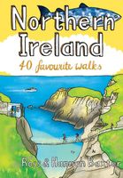
Wandelgids Northern Ireland | Pocket Mountains
Handige compacte wandelgids met 40 dagwandelingen. Deze gids bevat kleine kaartjes en leuke uitgebreide informatie over wat er langs de route te zien is. From the famous interlocking basalt columns of the Giant’s Causeway, part of a 200km-long wild Atlantic coastline littered with castles, lighthouses, wildflowers and birdlife, to the rugged granite summits of the mighty Mourne Mountains which dominate the County Down skyline, Northern Ireland is packed with a magnificent variety of unforgettable walking opportunities. In this guide you will find routes along windblown clifftop paths, through oakwood forests, over old smuggling routes and across high mountain ridges. On the way you’ll discover a land steeped in hundreds of years of history and ancient legend with a remarkable range of wildlife habitats and interesting geology.
10,95
Wandelgids Trekking the Tour Des Combins | Knife Edge Outdoor
The definitive guidebook for the Tour des Combins: the new bucket list trek in the Swiss/Italian Alps. A superb alternative to the more famous Tour du Mont Blanc. Two-way guide: both clockwise and anti-clockwise routes are described in full. Real Maps: full mapping inside (1:40,000), made specifically for Knife Edge Outdoor Guidebooks. All accommodation/campsites are numbered and marked on the maps. 10 different itineraries: schedules of 6, 7, 8 and 9 days for hikers and runners. Includes both clockwise and anti-clockwise itineraries. Difficult calculations of time, distance and altitude gain/loss are done for you. Also includes: * Detailed information on equipment and travelling light * Full accommodation/campsite listings * Wild camping rules explained * Everything the trekker needs to know: route, costs, difficulty, weather and more * Travel to the trail-head * Essential info for both self-guided and guided trekkers * Information on plants and wildlife * Numbered wayp…
27,50
Wandelgids Walk! Costa del Sol: Axarquia | Discovery Walking Guides
Goede wandelgids van een uitermate geschikt wandelgebied aan de Costa del Sol: het binnenland boven Nerja rond Competa en andere bergdorpen. De beschrijvingen zijn prima, zo ook de praktische informatie en de kaarten. We celebrate a Costa del Sol that does not correspond to the cliches, a Costa del Sol that is all right rather than all wrong, a playground of green valleys and gilded mountain tops, a hidden idyll unknown to most visitors, a haven for dedicated walkers and adventurous tourists alike, a place in which every nook is graced with some gratifying discovery and every outing is a great adventure. The majority of walks are aimed at the adventurous leisure walker, people who will on the whole have some experience of hiking in mountains, are happy to invest a certain amount of effort for a corresponding reward. Covering the best preserved stretch of coastline, the prettiest villages, and most spectacular mountains, Walk! Costa del Sol explores the Axarquia region east of Malaga, …
18,50

Klanten-reviews van Wandelgids Dutch Mountain Trail | Stichting Moving Mountains

Er zijn nog geen beoordelingen voor dit productBen jij de eerste die een review plaatst?

Meer over Wandelgids Dutch Mountain Trail | Stichting Moving Mountains

Productomschrijving

The Dutch Mountain Trail: Nederlands Enige echte bergwandeltocht!

De Seven Summits zijn de zeven steilste bergtoppen van Zuid-Limburg. Beklim ze allemaal in de spannendste rondwandelingen met de meeste bergbeleving! De Dutch Mountain Trail is een ruige wandeltocht van ruim 100 km die de Seven Summits met elkaar verbindt. Loop van station Eygelshoven (Kerkrade) naar station Maastricht over een route waar het echte berggevoel nooit ver weg is. Alpenweides, snelstromende beken, rots- wanden en natuurlijk spectaculaire vergezichten: ze zullen je uitdagen en in vervoering brengen tijdens deze trail.


Verken gerelateerde categorieën

Webshop.nl maakt gebruik van cookies. Ga je verder op onze website, ga dan akkoord met het plaatsen van cookies en de verwerking van deze data door ons en vermelde partners.