Wandelgids Dutch Mountain Trail (Engelstalig) | Stichting Moving Mountains

0
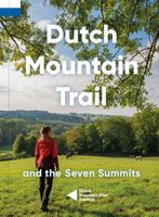
The Dutch Mountain Trail: Nederlands Enige echte bergwandeltocht nu ook in het Engels verkrijgbaar! The Dutch Mountain Trail traverses the southernmost part of the Netherlands, the only region which is not as flat as a pancake. Over 100 km long with several near-mountainous sections, it is a serious hiking trail which also incorporates the Seven S...

Verkopers met dit product

Webshop
Bezorging
Prijs
DeZwerver.nl logo
DeZwerver.nl
niet bekend
19,95

Anderen bekeken ook

Wandelgids Dutch Mountain Trail | Stichting Moving Mountains
The Dutch Mountain Trail: Nederlands Enige echte bergwandeltocht! De Seven Summits zijn de zeven steilste bergtoppen van Zuid-Limburg. Beklim ze allemaal in de spannendste rondwandelingen met de meeste bergbeleving! De Dutch Mountain Trail is een ruige wandeltocht van ruim 100 km die de Seven Summits met elkaar verbindt. Loop van station Eygelshoven (Kerkrade) naar station Maastricht over een route waar het echte berggevoel nooit ver weg is. Alpenweides, snelstromende beken, rots- wanden en natuurlijk spectaculaire vergezichten: ze zullen je uitdagen en in vervoering brengen tijdens deze trail.    
19,95
Wandelgids Via Dinarica | Bradt Travel Guides
Bijzondere wandelgids : het beschrijft de wandelroute in Bosnie Herzegovina van de Via Dinarica, the White trail. Veel praktische informatie, redelijk kaartmateriaal en een goede beschrijving van de route.  This is the first detailed guide to the Bosnian part of the new Via Dinarica hiking trail that carves its way through the Dinaric Alps, one of Europe's least explored mountain ranges and last true wilderness frontiers, connecting the seven nations of Slovenia, Croatia, Bosnia and Herzegovina, Montenegro, Serbia, Kosovo, and Albania. In total, this trail system will span over 1,350km, 333km of which is in Bosnia Herzegovina. The Via Dinarica consists of three routes - White, Green and Blue - and this guide focuses primarily on the White Trail through Bosnia and Herzegovina, following the natural flow of the highest peaks of the Dinaric Alps. Detailed descriptions of each of the 12 stages of the White Trail through Bosnia and Herzegovina are included, along with maps, altitude charts…
20,95
Nieuw
Dutch Mountain Trail (Paperback)
De Seven Summits zijn de zeven steilste bergtoppen van Zuid-Limburg. Beklim ze allemaal in de spannendste rondwandelingen met de meeste bergbeleving! De Dutch Mountain Trail is een ruige wandeltocht van ruim 100 km die de Seven Summits met elkaar verbindt. Loop van station Eygelshoven (Kerkrade) naar station Maastricht over een route waar het echte berggevoel nooit ver weg is. Alpenweides, snelstromende beken, rots- wanden en natuurlijk spectaculaire vergezichten: ze zullen je uitdagen en in vervoering brengen tijdens deze trail.
19,95
Wandelgids Walk! Costa del Sol: Axarquia | Discovery Walking Guides
Goede wandelgids van een uitermate geschikt wandelgebied aan de Costa del Sol: het binnenland boven Nerja rond Competa en andere bergdorpen. De beschrijvingen zijn prima, zo ook de praktische informatie en de kaarten. We celebrate a Costa del Sol that does not correspond to the cliches, a Costa del Sol that is all right rather than all wrong, a playground of green valleys and gilded mountain tops, a hidden idyll unknown to most visitors, a haven for dedicated walkers and adventurous tourists alike, a place in which every nook is graced with some gratifying discovery and every outing is a great adventure. The majority of walks are aimed at the adventurous leisure walker, people who will on the whole have some experience of hiking in mountains, are happy to invest a certain amount of effort for a corresponding reward. Covering the best preserved stretch of coastline, the prettiest villages, and most spectacular mountains, Walk! Costa del Sol explores the Axarquia region east of Malaga, …
18,50
Wereldkaart Mountains of the Earth | Bergen van de Wereld | 140 x 100 cm | Marmota Maps
Mountains of the Earth invites you to discover the fascinating summits of our planet. We show Earth's highest peaks in the Himalaya, impressive country high points such as Fuji-san in Japan, mountains of great historic importance like Mount Olympus, particularly beautiful landmarks like the Table Mountain or the Matterhorn, and some of the world's most remote and rarely known summits in Siberia, Greenland, or Antarctica.   Information on every mountain We show each mountain's height and prominence, as well as the country or countries it lies in. The altitude bar for each mountain is color-coded, same as the mountain icons on the map. This makes it easy, for instance, to find Earth's 14 8000ers in the list. The Seven (Second / Third) Summits are highlighted, as well as country high points. We also mark mountains of historic importance and particularly beautiful and iconic mountains as landmarks.   Mountain icons on the map  The mountains on our map reveal much more than just the…
74,95
Wandelgids Trekking the Tour Des Combins | Knife Edge Outdoor
The definitive guidebook for the Tour des Combins: the new bucket list trek in the Swiss/Italian Alps. A superb alternative to the more famous Tour du Mont Blanc. Two-way guide: both clockwise and anti-clockwise routes are described in full. Real Maps: full mapping inside (1:40,000), made specifically for Knife Edge Outdoor Guidebooks. All accommodation/campsites are numbered and marked on the maps. 10 different itineraries: schedules of 6, 7, 8 and 9 days for hikers and runners. Includes both clockwise and anti-clockwise itineraries. Difficult calculations of time, distance and altitude gain/loss are done for you. Also includes: * Detailed information on equipment and travelling light * Full accommodation/campsite listings * Wild camping rules explained * Everything the trekker needs to know: route, costs, difficulty, weather and more * Travel to the trail-head * Essential info for both self-guided and guided trekkers * Information on plants and wildlife * Numbered wayp…
27,50
Wandelgids Kilimanjaro - A Trekking Guide to Africa's Highest Mountain | Trailblazer Guides
Dat dit boek je met de planning helpt is geen loze kreet. Werkelijk alle facetten van de berg en zijn omgeving komen aan bod. De auteur geeft informatie over hoe je een reis naar de Kili kunt boeken, hoe je er komt, wat je er kunt verwachten en hoe je vervolgens de top kunt bereiken. Maar hij is ook erg duidelijk voor wat betreft het bereiken van die top: doe dat alleen onder begeleiding van een erkende gids en doe het op je gemak. Kilimanjaro is immers niet voor niets de hoogste berg van Afrika en daarmee één van de beruchte 'seven summits'. Practical, best-selling guide to climbing Mount Kilimanjaro, Africa's highest mountain and most popular trek.   Fully updated 6th edition with amendments in 2024.   At 5895m (19,341ft) Kilimanjaro is Africa's highest mountain. Yet with no mountaineering skills necessary to reach the summit, even non-climbers can experience the thrill of climbing one of the world's greatest peaks. Taking you from the dusty plains of East Africa through jungle…
25,95
Reisinspiratieboek - Reisboek Book of the Alps | Marmota Maps
The Book of the Alps  the great illustrated book about the Alps.290 pages with over 1000 illustrations, graphics, and maps on geography, sports, history, culture, climate, environment and much more. Understand the Alps like never before.Created in cooperation with the Alpine clubs of Germany, Austria, and South Tyrol. CONTENTS The Book of the Alps has 46 chapters in seven subject areas: Geography   Flora and Fauna   Climate and Environment    Alpinism   Mountain Sports   Society and Economy   Arts and Culture   GEOGRAPHY Geological Formation Ice Age Mountains Valleys Mountain Passes Lakes and Rivers Glaciers The Alps are unique. How did they form and evolve? How do glaciers, passes, valleys, lakes, and rivers shape the landscape? Answers to these and many more questions can be found in the geography chapter.   FLORA AND FAUNA Biodiversity Plants Forests Animals National Parks The Alpine environment is fascinating. Alpine flowers such as the edelweiss and Alpine anima…
44,95
Wandelkaart Tour & Trail Costa de Sol - Axarquia | Discovery Walking Guides
Goede wandelkaart van de omgeving Nerja - Competa in het binnenland. For better adventures, use the best map. Costa del Sol (Axarquia) Tour & Trail Super-Durable Map comes with a 2 year adventurous use wear and tear guarantee against splitting or falling apart, see Discovery Walking Guides website for details. From 1 April 2020 a free Custom Map digital edition for Garmin users is available to download from the Discovery Walking Guides website.   Our large 1:40,000 scale, combined with splitting the region into West and East sections with a generous overlap, produces double sided map whose total size is 840mm by 700mm that folds to a pocketable 240mm by 120mm. Costa del Sol (Axarquia) covers the region from Ventas de Zafarraya in the North-West to Almunecar in the South-East; approx 3 42'W to 4 08'W and 36 43'N to 36 58'N. You get the most detailed map of the region that is produced including our 'Tour & Trail' level of detail ranging from major roads to secondary roads to minor ro…
15,95
Wandelgids Canadian Rockies Trail Guide | Summerthought
The best loved and most detailed Canadian Rockies hiking guidebook is now in full color.   First published in 1971 and now in its 10th edition, the Canadian Rockies Trail Guide was the original guidebook with accurate distances and detailed descriptions to the trails of the Canadian Rockies.   Whether you’re a Canadian Rockies local or a visitor, the Canadian Rockies Trail Guide provides the best resource for hiking in the region, with everything from short interpretive trails to week-long backcountry treks. Now in its 10th edition and known affectionately as the “Bible” by outdoor enthusiasts, the popular tome is the most comprehensive and well-known guidebook to hiking in the region.   Having spent their entire adult lives hiking in the Canadian Rockies and writing about their experiences, authors Brian Patton and Bart Robinson are regarded as the ultimate authority on hiking in the Canadian Rockies. The Canadian Rockies Trail Guide is the only hiking guide to the region recommended…
29,95

Klanten-reviews van Wandelgids Dutch Mountain Trail (Engelstalig) | Stichting Moving Mountains

Er zijn nog geen beoordelingen voor dit productBen jij de eerste die een review plaatst?

Meer over Wandelgids Dutch Mountain Trail (Engelstalig) | Stichting Moving Mountains

Productomschrijving

The Dutch Mountain Trail: Nederlands Enige echte bergwandeltocht nu ook in het Engels verkrijgbaar!

The Dutch Mountain Trail traverses the southernmost part of the Netherlands, the only region which is not as flat as a pancake. Over 100 km long with several near-mountainous sections, it is a serious hiking trail which also incorporates the Seven Summits.

Along the way you will enjoy fast-flowing streams, alpine meadows, picturesque valleys and spectacular vistas and switch back and forth between three different countries. As well as detailed route descriptions for the Trail (with separate ones for the Seven Summits), this guide is packed full of interesting facts and curiosities about the region.


Verken gerelateerde categorieën

Webshop.nl maakt gebruik van cookies. Ga je verder op onze website, ga dan akkoord met het plaatsen van cookies en de verwerking van deze data door ons en vermelde partners.