webshop.nl
Categorieën
  Sluiten

Meer The Collins Press

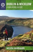
Wandelgids Dublin & Wicklow | The Collins Press

0
Duidelijke wandelgids van dit specifieke deel van Ierland. Goede praktische informatie en zeker voor de GPS wandelaar handig met vermelde waypoints. Kaarten zijn schetsmatig, maar er wordt verwezen naar de benodigde topografische kaarten van Ierland.  This guidebook describes the best walking routes in Dublin and Wicklow. From mountain landscape to...

Webshops met dit product

Webshop
Bezorging
Prijs

Anderen bekeken ook

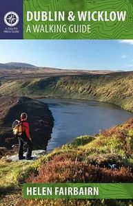
Wandelgids Dublin & Wicklow | The Collins Press
Duidelijke wandelgids van dit specifieke deel van Ierland. Goede praktische informatie en zeker voor de GPS wandelaar handig met vermelde waypoints. Kaarten zijn schetsmatig, maar er wordt verwezen naar de benodigde topografische kaarten van Ierland.  This guidebook describes the best walking routes in Dublin and Wicklow. From mountain landscape to scenic coastal paths, from woodland trails to challenging hill-walks, there are routes here for everyone. Trips vary from two-hour strolls to eight-hour treks, and are illustrated with sketch maps and colour photographs. This is an area of great scenic variety with countless hidden gems to discover - sheer cliffs, dramatic corries, secluded lakes and charming forests. As well as inspiring you to visit the region's natural attractions, the guide provides a host of practical and background information. Each route is prefaced with a quick-reference summary, and descriptions include detailed access notes and navigational guidance. Points of inte…
22,50
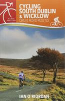
Fietsgids Cycling South Dublin & Wicklow | The Collins Press
From the doorstep of Dublin city, there is easy access to a different world of deep glens, forested mountains and wild scenery, including the Wicklow Mountains, the largest continuous upland region in Ireland. This guide journeys through some of the country's best-known tourist attractions, such as Glendalough, as well as revealing lesser-known points of interest like the Lemass Monument, where the body of Noel Lemass, older brother of the later Taoiseach Sean, was found in 1923. Information is provided on the many natural landmarks and historical sites en route. The graded routes suit all abilities, and are illustrated with colour maps, photos, gradient graphs, and key facts and statistics. The charm of the historic Military Road is central to many of the cycles. Constructed in the aftermath of the 1798 Rebellion, it runs from Rathfarnham in south Dublin to Aughavannagh in south-west Wicklow, with a side arm from Enniskerry to Glencree, and also from the Sally Gap to Roundwood. Reader…
22,50
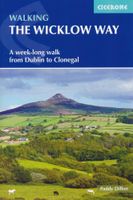
Wandelgids Walking the Wicklow Way | Cicerone
The Wicklow Way was the first long-distance walking trail to be established in Ireland. Coming in at 130km (81 miles), the route traverses the county of Wicklow, from Marlay Park on the outskirts of Dublin to Clonegal, just over the county border in neighbouring Carlow, and can be comfortably completed in a week. The guide also details several adjacent trails that can be interchanged with the main route, and short detours off-route (also described) lead to welcoming villages offering accommodation and a range of other facilities. The route is presented in seven stages, each with an overview followed by clear route description and mapping. There are elevation profiles and notes on local points of interest. In addition to background information about the county's history, geology, plants and wildlife, you will find all the information you need to walk the route, with helpful advice on transport, accommodation and kit. Accommodation listings, useful contacts and a glossary of Irish place-…
18,95
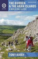
Wandelgids The Burren & the Aran Islands | The Collins Press
Duidelijke wandelgids van dit specifieke deel van Ierland. Goede praktische informatie en zeker voor de GPS wandelaar handig met vermelde waypoints. Kaarten zijn schetsmatig, maar er wordt verwezen naar de benodigde topografische kaarten van Ierland.  The Burren and the Aran Islands, with their unique combination of flora, fauna and landscape, are explored by large numbers of walkers annually. This is a revised guide to some of the best walking routes in the region, with lucid descriptions and additional information to enhance the walkers' enjoyment and appreciation of the place. From the rugged interior to spectacular coastal scenery, from challenging upland walks to shorter road and waterside excursions, this selection has something for everyone. Every part of the region is covered. Walks vary from two-hour strolls to the longer Burren Way, a six-hour walk from Lisdoonvarna to Ballyvaughan.   The author has put his considerable experience and detailed knowledge of the area to great u…
22,50
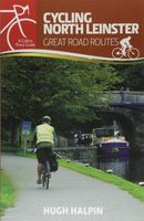
Fietsgids Cycling North Leinster | The Collins Press
With quiet roads, striking scenery and brimming with 5,000 years of heritage, north Leinster is a marvellous region to discover by bike. These thirty routes, exploring coast, lake, river and canal routes, vary in distance and difficulty and are graded to suit all abilities. Greenways along canals and old railway lines are ideal for novices and families, while the adventurous can take a challenge through the mountains of Louth's breathtaking Cooley Peninsula.   Each cycle is prefaced with summary information and illustrated with photos, a custom-drawn map and a gradient graph. Anecdotes, history and profiles of interesting locals are included throughout, adding colour to coffee breaks in the sleepy villages and medieval towns that dot the picturesque landscape. All but one of the routes are looped back to the train stations from which they started, making for perfect days out.   Visit the early Christian settlement of Monasterboice or the original home of the Book of Kells. Take in spec…
22,50
Wandelgids - Klimgids - Klettersteiggids Via Ferratas of the French Al
This guidebook covers 66 varied via ferratas in the French Alps. The routes are spread over six areas: Geneva and the Northern Alps, Chambéry, Tarentaise and Maurienne valleys, Grenoble and Briançon, amid the Mont Blanc, Vanoise and Queyras ranges. Difficulty ranges from easy, protected routes through to exposed, technical challenges. With some of the most beautiful scenery in the world, the French Alps have long been a popular destination for a wide range of outdoor activities. In recent years, the region has seen the arrival of a growing number of via ferrata routes.   Via ferrata climbing – using fixed cables, bridges and ladders to explore terrain that is normally only accessible to experienced rock climbers – combines elements of scrambling, mountaineering and rock climbing, yet is a very distinct pursuit. Increasingly popular, recent years have seen a surge in the number of routes being established in these iconic mountains.   The routes in this guidebook range from straightforwa…
25,95

Klanten-reviews van Wandelgids Dublin & Wicklow | The Collins Press

Er zijn nog geen beoordelingen voor dit productBen jij de eerste die een review plaatst?

Meer over Wandelgids Dublin & Wicklow | The Collins Press

Productomschrijving

Duidelijke wandelgids van dit specifieke deel van Ierland. Goede praktische informatie en zeker voor de GPS wandelaar handig met vermelde waypoints. Kaarten zijn schetsmatig, maar er wordt verwezen naar de benodigde topografische kaarten van Ierland.  This guidebook describes the best walking routes in Dublin and Wicklow. From mountain landscape to scenic coastal paths, from woodland trails to challenging hill-walks, there are routes here for everyone. Trips vary from two-hour strolls to eight-hour treks, and are illustrated with sketch maps and colour photographs. This is an area of great scenic variety with countless hidden gems to discover - sheer cliffs, dramatic corries, secluded lakes and charming forests. As well as inspiring you to visit the region's natural attractions, the guide provides a host of practical and background information. Each route is prefaced with a quick-reference summary, and descriptions include detailed access notes and navigational guidance. Points of interest are all highlighted, including local flora, fauna, geology, history and folklore.   Walking in Dublin and Wicklow is nothing new - it has long been one of Ireland's most popular outdoor playgrounds. Some routes are established classics, and most lie within an hour of Dublin city. So what are you waiting for? Pack your bag, pull on your boots and go - this guide will show you the way!

Productspecificaties

Artikelnummer(s)
Brand
The Collins Press
Webshop.nl maakt gebruik van cookies. Ga je verder op onze website, ga dan akkoord met het plaatsen van cookies en de verwerking van deze data door ons en vermelde partners.