webshop.nl
Categorieën
  Sluiten

Meer Vertebrate Publishing
Meer Vertebrate Publishing in Literatuur boeken

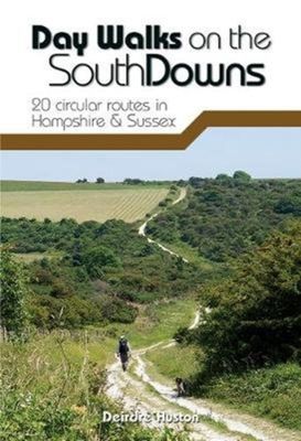
Wandelgids Day Walks n the South Downs | Vertebrate Publishing

0
Day Walks on the South Downs features 20 circular routes, between 6 and 14 miles (9km and 22km) in length, suitable for hill walkers of all abilities. The routes are split into three geographical areas - Hampshire, West Sussex and East Sussex - and include walks to the most historic and beautiful areas of the South Downs National Park, including Wi...

Webshops met dit product

Webshop
Bezorging
Prijs

Anderen bekeken ook

Wandelgids Day Walks n the South Downs | Vertebrate Publishing
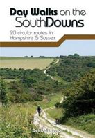
Day Walks on the South Downs features 20 circular routes, between 6 and 14 miles (9km and 22km) in length, suitable for hill walkers of all abilities. The routes are split into three geographical areas - Hampshire, West Sussex and East Sussex - and include walks to the most historic and beautiful areas of the South Downs National Park, including Winchester Hill Fort, Black Down, Chanctonbury Ring, Devil's Dyke, Ditchling Beacon and Beachy Head. This guidebook is written by Deirdre Huston, a South Downs local, keen hill walker and experienced author.   Each route in this guide is described with easy-to-follow directions and details of distance, navigation information, refreshment stops and is plotted on clear and easy to use Ordnance Survey 1:25,000 mapping. Also included is a detailed Appendix.
20,95
Wandelgids South Downs National Park | Ordnance Survey
Stroll up on the Downs, explore charming villages and wander woodland trails with ten hand-picked leisurely walks suitable for the whole family. Enjoy some of the loveliest and most accessible walks in the South Downs National Park and discover the benefits of being active outside.   South Downs Short Walks Made Easy include:   - Climb the Zig-Zag Path above charming Selborne, made famous by naturalist Gilbert White, for wonderful views - Explore the historic village of Bramber, once an important river port and full of intrigue, and enjoy the beautiful ‘Walk For All’ along the banks of the Adur - See the iconic Devil’s Dyke, offering great views in all directions from the hillfort above the longest and deepest dry valley in the country - Wander the Seven Sisters Country Park, part of the spectacular Sussex coastline between Eastbourne and Seaford - Follow the South Downs Way up Old Winchester Hill to find a hill-fort and barrows, as well as excellent views as far as the Solent and the …
10,95
Reisgids Brighton, Sussex & the South Downs | Rough Guides
Een kleinere versie in zakformaat van de grotere versies van de Rough Guides. Als altijd weer vol met goede informatie over cultuur en praktische zaken. Voorin een kaart van de stad. Inspirational and informative pocket guide, shining a spotlight on the best of holidaying at home in the UK through clearly laid-out walking and driving itineraries.   Explore the best of Brighton, Sussex & the South Downs with this unique Rough Guide Staycation to Brighton, Sussex & the South Downs, packed full of insider information and stunning images. From making sure you don’t miss out on must-see attractions like Brighton Pier, Chichester's Novium Museum and grandiose Petworth House to discovering hidden gems, including spotting Sussex wildlife at Arundel Wetland Centre, walking the rambling South Downs Way and mooching down Brighton's The Lanes, the easy-to-follow, ready-made walking and driving routes will save you time, help you plan, and enhance your staycation in Brighton, Sussex & the South Dow…
12,50
Wandelgids 100 outstanding British Walks | Ordnance Survey
Beschrijving van de 100 mooiste Pathfinder wandelingen in Engeland, Wales en Schotland. Uitstekende beschrijving van de route met een zeer duidelijke topografische kaart waarop de route is ingetekend.  This magnificent compendium of outstanding British walks brings together the finest selection of Pathfinder Walks in Britain s officially designated places of scenic beauty and historic interest: National Parks, Areas of Outstanding Natural Beauty, National Scenic Areas, Heritage Coast, National Trails and UNESCO World Heritage Sites. There are 100 walking gems in this collection, recommended by a group of experienced authors and guides. The walks span a range of distances and degrees of challenge and are organised by region with coverage across England, Wales and Scotland. 100 Outstanding British Walks is lavishly illustrated with stunning landscape photography and informative introductions to each of the walks. It is designed to be enjoyed at home, while the OS Maps app provides the pr…
27,95
Wandelgids South Downs National Park | Ordnance Survey
Stroll up on the Downs, explore charming villages and wander woodland trails with ten hand-picked leisurely walks suitable for the whole family. Enjoy some of the loveliest and most accessible walks in the South Downs National Park and discover the benefits of being active outside.   South Downs Short Walks Made Easy include:   - Climb the Zig-Zag Path above charming Selborne, made famous by naturalist Gilbert White, for wonderful views - Explore the historic village of Bramber, once an important river port and full of intrigue, and enjoy the beautiful ‘Walk For All’ along the banks of the Adur - See the iconic Devil’s Dyke, offering great views in all directions from the hillfort above the longest and deepest dry valley in the country - Wander the Seven Sisters Country Park, part of the spectacular Sussex coastline between Eastbourne and Seaford - Follow the South Downs Way up Old Winchester Hill to find a hill-fort and barrows, as well as excellent views as far as the Solent and the …
10,95
Reisgids Brighton, Sussex & the South Downs | Rough Guides
Een kleinere versie in zakformaat van de grotere versies van de Rough Guides. Als altijd weer vol met goede informatie over cultuur en praktische zaken. Voorin een kaart van de stad. Inspirational and informative pocket guide, shining a spotlight on the best of holidaying at home in the UK through clearly laid-out walking and driving itineraries.   Explore the best of Brighton, Sussex & the South Downs with this unique Rough Guide Staycation to Brighton, Sussex & the South Downs, packed full of insider information and stunning images. From making sure you don’t miss out on must-see attractions like Brighton Pier, Chichester's Novium Museum and grandiose Petworth House to discovering hidden gems, including spotting Sussex wildlife at Arundel Wetland Centre, walking the rambling South Downs Way and mooching down Brighton's The Lanes, the easy-to-follow, ready-made walking and driving routes will save you time, help you plan, and enhance your staycation in Brighton, Sussex & the South Dow…
12,50
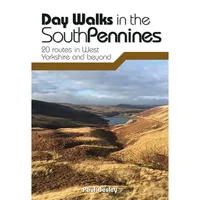
Wandelgids Day Walks in the South Pennines | Vertebrate Publishing
Day Walks in the South Pennines features 20 circular walks between 5 and 18 miles (8km and 29 km) in length, spread across West Yorkshire, Lancashire and Greater Manchester. Researched and written by knowledgeable and experienced author Paul Besley, the walks range from gentle rambles to more challenging day walks, all through striking and varied terrain. The routes are split into two geographical areas - Southern Walks, including routes around Dovestones, Ramsden Clough and Holmfirth; and Northern Walks, including routes around Hebden Bridge, Hardcastle Crags and Ilkley Moor.   Together with stunning photography, each route features Ordnance Survey 1:25,000 maps, easy-to-follow directions, details of distance and navigation information, and refreshment stops and local information.
20,95
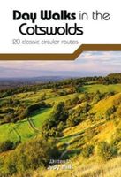
Wandelgids Day Walks in the Cotswolds | Vertebrate Publishing
Day Walks in the Cotswolds features 20 circular routes, between 7.1 and 12.6 miles (11.5km and 20.2km), suitable for hillwalkers of all abilities. Split across three areas - North-East Cotswolds, North-West Cotswolds and South Cotswolds - local author Judy Mills shares her favourite walks in this Area of Outstanding Natural Beauty. These walks take in a variety of local landmarks, including the World War II airfield and Roman villa at Chedworth; Neolithic long barrows such as Hetty Pegler's Tump; grand country estates like Badminton; magnificent Cotswold manor houses and historic churches; high points at Bredon Hill and North Nibley; and the many charming rural villages, such as the Duntisbournes and the Slaughters, for which the Cotswolds are famous.   Each route features Ordnance Survey 1:25,000 maps, easy-to-follow directions, details of distance and navigation information, and refreshment stops and local information. The walks are illustrated with stunning photography by outdoor ph…
20,95
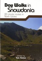
Wandelgids Day Walks in Snowdonia | Vertebrate Publishing
Day Walks in Snowdonia showcases 20 circular routes, between 5.5 and 12 miles (9km and 19km) in length, suitable for hillwalkers of all abilities. Additionally included in a Bonus Section are two of the UK's classic scrambles: The Bochlwyd Horseshoe and The Snowdon Horseshoe. The routes are split into three areas - Northern Snowdonia, Central Snowdonia and Southern Snowdonia - and include walks to the most iconic and beautiful peaks in the National Park, including; Snowdon, Y Glyderau, the Carneddau peaks, Moel Siabod, Cnicht, the Rhinogs, and Cadair Idris.   The author of this guidebook, Tom Hutton, is a Wales local, keen hillwalker and outdoors journalist. Each route in this guide is described with easy-to-follow directions and details of distance, navigation information, refreshment stops and public transport information, and is plotted on clear and easy to use Ordnance Survey 1:25,000 mapping. Also included is a detailed Appendix.
20,95
Wandelgids 100 outstanding British Walks | Ordnance Survey
Beschrijving van de 100 mooiste Pathfinder wandelingen in Engeland, Wales en Schotland. Uitstekende beschrijving van de route met een zeer duidelijke topografische kaart waarop de route is ingetekend.  This magnificent compendium of outstanding British walks brings together the finest selection of Pathfinder Walks in Britain s officially designated places of scenic beauty and historic interest: National Parks, Areas of Outstanding Natural Beauty, National Scenic Areas, Heritage Coast, National Trails and UNESCO World Heritage Sites. There are 100 walking gems in this collection, recommended by a group of experienced authors and guides. The walks span a range of distances and degrees of challenge and are organised by region with coverage across England, Wales and Scotland. 100 Outstanding British Walks is lavishly illustrated with stunning landscape photography and informative introductions to each of the walks. It is designed to be enjoyed at home, while the OS Maps app provides the pr…
27,95

Klanten-reviews van Wandelgids Day Walks n the South Downs | Vertebrate Publishing

Er zijn nog geen beoordelingen voor dit productBen jij de eerste die een review plaatst?

Meer over Wandelgids Day Walks n the South Downs | Vertebrate Publishing

Productomschrijving

Day Walks on the South Downs features 20 circular routes, between 6 and 14 miles (9km and 22km) in length, suitable for hill walkers of all abilities. The routes are split into three geographical areas - Hampshire, West Sussex and East Sussex - and include walks to the most historic and beautiful areas of the South Downs National Park, including Winchester Hill Fort, Black Down, Chanctonbury Ring, Devil's Dyke, Ditchling Beacon and Beachy Head. This guidebook is written by Deirdre Huston, a South Downs local, keen hill walker and experienced author.   Each route in this guide is described with easy-to-follow directions and details of distance, navigation information, refreshment stops and is plotted on clear and easy to use Ordnance Survey 1:25,000 mapping. Also included is a detailed Appendix.

Productspecificaties

Artikelnummer(s)
Brand
Vertebrate Publishing

Verken gerelateerde categorieën

Webshop.nl maakt gebruik van cookies. Ga je verder op onze website, ga dan akkoord met het plaatsen van cookies en de verwerking van deze data door ons en vermelde partners.