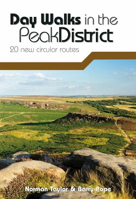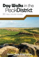
Wandelgids Day Walks in the Peak District | Vertebrate Publishing

0
Day Walks in the Peak District: 20 new circular routes features 20 circular walks, between 8 and 13 miles (14km and 21km) in length, suitable for hillwalkers of all abilities. The routes are split into three geographical areas - The High Moors, including the Kinder plateau and Bleaklow; Hills, Tors and Edges, including walks around the Eastern Edg...

Verkopers met dit product

Verkoper
Bezorging
Prijs
DeZwerver.nl logo
DeZwerver.nl
niet bekend
20,95

Anderen bekeken ook

Reisboek - Wandelgids Wild Swimming Walks Peak District | Wild Things Publishing
The best-selling Wild Swimming Walks series returns with adventures in Britain's oldest National Park. Ascend to the highest tarns and descend through a valley of secret waterfalls * Walk through woodland gorges carved by cascades * Follow bucolic river valleys dipping as you walk. Wild Swimming Walks Peak Disitrict leads you on 28 adventures in the soaring landscape of the Peak District. Find secret waterfalls, remote lakes and sparkling river pools. Complete with photos, maps and practical guidance, rich in local history and stories, this book will appeal to wild swimmers, family explorers, nature lovers and walkers alike.   JOIN THE ADVENTURE with the best-selling Wild Swimming Walks series and explore Britain’s oldest national park from the gritstone edges of the Hope Valley, to the magical streams on the moorlands of Bleaklow, through to the picturesque limestone river dales of the White Peak.   Scramble up streams and waterfalls at Black Clough Explore fairy pools and mossy…
20,95
Wandelgids Day Walks in the Lake District | Vertebrate Publishing
Day Walks in the Lake District features 20 circular routes between 5 and 13 miles (8 and 21 kilometres) in length, suitable for hillwalkers of all abilities. The routes are split into four geographical areas - north, east, south and west - and include walks from the main tourist bases, such as Keswick and Ambleside, as well as sought after peaks, such as Scafell Pike, Great Gable, Blencathra and Helvellyn. Also included for the adventurous are the Lake District's best known scrambles - Striding Edge on Helvellyn and Sharp Edge on Blencathra - together with more accessible alternatives.   The author of this guidebook, Stephen Goodwin, is a former freelance journalist (former staff writer for The Independent), and a Lake District local. In his introductions to each route he recalls the tales of Wordsworth, Walpole and the fascinating history of Lakeland and its peaks and fells. Each route in this guide is described with easy-to-follow directions and details of distance, navigation infor…
20,95
Wandelgids Day Walks in Snowdonia | Vertebrate Publishing
Day Walks in Snowdonia showcases 20 circular routes, between 5.5 and 12 miles (9km and 19km) in length, suitable for hillwalkers of all abilities. Additionally included in a Bonus Section are two of the UK's classic scrambles: The Bochlwyd Horseshoe and The Snowdon Horseshoe. The routes are split into three areas - Northern Snowdonia, Central Snowdonia and Southern Snowdonia - and include walks to the most iconic and beautiful peaks in the National Park, including; Snowdon, Y Glyderau, the Carneddau peaks, Moel Siabod, Cnicht, the Rhinogs, and Cadair Idris.   The author of this guidebook, Tom Hutton, is a Wales local, keen hillwalker and outdoors journalist. Each route in this guide is described with easy-to-follow directions and details of distance, navigation information, refreshment stops and public transport information, and is plotted on clear and easy to use Ordnance Survey 1:25,000 mapping. Also included is a detailed Appendix.
20,95
Wandelgids Mysterious Walks in the Peak District | Northern Eye Books
Even the Peak District’s name conceals a mystery. Forget the obvious: a visitor expecting towering peaks will be disappointed, as the name comes from the Pecsaetan tribe who once lived here. But there’s a twist: the Anglo-Saxon means “settlers of the Pec”…and that word pec has the same root as our peak, the dialect pike and the Pyrenean pic. So, ultimately, the Peak District is named after its peaks, after all.   The Peak District is broadly defined by the conurbations at its corners: Manchester, Sheffield, Derby and Stoke. Within this rectangle, the National Park forms a rough oval of around 550 square miles.   The area is traditionally divided into the Dark Peak – peat moorland edged by gritstone, with rugged villages in the valleys — and the softer White Peak – upland pastures defined by drystone walls, divided by gorges and limestone villages. The eastern and western moors are similar to the Dark Peak, but have their own subtly distinctive characters.   The Peak District was occup…
10,95
Wandelgids Day Walks in the Cotswolds | Vertebrate Publishing
Day Walks in the Cotswolds features 20 circular routes, between 7.1 and 12.6 miles (11.5km and 20.2km), suitable for hillwalkers of all abilities. Split across three areas - North-East Cotswolds, North-West Cotswolds and South Cotswolds - local author Judy Mills shares her favourite walks in this Area of Outstanding Natural Beauty. These walks take in a variety of local landmarks, including the World War II airfield and Roman villa at Chedworth; Neolithic long barrows such as Hetty Pegler's Tump; grand country estates like Badminton; magnificent Cotswold manor houses and historic churches; high points at Bredon Hill and North Nibley; and the many charming rural villages, such as the Duntisbournes and the Slaughters, for which the Cotswolds are famous.   Each route features Ordnance Survey 1:25,000 maps, easy-to-follow directions, details of distance and navigation information, and refreshment stops and local information. The walks are illustrated with stunning photography by outdoor p…
20,95
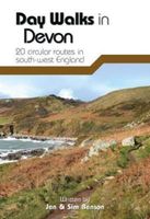
Wandelgids Day Walks in Devon | Vertebrate Publishing
Day Walks in Devon features 20 circular routes, between 8.8 and 17.6 miles (14.1km and 28.3km), suitable for hillwalkers of all abilities. The routes are split into five geographical areas: North Devon and Exmoor, Torridge and West Devon, Mid and East Devon, Dartmoor, and South Devon and the South Hams. Devon has some of the most diverse and beautiful terrain of any county in England.   Local authors Jen and Sim Benson share their favourite walks in the region, including coastal circuits taking in sections of the South West Coast Path past Baggy Point and Hartland Point; moorland loops of Dartmoor's granite tors such as Haytor and High Willhays; and tours through the county's rich history at Berry Pomeroy Castle and Castle Drogo. Together with stunning photography, each route features Ordnance Survey 1:25,000 maps, easy-to-follow directions, details of distance and navigation information, and refreshment stops and local information.
20,95
Wandelgids Walking in the Peak District - White Peak East | Cicerone
Uitstekende wandelgids van het Peak District van de gerenommeerde uitgever Cicerone.   This guidebook provides 35 day walks and 7 longer walks and trails exploring the eastern section of Derbyshire's limestone area. The walks are spread across the area, starting in pleasant towns and villages including Bakewell, Tissington, Eyam and Middleton. Largely travelling along well-marked paths over gentle rolling landscapes, these walks are suitable for walkers of all abilities.   The day walks range between 4 and 12 miles in length, and are illustrated with extracts of 1:50,000 OS mapping, while the longer walks and trails are covered by 1:100,000 scale mapping. Walkers can use the longer trails to link day walks into longer routes or explore the area on the three-day White Peak Circular, starting in Birchover.   While geologically fascinating with its layers of limestone and gritstone, the White Peak is also a landscape rich in history and art. These walks visit sites including medieval chu…
18,95
Wandelgids Day Walks in the Brecon Beacons | Vertebrate Publishing
Day Walks in the Brecon Beacons features 20 circular routes between 6.8 and 16.5 miles (11km and 16.6km) in length, suitable for hill walkers of all abilities. Local author and walker Harri Roberts shares his favourite walks in the region, including circuits in the hills around Llangors Lake, the Taf Fechan Skyline and Pen y Fan, and the Llanbedr Horseshoe. The routes are split into four areas - Blorenge and The Black Mountains, The Brecon Beacons, Mynydd Llangatwg and Mynydd Llangynidr, Fforest Fawr and The Black Mountain.   Each route features Ordnance Survey 1:25,000 maps, easy-to-follow directions, details of distance and navigation information, and refreshment stops and local information. The walks are illustrated with stunning photography by the author and outdoor photographer Adam Long.
20,95
Wandelgids Short Walks in the Peak District | Collins
A brand new range of practical little walk guides endorsed by the Ramblers. All the walks are 5 miles or under in length and can easily be completed in less that 3 hours. 20 walks are included and use clear maps to show the route plus easy to follow walk descriptions. The Peak District, with its two very different landscapes: the gentle limestone White Peak with its intimate wooded dales and steep-sided gorges; and the wilder more dramatic gritstone Dark Peak with its wild moorland, offer some superb walking areas. This guide, produced in co-operation with the Ramblers and featuring Ordnance Survey mapping, is the perfect way to get out and enjoy the stunning scenery. This compact little guide contains walks, all of which are 5 miles or under, which are ideal for an afternoon stroll. INCLUDES: 20 easy to follow walks which can be completed in 3 hours and under Each walk has a detailed Ordnance Survey map with the route clearly marked plus a detailed description of the route The wal…
10,50
Wandelgids Day Walks in the Yorkshire Dales | Vertebrate Publishing
Day Walks in the Yorkshire Dales is the fourth title in Vertebrate Publishing's series of compact and portable hillwalking guidebooks. This book showcases 20 circular walks in the Yorkshire Dales National Park, between 6 and 11 miles (10 and 17 kilometres) in length, suitable for hillwalkers of all abilities. The routes are split into three geographical areas - south, east, and north - and include walks to the Dales' most regarded beauty spots, such as Malham Cove, Gordale Scar, Brimham Rocks and Hardraw Force, as well as the trio of sought-after peaks Pen-y-ghent, Ingleborough and Whernside.   The author of this guidebook, Bernard Newman, is a freelance outdoor writer and photographer, and former editor of the internationally acclaimed Mountain magazine. A Yorkshire Dales local and graduate geologist, in his route descriptions he explores the incredible geology that has created the breathtaking scenery on show in the Dales. Each route in this guide is described with easy-to-follow di…
20,95

Klanten-reviews van Wandelgids Day Walks in the Peak District | Vertebrate Publishing

Er zijn nog geen beoordelingen voor dit productBen jij de eerste die een review plaatst?

Meer over Wandelgids Day Walks in the Peak District | Vertebrate Publishing

Productomschrijving

Day Walks in the Peak District: 20 new circular routes features 20 circular walks, between 8 and 13 miles (14km and 21km) in length, suitable for hillwalkers of all abilities. The routes are split into three geographical areas - The High Moors, including the Kinder plateau and Bleaklow; Hills, Tors and Edges, including walks around the Eastern Edges such as Stanage and Burbage; and Limestone Country, with walks in the beautiful limestone dales and valleys of the Peak. Written by Peak District hillwalkers Norman Taylor and Barry Pope, each route features Ordnance Survey 1:25,000 maps, easy-to-follow directions, details of distance and navigation information, and refreshment stops and local information.

Verken gerelateerde categorieën

Webshop.nl maakt gebruik van cookies. Ga je verder op onze website, ga dan akkoord met het plaatsen van cookies en de verwerking van deze data door ons en vermelde partners.