webshop.nl

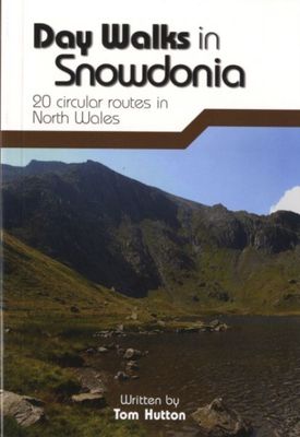
Wandelgids Day Walks in Snowdonia | Vertebrate Publishing

0
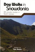
Day Walks in Snowdonia showcases 20 circular routes, between 5.5 and 12 miles (9km and 19km) in length, suitable for hillwalkers of all abilities. Additionally included in a Bonus Section are two of the UK's classic scrambles: The Bochlwyd Horseshoe and The Snowdon Horseshoe. The routes are split into three areas - Northern Snowdonia, Central Snow...

Webshops met dit product

Webshop
Bezorging
Prijs
DeZwerver.nl logo
DeZwerver.nl
niet bekend
20,95

Anderen bekeken ook

Wandelgids Mountain Walks Yr Wyddfa/Snowdon | Vertebrate Publishing
Mountain Walks Yr Wyddfa/Snowdon by Kate Worthington is a guide to walking routes to the summit of Yr Wyddfa in Eryri (Snowdonia). Alongside the summit routes, there are also lower-level alternatives for mixed weather or shorter days and those new to mountain walking.   Among the 15 inspiring routes, the classics are all included, such as the Yr Wyddfa/Snowdon Horseshoe via the grade-1 scramble of Crib Goch, and even those who are familiar with the area will find new and imaginative route ideas to discover. Whether you aspire to climb Yr Wyddfa on a straightforward route, or you’re looking for a bigger adventure, this is the only guidebook you need.   Together with stunning photography, each route features: Ordnance Survey 1:25,000 maps; easy-to-follow, detailed directions; essential info about public transport and safety advice; details about the terrain and navigation; facilities, refreshments and points of interest; and downloadable GPX files.
20,95
Wandelgids Day Walks in the Lake District | Vertebrate Publishing
Day Walks in the Lake District features 20 circular routes between 5 and 13 miles (8 and 21 kilometres) in length, suitable for hillwalkers of all abilities. The routes are split into four geographical areas - north, east, south and west - and include walks from the main tourist bases, such as Keswick and Ambleside, as well as sought after peaks, such as Scafell Pike, Great Gable, Blencathra and Helvellyn. Also included for the adventurous are the Lake District's best known scrambles - Striding Edge on Helvellyn and Sharp Edge on Blencathra - together with more accessible alternatives.   The author of this guidebook, Stephen Goodwin, is a former freelance journalist (former staff writer for The Independent), and a Lake District local. In his introductions to each route he recalls the tales of Wordsworth, Walpole and the fascinating history of Lakeland and its peaks and fells. Each route in this guide is described with easy-to-follow directions and details of distance, navigation infor…
20,95
Wandelgids Mountain Walks Yorkshire Three Peaks: | Vertebrate Publishing
Mountain Walks Yorkshire Three Peaks by Hannah Collingridge is a guide to walking routes on and around Pen-y-ghent, Ingleborough and Whernside in the Yorkshire Dales National Park. Alongside the routes to the peaks themselves, there are also valley walks for mixed-weather days and those new to hillwalking.   The routes explore the local area, visiting local caves and beauty spots and showcasing the stunning limestone scenery; even those who are familiar with the area will find new and imaginative route ideas to discover. Whether you aspire to walk in the southern Dales on a straightforward route, or you’re looking to take on the full Three Peaks challenge, this is the only guidebook you need.   Together with stunning photography, each route features Ordnance Survey 1:25,000 maps; easy-to-follow, detailed directions; downloadable GPX files; essential information about public transport and safety advice; details about the terrain and navigation; and information about facilities, refresh…
20,95
Wandelgids Snowdonia | Ordnance Survey
Everybody can explore Snowdonia, from England and Wales’ highest mountain to magical medieval castles and the spectacular Conwy coastline, with these accessible, family-friendly walks. Get outside and active with the whole family amidst the mysterious legends and natural beauty of Snowdonia.   Snowdonia Short Walks Made Easy include:   - Take Victorian tramcars or the chairlift to the summit of the Great Orme, then wander wildflower-rich meadows for incredible views of the mountains, the sea and the Isle of Anglesey - Follow the Lôn Gwyrfai trail round beautiful Llyn y Gader through Beddgelert Forest to the lovely village, with views of Snowdon and Y Garn throughout - Get off the beaten track in the valley of Cwm Penamnen with views of the cliffs of Moel Sabod and the 13th-century Dolwyddelan castle - Discover Porthmadog on a fascinating walk over Borth-y-Gest headland, the ingenious Cob and the salt marshes home to many seabirds - Explore Dolgellau and the riverside walk to Penmaenpo…
10,95
Wandelgids Peak Bagging | Vertebrate Publishing
Over fifty years ago, renowned British hillwalker and guidebook author Alfred Wainwright described 214 peaks in the English Lake District in his seven-volume illustrated Pictorial Guide to the Lakeland Fells. Like the Munros in Scotland, bagging all the Wainwrights has become a popular and significant challenge for walkers and runners, often taking many years in fits and starts because of the absence of a clear plan for how to link them together. With this problem in mind, Peak Bagging: Wainwrights by Karen and Dan Parker features forty-five routes designed to link up these iconic fells so you can enjoy the challenge of completing them at your own pace - over years, months or even just a few weeks.   It presents not only the most efficient routes for completing the Wainwrights as quickly as possible, but does so in such a way that each route is a fantastic walk or run in its own right. The featured routes include a round of the Scafells, and the Glenridding Horseshoe, taking in Helvel…
31,95
Wandelgids Day Walks in the Brecon Beacons | Vertebrate Publishing
Day Walks in the Brecon Beacons features 20 circular routes between 6.8 and 16.5 miles (11km and 16.6km) in length, suitable for hill walkers of all abilities. Local author and walker Harri Roberts shares his favourite walks in the region, including circuits in the hills around Llangors Lake, the Taf Fechan Skyline and Pen y Fan, and the Llanbedr Horseshoe. The routes are split into four areas - Blorenge and The Black Mountains, The Brecon Beacons, Mynydd Llangatwg and Mynydd Llangynidr, Fforest Fawr and The Black Mountain.   Each route features Ordnance Survey 1:25,000 maps, easy-to-follow directions, details of distance and navigation information, and refreshment stops and local information. The walks are illustrated with stunning photography by the author and outdoor photographer Adam Long.
20,95
Wandelgids Day Walks in the Yorkshire Dales | Vertebrate Publishing
Day Walks in the Yorkshire Dales is the fourth title in Vertebrate Publishing's series of compact and portable hillwalking guidebooks. This book showcases 20 circular walks in the Yorkshire Dales National Park, between 6 and 11 miles (10 and 17 kilometres) in length, suitable for hillwalkers of all abilities. The routes are split into three geographical areas - south, east, and north - and include walks to the Dales' most regarded beauty spots, such as Malham Cove, Gordale Scar, Brimham Rocks and Hardraw Force, as well as the trio of sought-after peaks Pen-y-ghent, Ingleborough and Whernside.   The author of this guidebook, Bernard Newman, is a freelance outdoor writer and photographer, and former editor of the internationally acclaimed Mountain magazine. A Yorkshire Dales local and graduate geologist, in his route descriptions he explores the incredible geology that has created the breathtaking scenery on show in the Dales. Each route in this guide is described with easy-to-follow di…
20,95
Reisgids - Wandelgids Wild Swimming Walks Eryri Snowdonia | Wild Things Publishing
Wild Swimming Walks Eryri Snowdonia leads you on 28 adventures in the soaring landscape of Eryri National Park in north Wales. Swim through secret valleys and find hidden waterfalls, exploring high lakes and woodland gorges. Complete with photos, maps and practical guidance, rich in local history and stories, this book will appeal to wild swimmers, family explorers, nature lovers and walkers alike. JOIN THE ADVENTURE with the best-selling Wild Swimming Walks series and explore Wales’s most popular National Park, from ancient rainforest waterfalls to hidden woodland valleys and serene mountain lakes.   Dip in blue lagoons under pinnacles of slate Glide along tranquil rivers beneath canopies of oak Plunge into jacuzzi pools with roaring chutes Float in a legendary lake beneath Yr Wyddfa/Snowdon’s peak Swim safari through a network of remote mountain lakes Including detailed directions, maps, stunning photography and downloadable route information to print out or take with you on…
20,95
Wandelgids Day Walks in Cornwall | Vertebrate Publishing
Day Walks in Cornwall features 20 circular routes between 7.2 and 13.7 miles (11.6km and 22km) in length, suitable for hillwalkers of all abilities. Researched and written by experienced authors Jen and Sim Benson, and covering the extremities of this stunning peninsula, the walks reach areas from Bude to the Isles of Scilly, and from Rame Head near Plymouth to Lizard Point on the southernmost tip. Taking advantage of the South West Coast Path, discover a unique view of the charming coastline at every turn in this Area of Outstanding Natural Beauty.   Explore Chapel Porth caves, and countless coves, archways and waterfalls, or simply immerse yourself in a leisurely stroll along white sands and blue waters. Head for the Merry Maidens stone circle in Lamorna, examine the serpentinite rock formations at Lizard Point, watch over medieval Tintagel Castle and parade past Cromwell's Castle. Find serenity overlooking St Enodoc's Church or soak up the vibe of trendy fishing village St Mawes, n…
20,95
Wandelgids Day Walks the North York Moors | Vertebrate Publishing
Day Walks on the North York Moors showcases 20 circular walks, between 5 and 13.7 miles (8 and 22 kilometres) in length, suitable for hillwalkers of all abilities. The routes are split into three areas - The Cleveland Hills and Hambleton Hills, Central Moors and Coastal Walks - and include walks to the most historic and beautiful areas of the Moors, including: Lord Stones, Wainstones and Clay Bank, Rievaulx Abbey, Blakey Ridge and Farndale, the Hole of Horcum, and the stunning coastline at Robin Hood's Bay and Ravenscar. The author of this guidebook, Tony Harker, is a Moors local and keen hillwalker.   Each route in this guide is described with easy-to-follow directions and details of distance, navigation information and refreshment stops, and is plotted on clear and easy to use Ordnance Survey 1:25,000 maps. The walks are illustrated with stunning photography by Adam Long. Also included is a detailed Appendix.
20,95

Klanten-reviews van Wandelgids Day Walks in Snowdonia | Vertebrate Publishing

Er zijn nog geen beoordelingen voor dit productBen jij de eerste die een review plaatst?

Meer over Wandelgids Day Walks in Snowdonia | Vertebrate Publishing

Productomschrijving

Day Walks in Snowdonia showcases 20 circular routes, between 5.5 and 12 miles (9km and 19km) in length, suitable for hillwalkers of all abilities. Additionally included in a Bonus Section are two of the UK's classic scrambles: The Bochlwyd Horseshoe and The Snowdon Horseshoe. The routes are split into three areas - Northern Snowdonia, Central Snowdonia and Southern Snowdonia - and include walks to the most iconic and beautiful peaks in the National Park, including; Snowdon, Y Glyderau, the Carneddau peaks, Moel Siabod, Cnicht, the Rhinogs, and Cadair Idris.   The author of this guidebook, Tom Hutton, is a Wales local, keen hillwalker and outdoors journalist. Each route in this guide is described with easy-to-follow directions and details of distance, navigation information, refreshment stops and public transport information, and is plotted on clear and easy to use Ordnance Survey 1:25,000 mapping. Also included is a detailed Appendix.

Verken gerelateerde categorieën

Webshop.nl maakt gebruik van cookies. Ga je verder op onze website, ga dan akkoord met het plaatsen van cookies en de verwerking van deze data door ons en vermelde partners.