webshop.nl
Categorieën
  Sluiten

Meer Vertebrate Publishing
Meer Vertebrate Publishing in Reisgidsen & talen boeken

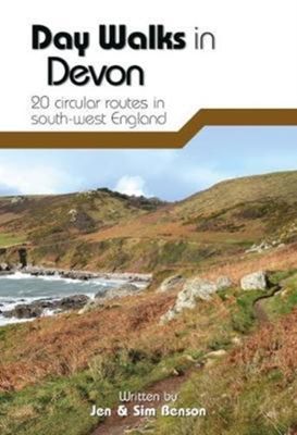
Wandelgids Day Walks in Devon | Vertebrate Publishing

0
Day Walks in Devon features 20 circular routes, between 8.8 and 17.6 miles (14.1km and 28.3km), suitable for hillwalkers of all abilities. The routes are split into five geographical areas: North Devon and Exmoor, Torridge and West Devon, Mid and East Devon, Dartmoor, and South Devon and the South Hams. Devon has some of the most diverse and beauti...

Webshops met dit product

Webshop
Bezorging
Prijs

Anderen bekeken ook

Wandelgids Day Walks in Devon | Vertebrate Publishing
Day Walks in Devon features 20 circular routes, between 8.8 and 17.6 miles (14.1km and 28.3km), suitable for hillwalkers of all abilities. The routes are split into five geographical areas: North Devon and Exmoor, Torridge and West Devon, Mid and East Devon, Dartmoor, and South Devon and the South Hams. Devon has some of the most diverse and beautiful terrain of any county in England.   Local authors Jen and Sim Benson share their favourite walks in the region, including coastal circuits taking in sections of the South West Coast Path past Baggy Point and Hartland Point; moorland loops of Dartmoor's granite tors such as Haytor and High Willhays; and tours through the county's rich history at Berry Pomeroy Castle and Castle Drogo. Together with stunning photography, each route features Ordnance Survey 1:25,000 maps, easy-to-follow directions, details of distance and navigation information, and refreshment stops and local information.
20,95
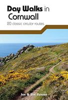
Wandelgids Day Walks in Cornwall | Vertebrate Publishing
Day Walks in Cornwall features 20 circular routes between 7.2 and 13.7 miles (11.6km and 22km) in length, suitable for hillwalkers of all abilities. Researched and written by experienced authors Jen and Sim Benson, and covering the extremities of this stunning peninsula, the walks reach areas from Bude to the Isles of Scilly, and from Rame Head near Plymouth to Lizard Point on the southernmost tip. Taking advantage of the South West Coast Path, discover a unique view of the charming coastline at every turn in this Area of Outstanding Natural Beauty.   Explore Chapel Porth caves, and countless coves, archways and waterfalls, or simply immerse yourself in a leisurely stroll along white sands and blue waters. Head for the Merry Maidens stone circle in Lamorna, examine the serpentinite rock formations at Lizard Point, watch over medieval Tintagel Castle and parade past Cromwell's Castle. Find serenity overlooking St Enodoc's Church or soak up the vibe of trendy fishing village St Mawes, ne…
20,95
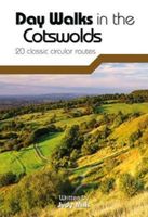
Wandelgids Day Walks in the Cotswolds | Vertebrate Publishing
Day Walks in the Cotswolds features 20 circular routes, between 7.1 and 12.6 miles (11.5km and 20.2km), suitable for hillwalkers of all abilities. Split across three areas - North-East Cotswolds, North-West Cotswolds and South Cotswolds - local author Judy Mills shares her favourite walks in this Area of Outstanding Natural Beauty. These walks take in a variety of local landmarks, including the World War II airfield and Roman villa at Chedworth; Neolithic long barrows such as Hetty Pegler's Tump; grand country estates like Badminton; magnificent Cotswold manor houses and historic churches; high points at Bredon Hill and North Nibley; and the many charming rural villages, such as the Duntisbournes and the Slaughters, for which the Cotswolds are famous.   Each route features Ordnance Survey 1:25,000 maps, easy-to-follow directions, details of distance and navigation information, and refreshment stops and local information. The walks are illustrated with stunning photography by outdoor ph…
20,95
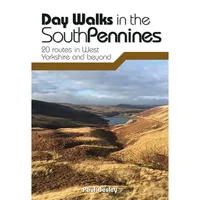
Wandelgids Day Walks in the South Pennines | Vertebrate Publishing
Day Walks in the South Pennines features 20 circular walks between 5 and 18 miles (8km and 29 km) in length, spread across West Yorkshire, Lancashire and Greater Manchester. Researched and written by knowledgeable and experienced author Paul Besley, the walks range from gentle rambles to more challenging day walks, all through striking and varied terrain. The routes are split into two geographical areas - Southern Walks, including routes around Dovestones, Ramsden Clough and Holmfirth; and Northern Walks, including routes around Hebden Bridge, Hardcastle Crags and Ilkley Moor.   Together with stunning photography, each route features Ordnance Survey 1:25,000 maps, easy-to-follow directions, details of distance and navigation information, and refreshment stops and local information.
20,95
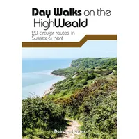
Wandelgids Day Walks on the High Weald | Vertebrate Publishing
Day Walks on the High Weald features 20 circular routes between 6.5 and 13.9 miles (10.5km and 22.4km) in length, spread across this Area of Outstanding Natural Beauty in the south-east of England. Local author Deirdre Huston has compiled her favourite walks in the region, which showcase the High Weald's rich history and varied landscape. Walk down old coach roads.   Clamber through deserted woodland and along riverbanks. March past castles and skirt battlefields. Linger in meadows and leap across Wealden streams.   See the countryside that inspired A.A. Milne and Rudyard Kipling. Visit Hastings Country Park, stroll around Bewl Water and through tranquil St Leonard's Forest.   Marvel at the Ouse Valley Viaduct and Bodiam castle, and consider the epic history of Battle and its surrounding landscape. Together with stunning photography, each route features Ordnance Survey 1:25,000 maps, easy-to-follow directions, details of distance and navigation information, and refreshment stops and lo…
20,95
Wandelgids Day Walks in the Lake District | Vertebrate Publishing
Day Walks in the Lake District features 20 circular routes between 5 and 13 miles (8 and 21 kilometres) in length, suitable for hillwalkers of all abilities. The routes are split into four geographical areas - north, east, south and west - and include walks from the main tourist bases, such as Keswick and Ambleside, as well as sought after peaks, such as Scafell Pike, Great Gable, Blencathra and Helvellyn. Also included for the adventurous are the Lake District's best known scrambles - Striding Edge on Helvellyn and Sharp Edge on Blencathra - together with more accessible alternatives.   The author of this guidebook, Stephen Goodwin, is a former freelance journalist (former staff writer for The Independent), and a Lake District local. In his introductions to each route he recalls the tales of Wordsworth, Walpole and the fascinating history of Lakeland and its peaks and fells. Each route in this guide is described with easy-to-follow directions and details of distance, navigation inform…
20,95
Wandelgids Day Walks on the Isle of Skye | Vertebrate Publishing
Day Walks on the Isle of Skye features 20 routes between 3.4 and 14.5 miles (5.5km and 23.3km) in length, spread across the Isle of Skye with one walk on the neighbouring Isle of Raasay. Researched and written by experienced and knowledgeable authors Helen and Paul Webster, founders of the Walkhighlands website, the walks explore the rugged mountains and wildlife-rich coastline of the islands.   The routes are split into four sections – Trotternish and the Braes; North-West Skye; Glen Brittle and Sligachan; and South Skye and the Isle of Raasay.   Together with stunning photography, each route features Ordnance Survey 1:25,000 maps, easy-to-follow directions, details of distance and navigation information, and refreshment stops and local information.
19,95

Klanten-reviews van Wandelgids Day Walks in Devon | Vertebrate Publishing

Er zijn nog geen beoordelingen voor dit productBen jij de eerste die een review plaatst?

Meer over Wandelgids Day Walks in Devon | Vertebrate Publishing

Productomschrijving

Day Walks in Devon features 20 circular routes, between 8.8 and 17.6 miles (14.1km and 28.3km), suitable for hillwalkers of all abilities. The routes are split into five geographical areas: North Devon and Exmoor, Torridge and West Devon, Mid and East Devon, Dartmoor, and South Devon and the South Hams. Devon has some of the most diverse and beautiful terrain of any county in England.   Local authors Jen and Sim Benson share their favourite walks in the region, including coastal circuits taking in sections of the South West Coast Path past Baggy Point and Hartland Point; moorland loops of Dartmoor's granite tors such as Haytor and High Willhays; and tours through the county's rich history at Berry Pomeroy Castle and Castle Drogo. Together with stunning photography, each route features Ordnance Survey 1:25,000 maps, easy-to-follow directions, details of distance and navigation information, and refreshment stops and local information.

Productspecificaties

Artikelnummer(s)
Brand
Vertebrate Publishing

Verken gerelateerde categorieën

Webshop.nl maakt gebruik van cookies. Ga je verder op onze website, ga dan akkoord met het plaatsen van cookies en de verwerking van deze data door ons en vermelde partners.