Wandelgids Cumbria Coast | Pocket Mountains

0
Handige compacte wandelgids met 40 dagwandelingen. Deze gids bevat kleine kaartjes en leuke uitgebreide informatie over wat er langs de route te zien is. Much quieter than the nearby Lake District. This book features 40 short walks exploring the best the area has to offer. Look one way and marvel at the majesty of The Lake District's magnificent p...

Verkopers met dit product

Verkoper
Bezorging
Prijs
DeZwerver.nl logo
DeZwerver.nl
2,95
10,95

Anderen bekeken ook

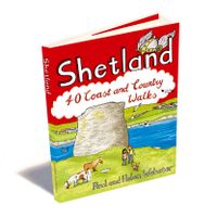
Wandelgids Shetland | Pocket Mountains
Handige compacte wandelgids met 40 dagwandelingen. Deze gids bevat kleine kaartjes en leuke uitgebreide informatie over wat er langs de route te zien is. Goede wandelkaarten zijn echter we noodzakelijk voor deze tochten: de Ordnance Survey explorer maps of Landanger maps zijn zeer geschikt. The most northerly of Britain's island groups, Shetland is so far removed from the rest of the UK that it usually appears as an inset on maps. Although relatively little known to those from outside the islands, Shetland is a magnificent terrain for walkers, especially those who love to really explore and get away from the beaten track. The coastal walking here includes some of the finest in the country, with superb cliffs, towering sea stacks, caves and natural arches seemingly around every corner. Added to this is Shetland's better known claim to fame for its spectacular seabird colonies, huge gannetries, moorland packed with arctic and great skuas, arctic terns in the more sheltered spots, and ev…
10,95
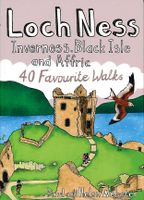
Wandelgids Loch Ness, Inverness, Black Isle and Affric | Pocket Mountains
Handige compacte wandelgids met 40 dagwandelingen. Deze gids bevat kleine kaartjes en leuke uitgebreide informatie over wat er langs de route te zien is. Goede wandelkaarten zijn echter we noodzakelijk voor deze tochten: de Ordnance Survey explorer maps of Landanger maps zijn zeer geschikt.   A guide to 40 favourite walks around Loch Ness, Inverness, Black Isle and Glen Affric. Loch Ness, with its legendary monster, is the most famous of all lochs. It holds more water than all the lakes of England and Wales combined and the countryside around it features an equally great variety of walks, with more waymarked trails and easy routes suitable for families than many other parts of the Highlands. Further north lies the magnificent Glen Affric - Scotland's most beautiful glen.   This is a wonderful area of the Highlands for walkers, having the highest mountains north of the Great Glen but also some splendid lower-level and forest walks. To the east is the fertile Black Isle, packed with cha…
10,95
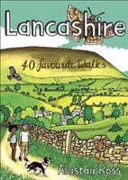
Wandelgids Lancashire | Pocket Mountains
Handige compacte wandelgids met 40 dagwandelingen. Deze gids bevat kleine kaartjes en leuke uitgebreide informatie over wat er langs de route te zien is. Goede wandelkaarten zijn echter we noodzakelijk voor deze tochten: de Ordnance Survey explorer maps of Landanger maps zijn zeer geschikt.   Don´t underestimate Lancashire! Although it is one of the UK¿s most populous counties, it is also largely a rural one, including no less than three Areas of Outstanding Natural Beauty and abutting the Pennines, Dales and Lake District. There is a huge variety of contrasting and inspiring walking country, from the coast to hills and from forests to moors. This collection of 40 favourite walks offers a remarkable range of excellent walking opportunities.
10,95
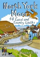
Wandelgids North York Moors | Pocket Mountains
Handige compacte wandelgids met 40 dagwandelingen. Deze gids bevat kleine kaartjes en leuke uitgebreide informatie over wat er langs de route te zien is. Goede wandelkaarten zijn echter we noodzakelijk voor deze tochten: de Ordnance Survey explorer maps of Landanger maps zijn zeer geschikt.   Designated a national park in 1952, the North York Moors include the largest area of heather upland in England, rising from the Vale of York and continuing to the North Sea coast where dramatic cliffs expose the geology that shaped this unique environment. This guide features 40 coast and country walks that take in the very best the moors have to offer - tranquil dales, stunning coastline, ancient woodlands, charming moorland villages and spectacular ruined castles and monasteries - as well as one of the UK's best heritage railways.
10,95
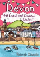
Wandelgids Devon | Pocket Mountains
Handige compacte wandelgids met 40 dagwandelingen. Deze gids bevat kleine kaartjes en leuke uitgebreide informatie over wat er langs de route te zien is. Goede wandelkaarten zijn echter wel aan te raden voor deze tochten: de Ordnance Survey explorer maps of Landranger maps zijn zeer geschikt. From the crumbly rhubarb-and-cream-coloured cliffs of the Jurassic Coast in the southeast to the surf-stroked craggy coves in the north, across the wilderness and woodland of Dartmoor and Exmoor, and through the verdant valleys and great green grazing lands of the dairy belt - Devon is a county of exquisite contrasts and natural wonder. Whether you're looking for an easy afternoon stroll along the shore, a riverside ramble to an atmospheric country pub or a tor-topping trek on the moors, there's something to suit every boot in Patrick Kinsella's inspiring collection of 40 Devon coast and country walks. Plaatsen in het boekje Axminster, Baggy Point, Beer, Berry Camp, Bigbury-on-Sea, Bishop’s Walk,…
10,95
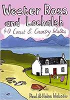
Wandelgids Wester Ross and Lochalsh | Pocket Mountains
Handige compacte wandelgids met 40 dagwandelingen. Deze gids bevat kleine kaartjes en leuke uitgebreide informatie over wat er langs de route te zien is. Goede wandelkaarten zijn echter we noodzakelijk voor deze tochten: de Ordnance Survey explorer maps of Landanger maps zijn zeer geschikt.     Wester Ross and Lochalsh are amongst the most popular areas for walks in the Scottish Highlands. The Lochalsh peninsula between the shores of Loch Duich and Loch Carron offers varied walking from villages such as Plockton as well as the region's main town at Kyle of Lochalsh. Across the dramatic Mam Ratagan pass is the remote and secluded Glenelg peninsula, a tranquil and peaceful haven far from busy routes.   Further north are Applecross and Lochcarron, with mountains that yield nothing in ruggedness to their more famous counterparts in Torridon, as well as attractive fishing villages and forest walks. Finally around Gairloch is an area that has long been famous for its fine sandy beaches, m…
10,95
Wandelgids The Welsh Marches | Pocket Mountains
Handige compacte wandelgids met 40 dagwandelingen. Deze gids bevat kleine kaartjes en leuke uitgebreide informatie over wat er langs de route te zien is. Goede wandelkaarten zijn echter we noodzakelijk voor deze tochten: de Ordnance Survey explorer maps of Landanger maps zijn zeer geschikt.     The tranquil borderland of the Marches, offers a varied landscape truncated by rivers meandering to lowland plains. Limestone to the west and north of the old red sandstone of the Hereford Plain has given rise to exceptionally attractive hilly country with delightful, narrow valleys. In these 40 walks Ben Giles explores all the best places to visit in this wonderful area of the country.  
10,95
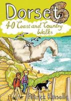
Wandelgids Dorset | Pocket Mountains
Handige compacte wandelgids met 40 dagwandelingen. Deze gids bevat kleine kaartjes en leuke uitgebreide informatie over wat er langs de route te zien is. Goede wandelkaarten zijn echter wel aan te raden voor deze tochten: de Ordnance Survey explorer maps of Landranger maps zijn zeer geschikt. From Old Harry Rocks, Lulworth Cove and Durdle Door, all along the shore of the Jurassic Coast to Lyme Regis, via the glowing summit of Golden Cap and the one-eyed winking lighthouse at Portland Bill, Dorset is a walkers’ wonderland.   The 40 routes in this book roam over hills and across heathland, go through forests and voluptuous valleys, trace ridgelines and precipitous cliffs, passing caves, castles, coves, country pubs and stunning viewpoints, to find vibrant villages and secret beaches. Here you’ll come face-to-face with history, walk with the words of Thomas Hardy ringing in your ears, witness wondrous wildlife and encounter all manner of cottage industries, from community cake- and marma…
10,95
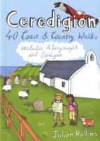
Wandelgids Ceredigion | Pocket Mountains
Handige compacte wandelgids met 40 dagwandelingen. Deze gids bevat kleine kaartjes en leuke uitgebreide informatie over wat er langs de route te zien is. Goede wandelkaarten zijn echter we noodzakelijk voor deze tochten: de Ordnance Survey explorer maps of Landanger maps zijn zeer geschikt. Encompassing the southern half of Cardigan Bay on the wild west coast of Wales, Ceredigion is famed for its glorious sandy beaches, dramatic sea cliffs and caves, spectacular sunsets and a wonderful array of wildlife, including the largest colony of bottlenose dolphins in Europe. Away from the sea, rolling farmland, fertile river valleys and characterful market towns give way to the brooding Cambrian Mountains, the main watershed of Wales. As one of the least populated regions of Wales, there is plenty of room to walk and in these 40 rambles Julian Rollins leads you through the best countryside and seascapes Ceredigion has to offer.
10,95
Wandelgids The Cotswolds | Pocket Mountains
Handige compacte wandelgids met 40 dagwandelingen. Deze gids bevat kleine kaartjes en leuke uitgebreide informatie over wat er langs de route te zien is. Goede wandelkaarten zijn echter we noodzakelijk voor deze tochten: de Ordnance Survey explorer maps of Landanger maps zijn zeer geschikt.   From upland outlooks and secret valleys to rolling pastures and honey stone villages, nature and history weave together in the Cotswolds to create a landscape that is the epitome of rural England. In these 40 walks Dominic North unlocks the secrets of the Cotswolds, from the hills and lanes in the north to the languid riverbanks and ancient woods of the south. Along the way discover sleepy villages, grand country houses and architectural curiosities, and then reach out to explore three of England's most celebrated cities, Bath, Oxford and Stratford-upon-Avon. Plaatsen in het boekje Bath, Bathampton, Batsford, Belas Knap, Bibury, Blenheim Park, Blockley, Bourton-on-the-Hill, Bourton-on-the-Water, …
10,95

Klanten-reviews van Wandelgids Cumbria Coast | Pocket Mountains

Er zijn nog geen beoordelingen voor dit productBen jij de eerste die een review plaatst?

Meer over Wandelgids Cumbria Coast | Pocket Mountains

Productomschrijving

Handige compacte wandelgids met 40 dagwandelingen. Deze gids bevat kleine kaartjes en leuke uitgebreide informatie over wat er langs de route te zien is.

Much quieter than the nearby Lake District. This book features 40 short walks exploring the best the area has to offer. Look one way and marvel at the majesty of The Lake District's magnificent peaks, the other to find tranquil sea views of the Isle of Man and Southern Scotland (weather permitting).

Verken gerelateerde categorieën

Webshop.nl maakt gebruik van cookies. Ga je verder op onze website, ga dan akkoord met het plaatsen van cookies en de verwerking van deze data door ons en vermelde partners.