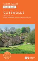
Wandelgids Cotswolds | Ordnance Survey

0
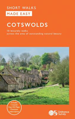
Explore ten easy-paced, family-friendly short walks across the Cotswolds Area of Outstanding Natural Beauty. Originating from a Saxon term meaning ‘wooded hollows, amid gentle hills’, the AONB straddles six counties, and is best known for its honey-coloured stone cottages, lush rolling hills, and deeply-cut wooded valleys. Walks explore quieter co...

Verkopers met dit product

Verkoper
Bezorging
Prijs
DeZwerver.nl logo
DeZwerver.nl
2,95
12,95

Anderen bekeken ook

Wandelgids Cotswolds | Ordnance Survey
Explore ten easy-paced, family-friendly short walks across the Cotswolds Area of Outstanding Natural Beauty. Originating from a Saxon term meaning ‘wooded hollows, amid gentle hills’, the AONB straddles six counties, and is best known for its honey-coloured stone cottages, lush rolling hills, and deeply-cut wooded valleys. Walks explore quieter corners of the region, covering fine gardens, rivers, parkland, and charming villages.       What to expect from Cotswolds Short Walks Made Easy:   • For quintessential Cotswold views, follow the trail from Broadway, escaping the crowds up a gently sloping hill to a sleepy hamlet and tempting tearooms   • Take a stroll down the magnificent Broad Ride in Cirencester Park, briefly enjoying the beautiful Roman town of Cirencester   • Have your camera ready to snap the country’s most photographed cottages at Arlington Row, whilst on an outing from Bibury   • Admiring formal gardens at the stately homes of Sudeley Castle and Blenheim Palace, you can…
12,95
Wandelgids 006 Pathfinder Guides Cotswolds | Ordnance Survey
180 miles of wonderful walking in idyllic, limestone countryside . . .   Take a journey on 28 beautiful walks across the Cotswolds with the OS Pathfinder Guidebooks, graded by length and ranging from 3 to 10 miles.   All walks in this book include written directions, an extract of the OS map for the area and some background on the history and natural environment you see. Most of the walks avoid busy roads and are designed to help you make the most of a holiday or day trips. There are notes on parking, pubs, and things to see en route.   The routes range from extended strolls to longer hikes, something for all levels! Each walk includes a detailed description, an OS map, GPS waypoints and notes of key features and things to see.   This is one of a series of books with great walking routes covering the most popular and scenic areas of Britain. Printed with weather-resistant covers featuring durable rounded corners, they are the perfect companion for country walking throughout Britain.  …
18,50
Wandelgids Walking in the Cotswolds | Cicerone
A guidebook to 30 circular walks in the Cotswolds, the largest Area of Outstanding Natural Beauty in England. Ranging from 4 to 12 miles in length, the routes are graded from easy to strenuous, offering something for every walker. Fourteen of the routes described include sections of the Cotswold Way National Trail, a 102-mile walk that winds its way from Chipping Campden to Bath.   Step-by-step route descriptions are accompanied by 1:50,000 mapping. There is plenty of information on the many points of interest passed en route, including Roman ruins, ancient stone circles, Neolithic long barrows and historic villages. Also included is a useful route table summary, information on accommodation, and details on the region’s geology, landscape, plants and wildlife.   Covering 790 square miles, the Cotswolds is home to lush green hills, picturesque valleys and beautiful beech woodlands. The impressive Edge – a remarkable limestone escarpment – offers ethereal views across the Vales of the S…
20,50
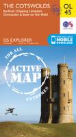
Wandelkaart - Topografische kaart OL45 OS Explorer Map The Cotswolds | Ordnance Survey
Met zijn 4cm voor 1 km (2 ½ cm voor 1 mijl) schaal, is de OS Outdoor Leisure kaartenserie de ideale en meest gedetailleerde kaartenreeks voor mensen die graag outdoor-activiteiten zoals fietsen, wandelen, paardrijden, klimmen en watersporten.   Deze kaart is nog gedetailleerder dan de 'gewone' Landranger maps. Voor- en achterzijde bedrukt! Zeker op de moors en andere natuurgebieden van onschatbare waarden met echt alle aspecten van het landschap op de kaart ingetekend. Zeer goede detailkaart met topografische ondergrond. Hierop zijn toeristische symbolen van bezienswaardigheden ingetekend, daarnaast staan bijvoorbeeld campings en jeugdherbergen vermeld en - voor wandelaars het belangrijkst - alle right of way paden en Lange afstands Wandelpaden zijn er op te vinden. De ideale kaart voor het wandelen in Engeland, Wales of Schotland.   These highly detailed maps show all the administrative boundaries, settlements as small as isolated farms, the road network down to unfenced roads and co…
19,50
Wandelkaart - Topografische kaart 45 OS Explorer Map | Active The Cotswolds | Ordnance Survey
Met zijn 4cm voor 1 km (2 ½ cm voor 1 mijl) schaal, is de OS Outdoor Leisure kaartenserie de ideale en meest gedetailleerde kaartenreeks voor mensen die graag outdoor-activiteiten zoals fietsen, wandelen, paardrijden, klimmen en watersporten.   Deze kaart is nog gedetailleerder dan de 'gewone' Landranger maps. Voor- en achterzijde bedrukt! Zeker op de moors en andere natuurgebieden van onschatbare waarden met echt alle aspecten van het landschap op de kaart ingetekend. Zeer goede detailkaart met topografische ondergrond. Hierop zijn toeristische symbolen van bezienswaardigheden ingetekend, daarnaast staan bijvoorbeeld campings en jeugdherbergen vermeld en - voor wandelaars het belangrijkst - alle right of way paden en Lange afstands Wandelpaden zijn er op te vinden. De ideale kaart voor het wandelen in Engeland, Wales of Schotland.   These highly detailed maps show all the administrative boundaries, settlements as small as isolated farms, the road network down to unfenced roads and co…
25,95
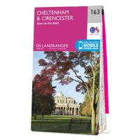
Wandelkaart - Topografische kaart 163 Landranger Cheltenham & Cirencester, Stow-on-the-Wold - Cotswolds | Ordnance Survey
Zeer goede detailkaart met topografische ondergrond. Kleurgebruik is goed over nagedacht: bijzonder goed leesbaar en helder kaartbeeld. Hierop zijn toeristische symbolen van bezienswaardigheden ingetekend, daarnaast staan bijvoorbeeld campings en jeugdherbergen vermeld en - voor wandelaars het belangrijkst - alle right of way paden en Lange afstands Wandelpaden zijn er op te vinden. De ideale kaart voor het wandelen in Engeland, Wales of Schotland. De kaarten zijn te gebruiken met GPS (UTM OSGB36), de legenda is in het Engels, Frans en Duits.    Plaatsen op deze kaart: Cheltenham, Cirencester, Stow-on-the-Wold, Northleach, Burford, Carterton, Lechlade on Thames, Fairford, Farringdon, Highworth, Cricklade, Tetbury, Crudwell, Oaksey, Minety, Broad Blunsdon, Longcot, Whelford, South Cerney, Kemble, Tarlton, Rodmarton, Poulton, Bagendon, Barnsley, Quenington, Alvescot, Bibury, Winson, Chedworth, Aldsworth, Great Barrington, Serborne, Chalford, Bisley, Duntisbourne Abbots, Cranham, Colesbo…
19,50
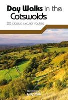
Wandelgids Day Walks in the Cotswolds | Vertebrate Publishing
Day Walks in the Cotswolds features 20 circular routes, between 7.1 and 12.6 miles (11.5km and 20.2km), suitable for hillwalkers of all abilities. Split across three areas - North-East Cotswolds, North-West Cotswolds and South Cotswolds - local author Judy Mills shares her favourite walks in this Area of Outstanding Natural Beauty. These walks take in a variety of local landmarks, including the World War II airfield and Roman villa at Chedworth; Neolithic long barrows such as Hetty Pegler's Tump; grand country estates like Badminton; magnificent Cotswold manor houses and historic churches; high points at Bredon Hill and North Nibley; and the many charming rural villages, such as the Duntisbournes and the Slaughters, for which the Cotswolds are famous.   Each route features Ordnance Survey 1:25,000 maps, easy-to-follow directions, details of distance and navigation information, and refreshment stops and local information. The walks are illustrated with stunning photography by outdoor p…
20,95
Reisgids Cotswolds | Rough Guides
Handige pocketgids met enkele auto- en wandelroutes.   Inspirational and informative new pocket guide, with free eBook, making the most of holidaying at home in the UK through clearly laid-out walks and tours.   Explore the best of the Cotswolds with this unique travel guide, packed full of insider information and stunning images. From making sure you don't miss out on must-see, top attractions like Stratford-upon-Avon, Cheltenham and Gloucester to discovering cultural gems including the stunning National Arboretum in Westonbirt, a picturesque hike along the Cotswold Way, and a typical Cotswold-stone manor house at Snowshill Manor, the easy-to-follow, ready-made walking and driving routes will save you time, and help you plan and enhance your staycation in the Cotswolds.   Features of this travel guide to the Cotswolds: - Eight walks and tours: detailed itineraries feature all the best places to visit, including where to eat along the way - Local highlights: discover the area's…
12,95
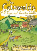
Wandelgids The Cotswolds | Pocket Mountains
Handige compacte wandelgids met 40 dagwandelingen. Deze gids bevat kleine kaartjes en leuke uitgebreide informatie over wat er langs de route te zien is. Goede wandelkaarten zijn echter we noodzakelijk voor deze tochten: de Ordnance Survey explorer maps of Landanger maps zijn zeer geschikt.   From upland outlooks and secret valleys to rolling pastures and honey stone villages, nature and history weave together in the Cotswolds to create a landscape that is the epitome of rural England. In these 40 walks Dominic North unlocks the secrets of the Cotswolds, from the hills and lanes in the north to the languid riverbanks and ancient woods of the south. Along the way discover sleepy villages, grand country houses and architectural curiosities, and then reach out to explore three of England's most celebrated cities, Bath, Oxford and Stratford-upon-Avon. Plaatsen in het boekje Bath, Bathampton, Batsford, Belas Knap, Bibury, Blenheim Park, Blockley, Bourton-on-the-Hill, Bourton-on-the-Water, …
10,95
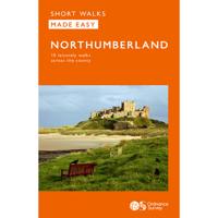
Wandelgids Northumberland | Ordnance Survey
Explore the castles and coast of Northumberland from Dunstanburgh to Hadrian’s Wall with ten walks suitable for all ages and abilities. Discover England’s most northerly county from the North Sea coast to the North Pennines on hand-picked, leisurely rambles for the whole family.   Northumberland Short Walks Made Easy include:   - Circle dramatic Bamburgh Castle, looking out to the Farne Islands from wildlife-rich dunes, and see the grave of lifeboat heroine Grace Darling - Enjoy the tranquility of secluded Wooler Common with its wealth of wildlife and ancient remains on the edge of the Cheviots - Start at picturesque Craster and follow the coast path to Dunstanburgh Castle, a rugged ruin perched on a rocky, wave-battered headland - Ramble the shores of Kielder Water, spot nesting ospreys and stumble upon the fascinating artworks in the forest - Follow Hadrian’s Wall from Cawfields near Haltwhistle to see the iconic Roman structure close up, with stunning views in both directions - Str…
10,95

Klanten-reviews van Wandelgids Cotswolds | Ordnance Survey

Er zijn nog geen beoordelingen voor dit productBen jij de eerste die een review plaatst?

Meer over Wandelgids Cotswolds | Ordnance Survey

Productomschrijving

Explore ten easy-paced, family-friendly short walks across the Cotswolds Area of Outstanding Natural Beauty. Originating from a Saxon term meaning ‘wooded hollows, amid gentle hills’, the AONB straddles six counties, and is best known for its honey-coloured stone cottages, lush rolling hills, and deeply-cut wooded valleys. Walks explore quieter corners of the region, covering fine gardens, rivers, parkland, and charming villages.       What to expect from Cotswolds Short Walks Made Easy:   • For quintessential Cotswold views, follow the trail from Broadway, escaping the crowds up a gently sloping hill to a sleepy hamlet and tempting tearooms   • Take a stroll down the magnificent Broad Ride in Cirencester Park, briefly enjoying the beautiful Roman town of Cirencester   • Have your camera ready to snap the country’s most photographed cottages at Arlington Row, whilst on an outing from Bibury   • Admiring formal gardens at the stately homes of Sudeley Castle and Blenheim Palace, you can relax in the Arts and Crafts-inspired planting at Hidcote   • The beautifully wooded valley of Woodchester Park and the ancient deer parkland at Cornbury offer away-from-it-all rambles   • Don’t miss the waterside wildlife-spotting opportunities along the Thames and Severn canal from Chalford       OS Short Walks Made Easy:   • 10 accessible walks suitable for the whole family – no walking experience needed!   • All routes are between 1½ to 4½ miles and can be completed all year round   • Know what to expect before you go: Information on locations of cafes/pubs and toilets, terrain, hilliness and accessibility for pushchairs and wheelchairs   • Large-scale Ordnance Survey maps for ultra-easy navigation and route-finding, featuring intuitive pictorial symbols   • Numbered points and route photographs which tie maps to route descriptions and walk profiles   • Enhance your adventure with stories behind each walk and nature notes   • Get active outside and enjoy the physical and mental health benefits

Productinformatie

    Verken gerelateerde categorieën

    Webshop.nl maakt gebruik van cookies. Ga je verder op onze website, ga dan akkoord met het plaatsen van cookies en de verwerking van deze data door ons en vermelde partners.