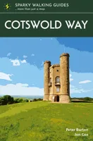
Wandelgids Cotswold Way | Sparky Books

0
The beauty of the Cotswolds is in no way lessened by its popularity, and the Cotswold Way leads you through the best of this most comforting of regions. The trail follows a snaking path along the western edge of the hills for 102 miles, from the pristine market town of Chipping Campden to the stately city of Bath – through deep-cut valleys and ove...

Verkopers met dit product

Verkoper
Bezorging
Prijs
DeZwerver.nl logo
DeZwerver.nl
2,95
20,95

Anderen bekeken ook

Wandelgids Cotswold Way | Sparky Books
The beauty of the Cotswolds is in no way lessened by its popularity, and the Cotswold Way leads you through the best of this most comforting of regions. The trail follows a snaking path along the western edge of the hills for 102 miles, from the pristine market town of Chipping Campden to the stately city of Bath – through deep-cut valleys and over beech-clad hills, across open pasture and past ancient barrows. You are never far from a view of the Severn Vale and the Welsh hills, or from a welcoming pub in a village of amber-hued stone.  * the latest 1:25,000 OS mapping, with the trail highlighted so you can see it at a glance * information nuggets throughout bring the countryside alive – past and present, seen and unseen * a handy slip-into-your-pocket design, with cover flaps to mark your page * planning info – practical help to plan your hike, including an overview map of the whole trail * stage descriptors, giving you an overview of what to expect on each leg * accommodation ideas…
20,95
Wandelgids Cotswold Way | Trailblazer Guides
Goede wandelgids van de hele route van Chipping Campden naar Bath. Met veel details zijn alle etappes beschreven. Tevens informatie over overnachtingen en openbaar vervoer. All-in-one hiking route guide and maps for the Cotswold Way, a 102-mile National Trail that runs from Chipping Campden to Bath, following the beautiful Cotswold escarpment, this is the fully revised and updated 4th edition. The trail leads through quintessentially English countryside with little villages of honey-coloured stone to the well-known town of Bath. Includes:   * 44 large-scale maps at just under 1:20,000 (3 1/8 inches to 1 mile) - showing route times, places to stay, points of interest and much more and trail profiles;   * 8 town plans - Chipping Campden, Broadway, Winchcombe, Cheltenham, Painswick, Dursley, Wotton-under-Edge, and the city of Bath and 8 overview maps.   * Full details of all accommodations and campsites, teashops, restaurants and pubs with reviews.   * Itineraries for all walkers - wheth…
21,95
Wandelgids South Downs Way | Sparky Books
The magnificent South Downs Way traverses the chalk hills of Hampshire and Sussex for 100 miles between Winchester and Eastbourne, building in drama from west to east. Cosy rolling countryside, wooded escarpment slopes and rolling grassland downs - this national trail has it all, including the dazzling spectacle of the world-famous Seven Sisters and Beachy Head. Walk with the ghosts of our prehistoric ancestors across an arrestingly empty landscape, with breath-catching views at almost every step.  * the latest 1:25,000 OS mapping, with the trail highlighted so you can see it at a glance * information nuggets throughout bring the countryside alive – past and present, seen and unseen * a handy slip-into-your-pocket design, with cover flaps to mark your page * planning info – practical help to plan your hike, including an overview map of the whole trail * stage descriptors, giving you an overview of what to expect on each leg * accommodation ideas – B&Bs, hotels, pubs and campsites clos…
20,95
Wandelgids The Cotswold Way | Cicerone
Uitstekende wandelgids van de Cotswolds Way, waarbij naast alle noodzakelijke informatie ook gebruik gemaakt wordt van de echte topografische kaart. inclusief gidsje met routekaarten van 1:25000 (deze is hier ook los te bestellen) Guidebook to walking the 102 mile (163km) Cotswold Way National Trail between Chipping Campden and Bath, across the Cotswolds AONB. The guidebook - which includes both a guide to the route and a separate OS 1:25,000 map booklet - describes the route in both directions.   The route is described over 13 stages, each following the Cotswold escarpment, with dramatic and far-reaching views across the Severn Vale towards the Welsh hills, plunging down to visit honey-coloured villages, old market towns and the elegant and historic city of Bath. The longest of the 13 stages is 10 miles, the shortest 6 miles: these are dictated by the existence of overnight accommodation. For the determined, the trail can be walked in as little as five days.   The Cotswold Way offers…
23,50
Wandelgids The Cotswold Way | Aurum Press
Goede beschrijving van de aantrekkelijke route. Kaartmateriaal van Ordnance Survey - de Engelse topografische dienst op een schaal van 1:25.000. Praktische info voor overnachten ed. niet altijd uitgebreid, maar die is op de site van de Ramblers (de engelse wandelorganisatie) te vinden. Following the limestone escarpment on the Western edge of the Cotswolds, the 102 miles of the Cotswold Way take the walker through a quintessentially English landscape as varied as it is beautiful.    Starting and finishing among the golden Cotswold stone of Chipping Camden and Bath, and affording stunning prospects of the Malvern Hills, the Forest of Dean and even the Black Mountains in Wales, it winds through rolling farmland, magnificent beech woodlands, and up over the austerely beautiful Cleeve Hill with its panoramic views out over Cheltenham and far beyond.    With a wealth of historic interest, from Neolithic burial mounds to Roman villas and country houses, this is genuinely a walk through the …
20,95
Wandelgids Trekking the Cotswold Way | Knife Edge Outdoor
The definitive two-way guide to the Cotswold Way: both southbound and northbound routes are described in full. Real Maps: Full Ordnance Survey mapping inside (1:25,000). All accommodation is numbered and marked on the maps. 18 different itineraries: schedules of 4, 5, 6, 7, 8, 9, 10, 11 and 12 days for hikers and runners. Includes both southbound and northbound itineraries. Difficult calculations of time, distance and altitude gain/loss are done for you. Also includes: - Detailed information on equipment and travelling light - Everything the trekker needs to know: route, costs, difficulty, weather, travel, and more - Full accommodation listings: the best inns, B&Bs and hotels - Detailed section on camping - What to see in the City of Bath - Essential info for both self-guided and guided trekkers - Information on history, plants and wildlife - Numbered waypoints linking the Real Maps to our clear descriptions The Cotswold Way travels 102 miles through the sublime scenery of the Cots…
22,50
Wandelgids The Ridgeway | Sparky Books
The Ridgeway - possibly the country’s oldest path - follows the central section of the mighty swathe of chalk that cuts across England from the Dorset to the Norfolk coasts. Between Avebury in Wiltshire and Ivinghoe Beacon in Buckinghamshire, it winds, undemandingly, for 87 miles along a trail of two halves, with the Thames providing its midpoint. The wide-open spaces of the bare North Wessex Downs are rich in prehistoric treasures and soul-cleansing views, while the Chilterns to the east are cosier, more populated, more heavily wooded. Step out and back in time on this classic ancient route.  * the latest 1:25,000 OS mapping, with the trail highlighted so you can see it at a glance * information nuggets throughout bring the countryside alive – past and present, seen and unseen * a handy slip-into-your-pocket design, with cover flaps to mark your page * planning info – practical help to plan your hike, including an overview map of the whole trail * stage descriptors, giving you an ove…
20,95
Wandelgids Cotswold Classic Walks | Goldeneye
Cotswold Classic Walks guide is a wonderful collection of 25 scenic, circular walks that will take you off the beaten track to discover the beautiful Cotswolds. Be prepared for some hills as you don your boots and enjoy a day or a weekend of fresh air, exercise and some much-needed freedom. We give you advice on which walks are best for kids, for dogs or a sumptuous pub lunch. If you’re after a great view or need some solitude, whatever you need, this book will guide you to find a walk that suits you. Discover bluebells in springtime, wonderful, hidden-away pubs, pushchair-friendly routes and peace and quiet in remote landscapes. The clear mapping and even clearer instructions will ensure you explore with confidence. Enjoy your time out with this wonderful Cotswold walking guide.
20,95
Wandelgids Capital Ring | Sparky Books
The Capital Ring traces a 78-mile loop between outer and inner London. Linking the city’s diverse communities and districts via green corridors, it provides a fascinating window into the ever-changing capital and the stories of those who have made it home. The variety is dizzying. Flitting between the urban and bucolic, you walk streets humble and high-class, across parks and woodlands, past palaces and factories, beside canals and rivers, taking in world-renowned sights and intriguing backwaters, and with frequent stunning views. No matter how well you think you know the metropolis, the Capital Ring will help you see London with fresh eyes. Guaranteed.   * super-clear OS town mapping, with the trail highlighted so you can see it at a glance * information nuggets throughout bring the city alive – past and present, seen and unseen * a handy slip-into-your-pocket design, with cover flaps to mark your page * planning info – practical help to plan your hike, including an overview map of t…
24,95
Wandelgids Cotswolds | Ordnance Survey
Explore ten easy-paced, family-friendly short walks across the Cotswolds Area of Outstanding Natural Beauty. Originating from a Saxon term meaning ‘wooded hollows, amid gentle hills’, the AONB straddles six counties, and is best known for its honey-coloured stone cottages, lush rolling hills, and deeply-cut wooded valleys. Walks explore quieter corners of the region, covering fine gardens, rivers, parkland, and charming villages.       What to expect from Cotswolds Short Walks Made Easy:   • For quintessential Cotswold views, follow the trail from Broadway, escaping the crowds up a gently sloping hill to a sleepy hamlet and tempting tearooms   • Take a stroll down the magnificent Broad Ride in Cirencester Park, briefly enjoying the beautiful Roman town of Cirencester   • Have your camera ready to snap the country’s most photographed cottages at Arlington Row, whilst on an outing from Bibury   • Admiring formal gardens at the stately homes of Sudeley Castle and Blenheim Palace, you can…
12,95

Klanten-reviews van Wandelgids Cotswold Way | Sparky Books

Er zijn nog geen beoordelingen voor dit productBen jij de eerste die een review plaatst?

Meer over Wandelgids Cotswold Way | Sparky Books

Productomschrijving

The beauty of the Cotswolds is in no way lessened by its popularity, and the Cotswold Way leads you through the best of this most comforting of regions. The trail follows a snaking path along the western edge of the hills for 102 miles, from the pristine market town of Chipping Campden to the stately city of Bath – through deep-cut valleys and over beech-clad hills, across open pasture and past ancient barrows. You are never far from a view of the Severn Vale and the Welsh hills, or from a welcoming pub in a village of amber-hued stone.  * the latest 1:25,000 OS mapping, with the trail highlighted so you can see it at a glance * information nuggets throughout bring the countryside alive – past and present, seen and unseen * a handy slip-into-your-pocket design, with cover flaps to mark your page * planning info – practical help to plan your hike, including an overview map of the whole trail * stage descriptors, giving you an overview of what to expect on each leg * accommodation ideas – B&Bs, hotels, pubs and campsites close to the path * links to inspirational resources – websites and books to help you dive deeper * flora & fauna – pictorial guides to nature’s riches along the trail

Productinformatie

    Verken gerelateerde categorieën

    Webshop.nl maakt gebruik van cookies. Ga je verder op onze website, ga dan akkoord met het plaatsen van cookies en de verwerking van deze data door ons en vermelde partners.