webshop.nl
Categorieën
  Sluiten

Meer Pocket Mountains
Meer Pocket Mountains in Literatuur boeken

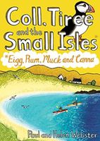
Wandelgids Coll, Tiree and the Small Isles | Pocket Mountains

0
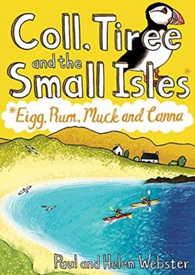
Handige compacte wandelgids met 40 dagwandelingen. Deze gids bevat kleine kaartjes en leuke uitgebreide informatie over wat er langs de route te zien is. Goede wandelkaarten zijn echter we noodzakelijk voor deze tochten: de Ordnance Survey explorer maps of Landanger maps zijn zeer geschikt.     Off the west coast of Scotland, south of the Isle of ...

Webshops met dit product

Webshop
Bezorging
Prijs

Anderen bekeken ook

Wandelgids Coll, Tiree and the Small Isles | Pocket Mountains
Handige compacte wandelgids met 40 dagwandelingen. Deze gids bevat kleine kaartjes en leuke uitgebreide informatie over wat er langs de route te zien is. Goede wandelkaarten zijn echter we noodzakelijk voor deze tochten: de Ordnance Survey explorer maps of Landanger maps zijn zeer geschikt.     Off the west coast of Scotland, south of the Isle of Skye and north of Mull and Ardnamurchan, the islands' of Coll and Tiree are the most westerly of the Inner Hebrides and have a reputation as being amongst Scotland's sunniest places. Together with the Small Isles archipelago of Eigg, Rum, Muck and Canna to the north, these Hebridean gems provide a remarkable range and variety of walking. The 36 routes in this book explore these six magical islands rich histories and thriving wildlife as well as the fine sandy beaches, awe-inspiring cliffs and coves, wild interiors and dramatic mountain ranges which make them so special.
10,95
Wandelgids Walking on Rum and the Small Isles - Schotland | Cicerone
A handy guidebook to walking and backpacking in the Western Isles of Scotland on Rum, Eigg, Muck, Canna, Coll and Tiree including a tough 55km backpack around the coast of Rum, a circuit of the Rum Cuillin and an ascent of An Sgurr (Eigg). 16 routes across all the islands suitable for a range of abilities exploring coasts, mountains and wilderness. The Small Isles, and the nearby Hebridean twins Coll and Tiree, offer adventurous walkers a fine range of routes, from the jagged volcanic peaks of the Cuillin on Rum to the beaches, dunes and machair pastures of its lower-lying neighbours. Many of the walks follow sublime coastlines, dotted with striking geological formations and teeming with wildlife.   Easier routes on Rum, along long-established paths, explore the National Nature Reserve with opportunities to spot deer, golden eagles, feral goats and Rum ponies along the way, and detailed information is included on each island's history, geology, wildlife, plants and flowers to help walk…
20,95
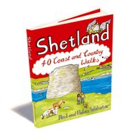
Wandelgids Shetland | Pocket Mountains
Handige compacte wandelgids met 40 dagwandelingen. Deze gids bevat kleine kaartjes en leuke uitgebreide informatie over wat er langs de route te zien is. Goede wandelkaarten zijn echter we noodzakelijk voor deze tochten: de Ordnance Survey explorer maps of Landanger maps zijn zeer geschikt. The most northerly of Britain's island groups, Shetland is so far removed from the rest of the UK that it usually appears as an inset on maps. Although relatively little known to those from outside the islands, Shetland is a magnificent terrain for walkers, especially those who love to really explore and get away from the beaten track. The coastal walking here includes some of the finest in the country, with superb cliffs, towering sea stacks, caves and natural arches seemingly around every corner. Added to this is Shetland's better known claim to fame for its spectacular seabird colonies, huge gannetries, moorland packed with arctic and great skuas, arctic terns in the more sheltered spots, and eve…
10,95
Wandelgids Walking on Rum and the Small Isles - Schotland | Cicerone
A handy guidebook to walking and backpacking in the Western Isles of Scotland on Rum, Eigg, Muck, Canna, Coll and Tiree including a tough 55km backpack around the coast of Rum, a circuit of the Rum Cuillin and an ascent of An Sgurr (Eigg). 16 routes across all the islands suitable for a range of abilities exploring coasts, mountains and wilderness. The Small Isles, and the nearby Hebridean twins Coll and Tiree, offer adventurous walkers a fine range of routes, from the jagged volcanic peaks of the Cuillin on Rum to the beaches, dunes and machair pastures of its lower-lying neighbours. Many of the walks follow sublime coastlines, dotted with striking geological formations and teeming with wildlife.   Easier routes on Rum, along long-established paths, explore the National Nature Reserve with opportunities to spot deer, golden eagles, feral goats and Rum ponies along the way, and detailed information is included on each island's history, geology, wildlife, plants and flowers to help walk…
20,95
Wandelgids Isle of Mull, Coll and Tiree | Hallewell Publications
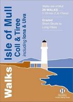
Rewalked and revised in 2015, Walks Isle of Mull, Coll & Tiree including Iona & Ulva includes walks on the Inner Hebridean island of Mull and the nearby islands. Mull is typified by spectacular coastal scenery and fine hill climbs, while the other islands are lower and gentler in character. The 29 walks featured range from 1 mile to 10.5 miles (1.6-17km). Routes on Mull include: Ben More, Carsaig Arches and two walks from Tobermory. The guide also features walks on the marvellous island of Ulva, two fine walks on Iona plus routes on the rugged island of Coll and the wide sand beaches of Tiree. Now on its 3rd edition, this guide is part of a popular series of A6 pocket walking guides which describe routes which are suitable for walkers of all abilities and to suit all tastes. Route descriptions are accompanied by 2-colour sketch maps. The guides are illustrated with line illustrations, and will provide walkers with a good introduction to what each area covered has to offer.
5,95
Wandelgids The Campsies and the Kilpatrick Hills | Pocket Mountains
Handige compacte wandelgids met 40 dagwandelingen. Deze gids bevat kleine kaartjes en leuke uitgebreide informatie over wat er langs de route te zien is. Goede wandelkaarten zijn echter we noodzakelijk voor deze tochten: de Ordnance Survey explorer maps of Landanger maps zijn zeer geschikt.   The Campsie Fells, along with the Kilpatrick, Kilsyth, Fintry and Gargunnock Hills, form a sprawling upland range which stretches eastwards from Dumbarton, passing to the north of the city of Glasgow and across the narrow waist of Scotland towards Stirling. It is often said that Glasgow is one of the easiest cities to get away from and the Campsies and theKilpatrick Hills, a few short miles north of the city, are the first port of call. This guide covers all of the major hills within both ranges, as well as low-level walks around and between the villages which lie on their perimeters.   Many of these 40 walks make use of both the West Highland Way and the John MuirWay which cut through the heart o…
10,95
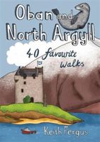
Wandelgids Oban and North Argyll | Pocket Mountains
This guidebook covers a large swathe of Mid and North Argyll, sweeping inland from the fractured western seaboard between Crinan and Appin to Arrochar and Bridge of Orchy on the region’s eastern periphery. Between these four points lies a landscape awash with sea lochs, with Inveraray roughly at the geographical centre. There are no large urban areas here and Oban is the largest settlement. Although the road network and public transport infrastructure are good, many routes feel off the beaten track. This is not only down to the low scattered population but also to the indented coast and its many islands, the sea lochs encroaching deep inland, the elongated freshwater lochs and the mountainous interior – making road travel much more convoluted than direct ‘as-the-crow-flies’ distances would suggest. As well as many great sea lochs, tumbling rivers and iconic mountains, Oban and North Argyll also boasts ancient, wildlife-rich woodlands and several fine gardens. Add to this the Crinan Can…
10,95

Klanten-reviews van Wandelgids Coll, Tiree and the Small Isles | Pocket Mountains

Er zijn nog geen beoordelingen voor dit productBen jij de eerste die een review plaatst?

Meer over Wandelgids Coll, Tiree and the Small Isles | Pocket Mountains

Productomschrijving

Handige compacte wandelgids met 40 dagwandelingen. Deze gids bevat kleine kaartjes en leuke uitgebreide informatie over wat er langs de route te zien is. Goede wandelkaarten zijn echter we noodzakelijk voor deze tochten: de Ordnance Survey explorer maps of Landanger maps zijn zeer geschikt.     Off the west coast of Scotland, south of the Isle of Skye and north of Mull and Ardnamurchan, the islands' of Coll and Tiree are the most westerly of the Inner Hebrides and have a reputation as being amongst Scotland's sunniest places. Together with the Small Isles archipelago of Eigg, Rum, Muck and Canna to the north, these Hebridean gems provide a remarkable range and variety of walking. The 36 routes in this book explore these six magical islands rich histories and thriving wildlife as well as the fine sandy beaches, awe-inspiring cliffs and coves, wild interiors and dramatic mountain ranges which make them so special.

Productspecificaties

Artikelnummer(s)
Brand
Pocket Mountains

Verken gerelateerde categorieën

Webshop.nl maakt gebruik van cookies. Ga je verder op onze website, ga dan akkoord met het plaatsen van cookies en de verwerking van deze data door ons en vermelde partners.