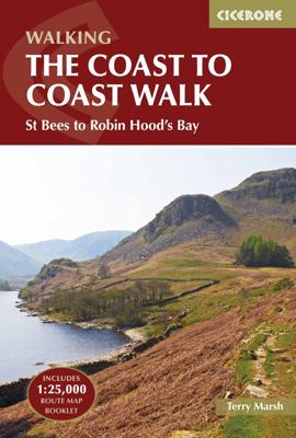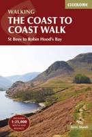
Wandelgids Coast to Coast Walk, From St Bees to Robin Hood's Bay | Cicerone

0
De beschrijving van de klassieke kust naar kust wandeling in het noorden van Engeland. Een van de mooiste en meest afwisselende wandeltochten van heel Engeland. Inclusief gidsje met routekaarten van 1:25000 First devised by Alfred Wainwright, the Coast to Coast Walk has emerged as a favourite among long-distance walkers. The route stretches some 1...

Verkopers met dit product

Verkoper
Bezorging
Prijs
DeZwerver.nl logo
DeZwerver.nl
2,95
23,95

Anderen bekeken ook

Wandelgids Coast to Coast Walk, From St Bees to Robin Hood's Bay | Cicerone
De beschrijving van de klassieke kust naar kust wandeling in het noorden van Engeland. Een van de mooiste en meest afwisselende wandeltochten van heel Engeland. Inclusief gidsje met routekaarten van 1:25000 First devised by Alfred Wainwright, the Coast to Coast Walk has emerged as a favourite among long-distance walkers. The route stretches some 185 miles (296km) from St Bees, an historic seaside village on Cumbria's west coast to Robin Hood's Bay in North Yorkshire. It is suitable for most fit walkers and can be comfortably walked in around a fortnight.   This guidebook presents the full route from west to east in 13 stages of 10½-20¾ miles (16.8-33.2km), with summaries covering the opposite direction. Alongside step-by-step route description, 1:100,000 mapping and fascinating notes about points of interest along the way, a comprehensive trek planner offers a helpful overview of facilities on route, and full accommodation listings and useful contacts can be found in the appendices. T…
23,95
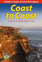
Wandelgids Coast to Coast Path: St Bees to Robin Hood's Bay | Trailblazer Guides
Goede wandelgids van de hele route van kust naar kust. Met veel details zijn alle etappes beschreven. Tevens informatie over overnachtingen en openbaar vervoer. All the information you need to enjoy your hiking adventure from Coast to Coast in this updated 10th edition. Fully re-walked and revised 10th edition of this classic 191-mile walk from the Irish Sea to the North Sea. Crossing three national parks - the Lake District, the Yorkshire Dales, and the North York Moors - it samples the very best of the English countryside - rugged mountains and lakes, gentle dales and stone-built villages; wild moorland; sea cliffs and fishing villages.   The guide includes:109 large-scale walking maps - at just under 1:20,000 - showing route times, places to stay, places to eat, points of interest, and 9 town plans14 colour stage maps to help plan your walk, including hills and descentsPlaces to stay with reviews - campsites, bunkhouses, hostels, B&Bs, pubs and hotelsPlaces to eat with reviews -…
19,95
Wandelgids The Andalucian Coast to Coast Walk - Andalusie | Cicerone
Wandelgids met goed beschreven etappes met veel praktische informatie om de route te kunnen lopen, inclusief redelijke kaarten. Kaartmateriaal is vrij beperkt, maar het is moeilijk om deze route geheel met kaarten te dekken, dan heb je er wel erg veel nodig. De beschrijvinen zijn echter best goed, met wat gepuzzel ter plekke is het prima te doen.  Guidebook to the Andalucian Coast to Coast Walk, a 440km, 21-day route from Maro on the Mediterranean coast to Bolonia, on the Atlantic. The route, which passes through 7 Natural Parks, links some of Andalucía's most beautiful villages and passes historical sites of both Roman and Moorish origins, including Ronda and Tarifa.   Seasons Seasons Andalucía's mild winter climate means that this is a region that is suited to year-round walking, apart from July and August when temperatures are generally too hot for comfortable hiking.   Centres Centres Frigiliana, Cómpeta, Alcaucín, Riogordo, Villanueva de la Concepción, El Chorro, Carratraca, El B…
20,95
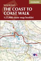
Wandelkaart The Coast to Coast Map Booklet | Cicerone
All the mapping you need to complete the 185-mile (296km) unwaymarked Coast to Coast Walk from St Bees in Cumbria to Robin Hood's Bay, North Yorkshire.   This booklet of Ordnance Survey 1:25,000 Explorer maps has been designed for convenient use on the trail. It shows the full line of the Coast to Coast Walk, along with the relevant extract from the OS Explorer map legend. It can be used when walking the trail west-east or east-west, and includes low-level and high-level options between Keld and Reeth. Conveniently sized for slipping into a jacket pocket or top of a rucksack, it comes in a clear PVC sleeve.   This booklet accompanies Cicerone's guidebook to the Coast to Coast Walk by Terry Marsh. The map booklet is INCLUDED with the guidebook.
13,95
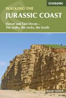
Wandelgids Jurassic Coast | Cicerone
The Jurassic Coast of Devon and Dorset, stretching between Exeter and Bournemouth, is a geological wonderland. Natural wonders like Chesil Beach, Durdle Door and fossils so numerous you'll be tripping over them, combine with southern England's rolling Downs, tiny villages, beaches and sunny summers to provide a stunning and awe-inspiring landscape to explore.   The 30 walks in this guide let walkers discover the best and most spectacular areas on the coast. The walks are between 5 and 25km (3 to 16 miles) and provide a range suitable for all abilities. The guide has been divided into areas: Devon's Red Beds, the Lias, Chesil Beach, Chalk walks (Lulworth and inland) and the Isle of Purbeck.    The geological descriptions are accompanied by strata diagrams, geological timelines, explanations of the creation of the various sedimentary rocks along the coast, and discussion of how and why the various formations formed millennia ago. The incredible - yet readable - detail brings these walks…
19,95
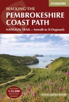
Wandelgids Walking the Pembrokeshire Coast Path | Cicerone
Engelstalige beschrijving van een mooie wandeltocht in Wales. De gids voldoet aan alle verwachtingen die je kunt hebben. Met apart gidsje met prima wandelkaarten.  This guidebook describes the Pembrokeshire Coast Path National Trail, a scenic 180-mile long-distance walk from Amroth, near Tenby, to St Dogmaels, north of Newport. The route, which takes roughly two weeks to complete, is divided into 14 stages of between 9 and 16 miles. Neither technically demanding nor difficult to navigate, the trail is suitable both for experienced distance walkers and those looking to cut their teeth on a long-distance route.   Detailed two-way route instructions are accompanied by 1:100,000 OS mapping. A route summary table and comprehensive trek planner are also included, with invaluable information on transport, accommodation and facilities en route. The guidebook is packed with interesting snippets of information about the places, landscapes and wildlife encountered along the way. It also includes…
25,95
Wandelgids Wales: The Ceredigion and Snowdonia Coast Paths | Cicerone
As part of the Wales Coast Path, the Ceredigion Coast Path and Snowdonia Coast Path trace a curve of 233km (145 miles) of coastal and inland walking down Cardigan Bay. This guidebook describes a 16-stage guide to the walk from Porthmadog to St Dogmaels covering the trail between the Llyn Peninsula and the Pembrokeshire Coast Path. .In 16 day stages from Porthmadog to St Dogmaels, this guidebook offers all the information walkers need to complete the 233km (145 miles) section of the Wales Coast Path that curve down Cardigan Bay, passing through a range of contrasting landscapes.   Six days are spent on the Snowdonia Coast Path, two around the Dyfi Estuary, seven on the Ceredigion Coast Path and one from Cardigan to St Dogmaels.   Linking the Llyn Peninsula Coast Path with that of the Pembrokeshire Coastal Path, this section takes in Snowdonia National Park’s splendid coastal plains, leads inland through beautiful hill country around the Dyfi Estuary and follows some of the finest coast…
18,50
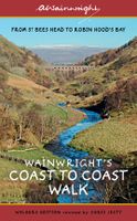
Wandelgids Wainwright's Coast to Coast Walk | Frances Lincoln
This is the first fully revised and updated edition of A. Wainwright's pocket-sized guide to the Coast to Coast Walk which he devised in the early 1970s. Over the years, this 190-mile walk -- from St. Bees Head on the Irish Sea by way of the Lake District, the Pennines, Swaledale, and the North York Moors, ending at Robin Hood's Bay on the North Sea -- has become one of the best-loved long-distance routes in the world. It has prompted countless enthusiasts to lace up their walking boots and follow Wainwright's example, and inspired a TV series, too. This brand-new edition of the Pictorial Guide contains Wainwright's hand-drawn route maps and his inimitable commentary, completely revised where necessary by Chris Jesty. The route is picked out in red for greater visibility on the page, and every step of the walk has been checked and updated.
23,50
Wandelgids The South West Coast Path | Cicerone
Goede wandelgids van het langste gemarkeerde wandelpad van Groot Brittanië; 1015 km! Uit de bekende Cicerone serie, dus met mooie foto's en duidelijke routebeschrijvingen en kaartjes. The South West Coast Path is Britain's longest way-marked trail, measuring a staggering 1015km (630 miles). Written by the well-known outdoor writer, Paddy Dillon, the guide provides a wealth of detailed knowledge to help tackle this immense route with confidence. It describes the way-marked trail from Minehead to Poole along the north Devon, Cornish and south Devon coastline to finish at Poole Harbour. A full introduction provides the route's historical background, advice on accommodation along the route and details on travelling to and around the South West.There is detailed information on how to use this guide to make the most of your walk, whether you choose to walk the whole route in one go or decide to achieve sections at intervals.Day-by-day route summaries accompany the 45-day stages and the fina…
24,95
Wandelgids Great Walks on the England Coast Path | Cicerone
Guidebook to 30 routes celebrating the best day and weekend walks on the England Coast Path, a new National Trail. Includes a varied selection of walks along the country's diverse shoreline, on cliff paths, estuaries, beaches and saltmarsh. Routes from 9 to 45km to suit all ages and abilities, many of which can be enjoyed all year round. At around 4500km (2800 miles), the England Coast Path is the longest coastal trail in the world. This inspirational large-format guide presents a handpicked selection of 30 highlight sections, offering a taste of England's stunning and diverse shoreline. Routes range from 9 to 45km, spanning between 3 hours and 2 days, offering options to suit all abilities. They can be accessed by public transport and are walkable year round (weather permitting!). Route descriptions are accompanied by 1:50,000 OS map extracts. Included in each walk are comprehensive listings of public transport, toilets and places to eat and drink, which highlight the excellent walki…
27,95

Klanten-reviews van Wandelgids Coast to Coast Walk, From St Bees to Robin Hood's Bay | Cicerone

Er zijn nog geen beoordelingen voor dit productBen jij de eerste die een review plaatst?

Meer over Wandelgids Coast to Coast Walk, From St Bees to Robin Hood's Bay | Cicerone

Productomschrijving

De beschrijving van de klassieke kust naar kust wandeling in het noorden van Engeland. Een van de mooiste en meest afwisselende wandeltochten van heel Engeland. Inclusief gidsje met routekaarten van 1:25000

First devised by Alfred Wainwright, the Coast to Coast Walk has emerged as a favourite among long-distance walkers. The route stretches some 185 miles (296km) from St Bees, an historic seaside village on Cumbria's west coast to Robin Hood's Bay in North Yorkshire. It is suitable for most fit walkers and can be comfortably walked in around a fortnight.   This guidebook presents the full route from west to east in 13 stages of 10½-20¾ miles (16.8-33.2km), with summaries covering the opposite direction. Alongside step-by-step route description, 1:100,000 mapping and fascinating notes about points of interest along the way, a comprehensive trek planner offers a helpful overview of facilities on route, and full accommodation listings and useful contacts can be found in the appendices. There is also a wealth of background information covering geology, history, wildlife and plants, and a list of further reading.   In addition, the guide INCLUDES a pocket-sized map booklet containing all the OS 1:25,000 mapping needed to complete the route, saving the need to carry numerous bulky maps.    The Coast to Coast Walk crosses three national parks – the Lake District, the Yorkshire Dales and the North York Moors – and is characterised by fantastic scenery, varied landscapes and great camaraderie among walkers. This guide is an ideal companion to discovering this captivating route, which was named by Country Walking magazine as the second best walk in the world!   Steden en Dorpen St Bees, Grasmere, Shap, Kirkby Stephen, Richmond, Ingleby Arncliffe, Grosmont, Whitby, Robin Hood's Bay

Productinformatie

    Verken gerelateerde categorieën

    Webshop.nl maakt gebruik van cookies. Ga je verder op onze website, ga dan akkoord met het plaatsen van cookies en de verwerking van deze data door ons en vermelde partners.