Wandelgids Cheshire | Pocket Mountains

0
Handige compacte wandelgids met 40 dagwandelingen. Deze gids bevat kleine kaartjes en leuke uitgebreide informatie over wat er langs de route te zien is. Goede wandelkaarten zijn echter we noodzakelijk voor deze tochten: de Ordnance Survey explorer maps of Landanger maps zijn zeer geschikt.   Full of surprises and infused with history, Cheshire is...

Verkopers met dit product

Verkoper
Bezorging
Prijs
DeZwerver.nl logo
DeZwerver.nl
2,95
10,95

Anderen bekeken ook

Wandelgids Cheshire | Pocket Mountains
Handige compacte wandelgids met 40 dagwandelingen. Deze gids bevat kleine kaartjes en leuke uitgebreide informatie over wat er langs de route te zien is. Goede wandelkaarten zijn echter we noodzakelijk voor deze tochten: de Ordnance Survey explorer maps of Landanger maps zijn zeer geschikt.   Full of surprises and infused with history, Cheshire is a wonderful place to go for a walk! From the wild and open hills of the Peaks to the low-lying pastures of the Plain, Cheshire is covered in a spider's web of footpaths, bridleways, towpaths and trails and is well served by welcoming pubs and cosy cafes. There is so much to see in this corner of England and there is no better way to explore it than by lacing up your boots and setting off on foot - armed of course with this selection of 40 circular walks.
10,95
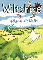
Wandelgids Wiltshire | Pocket Mountains
Handige compacte wandelgids met 40 dagwandelingen. Deze gids bevat kleine kaartjes en leuke uitgebreide informatie over wat er langs de route te zien is. Goede wandelkaarten zijn echter we noodzakelijk voor deze tochten: de Ordnance Survey explorer maps of Landanger maps zijn zeer geschikt.   The enigmatic Neolithic standing stones at Stonehenge and Avebury first drew footsore pilgrims to this landlocked area of Southern England more than 4000 years ago. Today there are scores of waymarked footpaths, bridleways and byways which connect the rolling downland, verdant valleys, white chalk horses, ancient settlements and vibrant historic towns of the 'great green county' of Wiltshire. This guide contains 40 circular routes which make the most of that network.   Most walks can be completed inside two or three hours, though some will require half a summer's day, with a few full-day routes along the downland ridges.
10,95
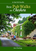
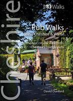
Wandelgids Best Pub Walks in Cheshire | Northern Eye Books
CHESHIRE IS WELL KNOWN for both its beautiful countryside and its country pubs. This fully revised and updated, 3rd edition of a classic guide book combines the two with superb walks through varied countryside, each one visiting a walker-friendly pub that is well known for its food and drink.   The 220-page book ideal for those with a connoisseur’s interest in Real Ale, and for walkers wanting a convenient starting point and route directions – plus some of the best pub lunches in Cheshire.   There are 30 circular walks included, covering the entire county from west to east and north to south. Each walk is graded in terms of mileage and difficulty — so families with young children can choose the easy ones, and enthusiasts can find more challenging routes to work up a thirst!
16,50
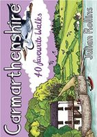
Wandelgids Carmarthenshire | Pocket Mountains
Handige compacte wandelgids met 40 dagwandelingen. Deze gids bevat kleine kaartjes en leuke uitgebreide informatie over wat er langs de route te zien is. Goede wandelkaarten zijn echter we noodzakelijk voor deze tochten: de Ordnance Survey explorer maps of Landanger maps zijn zeer geschikt.   Carmarthenshire is the largest of the old Welsh counties and nestles between Pembrokeshire and the Gower Peninsula in the heart of South West Wales. Its a land of contrasts; along the coast you'll walk close to the airy edge of tall cliffs, but there are beaches too, some so long you can't see an end to them. And sheltered estuaries, like the heron-priested shores at Laugharne that inspired the poet Dylan Thomas. Inland there are tucked-away valleys and castle-topped hills, open moorland, and ancient woodland that is fizzing with life.
10,95
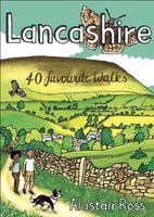
Wandelgids Lancashire | Pocket Mountains
Handige compacte wandelgids met 40 dagwandelingen. Deze gids bevat kleine kaartjes en leuke uitgebreide informatie over wat er langs de route te zien is. Goede wandelkaarten zijn echter we noodzakelijk voor deze tochten: de Ordnance Survey explorer maps of Landanger maps zijn zeer geschikt.   Don´t underestimate Lancashire! Although it is one of the UK¿s most populous counties, it is also largely a rural one, including no less than three Areas of Outstanding Natural Beauty and abutting the Pennines, Dales and Lake District. There is a huge variety of contrasting and inspiring walking country, from the coast to hills and from forests to moors. This collection of 40 favourite walks offers a remarkable range of excellent walking opportunities.
10,95
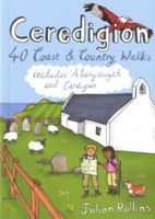
Wandelgids Ceredigion | Pocket Mountains
Handige compacte wandelgids met 40 dagwandelingen. Deze gids bevat kleine kaartjes en leuke uitgebreide informatie over wat er langs de route te zien is. Goede wandelkaarten zijn echter we noodzakelijk voor deze tochten: de Ordnance Survey explorer maps of Landanger maps zijn zeer geschikt. Encompassing the southern half of Cardigan Bay on the wild west coast of Wales, Ceredigion is famed for its glorious sandy beaches, dramatic sea cliffs and caves, spectacular sunsets and a wonderful array of wildlife, including the largest colony of bottlenose dolphins in Europe. Away from the sea, rolling farmland, fertile river valleys and characterful market towns give way to the brooding Cambrian Mountains, the main watershed of Wales. As one of the least populated regions of Wales, there is plenty of room to walk and in these 40 rambles Julian Rollins leads you through the best countryside and seascapes Ceredigion has to offer.
10,95
Wandelgids Cheshire & Wirral Pub Walks | Northern Eye Books
These attractive and cleverly structured guides will give walkers ten of the best themed short circular walks to Cheshire's finest pubs. With clear information, an overview and introduction for each walk, expertly written directions, large scale Ordnance Survey maps, superb photographs, and interpretation of points of interest along the way, these guides set a new standard in clarity and ease-of-use. Featured walks in Cheshire Pub Walks include: Brewery Tap, West Kirby; Harp Inn, Neston; Ring o' Bells, Frodsham; George and Dragon, Great Budworth; Boot Inn, Kelsall; Pheasant Inn, Burwardsley; Swan, Marbury; Swan Inn, Wybunbury; White Lion, Barthomley and the Ship Inn, Wincle.  
10,95
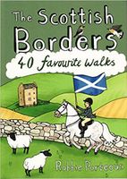
Wandelgids The Scottish Borders | Pocket Mountains
Handige compacte wandelgids met 40 dagwandelingen. Deze gids bevat kleine kaartjes en leuke uitgebreide informatie over wat er langs de route te zien is. Goede wandelkaarten zijn echter we noodzakelijk voor deze tochten: de Ordnance Survey explorer maps of Landanger maps zijn zeer geschikt.   The Scottish Borders cover a vast area, stretching from the east coast to rural Dumfriesshire and from the more populous Lothians to the border with England. Although there are no very high mountains, the Borders have always attracted walkers keen to explore the quiet moorlands, rolling hills, ancient woodland and rugged coast, as well as the romantic ruins of abbeys and castles, grand estates and rich literary heritage of the area.Ancient native tribes and Roman legions left their mark on this landscape, as did years of fierce warfare with our southern neighbours and raiding by ruthless Border Reivers. These 40 walks will introduce you to some of the fascinating history which shaped this most in…
10,95
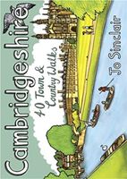
Wandelgids Cambridgeshire | Pocket Mountains
Handige compacte wandelgids met 40 dagwandelingen. Deze gids bevat kleine kaartjes en leuke uitgebreide informatie over wat er langs de route te zien is. Goede wandelkaarten zijn echter we noodzakelijk voor deze tochten: de Ordnance Survey explorer maps of Landanger maps zijn zeer geschikt.   With its hallowed streets, glorious colleges and peaceful riverside walks along the Cam, Cambridge is the jewel in the crown of Cambridgeshire and a richly rewarding city to tour on foot. This is a big county, however, and it is well worth exploring the countryside beyond the glittering city. This guide takes you through the rich heritage of the county's market towns and pretty thatched-roofed villages, along old hilltop tracks and into ancient woodlands, full of interest and beauty. Cambridgeshire is also the lowest and flattest place in England and the straight roads, endless network of dykes and isoloted windmills of the fenlands have a stange minimalist magnetism which is hard to resist.
10,95
Wandelgids Galloway | Pocket Mountains
Handige compacte wandelgids met 40 dagwandelingen. Deze gids bevat kleine kaartjes en leuke uitgebreide informatie over wat er langs de route te zien is. Goede wandelkaarten zijn echter we noodzakelijk voor deze tochten: de Ordnance Survey explorer maps of Landanger maps zijn zeer geschikt.   Made up of the old counties of Wigtownshire and The Stewartry, Galloway covers a vast swathe of Scotland's quiet southwest corner. This under-discovered area offers 260km of coast, full of sandy beaches and towering cliffs, lonely heather-clad moors and quiet hills. Add to this plenty of wildlife, a rich artistic heritage, strong spiritual influences and a climate kissed by the warming Gulf Stream, and you have a region beckoning to be visited.
10,95

Klanten-reviews van Wandelgids Cheshire | Pocket Mountains

Er zijn nog geen beoordelingen voor dit productBen jij de eerste die een review plaatst?

Meer over Wandelgids Cheshire | Pocket Mountains

Productomschrijving

Handige compacte wandelgids met 40 dagwandelingen. Deze gids bevat kleine kaartjes en leuke uitgebreide informatie over wat er langs de route te zien is. Goede wandelkaarten zijn echter we noodzakelijk voor deze tochten: de Ordnance Survey explorer maps of Landanger maps zijn zeer geschikt.   Full of surprises and infused with history, Cheshire is a wonderful place to go for a walk! From the wild and open hills of the Peaks to the low-lying pastures of the Plain, Cheshire is covered in a spider's web of footpaths, bridleways, towpaths and trails and is well served by welcoming pubs and cosy cafes. There is so much to see in this corner of England and there is no better way to explore it than by lacing up your boots and setting off on foot - armed of course with this selection of 40 circular walks.

Productinformatie

    Verken gerelateerde categorieën

    Webshop.nl maakt gebruik van cookies. Ga je verder op onze website, ga dan akkoord met het plaatsen van cookies en de verwerking van deze data door ons en vermelde partners.