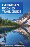
Wandelgids Canadian Rockies Trail Guide | Summerthought

0
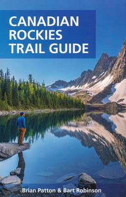
The best loved and most detailed Canadian Rockies hiking guidebook is now in full color.   First published in 1971 and now in its 10th edition, the Canadian Rockies Trail Guide was the original guidebook with accurate distances and detailed descriptions to the trails of the Canadian Rockies.   Whether you’re a Canadian Rockies local or a visitor, ...

Verkopers met dit product

Verkoper
Bezorging
Prijs
DeZwerver.nl logo
DeZwerver.nl
2,95
29,95

Anderen bekeken ook

Wandelkaart 14 Lake O'Hara | Gem Trek Maps
Mooie, gedetailleerde kaart uit de serie van Gem Trek Hiking map-guides, van het gebied Lake O'Hara.   Gem Trek's Lake O'Hara Map is a hiking and recreation map for the Lake O'Hara region of Yoho National Park in the Canadian Rockies.   Gem Trek's 1:20,000 Lake O'Hara Map is designed for visitors looking to explore one of the finest backcountry destinations in all of the Canadian Rockies. This map features detailed cartography, accurate hiking trails, and all the most significant natural features of the region. On the back are detailed descriptions of the most popular hiking trails with special emphasis given to the Lake O'Hara Alpine Circuit. Reaching Lake O'Hara, in Yoho National Park, requires advance planning and we help you with information needed to get to the destination, as well as lodge and campground details.   Map specs   Edition: 6th Scale: 1:20,000 Folded size: 4.5 x 9.5 inches Flat size: 18 x 24 inches Paper: Regular 80lb stock paper   Map coverage   This map covers the …
9,95
Reisgids Best Road Trips Canadian Rockies | Lonely Planet
Inside Lonely Planet's Canadian Rockies' Best Road Trips: Itineraries for classic road trips plus other lesser-known drives with expert advice to pick the routes that suit your interests and needs Full-color route maps - easy-to-read, detailed directions Detours - delightful diversions to see the Canadian Rockies' highlights along the way Link Your Trip - cruise from one driving route to the next Insider tips - get around like a local, avoid trouble spots and be safe on the road - local driving rules, parking, toll roads Stretch Your Legs - the best things to do outside the car Essential infoat your fingertips - hours of operation, phone numbers, websites, prices Honest reviews for all budgets - eating, sleeping, sightseeing, hidden gems that most guidebooks miss Lavish color photography provides inspiration throughout Covers the Icefield Parkway, Radium Hot Springs, Emerald Lake, Marble Canyon, Banff National Park, Spiral Tunnels, Yoho National Park, Lake Louise, Kootenay Lake, Kimb…
12,50
Reisgids British Columbia & the Canadian Rockies - Canada | Lonely Planet
De perfecte reisgids over British Columbia voor zowel de georganiseerde als de zelfstandige reiziger. Naast een algemene inleiding van het land / streek vol met praktische informatie over hoe je er het beste kunt reizen: slapen, eten, vervoer, excursies ... alles kun je er in vinden. Engelstalig. Lonely Planet's local travel experts reveal all you need to know to plan the trip of a lifetime to British Columbia & the Canadian Rockies.   Discover popular and off the beaten track experiences from searching for the world's rarest bear in the Great Bear Rainforest to sampling global street foods at the Richmond Night Market, and taking an authentic, indigenous-led fishing excursion in Haida Gwaii.   Build a trip to remember with Lonely Planet's British Columbia & the Canadian Rockies travel guide:   Our classic guidebook format provides you with the most comprehensive level of information for planning multi-week trips Updated with an all new structure and design so you can navigate…
24,95
Wandelkaart 07 Kananaskis Lakes | Gem Trek Maps
Waterproof and tear-resistant hiking and recreation map for the Kananaskis Lakes region of the Canadian Rockies   Gem Trek's Kananaskis Lakes Map is designed for hikers and outdoor enthusiasts looking to explore the south-central portion of Kananaskis Country immediately south of our Canmore and Kananaskis Village Map. Whether you are touring along the roads or heading into the backcountry, you'll find the waterproof and tear-resistant Kananaskis Lakes Map to be an invaluable tool.   This map features detailed cartography, accurate hiking trails with distances, and details such as logging roads, campgrounds, equestrian routes, picnic areas, and fire lookouts. On the back are descriptions of the most popular hiking trails, as well details of services such as campgrounds and visitor centres.   – Map scale: 1:50,000 – Sheet size: 27 x 39 inches – Folded size: 4.5 x 9.5 inches   Map Coverage   The Kananaskis Lakes Map covers Peter Lougheed Provincial Park, located off Highway 40 south of …
18,95
Wandelkaart 11 Banff Up-Close | Gem Trek Maps
Waterproof and tear-resistant hiking and recreation map for the town of Banff and surrounds in the Canadian Rockies.   Designed for both locals and visitors, Gem Trek’s 1:35,000 Banff Up-Close Map is a detailed relief-shaded topographic map of the Banff area. All hiking and biking trails are labeled, and distances are marked. Like all Gem Trek maps, the Banff Up-Close Map features detailed cartography and accurate hiking trails with distances, elevation gain, and directions to the trailhead noted. An inset on the back increases coverage of downtown Banff, with museums and all streets marked. Also on the flipside are descriptions of the sights, museums and scenic drives in Banff. We've also included a hand-picked list of the best seven walks and day hikes in the area. The highlights of each trail are noted, as well as distance, elevation gain and directions to the trailhead.   Map specs   Edition: 4th Scale: 1:35,000 Folded size: 4.5 x 9.5 inches Flat size: 18 x 24 inches Paper: Waterp…
13,95
Wandelkaart 15 Canmore Up-Close | Gem Trek Maps
Waterproof and tear-resistant hiking and recreation map for the town of Canmore and surrounds in the Canadian Rockies.   Designed for both locals and visitors, Gem Trek’s 1:35,000 Canmore Up-Close Map is a detailed relief-shaded topographic map of Canmore and the Bow Valley area. This edition has been updated to show all new subdivisions and recent changes to the trail network. On the back of the Canmore Up-Close Map are descriptions of recommended sights and detailed descriptions of the best and most scenic hiking and biking trails, including the highlights of each trail, as well as distance, elevation gain and directions to the trailhead. Also on the back of the map is an inset map of downtown Canmore and colour photos.   Map specs   Edition: 2nd Scale: 1:35,000 Folded size: 4.5 x 9.5 inches Flat size: 18 x 24 inches Paper: Waterproof and tear-resistant   Map coverage   The Canmore Up-Close Map focuses on the town of Canmore in the Canadian Rockies. The map boundary extends along th…
13,95
Wandelkaart 12 Jasper Up-Close | Gem Trek Maps
Water- en scheurvaste wandelkaart van Jasper. Met op de achterzijde een overzicht van de belangrijkste bezienswaardigheden.   Waterproof and tear-resistant hiking and recreation map for the town of Jasper and surrounds in the Canadian Rockies.   Designed for both locals and visitors, Gem Trek’s 1:35,000 Banff Up-Close Map is a detailed relief-shaded topographic map of the Jasper area. On the back of the Jasper Up-Close Map are descriptions of recommended sights, museums and scenic drives to make it easier to plan your day. We’ve also included a hand-picked list of the best six easy walks and day hikes in the area, noting the highlights of each trail, as well as distance, elevation gain and directions to the trailhead. Colour photos and three inset maps, including a town map of Jasper, accompany the descriptions of sights and hikes on the back of the map.   Map specs   Edition: 6th Scale: 1:35,000 Folded size: 4.5 x 9.5 inches Flat size: 18 x 24 inches Paper: Waterproof and tear-resist…
13,95
Wandelkaart 02 Columbia Icefield | Gem Trek Maps
Waterproof and tear-resistant hiking and recreation map for the Columbia Icefield region of the Canadian Rockies.   Updated with the latest satellite imagery of the icefield extent, Gem Trek's Columbia Icefield Map is designed for visitors looking to explore North America s largest icefield south of Alaska. Located beside the Icefields Parkway in Jasper National Park, the icefield is both spectacular and accessible. Whether you are touring along the parkway and taking an Ice Explorer out onto the Athabasca Glacier or heading off to explore the surrounding wilderness on foot, you'll find the waterproof and tear-resistant Columbia Icefield an invaluable tool for making the most of your visit.   The Columbia Icefield Map features detailed cartography, accurate hiking trails with distances, and details such as glacier flow direction and drainage routes. Campgrounds and highway viewpoints are also marked.   In addition to the map, this product is a user-friendly guide to the Columbia Icefi…
14,95
Wandelgids The Inca Trail - Cusco & Machu Picchu | Trailblazer Guides
Uitgebreide inleiding van de streek met veel aandacht voor geschiedenis, flora & fauna en tevens een stuk over Peru als geheel. Veel praktische informatie over de trekkings, een handleiding voor de ruïnes van Machu Picchu, uitgevoerd met veel schetskaarten. Engelstalig Fully revised 6th edition of this best-selling, all-in-one guide for hiking the Inca Trail. Includes Lima and Cusco city guides, route guide and maps for Classic Inca Trail, High Inca Trail, Salkantay, Choquequirao, Lares and Ausangate treks plus a full Machu Picchu guide. New for this edition   Lares Trek - with 9 maps and trail profile Ausangate Trek - with 10 maps and trail profile Lost to the jungle for centuries, Machu Picchu was rediscovered by Hiram Bingham 100 years ago.  It's now probably the most famous sight in South America – and justifiably so.  Perched high above the river on a knife-edge ridge, the ruins are truly spectacular.  The best way to reach them is on foot, following parts of the original paved I…
21,95
Reisgids Canadian Rockies, met Banff en Jasper NP | Moon Travel Guides
Uitstekende Amerikaanse reisgids van uitgever Moon. De gids is vergelijkbaar met Lonely Planet en Rough guide en is voor de backpacker - zelfstandige reiziger geschreven; toch is deze door de grote mate van details en achtergronden geschikt voor alle reizigers! De gids onderscheidt zich door gedegen en uitgebreide achtergrondinformatie over bijvoorbeeld natuur en cultuur. Snowy peaks, icy glaciers, glittering lakes, and alpine meadows: Answer the call of the wild with Moon Canadian Rockies. Inside you'll find: Strategic, flexible itineraries in the national parks, including a two-week Canadian Rockies road trip The best hikes in the Canadian Rockies: Find the right trek for you with details on length, elevation gains, difficulty levels, and trailheads Can't-miss outdoor experiences: Hike to incredible vistas and try to spot moose, bighorn sheep, wolves, and black bears. Soak in a natural hot spring after a day on the slopes or wander through meadows of colorful wildflowers. Ride ac…
20,95

Klanten-reviews van Wandelgids Canadian Rockies Trail Guide | Summerthought

Er zijn nog geen beoordelingen voor dit productBen jij de eerste die een review plaatst?

Meer over Wandelgids Canadian Rockies Trail Guide | Summerthought

Productomschrijving

The best loved and most detailed Canadian Rockies hiking guidebook is now in full color.   First published in 1971 and now in its 10th edition, the Canadian Rockies Trail Guide was the original guidebook with accurate distances and detailed descriptions to the trails of the Canadian Rockies.   Whether you’re a Canadian Rockies local or a visitor, the Canadian Rockies Trail Guide provides the best resource for hiking in the region, with everything from short interpretive trails to week-long backcountry treks. Now in its 10th edition and known affectionately as the “Bible” by outdoor enthusiasts, the popular tome is the most comprehensive and well-known guidebook to hiking in the region.   Having spent their entire adult lives hiking in the Canadian Rockies and writing about their experiences, authors Brian Patton and Bart Robinson are regarded as the ultimate authority on hiking in the Canadian Rockies. The Canadian Rockies Trail Guide is the only hiking guide to the region recommended by Fodor’s, Frommer’s, Moon, and Lonely Planet, and has even been recommended by the New York Times. With over 280,000 copies in print, the Canadian Rockies Trail Guide is one of the best-selling non-fiction books in Canadian publishing history.   The Canadian Rockies Trail Guide features:   - 227 Canadian Rockies hiking trails, as well as dozens of interesting side trips. - Hikes for everyone: Pick the perfect trail for your ability and interests, from short interpretive strolls to week-long backcountry treks. - Full colour: Over 250 colour photos and 34 regional colour topo maps. - Planning Details: Trail outlines, distance, elevation, and estimated hiking time for every trail. - Directions: Trailhead driving directions, including GPS location. - Advice from the experts: Authors Brian Patton and Bart Robinson are the ultimate Canadian Rockies hiking resource for accurate trail information and trusted opinions. - Hiking Tips: Expert advice on gear, first aid, camping permits, and ethical hiking, plus background information on climate, landscape, and wildlife. - Trip planning: Information sources, backcountry lodges, map recommendations, and safety tips.  
Verken gerelateerde categorieën

Webshop.nl maakt gebruik van cookies. Ga je verder op onze website, ga dan akkoord met het plaatsen van cookies en de verwerking van deze data door ons en vermelde partners.