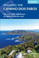
Wandelgids Camino dos Faros | Cicerone

0
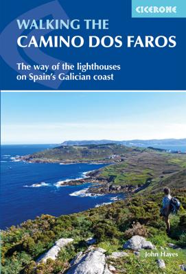
Handzaam boekje met de routebeschrijving inclusief een heleboel praktische informatie. Uitstekende beschrijving en redelijke kaarten. This guidebook explores the Camiño dos Faros (the Way of the Lighthouses), a 200km hike around the remote northwest corner of Spain. Starting in the old whaling town of Malpica and ending in Fisterra (Spain's Land's...

Verkopers met dit product

Verkoper
Bezorging
Prijs
DeZwerver.nl logo
DeZwerver.nl
2,95
20,95

Anderen bekeken ook

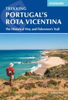
Wandelgids Portugal's Rota Vicentina | Cicerone
This guidebook follows the Rota Vicentina, a 224km walking route along the marvellous Atlantic coastline in the Alentejo and Algarve regions of Portugal. The 12-stage trek combines two well-marked routes, the Caminho Histórico (the Historical Way) and the Trilho dos Pescadores (the Fishermen's Trail), to create a hike starting in Santiago do Cacém and ending at Cabo de São Vicente. The guide also describes an alternative circular route for those who would prefer an 11-stage loop, moving inland from Odeceixe and back up to Santiago de Cacém. Whichever route is chosen, the Rota Vicentina is ideal for a two-week holiday in spring or late summer to autumn, offering walkers a remarkable range of landscapes from coastal fishing villages to wooded river valleys. The guidebook includes advice about accommodation options along the route, information about the surrounding area, and a glossary of Portuguese terms to aid with reading signs and maps. Along the Rota Vicentina are many delights fo…
24,95
Nieuw
Wandelgids Wales: The Ceredigion and Snowdonia Coast Paths | Cicerone
As part of the Wales Coast Path, the Ceredigion Coast Path and Snowdonia Coast Path trace a curve of 233km (145 miles) of coastal and inland walking down Cardigan Bay. This guidebook describes a 16-stage guide to the walk from Porthmadog to St Dogmaels covering the trail between the Llyn Peninsula and the Pembrokeshire Coast Path. .In 16 day stages from Porthmadog to St Dogmaels, this guidebook offers all the information walkers need to complete the 233km (145 miles) section of the Wales Coast Path that curve down Cardigan Bay, passing through a range of contrasting landscapes.   Six days are spent on the Snowdonia Coast Path, two around the Dyfi Estuary, seven on the Ceredigion Coast Path and one from Cardigan to St Dogmaels.   Linking the Llyn Peninsula Coast Path with that of the Pembrokeshire Coastal Path, this section takes in Snowdonia National Park’s splendid coastal plains, leads inland through beautiful hill country around the Dyfi Estuary and follows some of the finest coast…
18,50
Nieuw
Wandelgids GR10 trail, Pyrenees - Pyreneeen | Cicerone
Engelstalige beschrijving van de mooiste wandeltocht in de Pyreneeen. De gids voldoet aan alle verwachtingen die je kunt hebben. Wel heb je voor de zwaardere gedeelte voor de zekerheid goede kaarten nodig ...... Guidebook to the GR10, a 955km trek across the French Pyrenees from Hendaye on the Atlantic Coast to the Mediterranean coast at Banyuls-sur-Mer. Described in 55-day stages, the route can be completed in its entirety, or in shorter sections using the bus and rail links found throughout the Pyrenees.   Step by step route descriptions are accompanied by 1:100,000 mapping and gradient profiles. Useful practical information is also included such as when to go, getting there and back, camping, accessing fuel and water, plus handy equipment tips and more.   The easiest, oldest and most popular of the three long-distance routes that traverse the mountain range, the GR10 is well waymarked and follows good mountain paths. For many walkers, the highlight of the route is the magnificent w…
26,50
Nieuw
Wandelgids Spain's Sendero Historico: the GR1 | Cicerone
A step by step guide to walking the 1250km long Sendero Historico (the GR1) across northern Spain. Travelling from west to east, the GR1 starts at the Puerto de Tarna, on the border of Asturias and Castilla y Leon, heads east along the southern flank of the Cantabrian Mountains and the foothills of the Pyrenees before finishing on the Mediterranean coast near L'Escala. Arguably one of Spain's best long-distance paths, it follows gently graded paths, making a long but easy walk suitable for a reasonably fit walker. The complete trail requires around 53 days to complete end to end, but the guidebook splits the route into 7 sections, each with a start or endpoint that can be easily reached by train or bus, allowing walkers to explore the route in manageable chunks. The guidebook also describes how to extend the route to Finisterre and the Atlantic using GR routes. As well as extensive notes on the history of modern Spain, from medieval times to more recent events such as the Civil War, t…
26,50
Wandelgids The Peddars Way and Norfolk Coast Path | Cicerone
Uitstekende wandelgids van de Peddars Way en de Norfolk Coast Path, waarbij naast alle noodzakelijke informatie ook gebruik gemaakt wordt van de echte topografische kaart. The Peddars Way and Norfolk Coast Path National Trail is an easy-to-follow 130-mile trail that combines the best of inland and coastal walking in Norfolk, and one that, being well waymarked, largely flat and within easy reach of public transport for most of its length, is ideal for people new to long-distance walks.   Described here in 11 stages, the route can be walked in just over a week but also easily split into day walks or over a series of weekends, with full information about access to start and finish points for each stage by public transport. This handy guidebook is illustrated throughout with extracts of OS 1:50,000 mapping and stunning photographs depicting the Trail in all seasons and describes points of interest along the way, including the Nofolk Songlines sculptures, and also facilities available in t…
18,50
Nieuw
Wandelgids Pyrenean Haute Route - a high level trail, Pyreneeën HRP | Cicerone
Beschrijving van de klassieke HRP, Haute Randonnee Pyreneen. Goede beschrijving van de route met hoogteprofielen en andere praktische informatie. Kaartmateriaal is voor deze zware route onvoldoende aanwezig in de gids.  Aanbevolen wandelkaarten voor de hele of een deel van de route: Wandelkaarten van Rando Editions op Schaal 1:50.000 There are three main trekking routes across the Pyrenees from coast to coast: of these, the Pyrenean Haute Route (or HRP for Haute Route Pyrénéenne) is the most challenging - and arguably, the most spectacular. Unlike the GR10 and GR11, it is not waymarked and borders on mountaineering at times, sticking as closely as possible to the main ridge. It stretches 750km from the Atlantic resort of Hendaye to Banyuls-sur-Mer on the Mediterranean, crossing the French-Spanish border many times on its traverse. The hike calls for experience, navigational competence and self-reliance, but offers rich rewards as you pass through some of the most stunning landscapes t…
24,95
Nieuw
Fietsgids The River Loire Cycle Route | Cicerone
This guide describes a 1061km cycle route that starts at source of the Loire in the Massif Central mountains of central France and finishes at the Atlantic opposite St Nazaire. The route goes through the heart of France as the Loire becomes the royal river, bounded by extravagant châteaux, fields of Charolais cattle and vineyards. It passes through historic cities like Orléans and Tours, continuing past Angers and France's fourth largest city Nantes. The 1061km Loire Cycle Route starts at the source of the River Loire in the Massif Central mountains of central France and finishes at the Atlantic opposite St Nazaire. It descends past extinct volcanoes, crater lakes and deep gorges before joining EuroVelo route 6, followed by the fully waymarked Loire à Vélo, France's most popular cycle trail. Following the river downstream in 26 stages, the route is generally downhill or level, often on dedicated traffic-free cycle tracks.   Packed with a wealth of useful information - from practical p…
23,95
Wandelgids Walking Brittany - Bretagne | Knife Edge Outdoor
Wild coastline: endless towering cliffs, remote rocky headlands, almost forgotten islands and stunning beaches which would not be out of place on a Caribbean island.   Explore a region packed with beauty and historical interest: megalithic sites, World War 2 fortifications, ancient villages and much more. Real IGN Maps inside: 1:25,000.   Also includes:   ▶ Numbered waypoints linking the Real Maps to our clear descriptions ▶ Graded routes to suit all abilities ▶ Everything the hiker needs to know: route descriptions,  difficulty, weather, how to get there, and more ▶ Information on Wildlife and Plants ▶ Carnac and other Megalithic sites  ▶ Section on World War 2 and the 'Atlantic Wall'   France is a large country with a huge and varied coastline. This coastline is very wild and very beautiful but rarely is it both wilder and more beautiful than in Brittany. This stunning part of the world's most visited country has around 3,000 km of sea frontage so you could spend a lifetime here wa…
19,50
Nieuw
Fietsgids The Canal de la Garonne | Cicerone
Een gids voor het fietsen langs het Canal de la Garonne in Frankrijk, met een beschrijving van de 290 km lange fietsroute van Bordeaux naar Toulouse, waar deze verbinding maakt met het Canal du Midi. Beschrijft een 135 km lange excursie naar de Atlantische Oceaan, met omleidingen naar vele historische steden en dorpen langs de route. Met informatie over accommodatie, faciliteiten en fietswinkels op de route.   This guidebook presents a cycle ride along the Canal de la Garonne in the south of France. The 260km route is covered in 7 stages from bustling Bordeaux to the splendid rose city of Toulouse, with a 135km excursion from to Lacanau on the Atlantic coast. Optional side trips explore the countryside and historical towns and villages, including Agen, Moissac, Marmande and Montauban. Mainly flat and easy cycling, including 193km along the main canal towpath, this is an easy route suitable for lone cyclists, families, groups and those using e-bikes. It is perfect for those planning a …
20,95
Nieuw
Wandelgids The Cumbria Coastal Way | Cicerone
This guidebook follows the continuous 298km (182 mile) walking route from Silverdale, on Morecambe Bay, towards Gretna on the Scottish border. The route links a number of gems of landscape, wildlife, archaeology and history along this often little-known coastline. A walk of 10-14 days suitable for all levels of ability.   THE CUMBRIA COASTAL WAY is a continuous 298km (182 mile) walking route from north Lancashire towards the Scottish border, and links a number of gems of landscape, wildlife, archaeology and history that are found on this often little-known coastline.   Starting at Silverdale, on Morecambe Bay, and edging the coast up towards Gretna, the coastal way can be walked in its entirety (10–14 days), or in sections, by people of all ages and abilities. Much of the route-finding is easy, and the route, which rarely climbs higher than 100m above sea level, has been designed to link with public transport.    This is a totally new edition of the guidebook written by two walkers wh…
18,50

Klanten-reviews van Wandelgids Camino dos Faros | Cicerone

Er zijn nog geen beoordelingen voor dit productBen jij de eerste die een review plaatst?

Meer over Wandelgids Camino dos Faros | Cicerone

Productomschrijving

Handzaam boekje met de routebeschrijving inclusief een heleboel praktische informatie. Uitstekende beschrijving en redelijke kaarten.

This guidebook explores the Camiño dos Faros (the Way of the Lighthouses), a 200km hike around the remote northwest corner of Spain. Starting in the old whaling town of Malpica and ending in Fisterra (Spain's Land's End), the eight day hike along the Costa da Morte follows a path that sticks limpet-like to the Atlantic coast. It's a spectacular walk along dramatic cliffs and around deep, verdant river estuaries, exploring the rich Galician culture and history. With stages between 18 and 29km per day, this is a hike suitable for walkers willing to undertake reasonably long days and the occasional scramble up and down beach paths.   The guide provides in-depth descriptions of the route alongside clear mapping to aid navigation. It includes practical information for both before and during your trip, and details about wildlife and historic sites along the walk. In the back of the guide are a series of appendices listing accommodation, main Galician festivals, and useful contacts.   The Camiño dos Faros follows the wild coast of the Costa da Morte, which is battered by storms racing in from the Atlantic. For shipping it is one of the world's most dangerous coastlines and its ominous name meaning 'the coast of death' is well deserved. 'Dos Faros' refers to a series of beautifully located lighthouses that attempt to warn sailors of the perils that await them. The sea has shaped the landscape and the Galician culture, and the locally caught seafood including razor clams and percebes should not be missed.   Steden en Dorpen Malpica, Corme, Ponteceso, Laxe, Camelle, Arou, Camariñas, Muxía, Praia de Nemiña, Fisterra 


Verken gerelateerde categorieën

Webshop.nl maakt gebruik van cookies. Ga je verder op onze website, ga dan akkoord met het plaatsen van cookies en de verwerking van deze data door ons en vermelde partners.