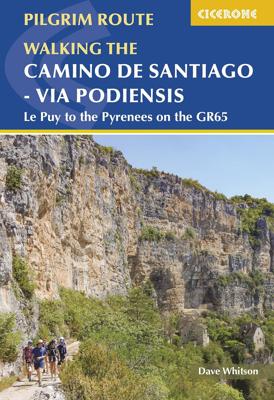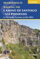
Wandelgids Camino de Santiago - Via Podiensis GR65 | Cicerone

0
Handzaam boekje met de routebeschrijving inclusief een heleboel praktische informatie. Uitstekende beschrijving en redelijke kaarten.   This guidebook describes in full the 735km Via Podiensis (GR65), a historic pilgrimage route through southern France from Le Puy-en-Velay to Saint-Jean-Pied-de-Port, where the trail meets the famous Camino Francé...

Verkopers met dit product

Verkoper
Bezorging
Prijs
DeZwerver.nl logo
DeZwerver.nl
niet bekend
2,95
26,95

Anderen bekeken ook

Wandelgids Camino de Santiago - Via Podiensis GR65 | Cicerone
Handzaam boekje met de routebeschrijving inclusief een heleboel praktische informatie. Uitstekende beschrijving en redelijke kaarten.   This guidebook describes in full the 735km Via Podiensis (GR65), a historic pilgrimage route through southern France from Le Puy-en-Velay to Saint-Jean-Pied-de-Port, where the trail meets the famous Camino Francés to Santiago de Compostela (Spain). Also detailed are 2 major variants: the Célé Valley (GR651) and Rocamadour (GR6 and GR46). Split into 28 stages, the full route takes 4 to 6 weeks to complete but can be divided into shorter sections - Figeac and Condom are well positioned to break the walk into three 2-week chunks. It can be adapted to suit all abilities, with regularly spaced accommodation and baggage transport available, and is best walked in spring and autumn, with May and September the most popular months. Abundant accommodation options offer a warm welcome to walkers and pilgrims and a chance to enjoy delicious home-cooked meals made…
26,95
Wandelgids - Pelgrimsroute Camino de Santiago - Camino Frances | Cicerone
Voor diegenen die de klassieke Camino Frances gaan lopen (als één van de vele wegen dienaar Santiago de Compostela leiden) is dit één van de beste wandelgidsen die er zijn. Zowel de beschrijvingen van de routes en etappes, de kaarten in een losse set en de hoeveelheid praktische informatie is bijzonder goed te noemen.  This two-volume set of guidebook and map book makes an indispensable companion to planning and walking the 784km Camino Frances pilgrim route from St-Jean-Pied-de-Port across northern Spain to Santiago de Compostela. Divided into 6 sections, the guidebook includes an additional section from Santiago de Compostela to Finisterre and Muxia on the Galician coast. Each section is broken down into detailed stages with easily customisable start and finish points due to the amount of accommodation available en route. Over 500 of these pilgrim lodgings are listed within this guidebook, including all public and private albergues, with contact details and a description of faciliti…
24,95
Wandelgids Camino de Santiago, Camino Frances | Village to Village Press
Now fully updated for 2023! This Village to Village Guide to the Camino de Santiago is a comprehensive guidebook to walking the Way of Saint James, from Saint-Jean-Pied-de- Port to Santiago de Compostela (the Camino Frances), and also the Camino Finisterre to Muxia and Finisterre. This Camino guidebook includes full-color detailed topographical stage maps of each day's walk with free GPS files online; 135 detailed stage, city and town maps (now easier to read); essential practical information on transport, accommodations and services. It includes detailed listings of pilgrim hostels (albergues) and private accommodations in each town, including prices, amenities, number of beds, contact information, open dates, and more.   There are regional introductions to the different areas along the Camino including information about traditional foods, flora and fauna, and local culture plus overviews of dozens of medieval pilgrim sites, with information about the historical context of the pilgri…
31,95
Fietsgids Cycling the Camino de Santiago | Cicerone
The Camino de Santiago de Compostela (Camino Francés or Way of St James) is among the world's most famous pilgrimages: Christian pilgrims have travelled to the shrine of St James in Santiago, northern Spain, since the ninth century. This guide provides all the information you need to successfully cycle the Camino. The Camino Francés is the most popular variant of the Camino, linking St Jean-Pied-de-Port on the French-Spanish border with Santiago via Pamplona, Burgos and León. The guide presents the journey in 18 stages. Two versions of the route are described, the first (770km) based closely on the walkers' route and suitable for hybrid or mountain bikes; the second (798km) a 'road route' for road and touring cycles. It can be cycled in around 10-14 days and is very well provisioned. Clear route description and mapping are accompanied by notes on local points of interest, as well as background information on Spanish history and the history of the Camino. The practicalities are also t…
18,95
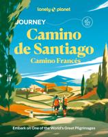
Wandelgids Journey Camino de Santiago | Lonely Planet
Lonely Planet's JourneyCamino de Santiago: the Camino Frances is the definitive guide to one of the world's great adventures - bringing you closer to the culture, history and landscapes you'll encounter along the way. Get inspiration, ideas and planning tips from our experts who have walked every step to uncover unique experiences you can make all your own. Have the best Spanish omelette you'll ever eat in Valdelafuente, wake to monks chanting at dawn in Roncesvalles, and order a nightcap of patxaran before you leave Navarra. InsideLonely Planet's JourneyCamino de Santiago: the Camino Frances travel guide: Our Journey guidebook format helps you build the trip of a lifetime with step-by-step coverage of this iconic path Six of our favorite ways to explore El Camino de Santiago, with itineraries ranging from 4 days to 5 weeks Easy-to-use maps with must-do stops for every stage of the journey, plus elevation charts and a birds' eye route tracker Discoverthe best places to eat, drink…
26,50
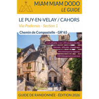
Wandelgids Miam Miam Dodo Section 1 Le Puy en Velay - Cahors GR65 Via Podiensis | 2025 | Les Editions du Vieux Crayon
Toonaangevende Franstalige wandelgids met zowel de route, kaarten en praktische informatie. Met een overzicht van de eetadressen en overnachtingsadressen langs het lange afstandswandelpad GR 65 van Puy-en-Velay naar Cahors. De uitgebreid in het Frans beschreven adressen (met prijzen en condities) van restaurants, cafe's en slaapplekken, zoals kloosters, herbergen, gastverblijven en campings liggen allen binnen een straal van 5km van de wandelroute GR 65. De gids geeft ook andere praktische informatie zoals adressen van postkantoren, apotheken, banken, etc. Two guides cover the entire route of the GR®65, also called Via Podiensis, between Le Puy-en-Velay and Roncesvalles. Here is the first guide, which covers the first part of the way of Puy: from Puy-en-Velay to Cahors.   The Via Podiensis, also called "the way of Puy", is one of the 4 main roads that cross France and converge towards Spain and then Santiago de Compostela. It starts in Le Puy-en-Velay and crosses the Pyrenees through …
22,50
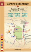
Wandelgids - Pelgrimsroute Camino de Santiago kaartenatlas | Camino Guides Brierley
Gids met kaartmateriaal voor de Jakobsweg van St. Jean Pied de Port, Roncesvalles naar Santiago de Compostela. De wandelkaarten ca. schaal 1:100.000 met begeleidende tekst in Engels, Spaans, Frans, Duits, Portugees, Italiaans, Nederlands en Pools en hoogteprofielen A complete set of maps and town plans in English, Spanish, French, German, Portuguese, Italian, Dutch and Polish make up this indispensable guidebook for spiritual seekers and travellers wishing to walk the way of Saint James. Covering the sacred route from St. Jean Pied de Port to Santiago, this portable book of maps makes the perfect companion for adventurers attempting to heed the spiritual calling.   Revised and updated to offer the most recent information, this exploration is light enough to carry while walking long distances each day. The maps show the location of all pilgrim hostels en route, the distances between villages, and points of interest, as well as counter guides, alternative routes, and accommodations.
21,95
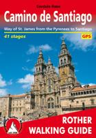
Wandelgids Camino de Santiago - Jakobsweg - Sint Jacobs route | Rother Bergverlag
With over 1000 years of history, the Way of St. James is one of the classic long distance walks. This historical route along almost 1000 kilometres from the Pyrenees to Santiago de Compostela offers unique cultural, scenic and nature experiences. Since the Holy Year of 2010 the Way of St. James has gained even more in popularity and attracts more and more people from very different backgrounds, faiths and generations. It does not matter what the reason might be for setting out on the path to Santiago de Compostela - in the end you are confident that you have had a quite special experience. The Rother walking guide describes in a total of 42 stages the whole of the Camino francés from Saint-Jean-Pied-de-Port via Roncesvalles, as well as the Aragon route from the Somport pass via Jaca to Santiago de Compostela, including possible secondary routes and the extension to Finisterre or Muxía. Thus the Way of St. James leads through a wealth of diverse landscapes, continuously interrupted by …
17,50
Wandelgids - Pelgrimsroute Camino de Santiago - Camino Francés | Camino Guides Brierley
 De populairste gids voor de Camino Francés!   A Pilgrim’s Guide to the Camino de Santiago van John Brierley is dé complete Engelstalige wandelgids voor de pelgrimstocht van St. Jean Pied de Port tot Santiago de Compostela. Met 33 etappes, gedetailleerde kaarten, hoogteprofielen, overnachtingsadressen en spirituele reflecties is dit de perfecte metgezel voor zowel praktische als innerlijke voorbereiding op de Camino. Deze compacte, full-colour gids van John Brierley is dé klassieker voor iedereen die de Camino Francés wil lopen – de beroemde pelgrimsroute van St. Jean Pied de Port in Frankrijk tot Santiago de Compostela in Galicië. De gids helpt je niet alleen bij de praktische voorbereiding, maar ook bij de innerlijke reis die het pelgrimspad symboliseert. Voordelen Overzichtelijke routeplanner met 33 dagetappes van 791 km in totaal 33 gedetailleerde kaarten met hoogteprofielen, alternatieve routes en stadplattegronden 14 town plans met duidelijke verwijzingen naar hostels, c…
27,95
Wandelgids - Pelgrimsroute 128 Frankrijk - Frankreich: Jakobsweg Via Podiensis GR65 | Conrad Stein Verlag
Handzaam boekje met de routebeschrijving inclusief een heleboel praktische informatie. De beschrijving is uitstekend, maar kaarten zijn beperkt en schetsmatig aanwezig. Duits. Von Le Puy-en-Velay führt der französische Jakobsweg Via Podiensis über gut 754 km nach Saint-Jean-Pied-de-Port, wo die Wanderung auf den spanischen Jakobswegen fortgesetzt werden kann. Im vorliegenden Band finden Sie weit über 400 Übernachtungsadressen entlang des Weges, Hinweise zu öffentlichen Verkehrsmitteln und Taxibetrieben und selbstverständlich eine detaillierte Wegbeschreibung. Sie finden Streckenvorschläge für Alternativrouten, Übersichtskarten, Höhenprofile und nicht zuletzt kurze Beschreibungen der naturkundlichen und kulturellen Sehenswürdigkeiten, wie z. B. der vielen Weltkulturerbestätten, die diesen Weg so überaus spannend und eindrucksvoll machen. Auch in der nunmehr 10., völlig überarbeiteten und neu gestalteten Auflage liegt der Fokus aber auf der praktischen Unterstützung der Pilger, für die …
19,90

Klanten-reviews van Wandelgids Camino de Santiago - Via Podiensis GR65 | Cicerone

Er zijn nog geen beoordelingen voor dit productBen jij de eerste die een review plaatst?

Meer over Wandelgids Camino de Santiago - Via Podiensis GR65 | Cicerone

Productomschrijving

Handzaam boekje met de routebeschrijving inclusief een heleboel praktische informatie. Uitstekende beschrijving en redelijke kaarten.   This guidebook describes in full the 735km Via Podiensis (GR65), a historic pilgrimage route through southern France from Le Puy-en-Velay to Saint-Jean-Pied-de-Port, where the trail meets the famous Camino Francés to Santiago de Compostela (Spain). Also detailed are 2 major variants: the Célé Valley (GR651) and Rocamadour (GR6 and GR46). Split into 28 stages, the full route takes 4 to 6 weeks to complete but can be divided into shorter sections - Figeac and Condom are well positioned to break the walk into three 2-week chunks. It can be adapted to suit all abilities, with regularly spaced accommodation and baggage transport available, and is best walked in spring and autumn, with May and September the most popular months. Abundant accommodation options offer a warm welcome to walkers and pilgrims and a chance to enjoy delicious home-cooked meals made with local ingredients.   Walking directions are accompanied by 1;100,000 maps showing the route line and the facilities available at different locations. Accommodation listings provide invaluable information on where to stay. There are useful town maps for Cahors, Condom, Figeac, Le Puy, Moissac and Saint-Jean-Pied-de-Port, and a stage planning table listing intermediate distances between accommodation means the schedule can be easily customised to individual requirements.   The Via Podiensis leads pilgrims and walkers through the best of French village life, offering a unique combination of pleasant trails, quaint historic communities and cultural delights. It passes through charming Estaing, Saint-Cirq-Lapopie and Lauzerte, and visits pilgrim shrines including Conques and Rocamadour. Pilgrims carrying on to Santiago can either proceed directly from Saint-Jean on the Camino Francés or transition (via the GR10) over to the Camino del Norte - a skeletal outline of the routes linking Saint-Jean and Irún, Spain, is included in the guidebook.


Productinformatie

    Verken gerelateerde categorieën

    Webshop.nl maakt gebruik van cookies. Ga je verder op onze website, ga dan akkoord met het plaatsen van cookies en de verwerking van deze data door ons en vermelde partners.