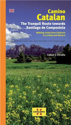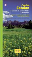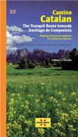
Wandelgids Camino Catalan | Editorial Piolet

0
Walking routes from Calalonia to La Rioja and Navarre.    For the first time these largely unknown pilgrim routes that connect Catalonia to the Camino Francés are collected in one guide. 62 stages along 6 different interconnected routes offer the chance to explore a range of fascinating landscapes.   Over 1600 kms of detailed route notes. 62 col...

Verkopers met dit product

Verkoper
Bezorging
Prijs
DeZwerver.nl logo
DeZwerver.nl
2,95
27,50

Anderen bekeken ook

Wandelgids Camino Catalan | Editorial Piolet
Walking routes from Calalonia to La Rioja and Navarre.    For the first time these largely unknown pilgrim routes that connect Catalonia to the Camino Francés are collected in one guide. 62 stages along 6 different interconnected routes offer the chance to explore a range of fascinating landscapes.   Over 1600 kms of detailed route notes. 62 colour maps and contour guides Detailed city and town maps. Information on pilgrim hostels and hotels. Over 100 colour photos and illustrations. Historical notes on places of interest. Langs de plaatsen: Barcelona - Monserrat - Girona - Lleida - Hueasca - Puente la Reina - Tortosa - Zaragosa - Logrono
27,50
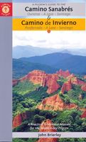
Wandelgids Camino Sanabrés & Camino Invierno | Camino Guides Brierley
140 pages paperback in full colour including:   Overview route planners Daily stage maps Contour guides Alternative routes & detours Detailed town plans List of all pilgrim hostels & hotels Historical notes Myths and Legends…   This guidebook combines two ancient routes into Santiago that remain largely undiscovered despite their historic significance. Each route offers a very different camino experience but are combined in one volume as they join in A Laxe for the final stages. Each provides the minimum distance required for a pilgrim to apply for a Compostela; but that is not the purpose of this guidebook which seeks to off er alternatives to the busy routes through Sarria and Tui which account for over 80% of all pilgrims to Santiago; by contrast the Camino Invierno currently carries less than 1%.    Camino Sanabrés offers a link from the Via de le Plata. This guide offers the last 5 stages of that itinerary commencing in Ourense with its rich Roman heritage and extant thermal bath…
21,50
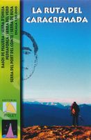
Wandelkaart La Ruta del Caracremada | Editorial Piolet
De Spaanse uitgever Editorial Piolet maakt bijzonder gedetailleerde kaarten van deelgebieden in Spanje, geschikt voor wandelaars en MTB-ers. Van ouds her zijn ze begonnen in de regio rond Barcelona maar ze breiden steeds meer uit richting andere delen van Spanje,   De kaarten hebben een topografische ondergrond met hoogtelijnen, toppen, schaduwtekening bij bergruggen, wegen en dorpen, gehuchten en zelfs boerderijen. Daarbij hebben ze enkele wandelpaden gemarkeerd, met name de GR paden en de PR paden, de regionale lange-afstands paden. Andere wandelpaden staan wel ingetekend, maar met de gewone zwarte lijntjes in plaats van een opvallende kleur. Ook worden op bepaalde kaarten MTB routes weergegeven, maar dat is eerder een uitzondering dan een regel. Met symbolen zijn andere handige zaken aangeduid als campings, bezienswaardigheden, grotten en zelfs hier en daar een lokale bar!    La Ruta del Caracremada, a hiking circuit in the Catalan Pyrenees just north-west of Berga, presented at 1…
12,95
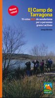
Opruiming - Wandelgids El Camp de Tarragona | Editorial Piolet
Spaanstalige wandelgids in het gebied van Tarragona. Goede beschrijvingen van de 15 wandelroutes met een degelijke kaart. Después de una primera guía de estas mismas características presentamos 15 rutas MÁS de senderismo por el Camp de Tarragona pensadas para que las puedan realizar personas mayores y activas con una mínima preparación física y con ganas de andar. Trazados con un recorrido inferior a los 15 km. El Camp de Tarragona está formado por las comarcas del Alt Camp, Baix Camp, Baix Penedès, Conca de Barberà, Priorat y Tarragonès. Tiene una orografía muy variada, desde las alturas próximas a los mil metros de la cordillera prelitoral hasta el mar Mediterráneo.   Uitgever: Na een eerste gids met dezelfde kenmerken presenteren we 15 MEER wandelroutes door Camp de Tarragona, ontworpen om te worden uitgevoerd door oudere en actieve mensen met minimale fysieke voorbereiding en de wens om te lopen. Routes met een route kleiner dan 15 km. Camp de Tarragona bestaat uit de regio's Alt …
5,-
Wandelkaart Rif Occidental, Chefchaouen - Chauen | Editorial Piolet
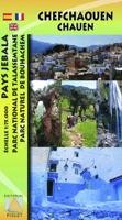
 Gedetailleerde topografische wandelkaart van het westelijke Rifgebergte, Pays Jebala, het Parc national de Talassemtane en het Parc naturel de Bouhachem in Marokko. De kaart bestrijkt een gebied met een straal van 25-30 km rondom Chefchaouen, grofweg tussen Es Soukkane, Oued Laou, Bkikcha en Beni Derkoul.   De kaart toont hoogtelijnen (interval 20 m), ingetekende wandelroutes, accommodaties, bezienswaardigheden, klimgebieden, etc. Op de achterzijde staat informatie over het gebied in drie talen (Engels, Frans, Spaans).   -------   Chefchaouen (Chauen) region of northern Morocco, south-east of Tangier and Tetouan, at 1:75,000 on a contoured and GPS compatible map from Editorial Piolet, highlighting recommended hiking trails, various tourist facilities and places of interest, etc.    Topography is vividly presented by contours at 20m intervals, enhanced by relief shading and altitude colouring. The map shows local roads, country tracks and footpaths, and highlights nine recommended …
14,95
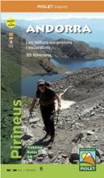
Wandelkaart Andorra | Editorial Piolet
Topographic map and hiking guide (multilingual, in 4 languages) that contain all the necessary information for the hiker.   It presents 30 itineraries, grouped in ascents and excursions that allow you to discover the country in all its facets. Each itinerary is described in detail and incorporates a technical sheet that includes the slope, duration, difficulty and the material necessary to carry out each of the excursions.   The guide is complemented by photographs of the most emblematic places of each itinerary.   On the 1: 40,000 scale map, all the itineraries described in the guide are represented, as well as the network of trails that run through the area.   In short, it is an essential tool to discover Andorra from a new perspective.
16,95
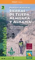
Wandelkaart Parque Natural Sierras de Tejeda, Almijara y Alhama | Editorial Piolet
Een prachtige kaartenset op heel gedetaileerd nivo van de Sierra de Tejeda, opgedeeld in een west en oost gedeelte. Het nationale park igt ten noorden van Nerja, tussen Malaga en Motril.  Alle noodzakelijke details staan er op die je nodig hebt voor het wandelen. Hoogtelijnen, schaduwwerking in de kleuren, ingetekende wandelpaden en routesuggesties. Met name in nationale parken en daarom heen in zuidelijk Europa is een geode kaart best handig: er zijn veel ezel- en geitenpaadjes die voor verwarring zorgen.  Van de uitgever Topographic map of the whole 'Natural Park of Sierras de Tejeda, Almijara and Alhama', more than 40,000 hectares of protected area with an impressive natural wealth. The peaks, some over 2,000 m high, are a natural border between the provinces of Granada and Malaga. The rugged and rugged landscapes make this area an ideal place for hiking enthusiasts of all levels. From a cultural point of view, Muslim heritage is present throughout the territory, with whitewashed v…
19,95
Wandelgids Camino Finisterre | Village to Village Press
The Camino Finisterre is a walking route from Santiago de Compostela to Finisterre and Muxía on the coast of Galicia in Spain. This route highlights the best of Galicia — the wild coast, misty forests, rolling green hills, and myths and legends of this enigmatic land. The Celtic and pagan roots of the region meld with Saint James lore on this path well trodden by seekers and pilgrims. An excellent 3-5 day standalone experience or epilogue to a longer Camino pilgrimage. The Village to Village Guide provides comprehensive planning information, detailed maps and route descriptions, as well as lodging and services along the way. Lace up your boots, and keep walking to “the end of the earth.” Full-color detailed topographical stage maps of each day’s walk with free GPS files online Detailed accommodations listings for pilgrim and private lodging including contact information, amenities and approximate prices Detailed stage, city and town maps and elevation profiles including town amenit…
20,95
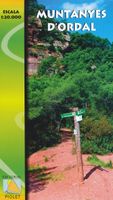
Wandelkaart Muntanyes d'Ordal | Editorial Piolet
De Spaanse uitgever Editorial Piolet maakt bijzonder gedetailleerde kaarten van deelgebieden in Spanje, geschikt voor wandelaars en MTB-ers. Van ouds her zijn ze begonnen in de regio rond Barcelona maar ze breiden steeds meer uit richting andere delen van Spanje,   De kaarten hebben een topografische ondergrond met hoogtelijnen, toppen, schaduwtekening bij bergruggen, wegen en dorpen, gehuchten en zelfs boerderijen. Daarbij hebben ze enkele wandelpaden gemarkeerd, met name de GR paden en de PR paden, de regionale lange-afstands paden. Andere wandelpaden staan wel ingetekend, maar met de gewone zwarte lijntjes in plaats van een opvallende kleur. Ook worden op bepaalde kaarten MTB routes weergegeven, maar dat is eerder een uitzondering dan een regel. Met symbolen zijn andere handige zaken aangeduid als campings, bezienswaardigheden, grotten en zelfs hier en daar een lokale bar!    Excelente e innovador mapa, que con el topónimo de "Muntanyes d'Ordal" es el primero dedicado íntegramente…
12,95

Klanten-reviews van Wandelgids Camino Catalan | Editorial Piolet

Er zijn nog geen beoordelingen voor dit productBen jij de eerste die een review plaatst?

Meer over Wandelgids Camino Catalan | Editorial Piolet

Productomschrijving

Walking routes from Calalonia to La Rioja and Navarre.    For the first time these largely unknown pilgrim routes that connect Catalonia to the Camino Francés are collected in one guide. 62 stages along 6 different interconnected routes offer the chance to explore a range of fascinating landscapes.  
  • Over 1600 kms of detailed route notes.
  • 62 colour maps and contour guides
  • Detailed city and town maps.
  • Information on pilgrim hostels and hotels.
  • Over 100 colour photos and illustrations.
  • Historical notes on places of interest.

Langs de plaatsen:

Barcelona - Monserrat - Girona - Lleida - Hueasca - Puente la Reina - Tortosa - Zaragosa - Logrono

Productinformatie

    Verken gerelateerde categorieën

    Webshop.nl maakt gebruik van cookies. Ga je verder op onze website, ga dan akkoord met het plaatsen van cookies en de verwerking van deze data door ons en vermelde partners.