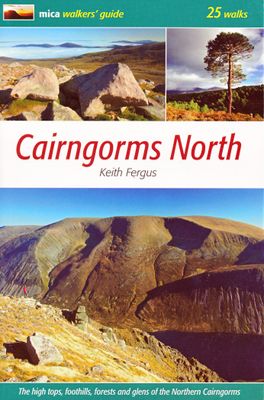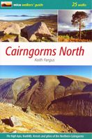
Wandelgids Cairngorms North | Mica Publishing

0
A detailed and superbly illustrated guidebook to walking the high tops, foothills, forests and glens of the Northern Cairngorms, one of Scotland's most popular mountain ranges, easily accessed from the town of Aviemore.   25 varied walks from glen to mountain top, with accompanying maps and information panels on fauna, flora and local interest   A...

Verkopers met dit product

Verkoper
Bezorging
Prijs
DeZwerver.nl logo
DeZwerver.nl
niet bekend
2,95
20,95

Anderen bekeken ook

Wandelgids Walking in the Cairngorms | Cicerone
Uitstekende wandelgids, sommige meerdaags, voor dit uitdagende wandelgebied in Schotland. This guidebook contains over 100 routes for walking in the Scottish Cairngorms. It includes 18 Munro summits and smaller viewpoint hills. Walks range in length from 1 to 26 miles and are graded for difficulty.    For the adventurous there are the best of the area's rocky scrambles, and the classic through-routes including the Lairig Ghru. For those looking for a more gentle alternative, there are easy, sandy trails wandering among the tall pines and along the banks of the great rivers Spey, Nethy and Dee.    Britain's biggest mountain range is home to exceptional and varied scenery - from the ancient Caledonian forest to the granite plateau, the glacial glens and high corries where green lochans lie below great crags of the plateau rim.  Along with the main Cairngorm range between Speyside and Deeside, the guidebook covers Lochnagar. It includes practical information on snack stops, public …
20,95
Wandelgids Day Walks in the Cairngorms | Vertebrate Publishing
Day Walks in the Cairngorms features 20 circular routes between 6.3 and 18.4 miles (10.2km and 29.6km) in length, spread across the Cairngorms National Park. Researched and written by local and experienced authors Helen and Paul Webster, founders of the Walkhighlands website, the walks range from gentle rambles to more challenging day walks, all through stunning and varied terrain. Enjoy riverside walks along the Spey and Dee, discover hidden lochans at Clais Fhearnaig, explore the ancient forests of Rothiemurchus or tackle the famous Munros of Braeriach, Ben Macdui and Cairn Gorm.   Examine geological features such as The Vat, see the results of rewilding projects at Glen Feshie and find tranquility at the breathtaking Uath Lochans. Together with stunning photography, each route features Ordnance Survey 1:25,000 maps, easy-to-follow directions, details of distance and navigation information, and refreshment stops and local information.  
20,95
Wandelgids Aviemore and the Cairngorms | Ordnance Survey
Get outside in the Cairngorms, Britain’s largest national park, with ten tried-and-tested accessible walks along the Spey Valley. Discover ancient Caledonian woodland, beautiful lochs and sparkling rivers against a backdrop of snow-capped mountains, waiting for the whole family to enjoy.   Aviemore and the Cairngorms Short Walks Made Easy include:   - Explore Loch Garten and Loch Mallachie, an RSPB Reserve and a haven for ospreys, and pine woodland filled with rare wildlife - Follow the line of the Strathspey Railway and see steam trains chugging past from Aviemore to the ‘osprey village’ of Boat of Garten - Go for a woodland ramble through Glenmore Forest Park to glacial Loch Morlich, where you can stroll the red sands of the highest beach in Britain - Wander the enchanted shores of Loch an Eileen, where a ruined castle stands on the loch’s one island - Stroll through wildflower-rich meadows on the banks of the Calder and the Spey as you circle Newtonmore - See the iconic Old Packhor…
10,-
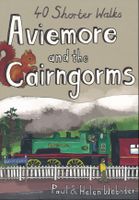
Wandelgids Aviemore and the Cairngorms | Pocket Mountains
Handige compacte wandelgids met 40 dagwandelingen. Deze gids bevat kleine kaartjes en leuke uitgebreide informatie over wat er langs de route te zien is. Goede wandelkaarten zijn echter we noodzakelijk voor deze tochten: de Ordnance Survey explorer maps of Landanger maps zijn zeer geschikt. 'Aviemore and the Cairngorms' features 40 shorter walks, including many perfect for families, stretching from the ancient region of Badenoch and the uppermost reaches of the Spey Valley, through the outdoor hub of Aviemore to Grantown and Tomintoul, then over Ballater and Royal Deeside to Braemar. Plaatsen in het boekje Abernethy Forest, An Lochan Uaine, Anagach Woods, Aviemore, Badenoch Way, Ballater, Balmoral Estate, Balnagowan Wood, Black Wood, Boat of Garten, Braemar, Bridge of Brown, Burn o’Vat, Cairngorm Club Bridge, Cairngorm Ski Centre, Calder Bridge, Carn Daimh, Carrbridge, Castle Roy, Coire an t-Sneachda, Colonel’s Bed, Coylumbridge, Craigellachie Woods, Craigendarroch, Craigmore Wood, Cr…
10,95
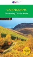
Wandelgids 004 Pathfinder Guides Cairngorms | Ordnance Survey
Wandelgids van een deel van Engeland, Schotland of Wales. Deze gids bevat 28 dagwandelingen, variërend van korte tochten tot pittige dagtochten. De bijbehorende kaarten zijn uitstekend: men heeft de topografische kaarten van Ordnance Survey gebruikt waarop de route is ingetekend. Daarnaast praktische informatie over de wandeling en wat beschrijvingen van het gebied. Each of the Jarrold Pathfinder titles features 28 circular routes, all tried and tested by seasoned walkers. The routes range from extended strolls to exhilarating hikes, so there is something for everyone. They also contain: -Ordnance Survey mapping; -background details of each area; -details of refreshment stops and parking; -walking safety advice; and -information about walkers and the law  
18,50
Wandelkaart Discover Cairngorms National Park | Footprint maps
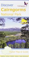
Since it was created in 2003 the Cairngorms National Park has provided the ultimate destination for visitors in the UK wanting to experience a unique mixture of wilderness and cultural heritage. At the heart of the Park are the magnificent Cairngorm Mountains, with five of the UK's highest mountains and some of the most impressive corries, it truly is a walker's paradise.   This double sided map and guide is the perfect companion to take when exploring the Cairngorms National Park. It's packed with information on how to get there, what to see and do - and where to go, once you're there.
12,95
Wandelgids Mountain Walks Kinder | Vertebrate Publishing
Mountain Walks Kinder Scout by Sarah Lister is a guide to walking routes up and around Kinder Scout in the Peak District. Alongside the routes up to the plateau, there are also valley walks for mixed weather days and those new to mountain walking.   Among the 15 inspiring routes, the classics are all included, such as Grindsbrook Clough from Edale, and Kinder Downfall from Hayfield, and even those who are familiar with the area will find new and imaginative route ideas to discover. Whether you aspire to walk up Kinder on a straightforward route, or you’re looking for a bigger adventure, this is the only guidebook you need.   Together with stunning photography, each route features: Ordnance Survey 1:25,000 maps; easy-to-follow, detailed directions; essential info about public transport and safety advice; details about the terrain and navigation; facilities, refreshments and points of interest; and downloadable GPX files.
20,95

Klanten-reviews van Wandelgids Cairngorms North | Mica Publishing

Er zijn nog geen beoordelingen voor dit productBen jij de eerste die een review plaatst?

Meer over Wandelgids Cairngorms North | Mica Publishing

Productomschrijving

A detailed and superbly illustrated guidebook to walking the high tops, foothills, forests and glens of the Northern Cairngorms, one of Scotland's most popular mountain ranges, easily accessed from the town of Aviemore.   25 varied walks from glen to mountain top, with accompanying maps and information panels on fauna, flora and local interest   An ideal guidebook for anyone seeking to explore all, or parts of these hills.

Productinformatie

    Verken gerelateerde categorieën

    Webshop.nl maakt gebruik van cookies. Ga je verder op onze website, ga dan akkoord met het plaatsen van cookies en de verwerking van deze data door ons en vermelde partners.