Wandelgids Brecon Beacons | Ordnance Survey

0
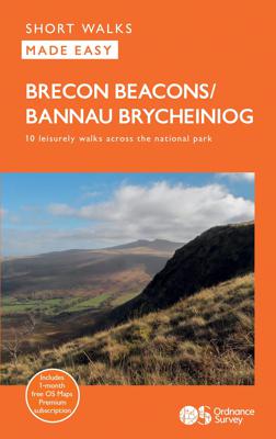
Get outside and enjoy ten short leisurely strolls across the Brecon Beacons National Park, indulging in wonderful mountain views across Southern Britain’s hilliest terrain. With routes for all abilities, enjoy a diverse range of experiences, including waterfalls, woodlands, riversides and even 12th century castle ruins.   Brecon Beacons Short Walk...

Verkopers met dit product

Verkoper
Bezorging
Prijs
DeZwerver.nl logo
DeZwerver.nl
2,95
12,95

Anderen bekeken ook

Wandelgids Brecon Beacons | Ordnance Survey
Get outside and enjoy ten short leisurely strolls across the Brecon Beacons National Park, indulging in wonderful mountain views across Southern Britain’s hilliest terrain. With routes for all abilities, enjoy a diverse range of experiences, including waterfalls, woodlands, riversides and even 12th century castle ruins.   Brecon Beacons Short Walks Made Easy routes include:       • Discover great mountain views from relatively level ground with routes at Mynydd Illtud and Craig y Cilau   • Or for a more strenuous walk, the ascent of Sugar Loaf will reward your uphill efforts with stupendous views across the national park   • Enjoy the thunderous sounds of the spectacular cascading waterfalls of Sgŵd Clun-gwyn and Sgŵd yr Eira, some of Wales most impressive!   • Delve into the Usk Valley for soothing riverside rambles from Brecon and Abergavenny, blessed with stunning views southwards towards the park’s highest peaks   • Spot an abundance of wildlife from the towpath along the Monmouth…
12,95
Wandelgids 031 Pathfinder Short Walks Brecon Beacons | Ordnance Survey
Wandelgids van een deel van Wales. Deze gids bevat 20 wandelingen, geschikt voor de hele familie. De bijbehorende kaarten zijn uitstekend: men heeft de topografische kaarten van Ordnance Survey gebruikt waarop de route is ingetekend. Daarnaast praktische informatie over de wandeling en wat beschrijvingen van het gebied. et outside and get active with all the family in the gorgeous Brecon Beacons with these 20 hand-picked and lovingly illustrated short walks. Everybody can enjoy country walking amidst mountains, lakes and forests and there are even accessible routes up the Sugar Loaf, around the Usk Reservoir and to the top of Pen y Fan.   Featured Brecon Beacons Short Walks include:   - Cross the Usk Bridge and see castle ruins on the riverside walk at Castle Meadows - Discover a legendary lake at Llyn y Fan Fach - Climb grassy mountain paths to the rocky summit of the iconic Sugar Loaf - Enjoy great views from an Iron Age Fort at Mynnyd Illtud - See the dazzling Ystradfellte waterfal…
11,50
Wandelgids 018 Pathfinder Guides Brecon Beacons | Ordnance Survey
Wandelgids van een deel van Engeland. Deze gids bevat 28 dagwandelingen, variërend van korte tochten tot pittige dagtochten. De bijbehorende kaarten zijn uitstekend: men heeft de topografische kaarten van Ordnance Survey gebruikt waarop de route is ingetekend. Daarnaast praktische informatie over de wandeling en wat beschrijvingen van het gebied.   28 fabulous country walks in the Becon Beacons National Park, graded by length and ranging from 3 to 10 miles.   All routes come with a clear, large-scale OS map, GPS waypoints and highlight where to park, good pubs and places of interest en route.   Within the boundaries of the Brecon Beacons National Park there are four separate mountain ranges, including the Black Mountains as well as the Beacons themselves. Most of the area is underlain by old red sandstone, which distinguishes it from the more rugged mountains of North Wales, and several walks explore this terrain of smooth, sweeping grassy uplands and wide, open vistas, including the …
18,50
Wandelgids Walking on the Brecon Beacons | Cicerone
Uitstekende wandelgids van dit geweldige gebied. goed beschreven met veel praktische informatie om de route te kunnen lopen, inclusief redelijke kaarten. Guidebook to 45 graded circular walks in the Brecon Beacons National Park, perfect for those wishing to discover the diversity of the region, away from the crowds. The routes range from 4 to 24km and cover the north-eastern, eastern and south-western valleys and ridges, Fforest Fawr, Waterfall Country, the Black Mountain (Mynydd Du) and the Black Mountains (y Mynyddoedd Duon). Designed to include all the interesting facts an expert park ranger would provide, the guide contains a wealth of information about local geology, botany, archaeology, history, mythology, industrial heritage and environmental issues.   Clear route description is illustrated with 1:50,000 OS Landranger mapping, summary statistics are provided for each walk and handy tables make it easy to compare routes or choose according to points of interest.   A remarkably v…
20,95
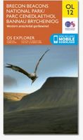
Wandelkaart - Topografische kaart OL12 OS Explorer Map Brecon Beacons NP West | Ordnance Survey
Een van de beste detailkaarten die er op de wereld gemaakt worden: zeer gedetailleerd, prachtig helder kleurgebruik, veel topografische aspecten en - zeer belangrijk - allerlei toeristische en recreatieve aspecten zijn ingetekend. De perfecte kaart voor vakantie en vrije tijd: wandelen, fietsen of gewoon de omgeving verkennen. Door de grootte van de kaart, voor- en achterzijde, bestrijkt het een behoorlijk groot gebied! These highly detailed maps show all the administrative boundaries, settlements as small as isolated farms, road network down to unfenced roads and country tracks, and field boundaries (hedges and drystone walls) which make navigation across the countryside much easier. Steep gradients on roads are indicated. Various landmarks, eg. powerlines, archaeological sites, windmills, churches and lighthouses are shown, and additional graphics indicate natural terrain features such as cliffs, scree, mud and vegetation variations. Contour interval is 5 metres in the lower parts o…
19,50
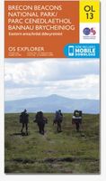
Wandelkaart - Topografische kaart OL13 OS Explorer Map Brecon Beacons NP East | Ordnance Survey
Een van de beste detailkaarten die er op de wereld gemaakt worden: zeer gedetailleerd, prachtig helder kleurgebruik, veel topografische aspecten en - zeer belangrijk - allerlei toeristische en recreatieve aspecten zijn ingetekend. De perfecte kaart voor vakantie en vrije tijd: wandelen, fietsen of gewoon de omgeving verkennen. Door de grootte van de kaart, voor- en achterzijde, bestrijkt het een behoorlijk groot gebied! These highly detailed maps show all the administrative boundaries, settlements as small as isolated farms, road network down to unfenced roads and country tracks, and field boundaries (hedges and drystone walls) which make navigation across the countryside much easier. Steep gradients on roads are indicated. Various landmarks, eg. powerlines, archaeological sites, windmills, churches and lighthouses are shown, and additional graphics indicate natural terrain features such as cliffs, scree, mud and vegetation variations. Contour interval is 5 metres in the lower parts o…
19,50
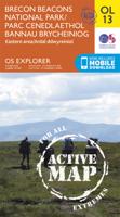
Wandelkaart - Topografische kaart 13 OS Explorer Map | Active Brecon Beacons NP - Eastern area | Ordnance Survey
Een van de beste detailkaarten die er op de wereld gemaakt worden: zeer gedetailleerd, prachtig helder kleurgebruik, veel topografische aspecten en - zeer belangrijk - allerlei toeristische en recreatieve aspecten zijn ingetekend. De perfecte kaart voor vakantie en vrije tijd: wandelen, fietsen of gewoon de omgeving verkennen. Door de grootte van de kaart, voor- en achterzijde, bestrijkt het een behoorlijk groot gebied!   These highly detailed maps show all the administrative boundaries, settlements as small as isolated farms, road network down to unfenced roads and country tracks, and field boundaries (hedges and drystone walls) which make navigation across the countryside much easier. Steep gradients on roads are indicated. Various landmarks, eg. powerlines, archaeological sites, windmills, churches and lighthouses are shown, and additional graphics indicate natural terrain features such as cliffs, scree, mud and vegetation variations. Contour interval is 5 metres in the lower parts…
25,95
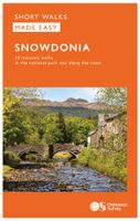
Wandelgids Snowdonia | Ordnance Survey
Everybody can explore Snowdonia, from England and Wales’ highest mountain to magical medieval castles and the spectacular Conwy coastline, with these accessible, family-friendly walks. Get outside and active with the whole family amidst the mysterious legends and natural beauty of Snowdonia.   Snowdonia Short Walks Made Easy include:   - Take Victorian tramcars or the chairlift to the summit of the Great Orme, then wander wildflower-rich meadows for incredible views of the mountains, the sea and the Isle of Anglesey - Follow the Lôn Gwyrfai trail round beautiful Llyn y Gader through Beddgelert Forest to the lovely village, with views of Snowdon and Y Garn throughout - Get off the beaten track in the valley of Cwm Penamnen with views of the cliffs of Moel Sabod and the 13th-century Dolwyddelan castle - Discover Porthmadog on a fascinating walk over Borth-y-Gest headland, the ingenious Cob and the salt marshes home to many seabirds - Explore Dolgellau and the riverside walk to Penmaenpo…
10,95
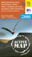
Wandelkaart - Topografische kaart 12 OS Explorer Map | Active Brecon Beacons NP - West - Central area | Ordnance Survey
Een van de beste detailkaarten die er op de wereld gemaakt worden: zeer gedetailleerd, prachtig helder kleurgebruik, veel topografische aspecten en - zeer belangrijk - allerlei toeristische en recreatieve aspecten zijn ingetekend. De perfecte kaart voor vakantie en vrije tijd: wandelen, fietsen of gewoon de omgeving verkennen. Door de grootte van de kaart, voor- en achterzijde, bestrijkt het een behoorlijk groot gebied!   These highly detailed maps show all the administrative boundaries, settlements as small as isolated farms, road network down to unfenced roads and country tracks, and field boundaries (hedges and drystone walls) which make navigation across the countryside much easier. Steep gradients on roads are indicated. Various landmarks, eg. powerlines, archaeological sites, windmills, churches and lighthouses are shown, and additional graphics indicate natural terrain features such as cliffs, scree, mud and vegetation variations. Contour interval is 5 metres in the lower parts…
25,95
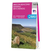
Wandelkaart - Topografische kaart 160 Landranger Brecon Beacons - Wales | Ordnance Survey
Zeer goede detailkaart met topografische ondergrond. Kleurgebruik is goed over nagedacht: bijzonder goed leesbaar en helder kaartbeeld. Hierop zijn toeristische symbolen van bezienswaardigheden ingetekend, daarnaast staan bijvoorbeeld campings en jeugdherbergen vermeld en - voor wandelaars het belangrijkst - alle right of way paden en Lange afstands Wandelpaden zijn er op te vinden. De ideale kaart voor het wandelen in Engeland, Wales of Schotland. De kaarten zijn te gebruiken met GPS (UTM OSGB36), de legenda is in het Engels, Frans en Duits.    Plaatsen op deze kaart: Merthyr Tydfil / Merthyr Tudful, Brecon / Aberhondu, Llandovery / Llanymddyfri, Rhandirmwyn, Cilycwm, Cynghordy, Tirabad, Gewnddwr, Upper Chapel, Lower Chapel, Llandeilo’r-Fan, Llanwrda, Halfway, Llangadog, Myddfai, Pentre-bach, Soar, Trawscoed, Llanddew, Aberyscir, Sennybridge, Cwmwysg, Talsarn, Brynamman, Glyntawe, Abercraf, Cwmllynfell, Ystalyfera, Rhyd-y-fro, Seven Sisters / Blaendulais, Ystradfellte, Coelbren, Pend…
19,50

Klanten-reviews van Wandelgids Brecon Beacons | Ordnance Survey

Er zijn nog geen beoordelingen voor dit productBen jij de eerste die een review plaatst?

Meer over Wandelgids Brecon Beacons | Ordnance Survey

Productomschrijving

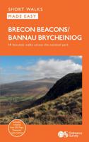
Get outside and enjoy ten short leisurely strolls across the Brecon Beacons National Park, indulging in wonderful mountain views across Southern Britain’s hilliest terrain. With routes for all abilities, enjoy a diverse range of experiences, including waterfalls, woodlands, riversides and even 12th century castle ruins.   Brecon Beacons Short Walks Made Easy routes include:       • Discover great mountain views from relatively level ground with routes at Mynydd Illtud and Craig y Cilau   • Or for a more strenuous walk, the ascent of Sugar Loaf will reward your uphill efforts with stupendous views across the national park   • Enjoy the thunderous sounds of the spectacular cascading waterfalls of Sgŵd Clun-gwyn and Sgŵd yr Eira, some of Wales most impressive!   • Delve into the Usk Valley for soothing riverside rambles from Brecon and Abergavenny, blessed with stunning views southwards towards the park’s highest peaks   • Spot an abundance of wildlife from the towpath along the Monmouthshire and Brecon Canal, where you will have the chance to see a working lock at the start   • Combine a fine stroll and bookshop browsing from the vibrant riverside town of Hay-on-Wye to the tranquillity of the Warren – a colourful riverside meadow   • For history lovers, explore the 17th century Newton House and 12th century castle via a magical stroll through Dinefwr Park, as well as castle ruins along a walk from Abergavenny       OS Short Walks Made Easy:   • 10 accessible walks suitable for the whole family – no walking experience needed!   • All routes are between 1 to 5 miles and can be completed all year round   • Know what to expect before you go: Information on locations of cafes/pubs and toilets, terrain, hilliness and accessibility for pushchairs and wheelchairs   • Large-scale simplified Ordnance Survey mapping for ultra-easy navigation and route-finding, featuring intuitive pictorial symbols   • Numbered points and route photographs which tie maps to route descriptions and walk profiles   • Enhance your adventure with stories behind each walk and nature notes   • Get active outside and enjoy the physical and mental health benefits
Productinformatie

    Verken gerelateerde categorieën

    Webshop.nl maakt gebruik van cookies. Ga je verder op onze website, ga dan akkoord met het plaatsen van cookies en de verwerking van deze data door ons en vermelde partners.