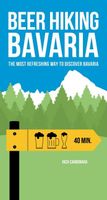
Wandelgids Beerhiking Bavaria | Helvetiq

0
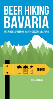
  Bavaria's beers and paths off the beaten track   Beer Hiking Bavaria combines much of what Bavaria is all about: wonderful hikes through cobbled old towns, dense forests and rugged mountain landscapes, past castles, traditional monastery breweries and lush barley fields.   In search of the best beer, the author Rich Carbonara has explored pictur...

Verkopers met dit product

Verkoper
Bezorging
Prijs
DeZwerver.nl logo
DeZwerver.nl
niet bekend
25,50

Anderen bekeken ook

Nieuw
Wandelgids Tenerife (Engelstalig) | Rother Bergverlag
Uitstekende wandelgids met een groot aantal dagtochten in dal en hooggebergte. Met praktische informatie en beperkt kaartmateriaal! Wandelingen in verschillende zwaarte weergegeven in rood/blauw/zwart. Aanbevolen wandelkaarten bij deze gids:   Voor het hele eiland Wandelkaart WKE7 Tenerife hiking map | Freytag & Berndt 1:50.000   of    Wandelkaart 233 Teneriffa | Kompass 1:50.000   Voor Nationaal Park El Teide Wandelkaart Tenerife - Teide - Anaga - Teno | Editorial Alpina 1:25.000   of   Wandelkaart 4 Parques Nacionales El Teide Red de Senderos -T enerife | CNIG - Instituto Geográfico Nacional 1:25.000     Tenerife can easily be described as the most versatile hiking paradise of the Canary Islands. The »Island of Bliss« not only offers the highest peak of the Canary archipelago and the whole of Spain – the Pico del Teide measuring 3718m – it also unites countless, completely different types of landscape: the extremely bare, almost desert-like south, holiday destination of sun aficion…
18,50
Nieuw
Wandelgids Gran Canaria | Rother Bergverlag
Gran Canary not only enjoys a fabulous reputation as a paradise of sunshine and beaches; it can also be described as one of the most versatile hiking islands of the Canary Archipelago. Connoisseurs praise it as a miniature continent because of its diversity of landscapes: shimmering dunes in contrast with luscious subtropical valleys, deep ravines with palm tree oases and glittering reservoirs, next to which are extensive pine tree forests and green slopes with grazing sheep and goats. To the North West cliffs drop down 800 m deep into the ocean, while in the centre of the island serrated, almost 2000 metre high ridges and bizarre rock monoliths emerge, which the Spanish writer Miguel de Unamuno once interpreted as »fossilised storms of fire and lava.   This Rother walking guide includes excursions to beaches and spectacular cave villages, walks through pine forests and atmospheric ridge paths. Due to the increased significance of hiking tourism, parts of what at times are more than 5…
18,50
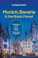
Reisgids Munich, Bavaria & The Black Forest | Munchen, Beieren & Zwarte WOud | Lonely Planet
De perfecte reisgids voor zowel de georganiseerde als de zelfstandige reiziger. Naast een algemene inleiding van het land / streek vol met praktische informatie over hoe je er het beste kunt reizen: slapen, eten, vervoer, excursies ... alles kun je er in vinden. Lonely Planet's local travel experts reveal all you need to know to plan the trip of a lifetime to Munich, Bavaria & the Black Forest.   Discover popular and off the beaten track experiences from visiting the fairytale castle of Neuschwanstein to celebrating lager and Bavarian culture at Oktoberfest, and exploring Germany's tallest mountain with a hike to the top of the Zugspitze.   Build a trip to remember with Lonely Planet's Munich, Bavaria & the Black Forest travel guide:   Our classic guidebook format provides you with the most comprehensive level of information for planning multi-week trips Updated with an all new structure and design so you can navigate Munich, Bavaria & the Black Forest and connect experiences…
24,95
Wandelgids 5885 Kompass Wanderführer Jakobsweg | Kompass
Kompass Wanderführer Jakobsweg Camino del Norte Der Jakobsweg Camino del Norte beeindruckt mit Küstenpanoramen, malerischen Dörfern und historischen Städten. Die Route führt entlang der nordspanischen Küste, durch grüne Landschaften und über charmante Brücken. Der spirituelle Pfad bietet unvergessliche Ausblicke auf das kantabrische Meer.   2in1 Wanderführer Jakobsweg Camino del Norte + Extra-Tourenkarte   Von Kompass-Experten erwanderte Touren Jede Tour mit Höhenprofil und Kartenausschnitt Ausflugs- und Übernachtungstipps Extra-Tourenkarte unterstützt bei Tourenauswahl Inklusive Download der GPS-Daten   Der Kompass Wanderführer mit Extra-Tourenkarte liefert die relevanten Informationen, die Du zur geplanten Wanderung benötigst. Er begleitet Dich sicher durch die gewählte Wanderdestination und bietet weitere Tipps rund um jede Menge Wandertouren. Kartenausschnitte geben dir örtliche Orientierung, Fakten und Berichte im Wanderführer erzählen dir Geschichten rund um die Gegend. Für unte…
19,95
Wandelgids 5756 Kompass Wanderführer Piemont - Valle Maira | Kompass
Goede Duitstalige wandelgids met heldere beschrijvingen van de wandeltochten. Met hoogteprofiel, kaartje en de benodigde praktische informatie als bijvoorbeeld de startlocatie met GPS coordinaten. De wandelingen zijn ingedeeld in zwaarte en dan op verschillende kleuren weergegeven. Beschreven worden eenvoudige wandelingen tot pittige (berg)tochten, voor getrainde en ongetrainde wandelaars, een aantal wandelingen zijn geschikt om met kinderen te doen. Belangrijke toevoeging bij de Kompass wandelgidsen is een bijgevoegde losse wandelkaart van het betreffende gebied waarop de wandelingen uit de gids op de kaart heel duidelijk zijn ingetekend. Schaal 1:35.000   Kompass Hiking Guide Piedmont, Valle Maira Piedmont with the Maira Valley offers majestic Alps, lonely valleys and charming villages. Hikers experience the alpine nature and traditional culture of this northern Italian region.   2-in-1 hiking guide Piedmont, Valle Maira + extra tour card.   Tours hiked by compass experts Eac…
18,50
Nieuw
Wandelgids Landscapes of the Tatra Mountains (Polen en Slowakije) | Sunflower books
Wandelgids: vele dagtochten worden degelijk beschreven met openbaar vervoer informatie, goede routebeschrijvingen en kaartmateriaal. Tevens enkele autotochten. (Engelstalig) The go-to Tatra Mountains travel guide for discovering the best walks and car tours. Strap on your boots and discover Tatra Mountains on foot with the Sunflower Tatra Mountains travel guide. And on the days when your feet may have had enough, enjoy some spectacular scenery on one of our legendary car tours.   The Sunflower Tatra Mountains guide is indispensable for hiking in the Tatra Mountains or seeing Tatra Mountains by car. For those who love mountain walks, there can be few places where hikers are better catered for than in the Polish Tatras and the Slovakian Tatras. Skilfully constructed paths make hiking in very rough terrain comparatively easy; signposting and waymarking are almost universally excellent.   Hillwalkers will be in their element here, but there are often shorter, easy suggestions for the less…
23,50
Wandelgids Madeira | Sunflower books
Wandelgids: vele dagtochten worden degelijk beschreven met openbaar vervoer informatie, goede routebeschrijvingen en kaartmateriaal. Tevens enkele autotochten. Deze gids staat goed bekend! Engelstalig, want nederlandstalige is uitverkocht en niet meer leverbaar. The go-to Madeira travel guide for over 30 years.    Strap on your boots and discover Madeira on foot with the Sunflower Madeira travel guide. And on the days when your feet may have had enough, enjoy some spectacular scenery on one of our legendary car tours.    The Sunflower Madeira guide is indispensable for hiking in Madeira or seeing Madeira by car. Not only has this 14th edition been updated to take into account treks recently out of bounds for one reason or another, but the format of the book has been expanded with larger type and a wider layout. The maps have been annotated with waypoints, and there are free downloadable GPS tracks for all the walks.   While dedicated hikers will revel in the island’s mountainou…
24,95
Wandelgids Canadian Rockies Trail Guide | Summerthought
The best loved and most detailed Canadian Rockies hiking guidebook is now in full color.   First published in 1971 and now in its 10th edition, the Canadian Rockies Trail Guide was the original guidebook with accurate distances and detailed descriptions to the trails of the Canadian Rockies.   Whether you’re a Canadian Rockies local or a visitor, the Canadian Rockies Trail Guide provides the best resource for hiking in the region, with everything from short interpretive trails to week-long backcountry treks. Now in its 10th edition and known affectionately as the “Bible” by outdoor enthusiasts, the popular tome is the most comprehensive and well-known guidebook to hiking in the region.   Having spent their entire adult lives hiking in the Canadian Rockies and writing about their experiences, authors Brian Patton and Bart Robinson are regarded as the ultimate authority on hiking in the Canadian Rockies. The Canadian Rockies Trail Guide is the only hiking guide to the region recommended…
29,95
Nieuw
Fietskaart - Wandelkaart 076 Nebelstein - Gmünd - Weitra - Gross Gerungs | Freytag & Berndt
The Nebelstein hiking map on a scale of 1:50,000 is the ideal companion for excursions, hikes and bike tours in the Oberes Waldviertel, Waldviertel Mitte and Mühlviertler Alm Freistadt regions Lainsitz, the Castles and Castles Trail, the St. John's Trail and the Life Trail. The hiking trails on the map are easy to follow thanks to the exact cartography by freytag & berndt and the ideal scale. Also for cyclists and mountain bikersthe Nebelstein hiking map is very suitable. In addition to demanding mountain bike routes, the course of the Waldviertel cycle path and parts of the EuroVelo 13 - Iron Curtain Trail can also be followed. Information on the Nebelstein hiking map 1:50,000 Hiking and long-distance hiking trails Cycle paths and mountain bike tours Attractive excursion destinations With info guide GPX Tracks zum Download Waterproof and tear resistant 90 x 61 cm, double-sided Info guide The "short and compact" info guide offers a journey through the regions of the Upper Waldviertel,…
13,95
Nieuw
Wandelgids Cyprus - South & North | Rother Bergverlag
Uitstekende wandelgids met een groot aantal dagtochten. Met praktische informatie en beperkt kaartmateriaal! Wandelingen in verschillende zwaarte weergegeven in rood/blauw/zwart. 192 pages, 122 photos, 50 maps in 1:25,000, 1:50,000 and 1:75,000, overview maps to a scale of 1:400,000 and 1:900,000 Cyprus is not only famous for its cultural heritage and 9000 year old past – »Aphrodite’s Island« is one of the most popular hiking destinations in the eastern Mediterranean. The centre of the island is dominated by the Troodos mountain measuring some 2000 m in height, which despite its considerable altitude is more reminiscent of European low mountains, due to its softly rounded and forested peak. This Rother hiking guide proposes 50 routes mostly ranging from easy to medium level. Next to mountain tours, it also includes a selection of coastal paths along bizarre cliffs and adventurous ravine tours. Forest paths and nature trails lead through aromatic cedar woods, silent valleys and to remo…
17,50

Klanten-reviews van Wandelgids Beerhiking Bavaria | Helvetiq

Er zijn nog geen beoordelingen voor dit productBen jij de eerste die een review plaatst?

Meer over Wandelgids Beerhiking Bavaria | Helvetiq

Productomschrijving

  Bavaria's beers and paths off the beaten track   Beer Hiking Bavaria combines much of what Bavaria is all about: wonderful hikes through cobbled old towns, dense forests and rugged mountain landscapes, past castles, traditional monastery breweries and lush barley fields.   In search of the best beer, the author Rich Carbonara has explored picturesque paths away from the tourist centres and put together his 50 favourites for this practical beer hiking guide. Each hike includes a detailed route description with length, duration, degree of difficulty and elevation profile as well as a well-founded characterisation of the type of beer that awaits you at the end of the day. Welcome to the beer and nature paradise Bavaria!   What you will like •   Original travel guide for Bavaria •   Detailed beer and route descriptions •   Refreshing gift idea for beer lovers •   Discover local beers •   Original gift idea •   From the successful "Bierwandern" series  

Verken gerelateerde categorieën

Webshop.nl maakt gebruik van cookies. Ga je verder op onze website, ga dan akkoord met het plaatsen van cookies en de verwerking van deze data door ons en vermelde partners.