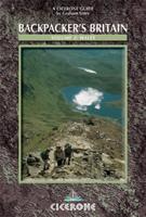
Wandelgids Backpacker's Britain | Cicerone

0
Guidebook includes 25 2 or 3-day walks taking walkers into the most scenic and wild parts of Wales, from Snowdon, the Glyderau and Carneddau in the north, down to the Black Mountains, Brecon Beacons and Fforest Fawr ranges in the south, including the ridges of the Arans, Arenigs, Berwyns and Cadair Idris, the Cwmdeuddwr hills and Plynlimon.   The ...

Verkopers met dit product

Verkoper
Bezorging
Prijs
DeZwerver.nl logo
DeZwerver.nl
2,95
18,95

Anderen bekeken ook

Wandelkaart A15 Sarrabus da Costa Rei a Porto Corallo | Abies
Sarrabus is a territory that is not known by everybody yet. Here lies its charm and this has made possible to keep this environmental area out of big building speculations and also out of history. In fact it preserves little traces of the past, and paradoxically the remains from the prehistoric age are more meaningful than those back to more recent times. We can find traces from the most remote past not far from the State Road SS125, that from Muravera goes to Costa Rei, by visiting the nuraghe Murtas, the nuraghe S’Aqua Secis and the megalithic complexes of Scalas and Cuili Piras. They are about ten menhirs, almost fully intact, arranged in groups and fixed in the ground in the original orthostatic position. They have been put in relation with the position of the sun and the moon, at dawn and at sunset. In fact they were used as a very precise astronomic calendar but also for religious purposes since they represented both the masculine divinity and the fertility according to the wors…
12,95
Reisgids Michelin groene gids Portugal | Lannoo
De serie Groene Gidsen van Michelin is een beproefde en betrouwbare reisgidsenreeks. Of u nu lekker lang op vakantie gaat of er zomaar even tussenuit trekt, de Groene Gids wijst u de weg naar alle bijzonderheden die uw reisbestemming te bieden heeft op een boeiende, grondige en praktische manier. Een handige sterrenbeoordeling vertelt u wat de reis of een uitstap waard is. Dankzij het handige adressenboekje bij elke stad hebt u een mooie keuze van eet-, slaap-, winkel- en andere ontspanningsadresjes. De praktische inlichtingen geven u bijzonder nuttige tips ter voorbereiding van uw reis of uitstap en tal van suggesties om optimaal van uw reis te kunnen genieten. De grondig uitgewerkte inleiding biedt u alle geografische, historische en culturele achtergrondinformatie over uw reisbestemming. De heldere cartografie wijst u de weg door middel van stadsplattegronden, plattegronden van bezienswaardigheden, thematische kaarten, kaarten met toeristische rondritten en overzichtskaarten. De se…
27,99
Wandelkaart - Topografische kaart 147 OS Explorer Map Sevenoaks and Tonbridge | Ordnance Survey
Met zijn 4cm voor 1 km (2 ½ cm voor 1 mijl) schaal, is de OS Explorer kaartenserie de ideale en meest gedetailleerde kaartenreeks voor mensen die graag outdoor-activiteiten zoals fietsen, wandelen, paardrijden, klimmen en watersporten. Deze kaart is nog gedetailleerder dan de 'gewone' Landranger maps. Voor- en achterzijde bedrukt! Zeker op de moors en andere natuurgebieden van onschatbare waarden met echt alle aspecten van het landschap op de kaart ingetekend. Zeer goede detailkaart met topografische ondergrond. Hierop zijn toeristische symbolen van bezienswaardigheden ingetekend, daarnaast staan bijvoorbeeld campings en jeugdherbergen vermeld en - voor wandelaars het belangrijkst - alle right of way paden en Lange afstands Wandelpaden zijn er op te vinden. De ideale kaart voor het wandelen in Engeland, Wales of Schotland.   These highly detailed maps show all the administrative boundaries, settlements as small as isolated farms, the road network down to unfenced roads and country tra…
19,50
Wandelgids Wales | Uitgeverij Elmar
De Rother wandelgids Wales beschrijft de 50 mooiste kust- en bergwandelingen in het westen van het Verenigd Koninkrijk - van Pembrokeshire tot Anglesey, van de Ierse Zee tot de grens met Engeland, in de bergachtige regio's, het binnenland en langs de kust.   * Betrouwbare routebeschrijvingen * Gedetailleerde wandelkaarten * Informatieve hoogteprofielen * Downloadbare GPS Tracks   Aanbevolen wandelkaarten bij deze gids:   The Gower + directe omgeving Wandelkaart - Topografische kaart 164 Explorer Gower, Gwyr | Ordnance Survey 1:25.000 Wandelkaart - Topografische kaart 178 Explorer Llanelli, Ammanford, Rhydaman | Ordnance Survey 1:25.000   Pembrokeshire Wandelkaart - Topografische kaart OL35 Explorer Pembrokeshire North - Gogledd Sir Benfro | Ordnance Survey 1:25.000 Wandelkaart - Topografische kaart OL36 Explorer South Pembrokeshire - De Sir Benfro | Ordnance Survey 1:25.000 Wandelkaart - Topografische kaart 198 Explorer Cardigan, New Quay | Ordnance Survey 1:25.000 Wandelkaart - Topog…
19,99
Wandelkaart A06 Siniscola | Abies
Siniscola area at 1:25,000 in a series of contoured maps from Ed. Abies. Overprint highlights campsites and agriturismo accommodation, climbing sites, wild sheep and bird watching sites and archaeological remains. This title has no UTM grid. Main series at 1:60,000 (Nos. 1 to 12) The maps have contours at 100m intervals and colouring for woodlands and maquis shrubland. Local trails are highlighted, with additional overprint for selected hiking, mountain bike and kayaking routes listed on the reverse of the maps with brief notes and grading for the degree of difficulty. All the maps have a UTM grid for GPS users. Very extensive range of symbols highlight numerous places of interest and tourist facilities, including campsites and caravan parks, beaches, sport and recreational sites, archaeological remains and nuraghi, etc. The maps also indicate places where typical local products can be purchased. On the reverse each title has descriptions of its main places of interest, beaches, etc…
12,95
Nieuw
Wandelgids GR 70: The Robert Louis Stevenson Trail van Le Puy tot St-Jean du Gard | Cicerone
Uitstekende wandelgids van een gerenommeerde Engelse uitgever. De tochten zijn met zorg beschreven en voorzien van allerhande nuttige informatie. Met beperkt kaartmateriaal. Aanbevolen wandelkaarten bij deze gids 1:100.000 Wandelkaart GR 70 The Stevenson Trail | IGN - Institut Géographique National Als overzichtskaart Of Wegenkaart 156 Le Puy en Velay - Privas - Mende | IGN - Institut Géographique National Wegenkaart 163 Avignon - Nimes | IGN - Institut Géographique National  of 1:25.000 1. Wandelkaart - Topografische kaart 2835OT Le Puy-en-Velay | IGN - Institut Géographique National 2. Wandelkaart - Topografische kaart 2836OT Gerbier de Jonc | IGN - Institut Géographique National 3. Wandelkaart - Topografische kaart 2736SB Monistrol d'Allier, Solignac-sur-Loire, Cayres | IGN - Institut Géographique National 4. Wandelkaart - Topografische kaart 2737SB Langogne - Grandrieu | IGN - Institut Géographique National 5. Wandelkaart - Topografische kaart 2738SB Le Bleymard | IGN - Institut G…
23,95
Wandelkaart - Topografische kaart OL62 OS Explorer Map Coreen Hills & Glenlivet | Ordnance Survey
Met zijn 4cm voor 1 km (2 ½ cm voor 1 mijl) schaal, is de OS Explorer kaartenserie de ideale en meest gedetailleerde kaartenreeks voor mensen die graag outdoor-activiteiten zoals fietsen, wandelen, paardrijden, klimmen en watersporten. Deze kaart is nog gedetailleerder dan de 'gewone' Landranger maps. Voor- en achterzijde bedrukt! Zeker op de moors en andere natuurgebieden van onschatbare waarden met echt alle aspecten van het landschap op de kaart ingetekend. Zeer goede detailkaart met topografische ondergrond. Hierop zijn toeristische symbolen van bezienswaardigheden ingetekend, daarnaast staan bijvoorbeeld campings en jeugdherbergen vermeld en - voor wandelaars het belangrijkst - alle right of way paden en Lange afstands Wandelpaden zijn er op te vinden. De ideale kaart voor het wandelen in Engeland, Wales of Schotland. Map sheet OL 62 covers Correen Hills and Glenlivet. Highlights include Cairngorms National Park, Gordon Way and Badingair Hill. Also includes Water of Bogie, Rhynie…
19,50
Nieuw
Wegenkaart - landkaart Kosovo | Freytag & Berndt
Uitstekende wegenkaart van Kosovo. Met index, toeristische informatie en afstanden in kilometers. Gedetailleerde, eenzijdige landkaart van Kosovo, prima geschikt voor planning en rondtrekken. De berijdbare wegen zijn goed weergeven, zowel de hoofdwegen als provinciale en lokale wegen; wegnummers worden vermeld. Afstanden tussen plaatsen zijn in kilometers op de kaart ingetekend, daarnaast worden ook op belangrijke plekken benzinepompen gemarkeerd. In het kaartbeeld wordt door middel van schaduw het reliëf weergegeven en soms enkele punten in het landschap met de daadwerkelijke hoogte. Provinciegrenzen zijn goed terug te vinden, nationale parken en reservaten ook. Met allerhande symbolen worden toeristische bezienswaardigheden weergegeven als monumenten, historisch belangrijke plekken en uitzichtpunten. In bepaalde plaatsen zijn hotels en campings te vinden, luchthavens, treinverbindingen en havens vindt u er ook op!   This detailed road map of Kosovo is very suitable for planning and …
14,95
Nieuw
Wegenkaart - landkaart 131 Forêt Noire, Alsace, Vallée du Rhin | Michelin
Speciale toeristische kaart, gemaakt voor een goed bezocht gebied en uitvergroot. Daardoor zeer prettig leesbaar met een hoog nivo wat we van Michelin al veel langer gewend zijn. Alle wegen staan er op, met verschillende kleuren voor de aparte soorten wegen. Verder veel aandacht met symbolen voor de bezienswaardigheden in de regio, de bekende groene stroken naast de mooie wegen en ingetekende doorgaande wandelroutes als grande randonnees. Part of Michelin's Zoom series covering major towns and popular holiday areas throughout France, this map of the Black Forest, Alsace and the Rhine Valley covers both sides of the Rhine Valley, extending from northern Switzerland to Saarland and Heidelberg, with the Black Forest on the German side and the Vosges mountains in France. The map shows road detail from motorways to rough tracks and footpaths, with intermediate road distances shown on most roads, toll and toll-free sections of motorways are indicated and various road obstacles such as stee…
10,95
Nieuw
Wandelgids GR 11 Spaanse Pyreneeen - Through the Spanish Pyrenees | Cicerone
Uitstekende wandelgids van dit geweldige gebied. goed beschreven met veel praktische informatie om de route te kunnen lopen, inclusief redelijke kaarten. Beschrijving van de GR 11, het lange afstandswandelpad aan de Spaanse kant van de Pyreneeën. Aanbevolen wandelkaarten Schaal 1:50.000 Wandelkaart Senda Pirenaica GR11 | Editorial Alpina - Set van 21 kaarten Of Wandelkaarten van Rando Pyreneeën - 10 losse kaarten This comprehensive guidebook to the magnificent GR11 trail, which runs 820km from the Atlantic to the Mediterranean, provides everything trekkers will need to take up the challenge - detailed route description, excellent photographs, lots of background information and unique, custom-produced maps. This glorious traverse of the Pyrenees, on the Spanish side, is a serious challenge - passing over a succession of high alpine passes where boulderfields, scree slopes and occasional snowfields may need to be crossed. It is presented in 47 stages of 8-31km.    It is well waymarked a…
23,95

Klanten-reviews van Wandelgids Backpacker's Britain | Cicerone

Er zijn nog geen beoordelingen voor dit productBen jij de eerste die een review plaatst?

Meer over Wandelgids Backpacker's Britain | Cicerone

Productomschrijving

Guidebook includes 25 2 or 3-day walks taking walkers into the most scenic and wild parts of Wales, from Snowdon, the Glyderau and Carneddau in the north, down to the Black Mountains, Brecon Beacons and Fforest Fawr ranges in the south, including the ridges of the Arans, Arenigs, Berwyns and Cadair Idris, the Cwmdeuddwr hills and Plynlimon.


The mountains of Wales are a great place to get away from it all for a few days, and this book describes the very best backpacking routes throughout the principality. A total of 25 two- or three-day walks take you into the most scenic, beautiful and wild parts of Wales, each one with a night or more out among the mountains at wild camp sites, bothies or hostels.

The routes cover all the main mountain ranges, from Snowdon, the Glyderau and Carneddau in the north, down to the Black Mountains, Brecon Beacons and Fforest Fawr ranges in the south.

Everything in between is included too, such as the superb ridges of the Arans, Arenigs, Berwyns and Cadair Idris, and the bleak moorland vastness of the Cwmdeuddwr hills and Plynlimon.

Details of equipment, mountain safety and navigation as well as a bibliography make this a complete guide to backpacking in Wales.

Benodigde kaarten

OS Landranger 1:50,000. Sheets: 115, 124, 125, 135, 148

OS Explorer 1:25,000. Sheets: 200, 256

OS Outdoor Leisure 1:25,000. Sheets: 12, 13, 17, 18

Verken gerelateerde categorieën

Webshop.nl maakt gebruik van cookies. Ga je verder op onze website, ga dan akkoord met het plaatsen van cookies en de verwerking van deze data door ons en vermelde partners.