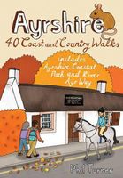
Wandelgids Ayrshire | Pocket Mountains

0
Handige compacte wandelgids met 40 dagwandelingen. Deze gids bevat kleine kaartjes en leuke uitgebreide informatie over wat er langs de route te zien is. Goede wandelkaarten zijn echter we noodzakelijk voor deze tochten: de Ordnance Survey explorer maps of Landanger maps zijn zeer geschikt.   The county of Ayrshire is located on the Firth of Clyde...

Verkopers met dit product

Verkoper
Bezorging
Prijs
DeZwerver.nl logo
DeZwerver.nl
2,95
10,95

Anderen bekeken ook

Wandelgids Ayrshire | Pocket Mountains
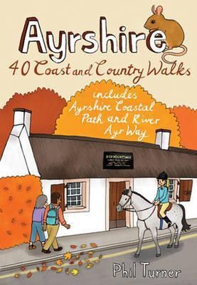
Handige compacte wandelgids met 40 dagwandelingen. Deze gids bevat kleine kaartjes en leuke uitgebreide informatie over wat er langs de route te zien is. Goede wandelkaarten zijn echter we noodzakelijk voor deze tochten: de Ordnance Survey explorer maps of Landanger maps zijn zeer geschikt.   The county of Ayrshire is located on the Firth of Clyde on the beautiful West Coast of Scotland and is known as one of the most fertile areas of the country, famed for its cattle and crops. Although more industrial to the north, it is in the main a landscape made for walking with an abundance of open countryside and rugged little hills, golden sandy beaches and beautiful sunsets. This guide features 40 mostly moderate walks full of interest which explore all aspects of the region, from craggy cliffs and caves to historic castles, ancient forests to sandy shorelines.
10,95
Wandelgids Caithness and Sutherland | Pocket Mountains
Handige compacte wandelgids met 40 dagwandelingen. Deze gids bevat kleine kaartjes en leuke uitgebreide informatie over wat er langs de route te zien is. Goede wandelkaarten zijn echter we noodzakelijk voor deze tochten: de Ordnance Survey explorer maps of Landanger maps zijn zeer geschikt. The county of Ayrshire is located on the Firth of Clyde on the beautiful West Coast of Scotland and is known as one of the most fertile areas of the country, famed for its cattle and crops. Although more industrial to the north, it is in the main a landscape made for walking with an abundance of open countryside and rugged little hills, golden sandy beaches and beautiful sunsets. This guide features 40 mostly moderate walks full of interest which explore all aspects of the region, from craggy cliffs and caves to historic castles, ancient forests to sandy shorelines. Sutherland and Caithness are the most northerly parts of mainland Britain. Northwest Sutherland is a landscape of sandy beaches and …
10,95
Wandelgids Cornwall | Pocket Mountains
Handige compacte wandelgids met 40 dagwandelingen. Deze gids bevat kleine kaartjes en leuke uitgebreide informatie over wat er langs de route te zien is. Goede wandelkaarten zijn echter we noodzakelijk voor deze tochten: de Ordnance Survey explorer maps of Landanger maps zijn zeer geschikt.   With over 400 miles of mainland coastline and an excellent public path network, Cornwall is all about rugged shorelines, gorgeous sandy beaches, turquoise waters, meandering rivers and wide open countryside. Add to the mix a fantastic diversity of flora and fauna, interesting geology, fascinating history and some of the most striking views in the country and you have one of England's best regions to explore on foot. In these 40 walks, all between two and eight miles in length, Keith Fergus leads you through some of the best rambles Cornwall has to offer. Plaatsen in het boek Bedruthan Steps, Bessie’s Cove, Bude, Cambeak, Camel Estuary, Cape Cornwall, Carbis Bay, Cawsand, Charlestown, Crackington …
10,95
Wandelgids Fort William and Lochaber | Pocket Mountains
Handige compacte wandelgids met 40 dagwandelingen. Deze gids bevat kleine kaartjes en leuke uitgebreide informatie over wat er langs de route te zien is. Goede wandelkaarten zijn echter wel aan te raden voor deze tochten: de Ordnance Survey explorer maps of Landranger maps zijn zeer geschikt. With the historic town of Fort William at its heart, Lochaber boasts some of Scotland's most celebrated mountains and glens, beautiful sea lochs and, on the craggy west coast, dazzling white sandy beaches. Ben Nevis may draw the crowds, but with countless miles of lower-level paths and tracks to explore there is far more than Britain's highest mountain for walkers to enjoy in the region which lays claims to the title of 'The Outdoor Capital of the UK'. This guide features 40 varied walks that take in the very best of Lochaber. From the iconic Glencoe and Glen Nevis to the wild lands of Ardnamurchan and Moidart, there is something for everyone in this diverse selection of routes.
10,95
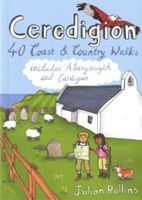
Wandelgids Ceredigion | Pocket Mountains
Handige compacte wandelgids met 40 dagwandelingen. Deze gids bevat kleine kaartjes en leuke uitgebreide informatie over wat er langs de route te zien is. Goede wandelkaarten zijn echter we noodzakelijk voor deze tochten: de Ordnance Survey explorer maps of Landanger maps zijn zeer geschikt. Encompassing the southern half of Cardigan Bay on the wild west coast of Wales, Ceredigion is famed for its glorious sandy beaches, dramatic sea cliffs and caves, spectacular sunsets and a wonderful array of wildlife, including the largest colony of bottlenose dolphins in Europe. Away from the sea, rolling farmland, fertile river valleys and characterful market towns give way to the brooding Cambrian Mountains, the main watershed of Wales. As one of the least populated regions of Wales, there is plenty of room to walk and in these 40 rambles Julian Rollins leads you through the best countryside and seascapes Ceredigion has to offer.
10,95
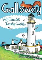
Wandelgids Galloway | Pocket Mountains
Handige compacte wandelgids met 40 dagwandelingen. Deze gids bevat kleine kaartjes en leuke uitgebreide informatie over wat er langs de route te zien is. Goede wandelkaarten zijn echter we noodzakelijk voor deze tochten: de Ordnance Survey explorer maps of Landanger maps zijn zeer geschikt.   Made up of the old counties of Wigtownshire and The Stewartry, Galloway covers a vast swathe of Scotland's quiet southwest corner. This under-discovered area offers 260km of coast, full of sandy beaches and towering cliffs, lonely heather-clad moors and quiet hills. Add to this plenty of wildlife, a rich artistic heritage, strong spiritual influences and a climate kissed by the warming Gulf Stream, and you have a region beckoning to be visited.
10,95
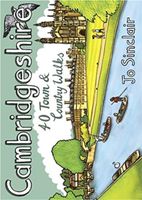
Wandelgids Cambridgeshire | Pocket Mountains
Handige compacte wandelgids met 40 dagwandelingen. Deze gids bevat kleine kaartjes en leuke uitgebreide informatie over wat er langs de route te zien is. Goede wandelkaarten zijn echter we noodzakelijk voor deze tochten: de Ordnance Survey explorer maps of Landanger maps zijn zeer geschikt.   With its hallowed streets, glorious colleges and peaceful riverside walks along the Cam, Cambridge is the jewel in the crown of Cambridgeshire and a richly rewarding city to tour on foot. This is a big county, however, and it is well worth exploring the countryside beyond the glittering city. This guide takes you through the rich heritage of the county's market towns and pretty thatched-roofed villages, along old hilltop tracks and into ancient woodlands, full of interest and beauty. Cambridgeshire is also the lowest and flattest place in England and the straight roads, endless network of dykes and isoloted windmills of the fenlands have a stange minimalist magnetism which is hard to resist.
10,95
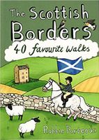
Wandelgids The Scottish Borders | Pocket Mountains
Handige compacte wandelgids met 40 dagwandelingen. Deze gids bevat kleine kaartjes en leuke uitgebreide informatie over wat er langs de route te zien is. Goede wandelkaarten zijn echter we noodzakelijk voor deze tochten: de Ordnance Survey explorer maps of Landanger maps zijn zeer geschikt.   The Scottish Borders cover a vast area, stretching from the east coast to rural Dumfriesshire and from the more populous Lothians to the border with England. Although there are no very high mountains, the Borders have always attracted walkers keen to explore the quiet moorlands, rolling hills, ancient woodland and rugged coast, as well as the romantic ruins of abbeys and castles, grand estates and rich literary heritage of the area.Ancient native tribes and Roman legions left their mark on this landscape, as did years of fierce warfare with our southern neighbours and raiding by ruthless Border Reivers. These 40 walks will introduce you to some of the fascinating history which shaped this most in…
10,95
Wandelgids Harris | Pocket Mountains
The Isle of Harris is home to some wonderful walking country, from the rugged ridges and glens of the Harris Hills to the astonishingly beautiful white sand beaches of the island's west coast, while the remarkably complex eastern coastline is punctuated with sea lochs, headlands, coves and bays. These environments are also full of historical interest and spectacular wildlife. These 25 walking routes explore the island's range of landscapes, including strolls along the west coast beaches, half-day walks on rocky coastal paths, day-long mountain ridge traverses and wild country backpacking routes.  
10,95
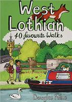
Wandelgids West Lothian | Pocket Mountains
Handige compacte wandelgids met 40 dagwandelingen. Deze gids bevat kleine kaartjes en leuke uitgebreide informatie over wat er langs de route te zien is. Goede wandelkaarten zijn echter we noodzakelijk voor deze tochten: de Ordnance Survey explorer maps of Landanger maps zijn zeer geschikt.     Midway between Glasgow and Edinburgh on the southern shore of the Firth of Forth, West Lothian has a surprising number of country parks, craggy hills and wildlife havens and is home to several prehistoric burial sites, ruined castles and palaces and stately homes as well as the remains of the Antonine Wall, the Roman Empire's northernmost frontier. Although the area is predominantly rural there were also extensive coal, iron and shale oil mining operations in the 18th and 19th centuries which left behind distinctive red spoil heaps, or bings, as they are known in Scotland, and the Union Canal which linked Falkirk to the capital via some of the county's most impressive aqueducts.  
10,95

Klanten-reviews van Wandelgids Ayrshire | Pocket Mountains

Er zijn nog geen beoordelingen voor dit productBen jij de eerste die een review plaatst?

Meer over Wandelgids Ayrshire | Pocket Mountains

Productomschrijving

Handige compacte wandelgids met 40 dagwandelingen. Deze gids bevat kleine kaartjes en leuke uitgebreide informatie over wat er langs de route te zien is. Goede wandelkaarten zijn echter we noodzakelijk voor deze tochten: de Ordnance Survey explorer maps of Landanger maps zijn zeer geschikt.   The county of Ayrshire is located on the Firth of Clyde on the beautiful West Coast of Scotland and is known as one of the most fertile areas of the country, famed for its cattle and crops. Although more industrial to the north, it is in the main a landscape made for walking with an abundance of open countryside and rugged little hills, golden sandy beaches and beautiful sunsets. This guide features 40 mostly moderate walks full of interest which explore all aspects of the region, from craggy cliffs and caves to historic castles, ancient forests to sandy shorelines.

Productinformatie

    Verken gerelateerde categorieën

    Webshop.nl maakt gebruik van cookies. Ga je verder op onze website, ga dan akkoord met het plaatsen van cookies en de verwerking van deze data door ons en vermelde partners.