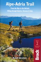
Wandelgids Alpe-Adria Trail | Bradt Travel Guides

0
Goede wandelgids met heel veel praktische informatie. Naast een duidelijke beschrijving van de route veel adressen om te kunnen overnachten. Per etappe wordt er een hoogteprofiel gegeven, kaartmateriaal is iets minder van kwaliteit, per deel van de route wordt verwezen naar de echte wandelkaarten.  This is the first English-language guide to the e...

Verkopers met dit product

Verkoper
Bezorging
Prijs
DeZwerver.nl logo
DeZwerver.nl
2,95
20,95

Anderen bekeken ook

Wandelgids Via Dinarica | Bradt Travel Guides
Bijzondere wandelgids : het beschrijft de wandelroute in Bosnie Herzegovina van de Via Dinarica, the White trail. Veel praktische informatie, redelijk kaartmateriaal en een goede beschrijving van de route.  This is the first detailed guide to the Bosnian part of the new Via Dinarica hiking trail that carves its way through the Dinaric Alps, one of Europe's least explored mountain ranges and last true wilderness frontiers, connecting the seven nations of Slovenia, Croatia, Bosnia and Herzegovina, Montenegro, Serbia, Kosovo, and Albania. In total, this trail system will span over 1,350km, 333km of which is in Bosnia Herzegovina. The Via Dinarica consists of three routes - White, Green and Blue - and this guide focuses primarily on the White Trail through Bosnia and Herzegovina, following the natural flow of the highest peaks of the Dinaric Alps. Detailed descriptions of each of the 12 stages of the White Trail through Bosnia and Herzegovina are included, along with maps, altitude charts…
20,95
Wandelgids The Slovene Mountain Trail | Cicerone
Uitstekende wandelgids van de Slovenska Planinska Pot. Goed beschreven met veel praktische informatie om de route te kunnen lopen, inclusief redelijke kaarten. A guidebook to trekking the Slovene Mountain Trail, crossing Slovenia from Austria to the Adriatic. The 550km route is presented in a series of 12 3 to 6-day treks of all levels of difficulty, all featuring start and finish points that can be accessed by public transport. They can be completed as single sections or linked to create a longer trip. Each day is graded: low-grade walking is mostly on tracks or lanes with no steep ascents, whereas the most difficult stages may involve steep and technical terrain including fixed protection or sections of via ferrata, for which a helmet, self-belaying equipment and the appropriate experience are required.   In addition to clear route description and mapping, the guide provides all the practical information you will need to plan your trip, covering transport, accommodation and safet…
23,95
Reisgids Slovenia - Slovenie | Bradt Travel Guides
This new, thoroughly updated and significantly expanded third edition of Bradt's Slovenia offers expert travel advice about this engaging European country. Slovenia has emerged as a serious year-round tourist destination that combines captivating city breaks in the capital Ljubljana with stellar outdoor activities in varied, wildlife-rich landscapes. Widely renowned as a world leader in green tourism and sustainable development, Slo-venia showcases many of Europe's finest elements in an area roughly the size of New Jer-sey. Here you can walk amid Alpine mountains or lush valleys, visit glacial lakes and charming Adriatic coastal towns, or admire a rich tapestry of architectural styles while delving into the country's captivating culture, diverse history or delicious cuisine. Ljubljana is a vibrant capital, so Bradt's Slovenia provides intimate detail on where to stay and eat, what to see and do, and how to get around. But this guide will also inspire and inform wider explorations in t…
27,50
Wandelgids Camino Ignaciano Loyola - Manresa 675 km | Bradt Travel Guides
In 1522 Ignatius of Loyola made a pilgrimage from his home in Spain's Basque country to Montserrat and Manresa. This new guide from Bradt provides all the information needed to follow in his footsteps in a neat, easy-to-carry portable format, including an essential mix of practicalities, such as when to go, where to stay along the route, national parks and public transport, and a detailed breakdown of the route's 27 stages. Start and finish points, level of difficulty, duration, distance, ascent and descent, and route descriptions are all included, as well as elevation charts, maps and what to see along the way. This is a unique secular walking guide to a religious-themed walk which takes intrepid hikers from the imposing tower house and sanctuary of Loyola in the Basque Country, up through the stunning Basque mountains and down to the beautiful town of Laguardia with its myriad wine caves. Through the vineyards of Alava and world-famous La Rioja, the trail visits lively Logroño and f…
23,95
Reisgids Zimbabwe | Bradt Travel Guides
Voor vele landen net zo goed, zo niet beter dan de Planet. Beduidend soberder uitgevoerd, maar ook met veel informatie voor backpackers en met veel kaartmateriaal. Een aanrader! This new fourth edition of Bradt's Zimbabwe remains the most authoritative and trusted guide available, written in an engaging and entertaining style by an expert author who has been visiting Zimbabwe annually for nearly 30 years and now spends six months of each year there. In this new thoroughly revised edition, Paul Murray brings a particular focus for those wanting to travel independently as well as visitors on organised tours. Game viewing in some of Africa's greatest national parks is a rewarding experience and this guide offers in-depth information on the facilities, advice on itinerary planning as well as how to select a safari. Accommodation is covered with up-to-date information on everything from luxury safari camps to budget stays for younger travellers who arrive overland, heading for the fast flo…
23,95
Wandelgids Karawanken - Slovenie - Walking in the Karavanke | Cicerone
Goede wandelgids met veel dagtochten; redelijk kaartmateriaal en goede praktische informatie. This guidebook offers 23 walking routes set across the magnificent 120km-long Karavanke mountain range, which forms a natural border between Austria and Slovenia. Commonly known as 'the way the Alps used to be', as it is yet to experience the extent of commercial development known by the Western Alps, it is one of the longest ranges in Western Europe but it remains genuinely unspoilt and relatively unvisited by English-speaking hillwalkers. The guide's walks begin in pretty towns and villages, and most of them access the peaks from the relatively more gentle Slovenian side of the range, where forest-clad slopes lead to grassy summits where spectacular views can be enjoyed. Arranged by peak from west to east along the range, most of the summits can be reached by waymarked paths and trails. The guide gives all the practical details you need on transport, accessing the routes, accommodation and …
20,95
Reisgids City guides Bratislava | Bradt Travel Guides
Stadsgids van deze goede uitgever in handzaam formaat. Voor vele steden net zo goed, zo niet beter dan de Planet. Beduidend soberder uitgevoerd, maar ook met veel informatie voor backpackers en met veel kaartmateriaal. Een aanrader! This new, thoroughly updated fifth edition of Bradt's Bratislava remains the only standalone guide from a major publisher that is dedicated to this compact and increasingly popular capital of Slovakia - declared by the legendary Casanova as 'the most beautiful city in Europe' (and he knew a thing or two about beauty). Situated by the mighty Danube River and nestling in the Small Carpathian Mountains, with new downtown skyscrapers overlooking refurbished old buildings, Bratislava is indeed a good-looking city, filled with good-looking people who seem to enjoy life. Bratislava is a city that effortlessly blends history with hedonism, where world-class restaurants have been joined by a clutch of artisan coffee houses and literary tea- and bookshops.   Loca…
21,95
Fietsgids Cycling East Anglia | Bradt Travel Guides
Following the same format as Bradt's Cycling in Cornwall & the Isles of Scilly, this new cycling guide to East Anglia offers 21 routes for beginners and 'leisure cyclists', covering Norfolk, Suffolk and Cambridgeshire. Each ride includes comprehensive directions, as well as background features on local history, wildlife and culture. All are linked to OS Explorer maps and relevant National Cycle Network routes (NCN), and include National Grid Reference (NGR) coordinates. In addition, each route has been mapped on route planning and navigation app komoot, where readers can find detailed route insights including an elevation profile and waytype and surface information. Using the komoot app for iOS or Android, readers can also use their smartphones to navigate each route.East Anglia, the snail-like bulge protruding off the back of the United Kingdom's east coast, is a vast flatland of broads, fens and marshes, stretched out under a wide sky. Despite its proximity to London and the Midland…
18,50
Reisgids Armenia (with Nagorno Karabagh) | Bradt Travel Guides
Er bestaat geen Lonely Planet van Armenië. Daarom vermelden wij de enige goede reisgids, die van Bradt Guides. Voor vele landen net zo goed, zo niet beter dan de Planet. Beduidend soberder uitgevoerd, maar ook met veel informatie voor backpackers en met veel kaartmateriaal. Een aanrader! This new, thoroughly updated sixth edition of Bradt’s Armenia remains the only standalone, English-language guide to this mountainous post-Soviet republic at the crossroads of Europe, Asia and the Middle East. Packed with detailed background information and invaluable practical advice, Bradt’s Armenia remains the essential choice for anyone travelling to this beautiful country, which is now easily and cheaply accessed by air. Following recent political changes, the story of this new republic is rapidly being rewritten, with transformations extending far beyond the vibrant capital of Yerevan. Road infrastructure has greatly improved, while rural tourism is coming to life in even far-flung provinces, …
27,95
Fietsgids Cycling in Surrey | Bradt Travel Guides
Bradt's new cycling guide to Surrey - part of a growing series designed for the saddle bag - offers 21 routes, each including comprehensive directions plus contextual exploration of history, wildlife and culture, written by avid cyclist and historian Ross Hamilton. Each route links to OS Explorer maps and, where relevant, National Cycle Network routes, while QR codes connect with downloadable GPX maps via the komoot app, enabling navigation by smartphone. With a dedicated bike-hire section (so you have an alternative if your bicycle isn't suitable for a particular ride) and accommodation suggestions, this book is an indispensable travel companion for two-wheeled adventures. Once a relatively sparsely populated and rustic area despite its proximity to London, present-day Surrey is prime commuter-belt territory. Even so, the county has not lost its rural charm. As well as boasting many Areas of Outstanding Natural Beauty, it is England's most wooded county and is riddled with rivers inc…
18,50

Klanten-reviews van Wandelgids Alpe-Adria Trail | Bradt Travel Guides

Er zijn nog geen beoordelingen voor dit productBen jij de eerste die een review plaatst?

Meer over Wandelgids Alpe-Adria Trail | Bradt Travel Guides

Productomschrijving

Goede wandelgids met heel veel praktische informatie. Naast een duidelijke beschrijving van de route veel adressen om te kunnen overnachten. Per etappe wordt er een hoogteprofiel gegeven, kaartmateriaal is iets minder van kwaliteit, per deel van de route wordt verwezen naar de echte wandelkaarten. 

This is the first English-language guide to the epic new 750-km hiking route through the mountains of Austria, Slovenia and Italy, from the foot of the Grossglockner (at 3,798m, the highest peak in Austria and the Eastern Alps) to Muggia near Trieste on the Adriatic coast. Detailed maps and route descriptions for all 44 stages of the route are included, with a clear breakdown of time, distance and ascent for each stage. Published in a small, handy-sized format which is easy to pack and carry, it is written by an expert who has authored over half a dozen hiking guides and who specialises in Eastern and Central Europe. He has been a regular visitor to the borderlands of Slovenia, Austria and Italy for over 15 years, as well as living for two years in neighbouring Croatia. The Alpe-Adria route is well marked, relatively easy to walk and is suitable for hikers of all abilities as well as families a point which is emphasised in the guide. The route takes in spectacular, unspoilt mountain scenery, alpine lakes, rolling coastal hills, beautiful villages and several national parks and nature reserves. An introduction covering the history, wildlife, flora and geography of the area is included, along with accommodation details for each stage and information on local public transport, culture, food and language."

Verken gerelateerde categorieën

Webshop.nl maakt gebruik van cookies. Ga je verder op onze website, ga dan akkoord met het plaatsen van cookies en de verwerking van deze data door ons en vermelde partners.