Wandelgids Algarve | Sunflower books

0
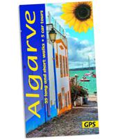
Wandelgids voor de Algarve: vele dagtochten worden degelijk beschreven met openbaar vervoer informatie, goede routebeschrijvingen en kaartmateriaal. Tevens enkele autotochten. (Engelstalig) 'Few visitors explore beyond the beautiful Algarve coastline, but the Andersons did. They say, ‘We found a countryside full of interest and beauty. From flower...

Verkopers met dit product

Webshop
Bezorging
Prijs
DeZwerver.nl logo
DeZwerver.nl
niet bekend
20,95

Anderen bekeken ook

Wandelgids Walk! La Gomera | Discovery Walking Guides
La Gomera is the ultimate get-away-from-it-all island: easy-going, unspoilt, friendly, isolated from the hustle and bustle of modern living, and so laid back it’s virtually supine - even the volcanoes have been dormant for millions of years. The walks, however, are a bit more energetic. For the new 4th edition of Walk! La Gomera Charles Davis has teamed up with Jan Kostura. Jan brings his wide experience and passion for the Canaries, checking, re-walking and revising existing routes, and adding a couple of his own adventures, including a new Top Three Gomeran walk. Two routes have been dropped as having become too dangerous, but the good news is that many of the more harum-scarum walks have been improved through path clearing and the addition of railings to the vertiginous stretches. Other good news is that the devastating forest fires of 2012 have proved not nearly as damaging as we feared, leaving most of our itineraries unscathed. In short, there is every reason to take off and ex…
17,50
Wandelgids Pembrokeshire | Northern Eye Books
OS Map Books: Wales Coast Path: Pembrokeshire Coast Path Map Atlas | Ordnance Survey ‘Explorer’ Large-scale 1:25,000 maps for the Pembrokeshire Coast in compact book format | Pocket Atlas | Walking Wales | UK Long-Distance Trails | Hiking | Adventure   One of seven handy Ordnance Survey Map Books covering the entire 870 mile/1400 kilometre-long, world-class Wales Coast Path — from Chester in the north to Chepstow in the south.   Enjoy enhanced, large scale (1:25,000) Ordnance Survey Explorer mapping in compact atlas format with all the detailed mapping you need to walk the Pembrokeshire Coast section of the Wales Coast Path.   Continuous, full colour OS mapping covering the Wales Coast Path between Cardigan and Amroth. Contains extracts from large scale Explorer maps OL 35 and OL 36. The enhanced OS 1:25,000 maps are accurate, up-to-date and reliable. Additional map symbols show tea shops, cafes, extra parking, and public toilets.   A brief introduction to Pembrokeshire Coast includes…
17,50
Reisgids Jersey | Sunflower books
Gids met 25 wandelingen en 2 autoroutes over het eiland. This new  edition of Landscapes of Jersey has been thoroughly revised with completely new, easily readable 1:25,000 maps based on OpenStreet mapping and our own GPS research.   Walking in Jersey can be quite challenging: the coastline features some steep paths with endless steps. But away from the coast there is slightly more variety in the landscape, and walking is relaxed and easy, mainly along quiet lanes and country paths. Geoff Daniel has the happy knack of finding sights and places to stir the imagination — from the Pinnacle (one-time scene of pagan rituals) to the eerie towering concrete relics dating from the German Occupation during World War II. Whether you’re a first-timer seeing Jersey by car or a regular visitor, you’ll enjoy exploring places you might never see without this guide.   Area covered: the entire island   Best months for walking: Walk here in April or May if you can, to catch the spring flowers. Otherwis…
16,50
Wandelgids Norfolk Coast Path - Peddars Way | Trailblazer Guides
The Norfolk Coast Path & Peddars Way cover 130-miles of walking trails. The Peddars Way runs through East Anglia from Knettishall Heath on the Norfolk/Suffolk border and follows a Roman road to Holme-next-the-Sea. From here it becomes the Norfolk Coast Path, hugging the beautiful Norfolk coastline through Holkham, Wells, Blakeney and Cley to Cromer before it rounds the shoulder of the county and continues along the superb beaches and crumbling cliffs to Mundesley, Sea Palling and Great Yarmouth, finishing just before the Suffolk border.   Includes: 77 large-scale walking maps - at just under 1: 20,000 (8cm or 3 and one eighth inches to 1 mile) our maps are bigger than even the most detailed walking maps currently available, with walking directions, tricky junctions, places to stay and eat, points of interest and walking times written onto the maps Text and maps in clear TWO-COLOUR style All standards of accommodation with reviews - campsites, B&Bs, hostels, hotels, bunkhouses Where to…
20,95
Campinggids - Campergids Sea View Camping Wales | Vicarious Books
This unique guide shows and tells you about 111 campsites, camping and caravan parks and holiday parks with sea views around the Welsh coast. Whether walker, surfer, history buff or beach bum, Sea View Camping Wales has the sea view campsite for you.   From family-focused holiday parks to farmers’ fields down dirt tracks and laid back camping where you can sing around a camp fire, all you have to do is decide where you want to go and be ready for a fantastic time as you explore the mudflats, mountains, cliffs and caves.   What campsites, where? 111 inspected camping and caravan parks around the Wales coastline 89 campsites directly on or within 0.25 miles of the Wales Coast Path or other footpaths 51 holiday parks directly on or within 0.5 miles of a beach 12 camping sites on the Isle of Anglesey 6 sites which allow open fires The OS Grid references and the proximity of the Wales Coast Path to so many of the coastal campsites make this guide the perfect companion for walking enthusias…
14,50
Wandelgids Thames Path | Trailblazer Guides
This book follows the Thames Path National Trail from the river's source in Gloucestershire to the Thames Barrier in London. Officially 184 miles (294km) in length (although the actual distance you walk will depend on a number of decisions you make en route), the path meanders, accompanied by its watery muse, through pristine and tranquil countryside, past historic sites and buildings, via pub, lock, weir, and the occasional scattering of waterfowl, to a city, once the fulcrum of an empire, and now the heart of modern day England. The river, responsible for the metropolis' very being, tells tales, inspires artists, accommodates swans, geese, and water voles, reflects the silhouettes of red kites and kingfishers, provides employment, entices adventure, and allows time for carefree pilgrims to procrastinate and think. Following its banks is a grand way to go for a ramble. The path begins, as the river does, in a meadow in the Cotswolds; its upper reaches lonely and wild, the meadows and…
19,95
Wandelgids Walks to Lighthouses Wales | Northern Eye Books
Klein, handzaam wandelgidsje met spectaculaire wandelingen naar vuurtorens. Met goede kaartjes van Ordnance Survey. This attractive and cleverly structured guide gives walkers ten of the finest walks to the ten most spectacular lighthouses in Wales in a popular pocketable format. With clear information, an overview and introduction for each walk, expertly written numbered directions, large scale Ordnance Survey maps, superb eye-grabbing panoramic photographs, and interpretation of points of interest along the way, these guides set a new standard in clarity and ease-of-use. Featured walks include: Talacre and Great Orme, North Wales Coast; Penmon Point, South Stack and Llandwyn Island, Anglesey; Strumble Head and St Anne's Head, Pembrokeshire; Whiteford, Carmarthen Bay; and Nash Point, South Wales Coast. The ten walks featured here highlight the very best Welsh lighthouses and huge variety of the coastline of Wales.   From vast expanses of sand, sea and sky, such as at Whiteford Point …
10,95
Fietskaart 09 Cycling guides Norfolk | Goldeneye
Norfolk is the fourth largest county in England and one of the most rural. It is also one of the flattest and our circular routes have been chosen to explore the quiet lanes linking the isolated and picturesque villages and places of interest. This is ideal cycling territory and fortunately, the Norfolk County Council (and its District Councils) are seriously committed in providing and developing cycling routes and in promoting a cycling culture that is sustainable and family friendly. Some of their routes are illustrated, hitherto.   The County has been described as flat (rather gentle undulations) and does not in fact rise much over 300 feet, but it offers great scenic interest; the dark forests of Breckland, the rolling chalk lands of the northwest, the unique watery patch of the Broads, and a coastline of great variety. Ancient churches and picturesque villages are there in abundance, the latter often decorated with the attractive signs designed by Harry Carter in the 1950’s.   Re…
14,95
Wandelgids 2 Madeira Walks | Discovery Walking Guides
Engelstalige wandelgids Madeira, met uitgebreide beschrijvingen van wandelroutes, routekaartjes en praktische informatie zoals bussen en accommodatie. In dit tweede deel staan de wat uitdagendere routes. As a walker's paradise, Madeira has it all - majestic mountains, rugged coastline, ancient forests, a unique levada network and verdant flora; easy to see why so many walkers return year after year. In 2015 Madeira was voted the "World's Best Island Destination" by the World Travel Awards the final accolade from the previous two years when it was voted "Europe's Leading Island Destination". Quite an achievement, brought about largely by the substantial EU investment over the past decade in the improvement and development of the island's infrastructure and facilities.   One of the initiatives focused on improving and creating new walking trails which has resulted in Madeira now being regarded as one of Europe's top hiking destinations.To date, around thirty routes on Madeira have been …
19,95
Wandelgids South Downs Way | Trailblazer Guides
The South Downs Way is a 100-mile footpath which follows the line of chalk hills stretching from Winchester to Eastbourne. Walking the length of the Downs is the best way to experience this beautiful landscape with its mixture of rolling hills, steep hanging woodland and windswept fields. You'll also pass through picture-postcard villages with welcoming pubs, thatched cottages and country gardens. 1. Unique mapping features - In many walking guides the reader has to read a route description then try to relate it to the map. Our guides are easier to use because walking directions, tricky junctions, places to stay and eat, points of interest and walking times are all written onto the maps themselves in the places to which they apply. With their uncluttered clarity, these are not general-purpose maps but fully-edited maps drawn by walkers for walkers. Downloadable GPS waypoints also included. 2. The largest scale walking maps available - At just under 1:20,000 (8cm or 31/8 inches to 1 mi…
20,95

Klanten-reviews van Wandelgids Algarve | Sunflower books

Er zijn nog geen beoordelingen voor dit productBen jij de eerste die een review plaatst?

Meer over Wandelgids Algarve | Sunflower books

Productomschrijving

Wandelgids voor de Algarve: vele dagtochten worden degelijk beschreven met openbaar vervoer informatie, goede routebeschrijvingen en kaartmateriaal. Tevens enkele autotochten. (Engelstalig)

'Few visitors explore beyond the beautiful Algarve coastline, but the Andersons did. They say, ‘We found a countryside full of interest and beauty. From flowers and fountains, hilltops and history, to windmills and watermills, we can set your feet wandering to find them all. But you can explore Algarve by car, too, searching out little-known points of interest — like the huge rose compass on the barren promontory of Sagres, where Prince Henry the Navigator founded his school of navigation. But don’t think that we have ignored the beautiful and rugged coastline. Wherever it is still unspoilt and free from development, we have incorporated it into a walk.’

Area covered: from the west coast east to the Spanish border and north to the area around Monchique. When to go: The best months for walking in the Algarve are March to May or September and October, but winter walking is enjoyable too.   5 car tours, 55 long and short walks, picnic suggestions

Verken gerelateerde categorieën

Webshop.nl maakt gebruik van cookies. Ga je verder op onze website, ga dan akkoord met het plaatsen van cookies en de verwerking van deze data door ons en vermelde partners.