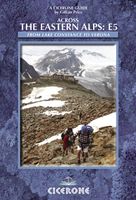
Wandelgids Across the eastern alps: E5 | Cicerone

0
Launched on the shores of beautiful Lake Constance, this well-established long-distance European pathway (600km) takes 30 days to make its way through a remarkable kaleidoscope of landscapes and culture spanning rural alpine regions in Germany, Switzerland, Austria and Italy. Passes as high as 2900m above sea level are crossed en route to the nort...

Verkopers met dit product

Verkoper
Bezorging
Prijs
DeZwerver.nl logo
DeZwerver.nl
2,95
21,95

Anderen bekeken ook

Wandelgids Across the eastern alps: E5 | Cicerone
Launched on the shores of beautiful Lake Constance, this well-established long-distance European pathway (600km) takes 30 days to make its way through a remarkable kaleidoscope of landscapes and culture spanning rural alpine regions in Germany, Switzerland, Austria and Italy. Passes as high as 2900m above sea level are crossed en route to the northern Italian city of Bolzano. Gentler gradients follow as the E5 bears south parallel to the mighty Adige river through the Lagorai, Pasubio and Lessini groups. The final destination is marvellous Verona, romantic city par excellence. A well-organised network of alpine refuges and cosy guesthouses welcome walkers along the route, and convenient transport links make it possible to join or leave the trek at virtually every stage to fit in with individual holiday needs. Traverses the Allgauer, Lechtaler and Ötztaler Alps Visits spectacular geological sites and First World War remains Can be easily split into shorter stages
21,95
Wandelgids Trekking in the Alps | Cicerone
All the rich scenic diversity for which the Alps are renowned is celebrated here, while the 20 treks described include well-known classics as well as newly-created multi-day routes. The eight talented writers and photographers brought together to produce this book are among the most experienced of Alpine trekkers. Between them they have explored every corner of Europe’s premier mountain range, written dozens of guides and, in some cases, led trekking holidays there in order to share their enthusiasm for the Alps with other walkers. And that is the prime motivation for Trekking in the Alps – an inspiration and a celebration of the very best of these mountains. Best-known treks Tour of Mont Blanc; Tour of the Matterhorn; Tour of Monte Rosa; Walker’s Haute Route; Tour of the Jungfrau Region; Tour of the Vanoise; Dolomites AV 1 & 2 Longer trans-Alpine treks GR5 (Lake Geneva to Nice); Eastern Alps E5; Italian Alps GTA; Traverse of the Slovenian Alps For the Alpine adventurer Alpine Pass Ro…
28,95
Wandelgids Trekking in the Silvretta and Ratikon Alps | Cicerone
Aanbevolen wandelkaarten bij deze gids: Schaal 1:60.000 Wandelkaart 14 Unterengadin | Kümmerly & Frey Wandelkaart 13 Davos - Arosa | Kümmerly & Frey Of schaal 1:25.000 Wandelkaart 26 Alpenvereinskarte Silvrettagruppe This guide describes three treks, between 5 and 8 days, in the Silvretta and Rätikon Alps starting near Klosters, and 12 half-day hut-to-hut routes. These contrasting ranges form a line on the borders of Switzerland, Austria and Liechtenstein. The Tour of the Silvretta, the Prättigauer Höhenweg and the Rätikon Höhenweg. Straddling the borders of Austria, Switzerland and Liechtenstein, the limestone Rätikon Alps reach into the snow-bound and glacier-hung Silvretta Alps to provide a richly diverse series of landscapes. The Tour of the Silvretta, the Prättigauer Höhenweg and the Rätikon Höhenweg, all within easy reach of Klosters, have been devised to help trekkers explore the best of the region. Given sifficient time they can also be combined to create a continuous 2-week t…
25,95
Wandelgids 100 Hut Walks In The Alps | Cicerone
This guidebook has route descriptions for 100 day walks to suit alpine walkers of all abilities, with suggestions for some hut-to-hut tours. These routes take you through breathtaking scenery in the Maritime Alps, Julian Alps, Gran Paradiso, the Turnitzer Alps, Bernese Oberland, the Kitzbuheler Alps and the Dolomites of South Tirol. Extending in huge arc of more than 1000km (620 miles) from the Mediterranean coast near Nice to the low, wooded foothills outside Vienna, the Alps display the full gamut of mountain landscape features. All of the routes in this guide have been specially selected to show the amazing diversity of this wonderful mountain chain.   There are walks to suit every taste: gentle and undemanding, long and tough, and everything in between. Most of the routes avoid climbing of a technical nature except the odd scramble aided by a fixed rope. Glacier crossings where crevasses lurk for the unwary have also been avoided in the main, although just a small handful of walks…
22,95
Wandelgids The Giants' Trail: Alta Via 1 Through the Italian Pennine Alps | Cicerone
Uitstekende wandelgids van een gerenommeerde Engelse uitgever. De tochten zijn met zorg beschreven en voorzien van allerhande nuttige informatie. Italy's Alta Via 1, a 180km hiking trail through the Italian Alps following the northern flank of the Aosta Valley, boasts magnificent views of the Alpine giants: Mont Blanc, the Matterhorn, the Grand Combin and Monte Rosa. Indeed, it is sometimes known as the Giants' Trail and can be combined with a sister-route, the Alta Via 2 (covered in a separate Cicerone guide), which runs along the southern flank of the valley, to form the Tor des Geants. Stretching from Donnas to Courmayeur, the Alta Via 1 offers fantastic alpine walking, with welcoming refuges and small hotels providing overnight accommodation (and great food) along the way. The guide presents the route in two sections, for the advantage of those who can't spare the full fortnight-plus needed to walk the entire AV1. The trail is described in 16 stages, with alternative stages coveri…
23,95
Wandelgids The Adlerweg | Cicerone
A guidebook to Austria's Adlerweg (the Eagle's way) a long-distance trail from St Johann in Tirol in the east, passing through the historic town of Innsbruck at its mid-point before continuing to St Anton am Arlberg in the west. This waymarked 324km trek is presented in 24 stages ranging between 7 and 32km in length, with easier alternate routes provided for the most difficult stages. This guide features 1:50,000 mapping, accommodation details for the start and end points of each stage, which serve hearty meals and refreshments, and details on local transport, planning and local history.   Traversing the North Kakalpen Alps the route passes through the Wilderkaiser, Bradenberger Alpen, Rofangebirge, Karwendelgebirge, Wettersteinebirge and the Lechtaler Alpen ranges, enjoying views as far as Munich and the Swiss Alps. It is the perfect adventure for those looking for an alpine challenge.
26,50
Wandelgids Trekking in Austria's Zillertal Alps | Cicerone
Guide detailing four short Alpine hut-to-hut treks in the stunning Zillertal region of the Austrian Tirol. Included are the 9-day Zillertal Rucksack Route (also known as the Berliner Hohenweg), the 7-day Zillertal South Tirol Tour, the 7-day Peter Habeler Tour and the 6-day Olperer Runde Tour, as well as optional ascents of neighbouring peaks, including the region's highest, the 3510m Hochfeiler. Good fitness and experience of mountain walking is necessary, and some of the treks include long days, steep and uneven terrain and aided sections.   The optional excursions may call for specialist equipment, mountaineering skills and experience of glacier crossing. The routes are presented in day stages, each with notes on the particular highlights and challenges/hazards of the day's route. In addition to clear route description illustrated with 1:50,000 mapping and elevation profiles, the guide also includes a wealth of practical information on transport, mountain huts, recommended kit and …
26,50
Wandelgids Trekking in the Vanoise | Cicerone
Uitstekende wandelgids van dit geweldige gebied. goed beschreven met veel praktische informatie om de route te kunnen lopen, inclusief redelijke kaarten. This guide describes the eleven-day 163km Tour of the Vanoise and the five-day 72km Tour des Glaciers de la Vanoise, two fantastic hut-to-hut treks through the pristine Alpine landscapes of France's Vanoise National Park. Three other short treks - the Tour of the Eastern Vanoise, the Tour of the Western Vanoise and a Traverse of the Vanoise via the GR5 and GR55 - are also summarised. The routes tackle several passes in excess of 2500m but there are no glacier crossings, no significant scrambling and no lengthy paths exposed to either stonefall or vertigo-inspiring exposure (though optional variants may involve some slightly more challenging sections), and waymarking is usually clear - making this an ideal route for those new to Alpine trekking.   The guide contains everything you need to plan and walk the routes, with advice on trave…
23,95
Wandelgids Trekking in the Apennines - Apennijnen | Cicerone
Uitstekende wandelgids die in etappes de route nauwkeurig beschijft; ook de zijtakken en alternatieve routes koman aan bod. Kaarten zijn schetsmatig en in onze ogen onvoldoende bij slechte weersomstandigheden. Wij raden dan ook om er losse kaarten bij te kopen, voor zover verkrijgbaar! Guidebook to the Grand Apennines Trek, or Grande Escursione Appenninica (GEA). Through Tuscany and Emilia-Romagna and two National Parks, this 400km, 23 day trail explores the mountains, forests and hills of central Italy. Suitable for a range of walkers, it can be split into shorter sections or day walks if needed. This guidebook describes the Grande Escursione Appenninica (GEA), a nearly 400km long, three week trek crossing the Appenines in 23 stages, from Bocca Trabaria to Passo Due Santi on the edge of Liguria. The route dips in and out of Tuscany and Emilia-Romagna, never dropping below 400 metres. Best walked between spring and autumn, it is suitable for any reasonably fit walker. Highlights inclu…
22,95
Wandelgids The Overland Track | Cicerone
Uitstekende wandelgids, goed beschreven met veel praktische informatie om de route te kunnen lopen, inclusief redelijke kaarten. Guidebook to Tasmania's iconic Overland Track. Described over 7 stages, the 80km trail from Cradle Valley to Lake St Clair takes in glacier-carved valleys, vast buttongrass moorlands, mossy rainforests, rugged peaks, thundering waterfalls, alpine meadows and peaceful lakes. Adventurous side trips are also described. This guidebook covers the iconic Overland Track in Tasmania's stunning Cradle Mountain-Lake St Clair National Park. The well-maintained 80km route from Cradle Valley to Lake St Clair is described over seven stages, along with optional sidetrips to the area's many accessible peaks including Mt Ossa, Tasmania's highest mountain. The track can be completed in between 5 and 9 days, depending on fitness and whether hikers undertake sidetrips.   Each stage features clear 1:50,000 mapping and profiles alongside detailed route description. The guide also…
24,95

Klanten-reviews van Wandelgids Across the eastern alps: E5 | Cicerone

Er zijn nog geen beoordelingen voor dit productBen jij de eerste die een review plaatst?

Meer over Wandelgids Across the eastern alps: E5 | Cicerone

Productomschrijving

Launched on the shores of beautiful Lake Constance, this well-established long-distance European pathway (600km) takes 30 days to make its way through a remarkable kaleidoscope of landscapes and culture spanning rural alpine regions in Germany, Switzerland, Austria and Italy.

Passes as high as 2900m above sea level are crossed en route to the northern Italian city of Bolzano. Gentler gradients follow as the E5 bears south parallel to the mighty Adige river through the Lagorai, Pasubio and Lessini groups. The final destination is marvellous Verona, romantic city par excellence.

A well-organised network of alpine refuges and cosy guesthouses welcome walkers along the route, and convenient transport links make it possible to join or leave the trek at virtually every stage to fit in with individual holiday needs.

Traverses the Allgauer, Lechtaler and Ötztaler Alps
Visits spectacular geological sites and First World War remains
Can be easily split into shorter stages

Productinformatie

    Verken gerelateerde categorieën

    Webshop.nl maakt gebruik van cookies. Ga je verder op onze website, ga dan akkoord met het plaatsen van cookies en de verwerking van deze data door ons en vermelde partners.