webshop.nl
Categorieën
  Sluiten

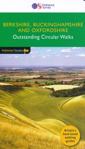
Wandelgids 84 Pathfinder Guides Berkshire, Buckinghamshire and Oxfordshire | Ordnance Survey

Wandelgids van een deel van Engeland. Deze gids bevat 28 dagwandelingen, variërend van korte tochten tot pittige dagtochten. De bijbehorende kaarten zijn uitstekend: men heeft de topografische kaarten van Ordnance Survey gebruikt waarop de route is ingetekend. Daarnaast praktische informatie over de wandeling en wat beschrijvingen van het gebied. T...
18,50

Webshops met dit product

Webshop
Bezorging
Prijs

Anderen bekeken ook

Wandelgids 54 Pathfinder Guides Hertfordshire and Bedfordshire | Ordnance Survey
Wandelgids van een deel van Engeland, Schotland of Wales. Deze gids bevat 28 dagwandelingen, variërend van korte tochten tot pittige dagtochten. De bijbehorende kaarten zijn uitstekend: men heeft de topografische kaarten van Ordnance Survey gebruikt waarop de route is ingetekend. Daarnaast praktische informatie over de wandeling en wat beschrijvingen van het gebied. Both counties tend to be underrated by walkers, often overlooked in favour of the delights of the Thames Valley or the hillier Chilterns country of Buckinghamshire. But they do possess much fine walking country, with a diversity of terrain, gentle hilly regions, lots of pleasant woodland, attractive riverside landscapes and an impressive collection of pretty villages.   There are a large number of country parks, especially in Bedfordshire, which make excellent starting points for walks in the surrounding countryside, linked by the public footpath network. Both Hertfordshire and Bedfordshire have an extensive network of well…
18,50
Wandelgids Walking in the Thames Valley | Cicerone
Walking in the Thames Valley offers 25 challenging circular walks around the River Thames and River Kennet in the south of England, taking in the Southern Chilterns, the Berkshire and North Hampshire Downs, Southern Oxfordshire and the eastern edge of Wiltshire. All routes are within easy reach of Reading, Newbury, Abingdon and London. While some walks visit Iron Age hill forts, others pass more modern features such as Wilton Windmill and the Kennet and Avon Canal. Some follow sections of the Ridgeway, while others meander along the banks of the Thames. What they all have in common is that they take the keen rambler to some of the best parts of the Thames Valley – a patchwork of open chalk grassland, broadleaved woodland and farmland and home to two Areas of Outstanding Natural Beauty. • walks from 10 to 18 miles, including one 2-day route • shorter, less strenuous alternatives for many of the walks • detailed route descriptions with information on local points of interest, OS mapping …
18,50
Nieuw
Wandelgids Cotswolds | Ordnance Survey
Explore ten easy-paced, family-friendly short walks across the Cotswolds Area of Outstanding Natural Beauty. Originating from a Saxon term meaning ‘wooded hollows, amid gentle hills’, the AONB straddles six counties, and is best known for its honey-coloured stone cottages, lush rolling hills, and deeply-cut wooded valleys. Walks explore quieter corners of the region, covering fine gardens, rivers, parkland, and charming villages.       What to expect from Cotswolds Short Walks Made Easy:   • For quintessential Cotswold views, follow the trail from Broadway, escaping the crowds up a gently sloping hill to a sleepy hamlet and tempting tearooms   • Take a stroll down the magnificent Broad Ride in Cirencester Park, briefly enjoying the beautiful Roman town of Cirencester   • Have your camera ready to snap the country’s most photographed cottages at Arlington Row, whilst on an outing from Bibury   • Admiring formal gardens at the stately homes of Sudeley Castle and Blenheim Palace, you can …
13,50
Wandelgids 65 Pathfinder Guides Surrey | Ordnance Survey
Fraaie, goed verzorgde wandelgidsjes met 28 wandelingen van max. een dag, (beginnend bij korte, eindigend bij langere wandelingen). Weergegeven op duidelijke topografische kaartjes (1:25.000). Bevat verder wetenswaardigheden en praktische informatie voor onderweg. Areas covered include the North Downs Way and Box Hill, with all walks accompanied by GPS waypoints, Ordnance Survey maps and beautiful photography. The Pathfinder Guide to Surrey Walks contains 28 fantastic circular walks across the county, much of which lies only a few miles away from the heart of London but which contains some of the country's most beaufiul landscapes, including the oldest untouched area of natural woodland in the UK and the rolling contours of the North Downs. Each walk in Pathfinder Guide to Surrey Walksis accompanied by clear, large-scale Ordnance Survey route maps and GPS waypoints to help you navigate your hike with ease. Exploring one of the most popular Home Counties, Pathfinder Guide to Surrey Walk…
18,50
Wandelgids 87 Pathfinder Guides Northumberland | Ordnance Survey
Pathfinder® Guide to Northumberland, featuring 28 outstanding walks designed for a range of abilities covering 180 miles of walking.   Features:   28 guided walks for a range of abilities Large detailed Ordnance Survey map extracts Key information such as parking and type of terrain GPS waypoints for each route Weather-resistant book cover Durable rounded corners   This new guide to Northumberland has ten brand-new Pathfinder walks across the county. There are new short walks at Berwick-upon-Tweed, Almouth and Bellingham. There are new half-day walks in the Coquet Valley at Felton, in the Humbleton Hills from Wooler, exploring the countryside south of the River Tyne from Hexham, and taking you along the scenic Wansbeck Valley to Morpeth from Bothal. And there are new longer walks in Hulne Park, Alnwick; along the coast and inland from Bamburgh; and a lengthy but hugely enjoyable ramble in a circuit from Druridge Bay to Warkworth and a return via Amble along the Northumberlan…
18,50
Wandelgids 44 Pathfinder Guides Essex | Ordnance Survey
Pathfinder Guide to Essex offers excellent lowland walking in the south-east of England. The routes are all circular exploring the finer countryside of the county, in a series of parkland, farmland, woodland and coastal and estuarine walks, visiting its places of historic interest, attractive towns and charming villages. Given the pleasant and undramatic nature of the terrain, routes only really vary in length in terms of difficulty and there is a general progression through the book from shortest to longest. Beginning with a short walk linking Laindon Common with Great and Little Burstead, encountering the infant River Crouch, the book progresses to a near 10-mile excursion across Bradwell Marsh, with its wide open horizons, and a visit to the isolated and tiny Saxon chapel of St Peter-on-the-Wall. Sea air can also be taken on walks from Walton-on-the-Naze, a circuit of the eastern end of Mersea Island, along St Osyth Creek, at Maldon, from Burnham-on-Crouch, and overlooking Benfleet …
18,50
Wandelgids 88 Pathfinder Guides Scottish Borders | Ordnance Survey
Pathfinder® Guide to the Scottish Borders, featuring 28 outstanding walks designed for a range of abilities covering 170 miles of walking.   Features:   28 guided walks for a range of abilities Large detailed Ordnance Survey map extracts Key information such as parking and type of terrain GPS waypoints for each route Weather-resistant book cover Durable rounded corners     This new guide to Scottish Borders has 18 brand-new Pathfinder walks across the county. There are new short walks along the Tweed Valley between Peebles and Coldstream, and along the Teviot Valley from Hawick to Kelso. The stunningly scenic coastline has new walks at Eyemouth and Cockburnspath, while inland peaceful circuits explore the heritage at Duns, Greenlaw, Lauder and St Mary’s Loch.   The other much-loved walks in the book feature circuits along the coast at St Abb’s Head; in the Eildon and Leaderfoot National Scenic Area; in the remote Liddesdale countryside and along the Scotland/England border using both b…
18,95
Wandelgids 29 Pathfinder Guides Wye Valley and Forest of Dean | Ordnance Survey
Wandelgids Wye Valley en Forest of Dean. Deze gids bevat 28 dagwandelingen, variërend van korte tochten tot pittige dagtochten. De bijbehorende kaarten zijn uitstekend: men heeft de topografische kaarten van Ordnance Survey gebruikt waarop de route is ingetekend. Daarnaast praktische informatie over de wandeling en wat beschrijvingen van het gebied. The Wye Valley and Forest of Dean Pathfinder guidebook contains 28 circular walks for all abilities. Walks are from 4km to 17km long, and each route includes a difficulty rating, route directions, an extract of the Ordnance Survey map and notes and photos of key features to look for. All of them have been created and tested by experienced walkers to help you make the most of the area.   This guide focuses on the middle and lower sections of the Wye Valley, roughly where the river leaves its upper reaches in mid-Wales to enter Herefordshire. Hay-on-Wye, Hereford and the walled town of Chepstow are also covered, as is the classic view over th…
18,50
Wandelgids 41 Pathfinder Guides Mid Wales | Ordnance Survey
Wandelgids van midden Wales. Deze gids bevat 28 dagwandelingen, variërend van korte tochten tot pittige dagtochten. De bijbehorende kaarten zijn uitstekend: men heeft de topografische kaarten van Ordnance Survey gebruikt waarop de route is ingetekend. Daarnaast praktische informatie over de wandeling en wat beschrijvingen van het gebied. Explore Mid Wales over 28 walks with this walking guidebook from the Pathfinder series. Each walk is listed by distance and difficulty, and range from a family-friendly 4km (2.5 miles) to a challenging 20km (12 miles)   Often ignored in favour of the more popular Snowdonia and Brecon Beacons National Parks to the north and south, mid Wales still offers some stunning views and beautiful walks. Both coastal routes and upland walks are featured, and include Catti's Cave, Devil's Bridge and the Mynach Valley, The Claerwen Valley and the source of the river Severn   Each of the 28 circular walks has been created by experienced walkers, and includes a route …
18,50
Wandelgids 48 Pathfinder Guides Suffolk | Ordnance Survey
Fraaie, goed verzorgde wandelgidsjes met 28 wandelingen van max. een dag, (beginnend bij korte, eindigend bij langere wandelingen). Weergegeven op duidelijke topografische kaartjes (1:25.000). Bevat verder wetenswaardigheden en praktische informatie voor onderweg. Suffolk's riverside meadows of the Stour valley remain as beautiful today as when Constable painted them two centuries ago. Similarly, the county's lonely expanses of estuarine marsh, which are a feature of the coast, have a quality that appeal to writers as well as artists. A walk through Flatford and East Bergholt passes one of Constable's most famous viewpoints, and Flatford Mill itself. There is a choice of coastal walks, including routes through Southwold, Shingle Street, Dingle Marshes, Thorpeness and the Shotley peninsula. With 28 walks through the Suffolk countryside, if you’re a walker who really wants to make the most of the Suffolk countryside, make sure you don’t set off on your walk without a copy of Pathfinder G…
18,50

Klanten-reviews van Wandelgids 84 Pathfinder Guides Berkshire, Buckinghamshire and Oxfordshire | Ordnance Survey

Er zijn nog geen beoordelingen voor dit productBen jij de eerste die een review plaatst?

Meer over Wandelgids 84 Pathfinder Guides Berkshire, Buckinghamshire and Oxfordshire | Ordnance Survey

Productomschrijving

Wandelgids van een deel van Engeland. Deze gids bevat 28 dagwandelingen, variërend van korte tochten tot pittige dagtochten. De bijbehorende kaarten zijn uitstekend: men heeft de topografische kaarten van Ordnance Survey gebruikt waarop de route is ingetekend. Daarnaast praktische informatie over de wandeling en wat beschrijvingen van het gebied. This all-new Pathfinder® Guide covering the ceremonial counties of Berkshire, Buckinghamshire and Oxfordshire features 28 outstanding circular walks across all three counties, offering more wonderful Pathfinder® routes in the south-central Midlands between the Cotswolds (PF 6 Cotswolds) and the Chilterns (PF 25 Thames Valley and Chilterns). In this welcome addition to the Pathfinder® series, walks range from Banbury in the north to Newbury in the south and, west to east, from Milton-under-Wychwood to Virginia Water. Follow brand-new rambles exploring the Chilterns, the Thames Valley, the North Wessex and Berkshire Downs, the Kennet valley, the Oxfordshire Cotswolds and over the Oxfordshire Plain.   Walks are set out with the shorter routes at the front of the book, generally progressing through half-day walks to the longer distance outings near the end of the guide. Walks are professionally authored and depicted with GPS waypoints, Ordnance Survey maps and beautiful photography.
Webshop.nl maakt gebruik van cookies. Ga je verder op onze website, ga dan akkoord met het plaatsen van cookies en de verwerking van deze data door ons en vermelde partners.